Timeline
Trailcenter Hohe Wand Wiese planned a mountain bike ride
October 18, 2019
Time
Distance
Speed
Ascent
Descent

Ivan likes this.
Trailcenter Hohe Wand Wiese planned a bike ride
October 18, 2019
Time
Distance
Speed
Ascent
Descent

Trailcenter Hohe Wand Wiese planned a mountain bike ride
April 17, 2019
Time
Distance
Speed
Ascent
Descent
Trailcenter Hohe Wand Wiese planned a mountain bike ride
April 11, 2019
Time
Distance
Speed
Ascent
Descent

Trailcenter Hohe Wand Wiese planned a mountain bike ride
April 10, 2019
Time
Distance
Speed
Ascent
Descent

April 10, 2019
The most relaxed variant of the KendA-Line! So that enough reserves remain downhill, it goes over the Family Uphill to the upper forest road and then the uphill line to Trailstart. Nevertheless, take a deep breath before heading into the KendA-Line - advanced driving technique is required! Jump kills
Translated by Google •
Trailcenter Hohe Wand Wiese planned a mountain bike ride
April 10, 2019
Time
Distance
Speed
Ascent
Descent

April 10, 2019
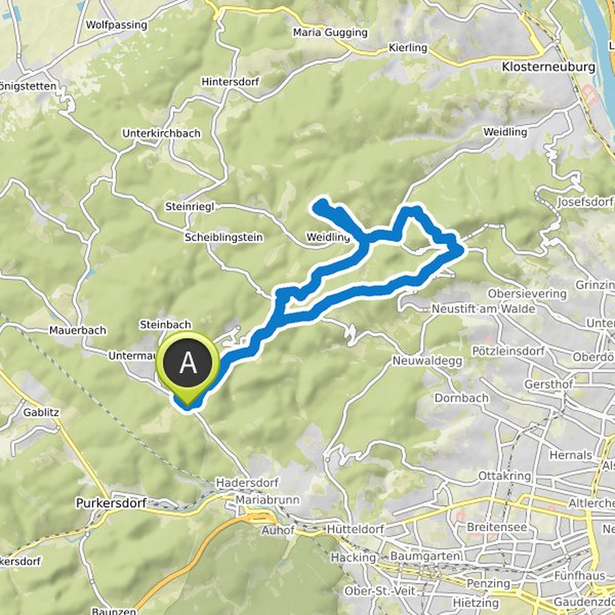
Wonderful lap on the Sophienalpe with a wonderful view, before it continues in the direction Trail Park to the flow line. There you can expect a beginner-friendly flow line with moorings, waves and tables - all of which can be rolled over. Experienced riders will get their money's worth with a bit more
Translated by Google •
Trailcenter Hohe Wand Wiese planned a mountain bike ride
April 10, 2019
Time
Distance
Speed
Ascent
Descent
Trailcenter Hohe Wand Wiese planned a mountain bike ride
March 26, 2019
Time
Distance
Speed
Ascent
Descent

April 10, 2019
Family-friendly MTB Loop, which leads uphill via the "family uphill" of the trail center to the flow line. This is driven here from the upper forest road and waits with residents, waves & Tables that you can all safely overrun on you. Ideal lap for the shared MTB experience with your loved one.
Family Time!
Translated by Google •
Trailcenter Hohe Wand Wiese planned a mountain bike ride
March 24, 2019
Time
Distance
Speed
Ascent
Descent

April 10, 2019
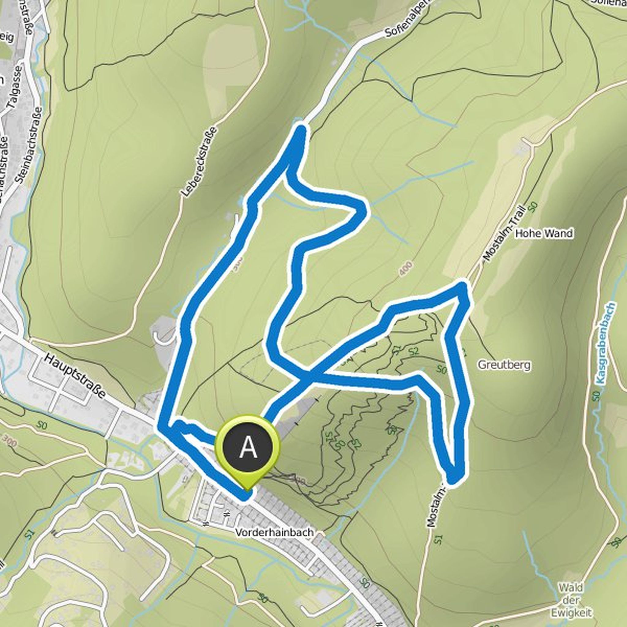
Gorgeous, demanding E-MTB Enduro round over the Mostaltrail (uphill only shared trail) to the Enduro Line - this requires advanced driving technique! Both uphill and downhill you can expect a technically sophisticated single trail, which plays a few lumps depending on the line choice!
test your endurance!
Translated by Google •
Trailcenter Hohe Wand Wiese planned a mountain bike ride
March 24, 2019
Time
Distance
Speed
Ascent
Descent
April 10, 2019
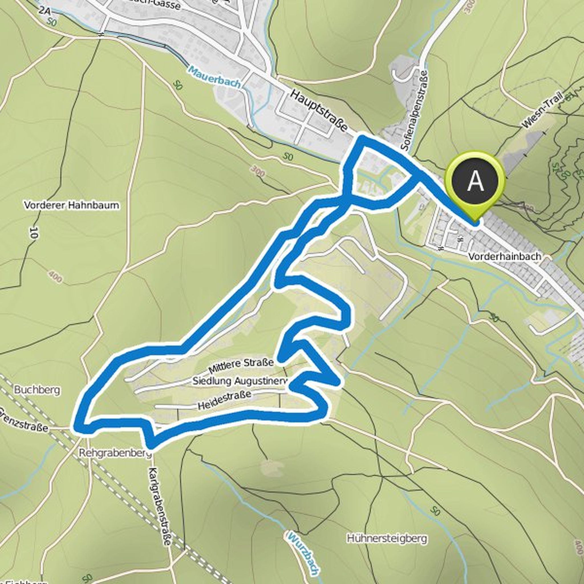
Crisp asphalt uphill where you can really test your E-MTB. As a reward, there is the Augustinertrail (shared trail) as a flowing, easy singletrack. In the lower area with roots depending on the line choice a bit more demanding if you like.
Enjoy!
Translated by Google •
April 11, 2019
THE Enduro loop in the trail center! Uphill's conditionally and technically demanding over the Uphill Line, which gently meandering transported you to the Trailhead. On the Enduro Line it's time to get down to business - advanced driving technique is a must. Wurzln, steps, Rythm changes, off-camber
Translated by Google •