Timeline
Ortnfr planned a hike
April 12, 2022
Time
4h28m
Distance
11.8km
Speed
2.6km/h
Ascent
490m
Descent
490m
Map data © OpenStreetMap contributors
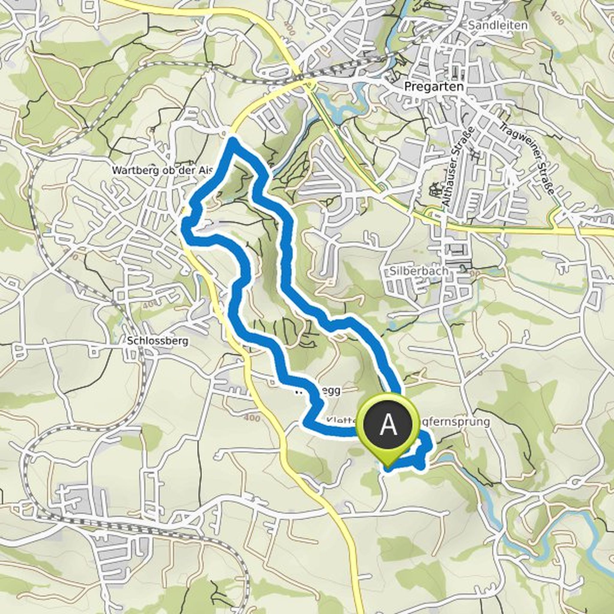
Ortnfr planned a hike
April 12, 2022
Time
2h19m
Distance
8.87km
Speed
3.8km/h
Ascent
60m
Descent
70m
Map data © OpenStreetMap contributors
Ortnfr planned a hike
August 17, 2021
Time
2h00m
Distance
6.61km
Speed
3.3km/h
Ascent
120m
Descent
120m
Map data © OpenStreetMap contributors
Ortnfr planned a hike
May 26, 2020
Time
2h32m
Distance
8.29km
Speed
3.3km/h
Ascent
270m
Descent
270m

Map data © OpenStreetMap contributors
Ortnfr planned a hike
June 30, 2018
Time
3h19m
Distance
10.7km
Speed
3.2km/h
Ascent
380m
Descent
370m

Map data © OpenStreetMap contributors
Ortnfr planned a hike
June 19, 2018
Time
3h34m
Distance
10.7km
Speed
3.0km/h
Ascent
450m
Descent
460m

Map data © OpenStreetMap contributors
Ortnfr planned a hike
June 3, 2018
Time
3h22m
Distance
11.4km
Speed
3.4km/h
Ascent
300m
Descent
310m

Map data © OpenStreetMap contributors
Ortnfr planned a hike
November 3, 2017
Time
2h32m
Distance
8.57km
Speed
3.4km/h
Ascent
200m
Descent
200m

Map data © OpenStreetMap contributors
Ortnfr planned a mountaineering activity
October 27, 2017
Time
4h24m
Distance
10.7km
Speed
2.4km/h
Ascent
500m
Descent
500m

Map data © OpenStreetMap contributors