Timeline
Aktivhotel DAS Hintersee**** planned an e-mountain bike ride
April 26, 2022
Time
Distance
Speed
Ascent
Descent
Aktivhotel DAS Hintersee**** planned an e-mountain bike ride
June 11, 2021
Time
Distance
Speed
Ascent
Descent

June 11, 2021
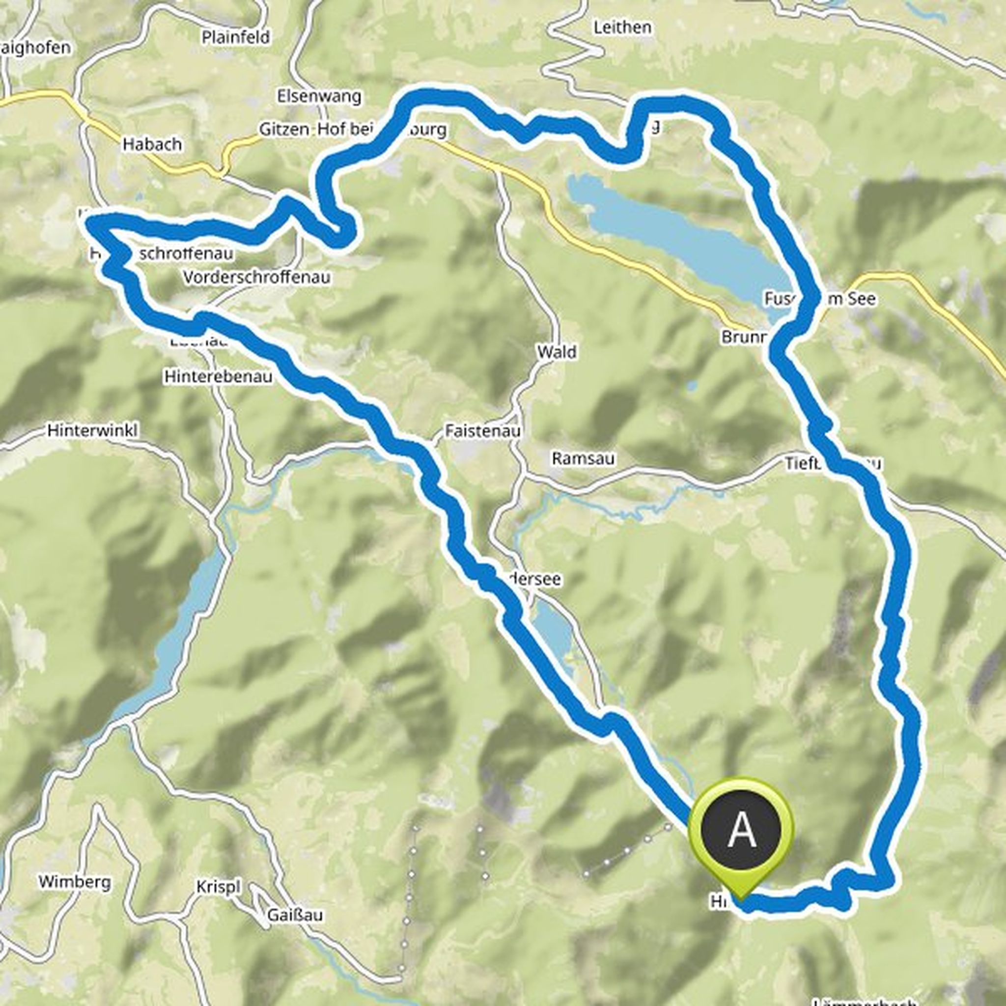
Off to the state capital! One of the most beautiful cities in Europe should be worth a visit. Simple but longer eMTB tour. The asphalt content is a little higher. From Hintersee via Ebenau, Koppl to the south-eastern shoulder of the Gaisberg. Via the Fageralm to Elsbethen to the Salzach. This along to
Translated by Google •
Aktivhotel DAS Hintersee**** and Peter Schuppe planned an e-mountain bike ride
June 11, 2021
Time
Distance
Speed
Ascent
Descent
June 11, 2021
Longer eMTB drive-in tour and getting to know the region is not uninteresting! The Fuschlsee region communities are experienced on different road surfaces. Many short uphill and downhill hikes challenge and promote your eBike technique.
Translated by Google •
Aktivhotel DAS Hintersee**** planned an e-mountain bike ride
June 11, 2021
Time
Distance
Speed
Ascent
Descent

Sagie likes this.
June 11, 2021
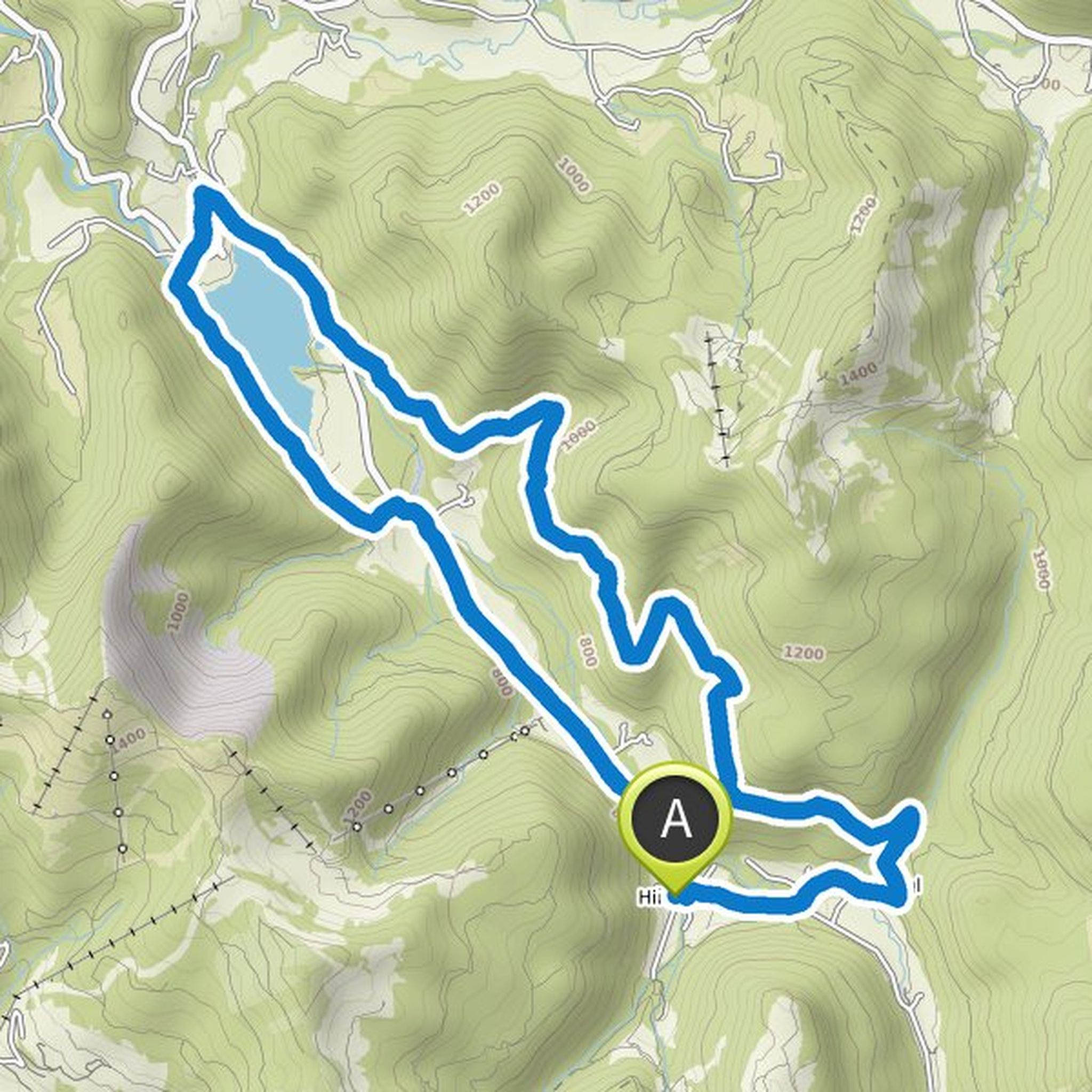
Easy eMTB entry tour with a little more asphalt. Getting used to the eMTB is in the foreground. Past the south bank of the Hintersee over the "Felsenbad" to Faistenau
1000 year old linden tree.
Via side roads to Tiefbrunnau and on to the Hatznalm. Stop in, enjoy and return via Unterzagl to Hintersee.
Translated by Google •
Aktivhotel DAS Hintersee**** planned an e-mountain bike ride
June 11, 2021
Time
Distance
Speed
Ascent
Descent
June 11, 2021
Optimal entry tour for eMTBs. The characteristics of the route offer ideal conditions for beginners, beginners or those who want to get used to their eMTB again after a break.
The uphill and downhill hikes are comfortable and require general cycling technique.
From the center of Hintersee the state road
Translated by Google •
Aktivhotel DAS Hintersee**** planned an e-mountain bike ride
June 4, 2021
Time
Distance
Speed
Ascent
Descent
June 4, 2021
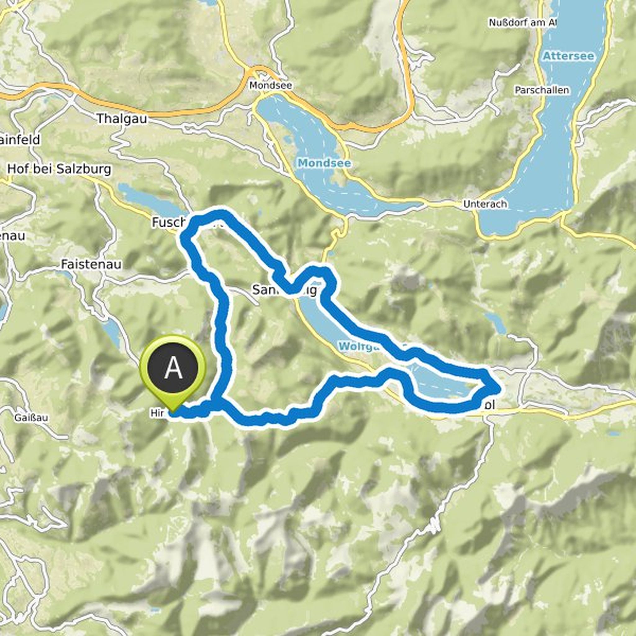
A demanding eMTB tour with all the delicacies that the western Salzkammergut has to offer. Excellent groomed forest roads, plenty of places to stop for refreshments, wonderful views, the boat trip over Lake Wolfgang and a short technical passage at KM 43.
From Hintersee we continue in the direction of
Translated by Google •
Aktivhotel DAS Hintersee**** planned a hike
March 21, 2021
Time
Distance
Speed
Ascent
Descent
March 21, 2021
The hike to the Faistenauer Schafberg or to the Loibersbacher Höhe is an insider tip among hikers. The view from the summit is really unbelievable, because you can see countless mountain peaks of the Osterhorn group, lakes and valleys, which together form a unique panorama.
From the Faistenau Moosegg
Translated by Google •
Aktivhotel DAS Hintersee**** planned a hike
March 21, 2021
Time
Distance
Speed
Ascent
Descent
March 21, 2021
The 3 summit tour is a long but very rewarding tour that has everything you could want. For the hike, however, you need sturdy shoes, surefootedness and a head for heights, because the route not only takes you past alpine pastures, but also over rugged peaks and narrow ridges.
It starts at the Lämmerbach
Translated by Google •
Aktivhotel DAS Hintersee**** planned an e-mountain bike ride
March 8, 2021
Time
Distance
Speed
Ascent
Descent

March 8, 2021
Demanding eMTB tour with a rewarding view from the Zwölferhorn.
The goal at approx. 1500 meters altitude is also the requirement of your very good driving technique.
The crisp UP and downhill hikes on and off the Zwölferhorn require excellent cornering and braking techniques.
The return route leads along
Translated by Google •
Aktivhotel DAS Hintersee**** planned an e-mountain bike ride
March 8, 2021
Time
Distance
Speed
Ascent
Descent

March 8, 2021
Very demanding eMBT tour around the Zwölferhorn. A fantastic view from the Sausteigalm on the Zwölferhorn over Lake Wolfgang. Between KM 15 and 17 there is a very difficult downhill trail to tackle. Excellent eMTB technology is a prerequisite here (the bike can of course also be pushed).
There is also
Translated by Google •
Aktivhotel DAS Hintersee**** planned an e-mountain bike ride
March 8, 2021
Time
Distance
Speed
Ascent
Descent

March 8, 2021
"Marathon", a challenge that should not be faced without good reason.
This endeavor is also a real challenge with the eMTB!
With this route, all points of interest in our region are combined into one highlight.
Consider tackling this venture with an overnight stay. The Marathon company is already looking very different.
Translated by Google •
Aktivhotel DAS Hintersee**** planned an e-mountain bike ride
March 8, 2021
Time
Distance
Speed
Ascent
Descent
matador88 likes this.
March 8, 2021
Very demanding tour with an uphill single trail, rapid downhill's on well-groomed forest roads and crisp uphills require very good driving technique.
Let's go, from Hintersee to the Bergalm, in the last section of the route a casual Singel Trail (short sliding passage).
Dream view towards the mountains
Translated by Google •
Aktivhotel DAS Hintersee**** planned an e-mountain bike ride
March 8, 2021
Time
Distance
Speed
Ascent
Descent

March 8, 2021
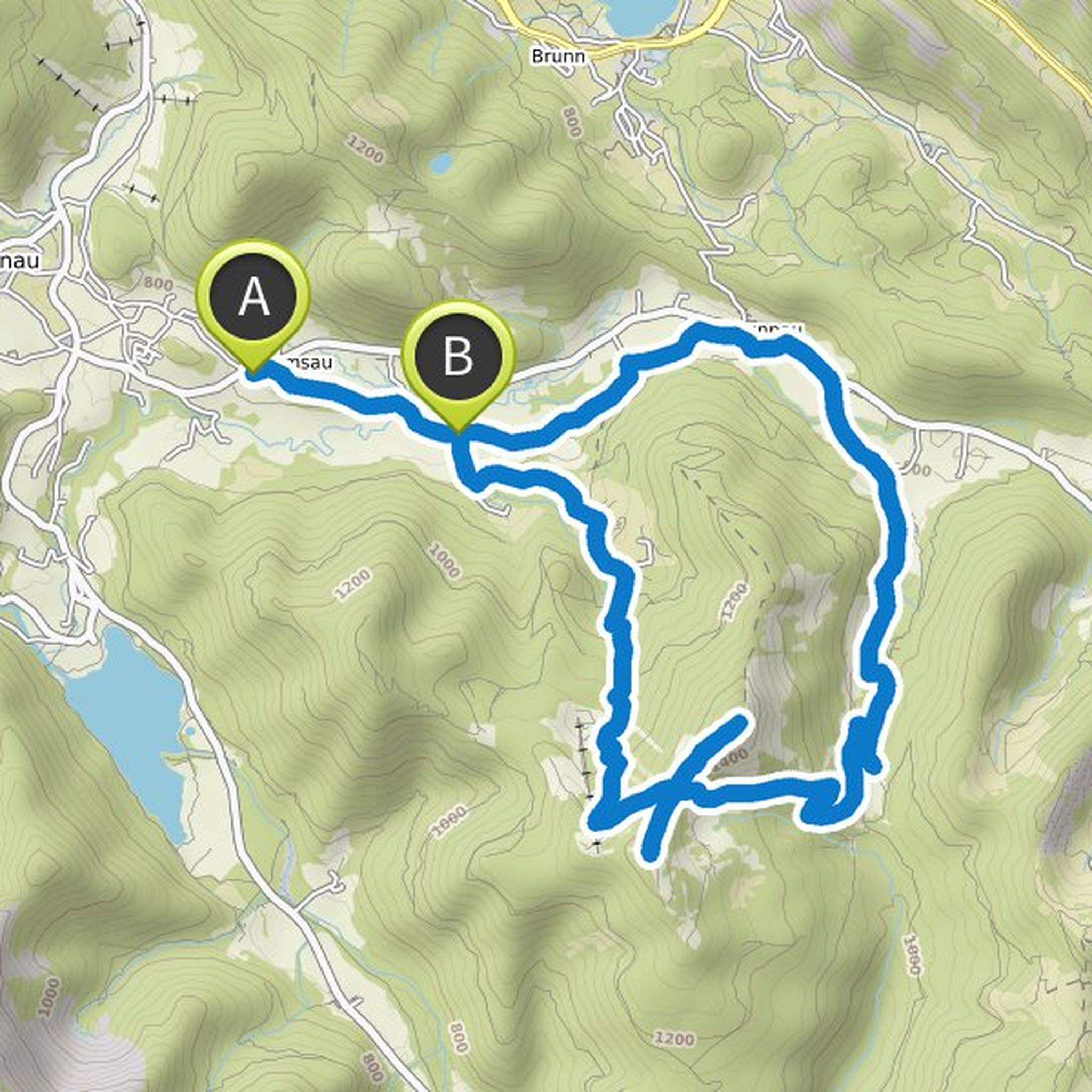
Short, very demanding eMTB tour to the Bergalm with an Uphill Singel Trail in the last section (short sliding passage). Very good driving technique is necessary.
The way back is via the ascent route.
Translated by Google •
Aktivhotel DAS Hintersee**** planned an e-mountain bike ride
March 8, 2021
Time
Distance
Speed
Ascent
Descent

March 8, 2021
Short, demanding eMTB tour on the Gennersattel to the Poschnhütte.
Good driving technique is required due to the incline / decline of the forest road and the car traffic through the toll road.
The way back follows the way there
Translated by Google •
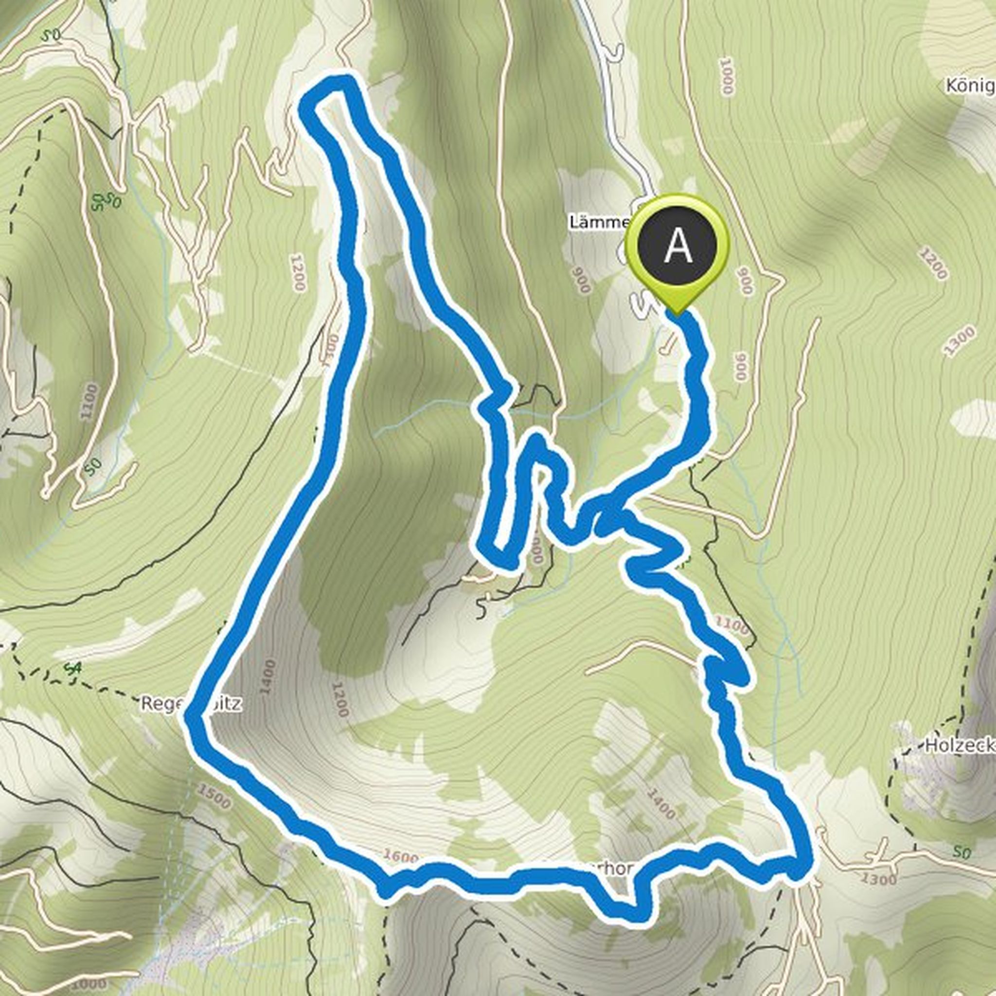
April 26, 2022
The round to the Genneralm and on to the Seewaldsee is the easiest way to fall in love with the Osterhorn mountains in no time at all. Wonderful alpine pastures, secluded valleys and rustic huts await you on this sporty and challenging tour with trail sections and steep uphills. It doesn't matter whether
Translated by Google •