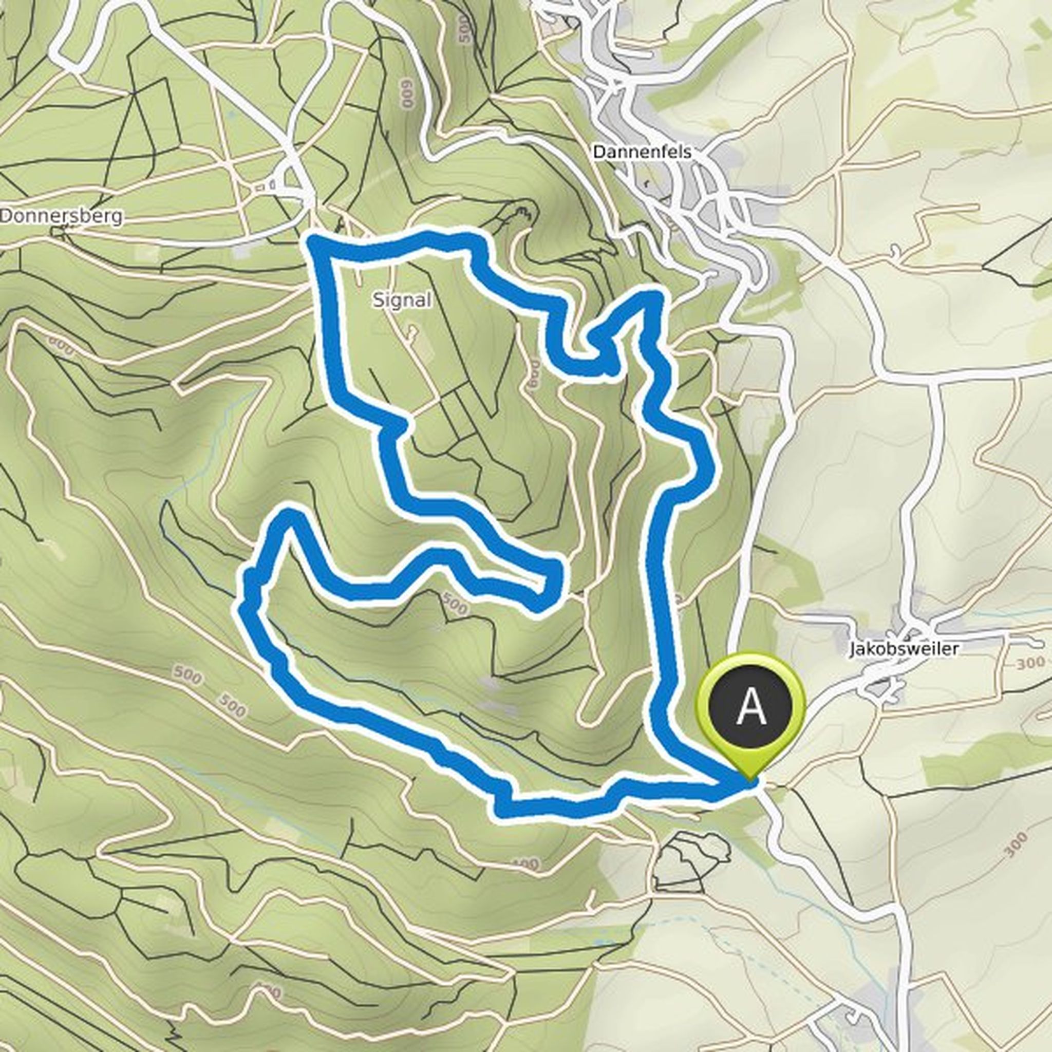
Timeline
Jürgen planned a hike
March 19, 2022
Time
3h09m
Distance
11.6km
Speed
3.7km/h
Ascent
170m
Descent
170m
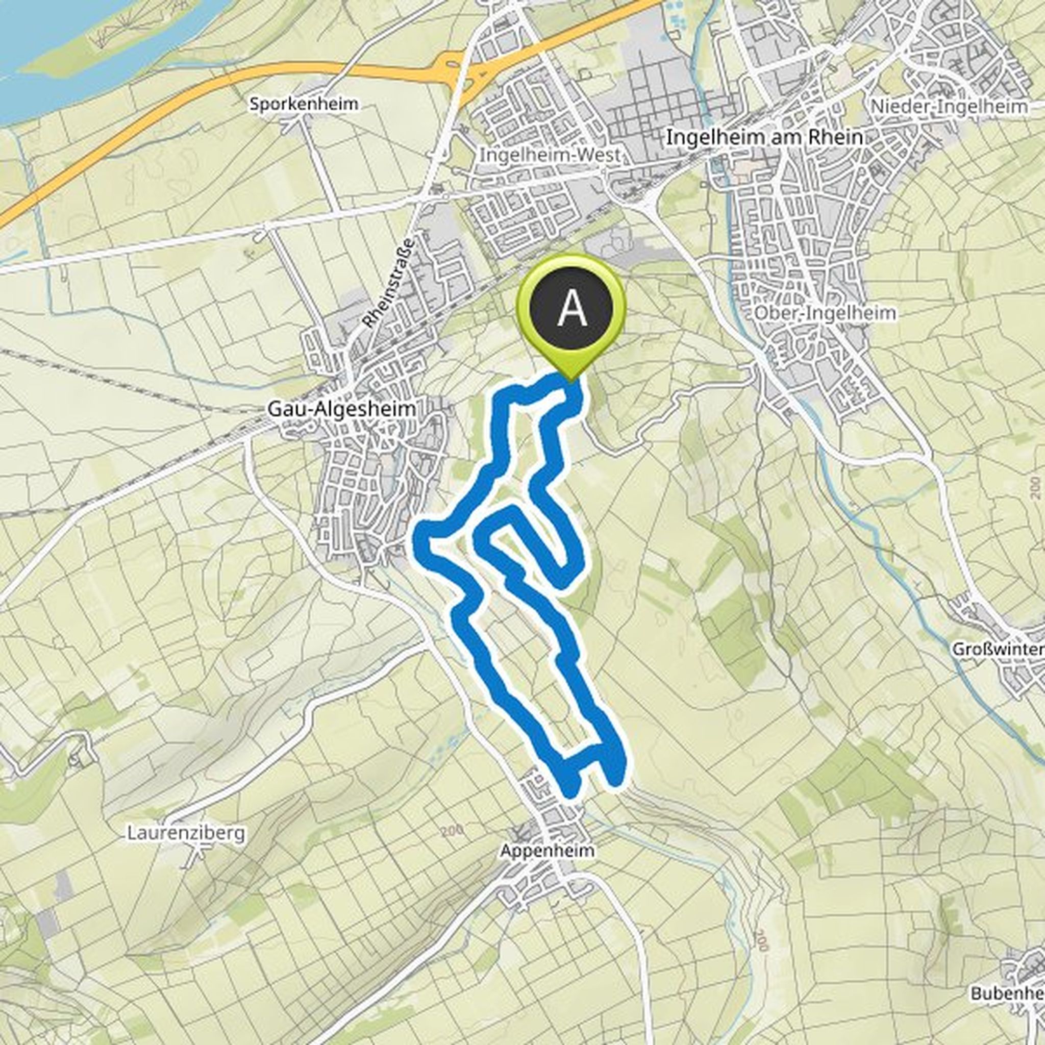
Map data © OpenStreetMap contributors
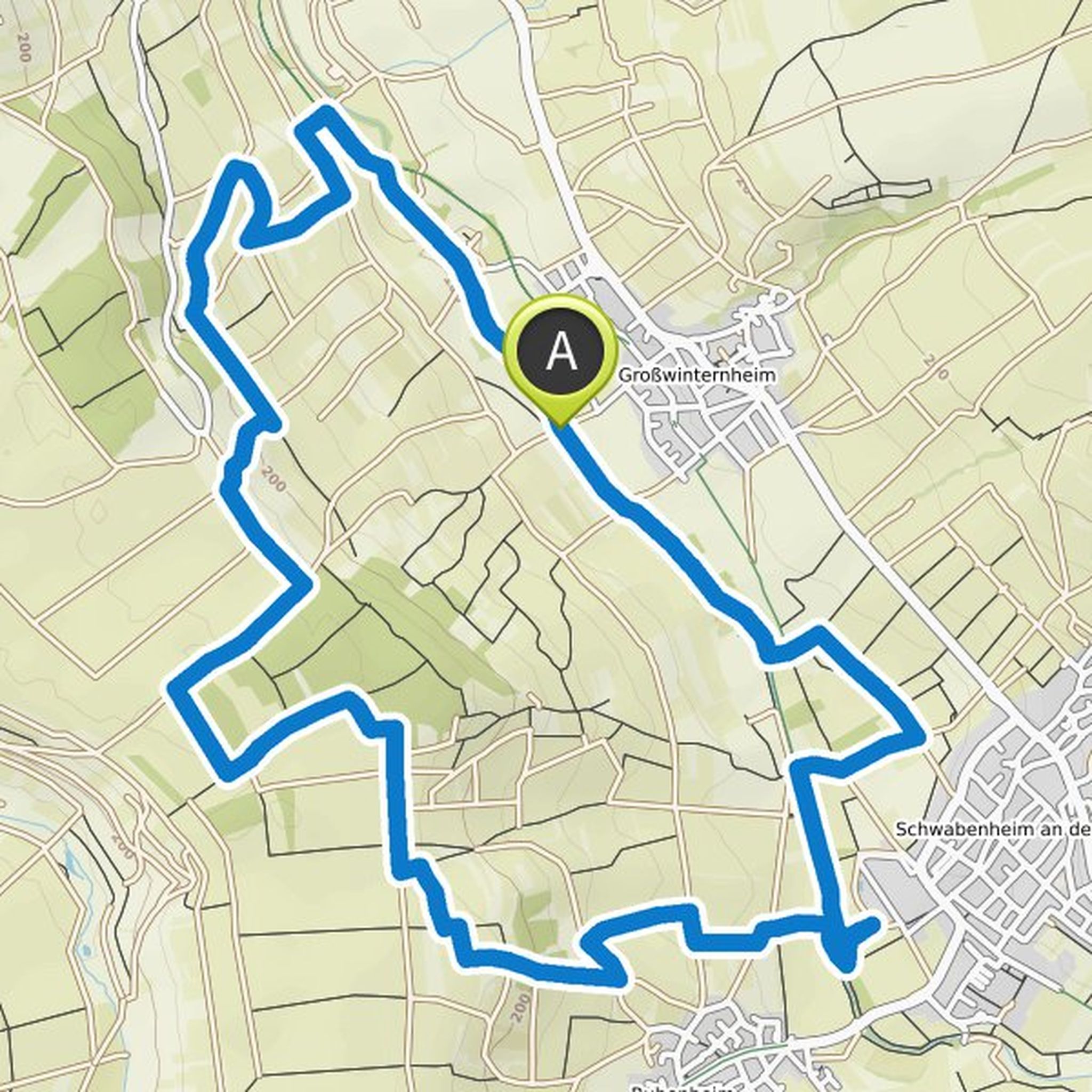
Jürgen planned a hike
March 19, 2022
Time
2h07m
Distance
7.58km
Speed
3.6km/h
Ascent
140m
Descent
140m
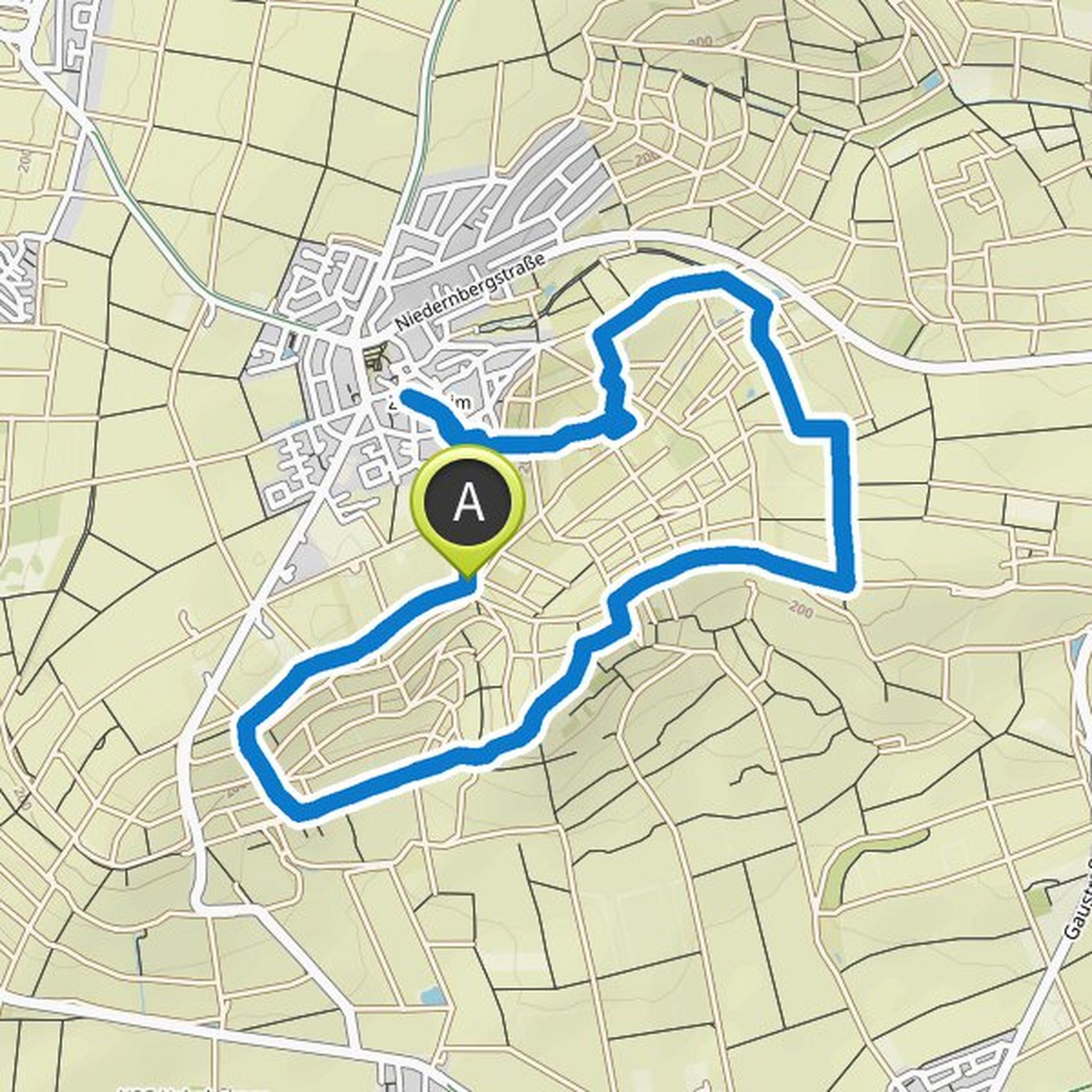
Map data © OpenStreetMap contributors
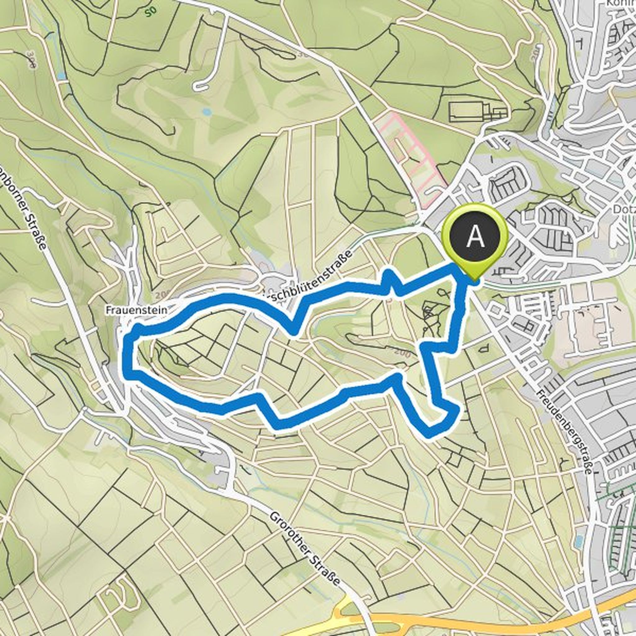
Jürgen planned a hike
March 19, 2022
Time
2h47m
Distance
10.2km
Speed
3.7km/h
Ascent
150m
Descent
150m
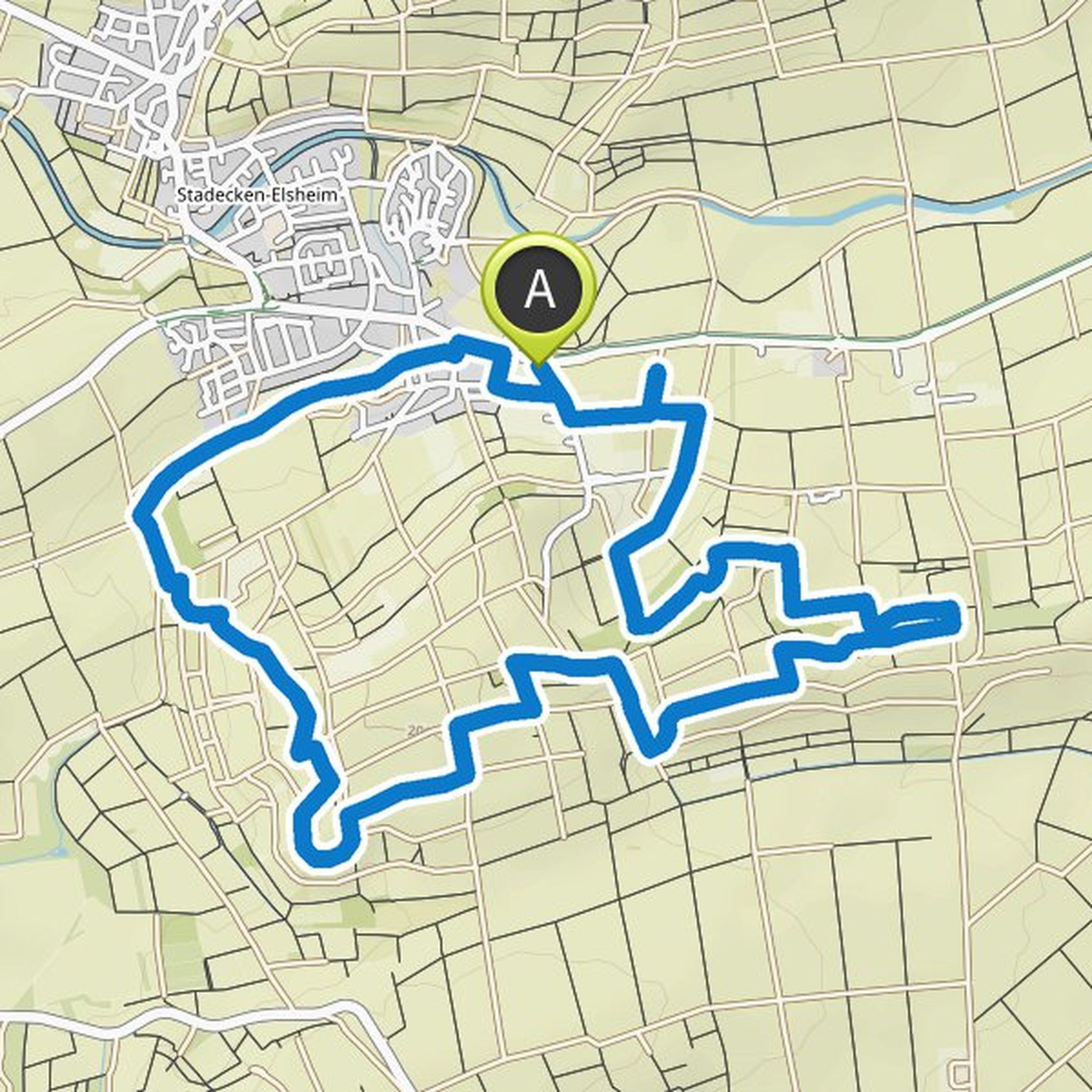
Map data © OpenStreetMap contributors
Jürgen planned a hike
February 11, 2022
Time
1h19m
Distance
4.67km
Speed
3.5km/h
Ascent
100m
Descent
100m
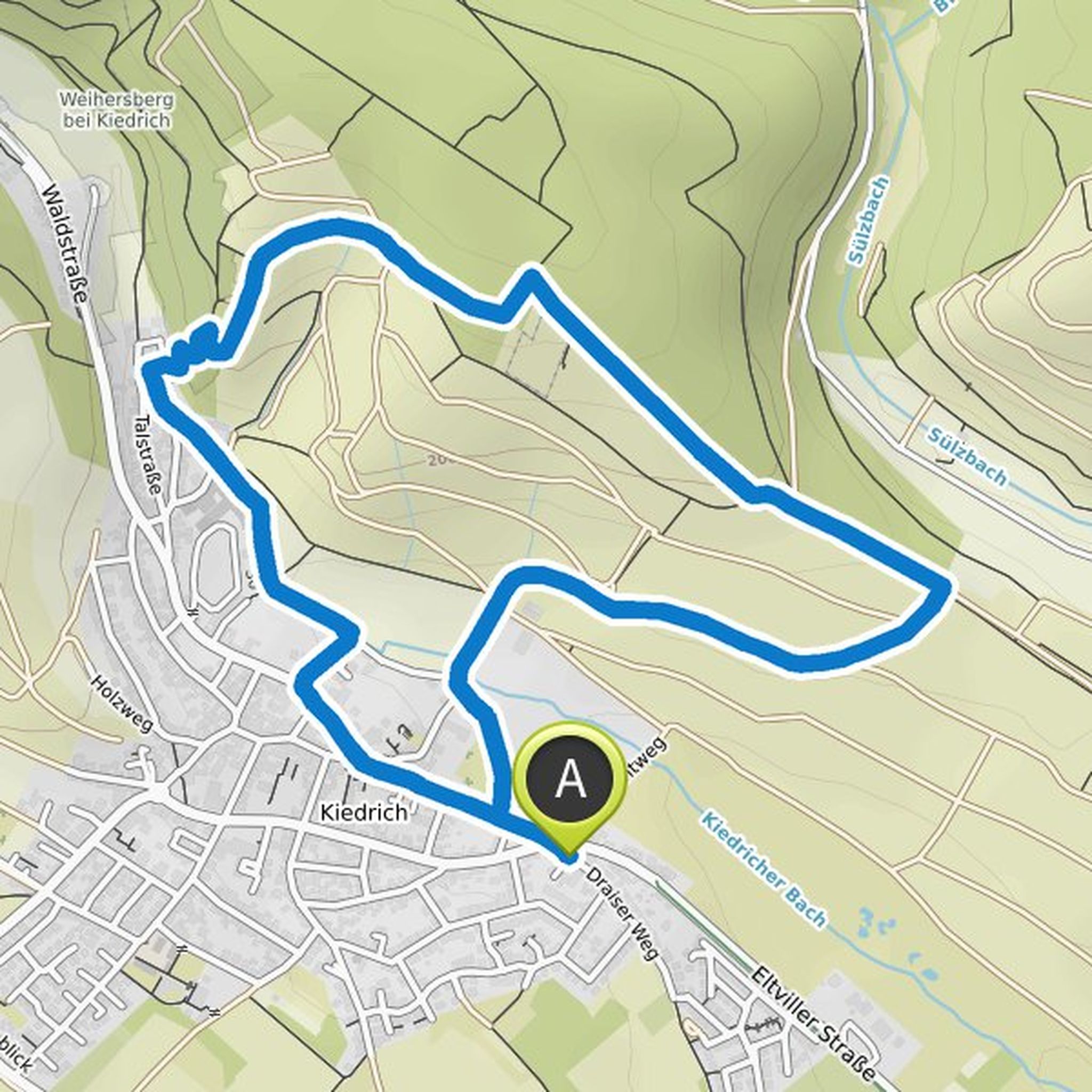
Map data © OpenStreetMap contributors
Jürgen planned a hike
June 3, 2021
Time
3h05m
Distance
10.1km
Speed
3.3km/h
Ascent
360m
Descent
370m
Map data © OpenStreetMap contributors
Jürgen planned a hike
April 4, 2020
Time
1h49m
Distance
6.51km
Speed
3.6km/h
Ascent
120m
Descent
120m
Map data © OpenStreetMap contributors
Jürgen planned a hike
April 4, 2020
Time
1h45m
Distance
6.90km
Speed
4.0km/h
Ascent
10m
Descent
10m
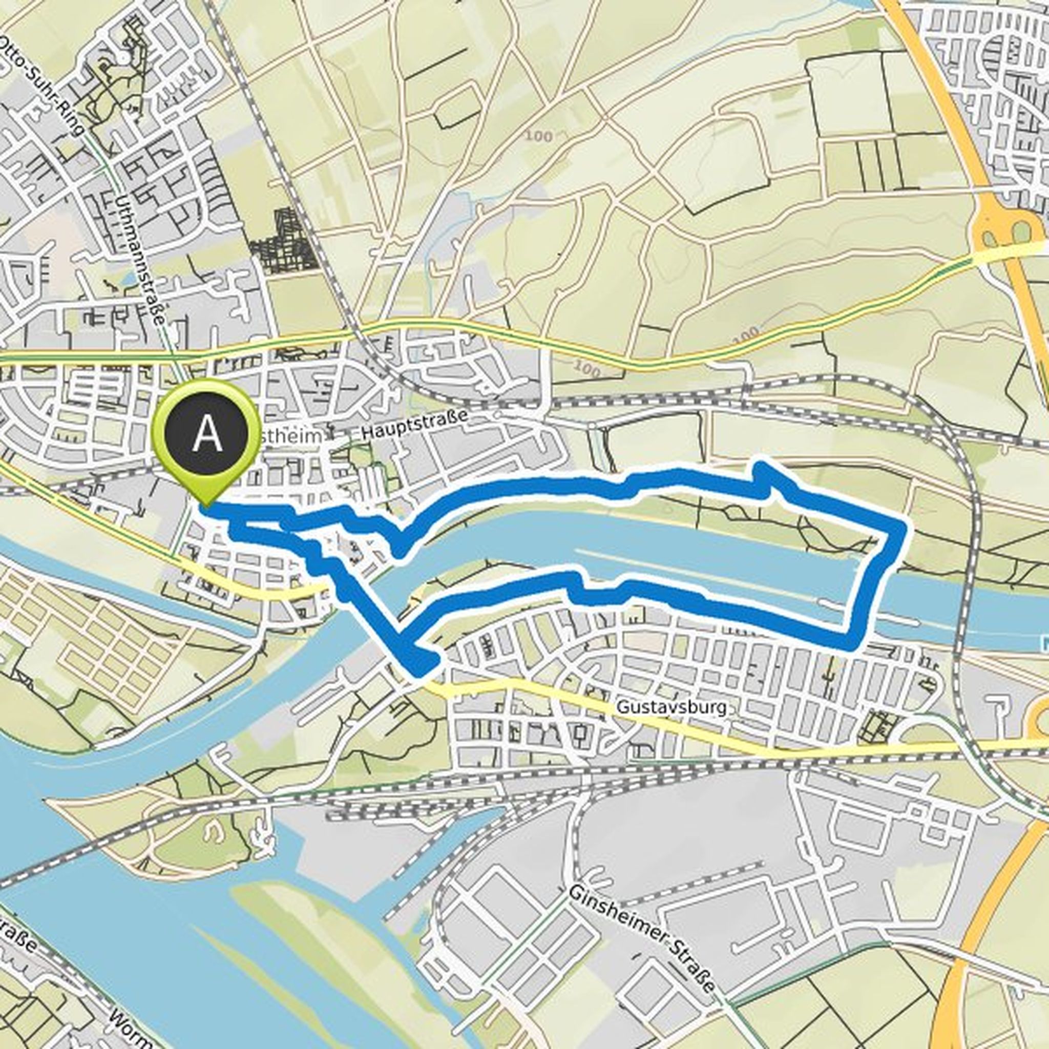
Map data © OpenStreetMap contributors
June 7, 2021
Dear hikers,
we ran this tour and, as always, were very impressed by the nature and clever routing.
The first part goes without any problems, even if the terrain there is less well paved and the geology of the Donnersberg is accompanied by a lot of gravel roads. However, we found the second part of the
Translated by Google •