Timeline
Oli aus F planned a hike
June 11, 2020
Time
2h38m
Distance
10.3km
Speed
3.9km/h
Ascent
40m
Descent
40m

Map data © OpenStreetMap contributors
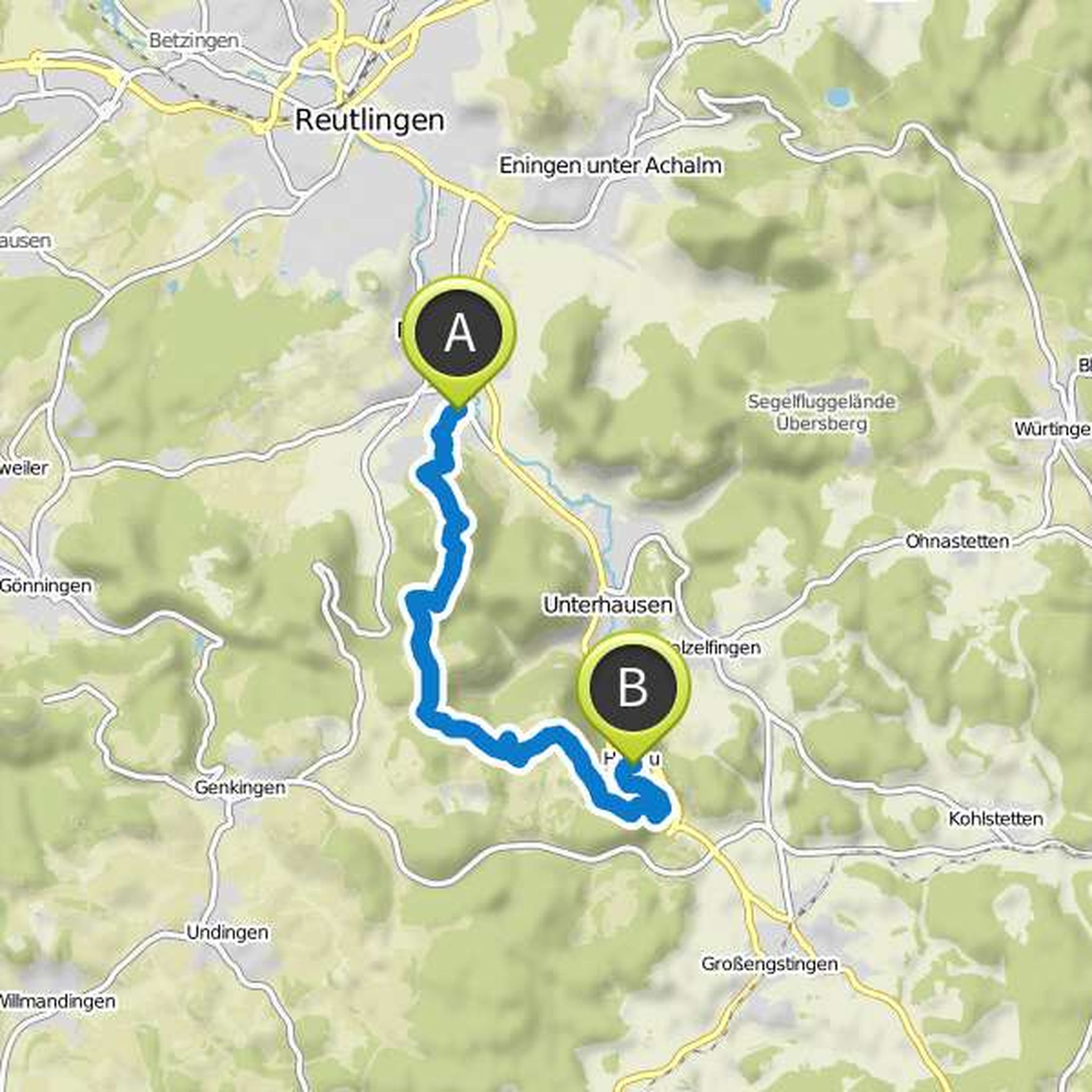
Time
3h16m
Distance
10.8km
Speed
3.3km/h
Ascent
360m
Descent
350m

Map data © OpenStreetMap contributors
Oli aus F planned a hike
March 19, 2017
Time
4h30m
Distance
14.2km
Speed
3.1km/h
Ascent
580m
Descent
460m
Map data © OpenStreetMap contributors
Oli aus F planned a hike
September 22, 2013
Time
4h31m
Distance
17.5km
Speed
3.9km/h
Ascent
530m
Descent
860m

Map data © OpenStreetMap contributors
September 22, 2013
The destination is directly at the dam and is very well connected by bus. As well as the starting place.
Translated by Google •
Oli aus F planned a hike
September 13, 2013
Time
10h45m
Distance
29.4km
Speed
2.7km/h
Ascent
1,660m
Descent
2,560m

Map data © OpenStreetMap contributors
September 13, 2013
Overnight stay in the Lindauer Hütte makes sense!
Translated by Google •
May 30, 2018
The tour will be very nice!
Most of all, I'm looking forward to the final barbecue with a cold beer in Kollnau at Christo.
Translated by Google •