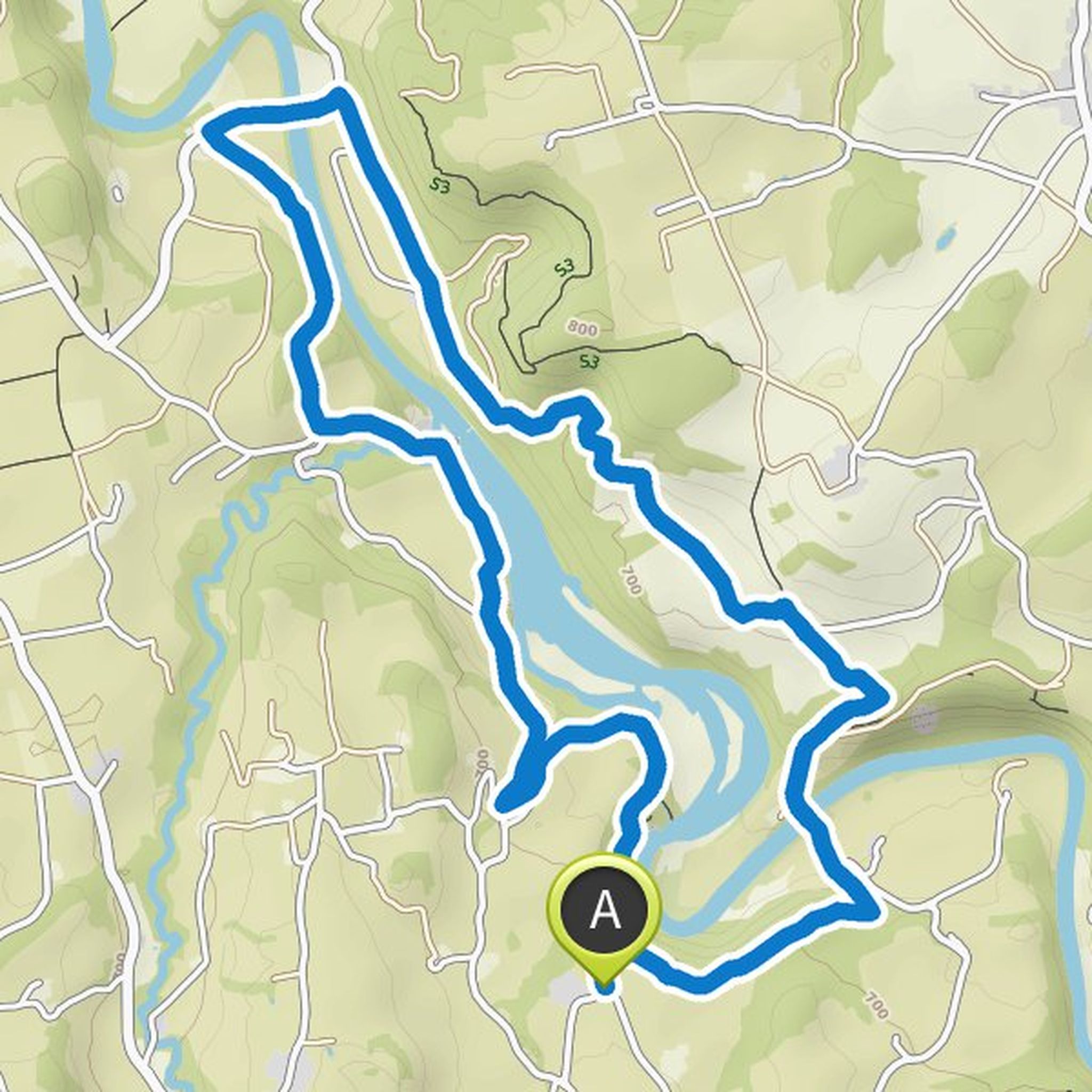
Timeline
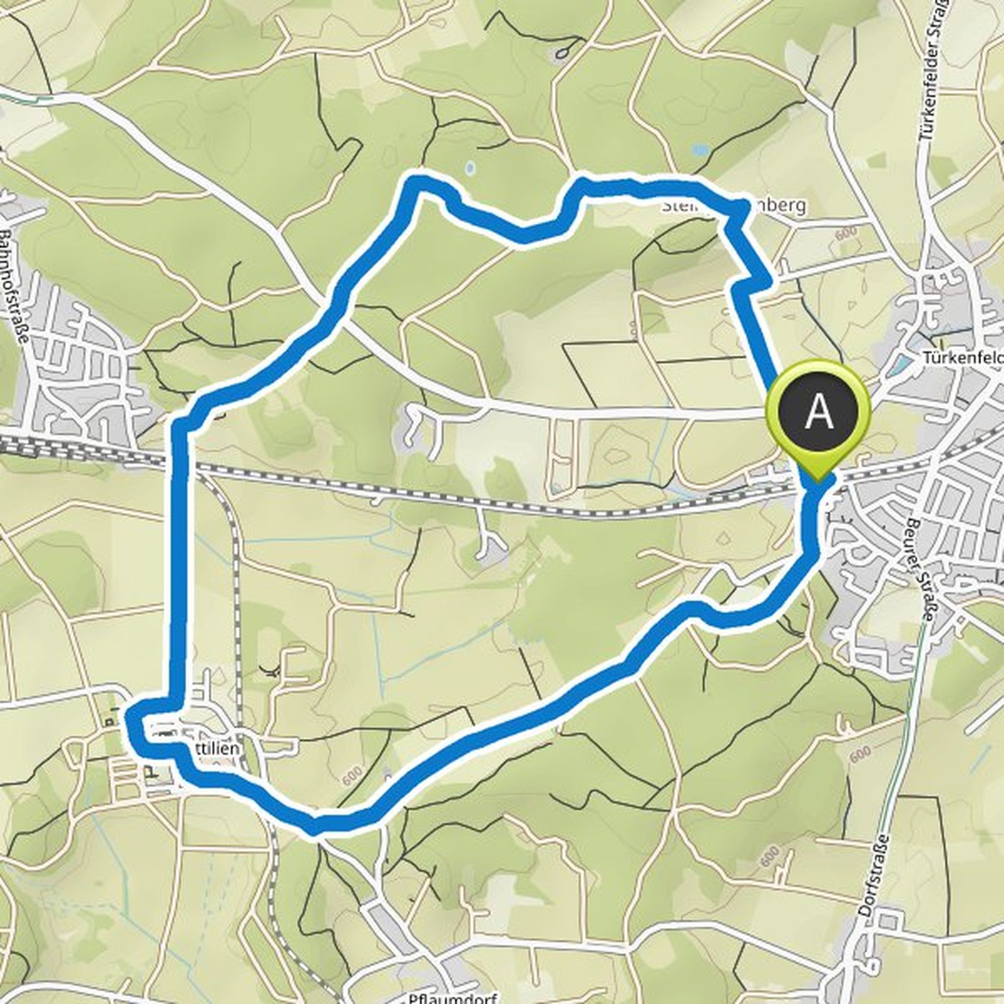
Günter planned a hike
March 28, 2022
Time
3h27m
Distance
10.8km
Speed
3.1km/h
Ascent
400m
Descent
400m
Map data © OpenStreetMap contributors
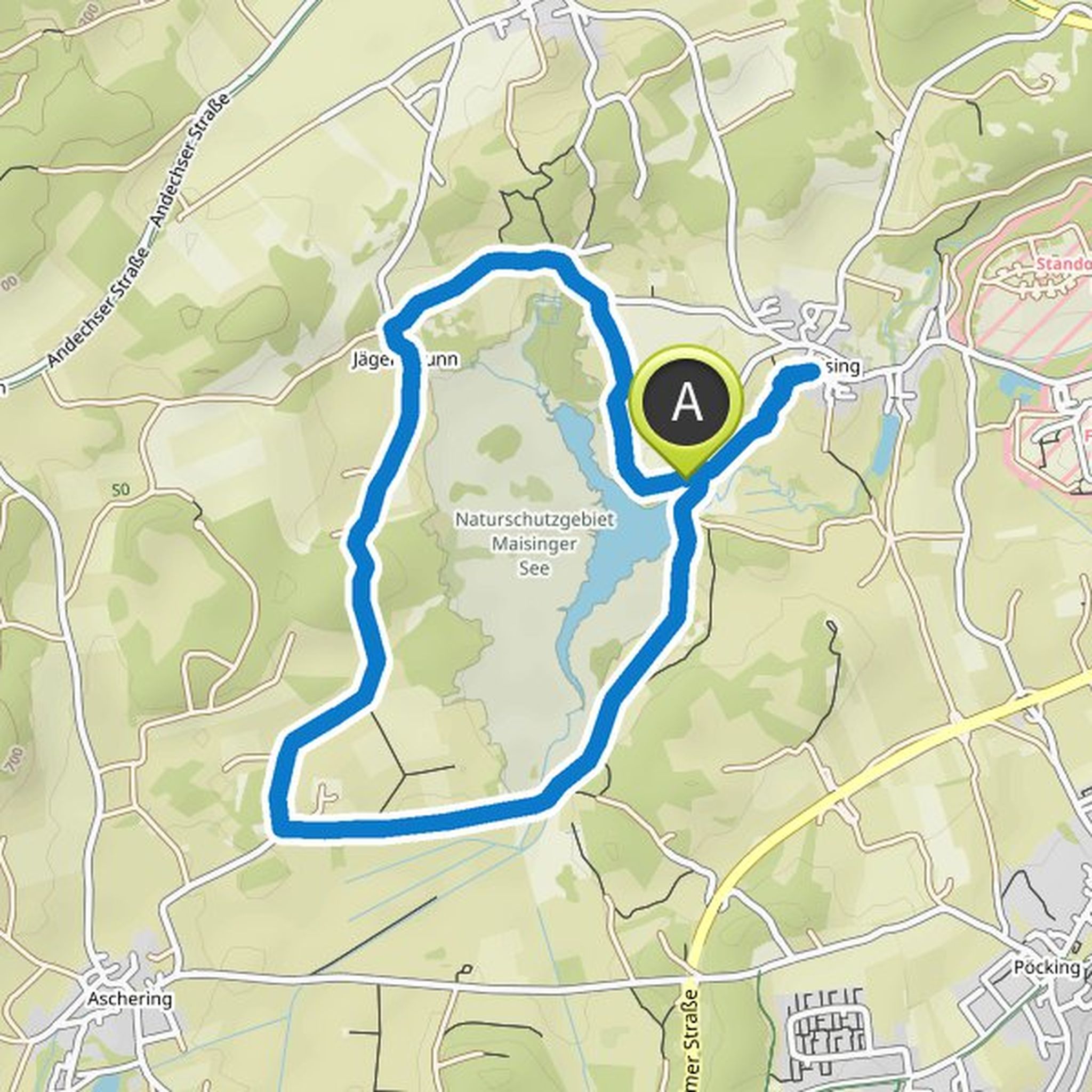
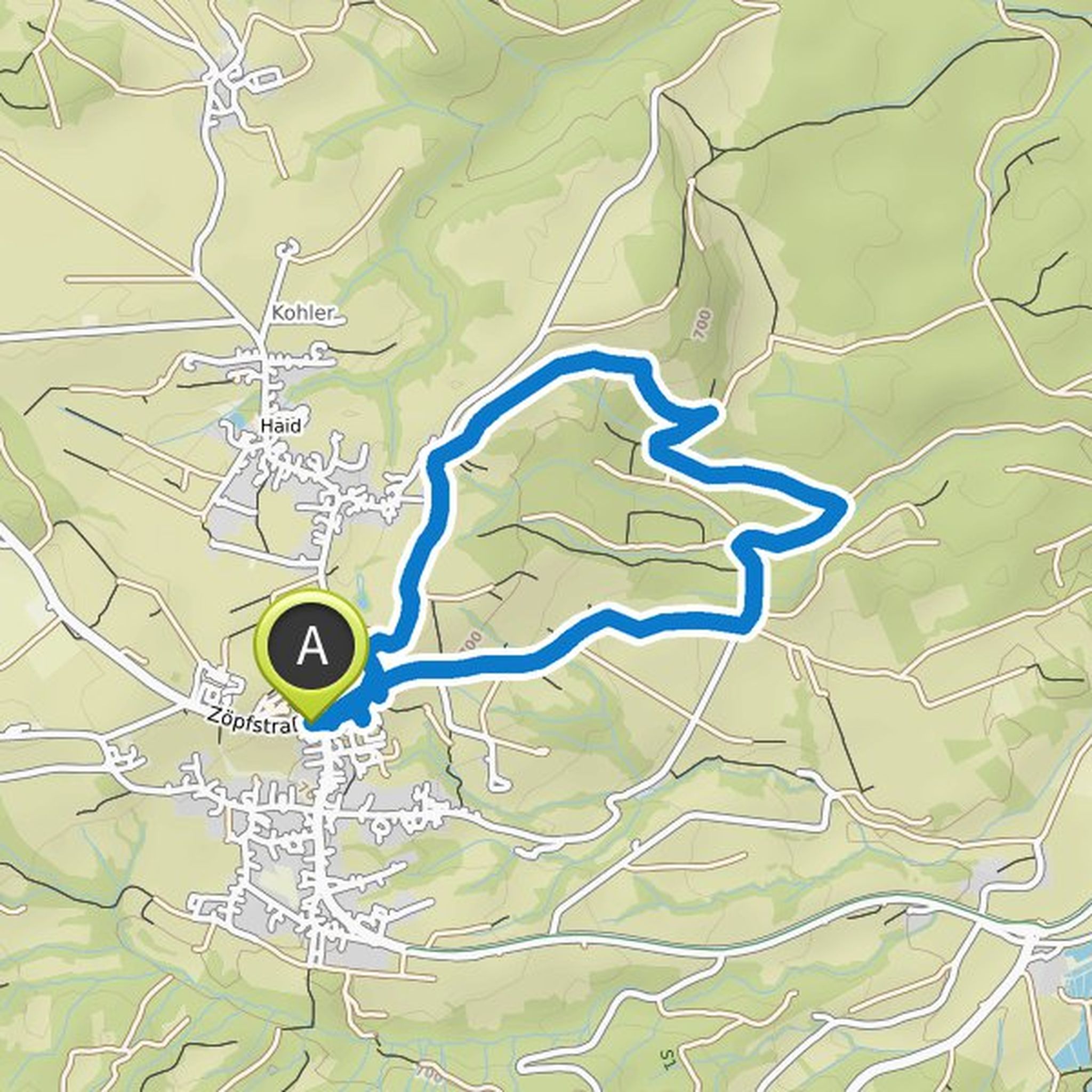
Günter planned a hike
March 19, 2022
Time
2h25m
Distance
9.16km
Speed
3.8km/h
Ascent
80m
Descent
80m
Map data © OpenStreetMap contributors
Günter planned a hike
March 6, 2022
Time
1h59m
Distance
7.54km
Speed
3.8km/h
Ascent
60m
Descent
60m
Map data © OpenStreetMap contributors
Günter planned a hike
June 27, 2021
Time
2h47m
Distance
8.52km
Speed
3.1km/h
Ascent
370m
Descent
370m
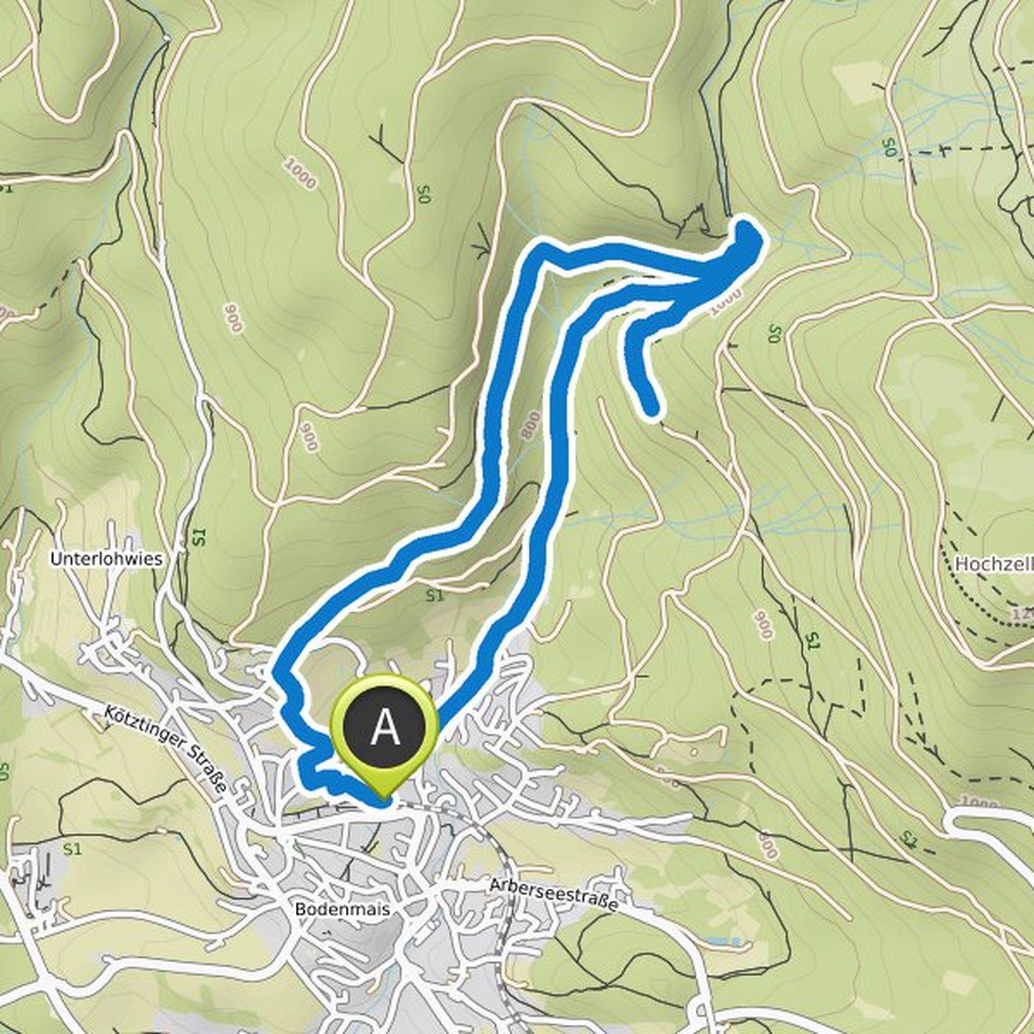
Map data © OpenStreetMap contributors
Günter planned a hike
June 5, 2021
Time
2h25m
Distance
9.14km
Speed
3.8km/h
Ascent
90m
Descent
90m
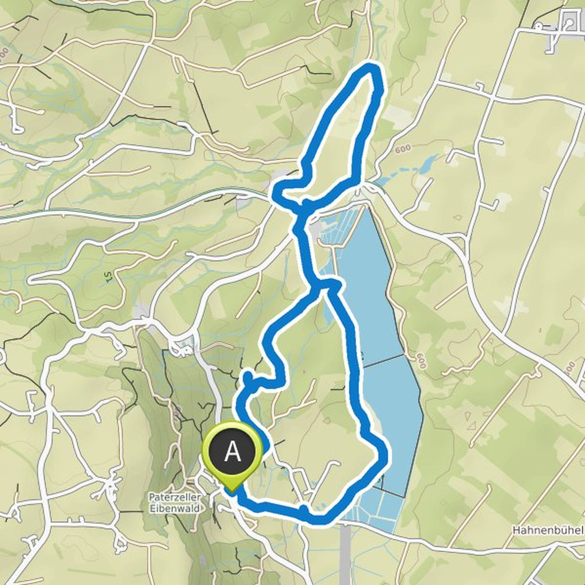
Map data © OpenStreetMap contributors
Günter planned a hike
June 5, 2021
Time
1h40m
Distance
6.09km
Speed
3.6km/h
Ascent
100m
Descent
100m
Map data © OpenStreetMap contributors
May 8, 2021
Very nice round, also very suitable for barefoot hiking
Translated by Google •