Timeline
Peter Wiegandt planned a run
August 16, 2025
Time
Distance
Pace
Ascent
Descent
Peter Wiegandt planned a hike
August 5, 2020
Time
Distance
Speed
Ascent
Descent
Peter Wiegandt planned a run
May 10, 2020
Time
Distance
Pace
Ascent
Descent
Peter Wiegandt planned a run
May 10, 2020
Time
Distance
Pace
Ascent
Descent
Peter Wiegandt planned a run
May 6, 2020
Time
Distance
Pace
Ascent
Descent
Peter Wiegandt planned a run
May 6, 2020
Time
Distance
Pace
Ascent
Descent
Markus F. Weidner and Peter Wiegandt planned a run
August 25, 2019
Time
Distance
Pace
Ascent
Descent
Markus F. Weidner and Peter Wiegandt planned a run
August 25, 2019
Time
Distance
Pace
Ascent
Descent
August 25, 2019
Distance 44.9 km, altitude ascent 1698 Hm, altitude in descent 1989 Hm
From Scuol (1195m) in the Lower Engadine the route along the Inn leads down to Sur En (1133m). Now it goes steadily uphill through the romantic Uina gorge. First we reach Uina Dadora (1460m) with the first food, before we go through
Translated by Google •
Markus F. Weidner and Peter Wiegandt planned a run
August 25, 2019
Time
Distance
Pace
Ascent
Descent
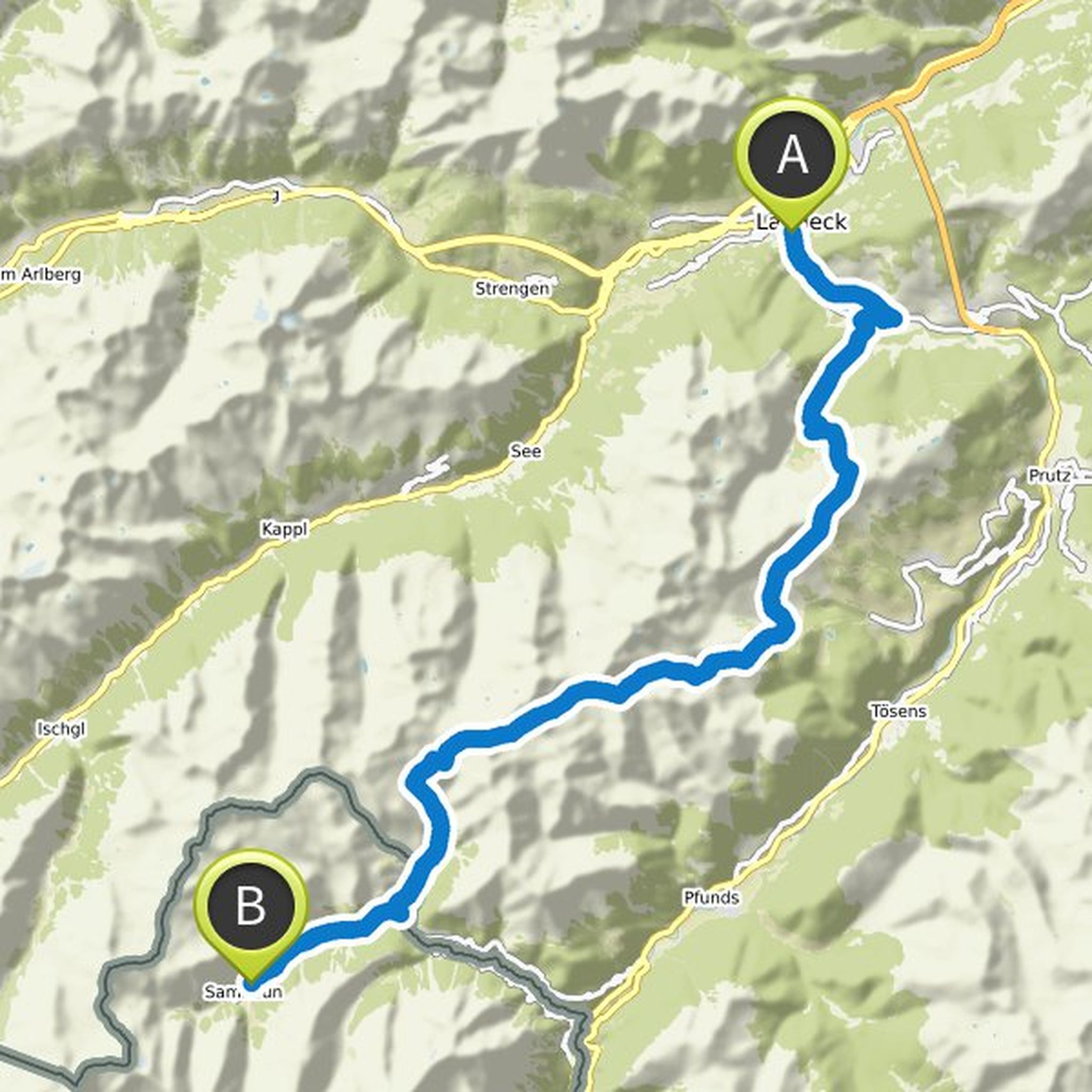
August 25, 2019
Distance 40.5 km, altitude ascent 2275 Hm, altitude in descent 2886 Hm
After the start in Samnaun (1841m) it goes along the Schergenbach to the Zeblasjoch (2539m). Here is the first food station. Then we reach the highest point of the day Fuorcla Val Gronda (2752m), below the Piz Val Gronda. From there
Translated by Google •
Markus F. Weidner and Peter Wiegandt planned a run
August 25, 2019
Time
Distance
Pace
Ascent
Descent
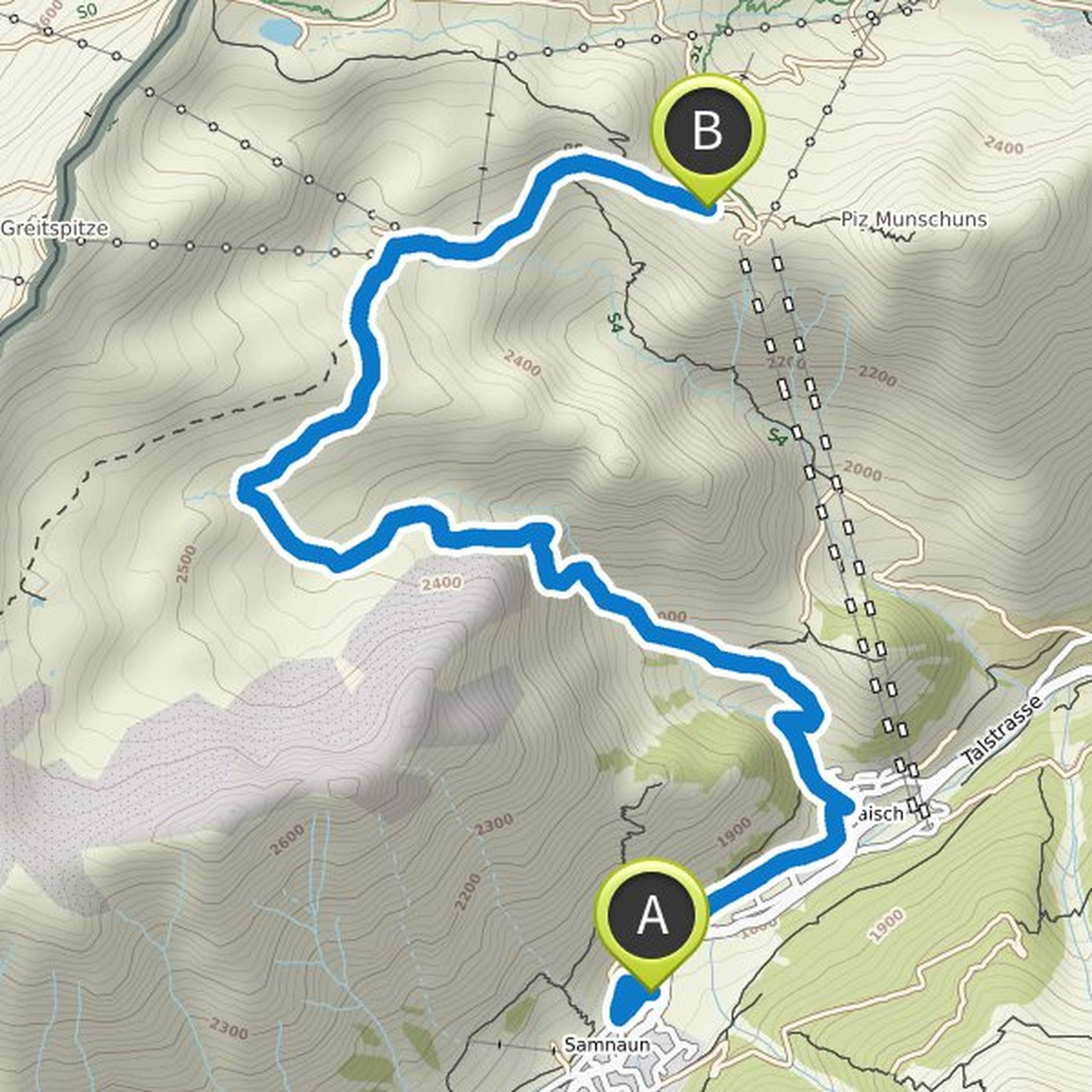
August 25, 2019
Distance 7.8 km, altitude ascent 834 m, altitude in descent 149 m
After the start in Samnaun (1841m) it goes out of the valley to Ravaisch (1802m). From here it rises continuously. First over steep meadows, then through Schrofen and Felsgelände up to Fuorcla (2304m). Continue on the Salaaser high plateau
Translated by Google •
Markus F. Weidner and Peter Wiegandt planned a run
August 25, 2019
Time
Distance
Pace
Ascent
Descent
August 25, 2019
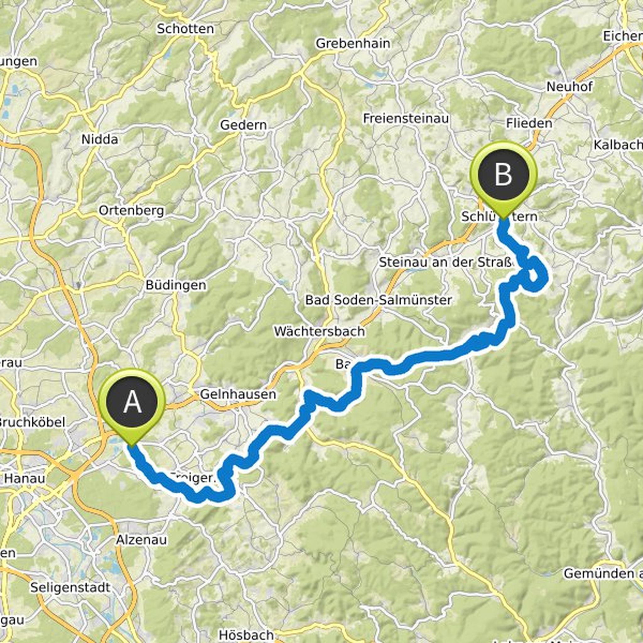
Distance 46.3 km, altitude ascent 2895 Hm, altitude in descent 1868 Hm
After the early start in Landeck (809m), we walk via Hochgallmigg (1218m) and the Landecker Skihütte (1766m) to the Fisser Joch (2432m). Here is the first food station. From there it goes along the Komperdell to the Cologne hut (1965m
Translated by Google •
Markus F. Weidner and Peter Wiegandt planned a run
August 25, 2019
Time
Distance
Pace
Ascent
Descent
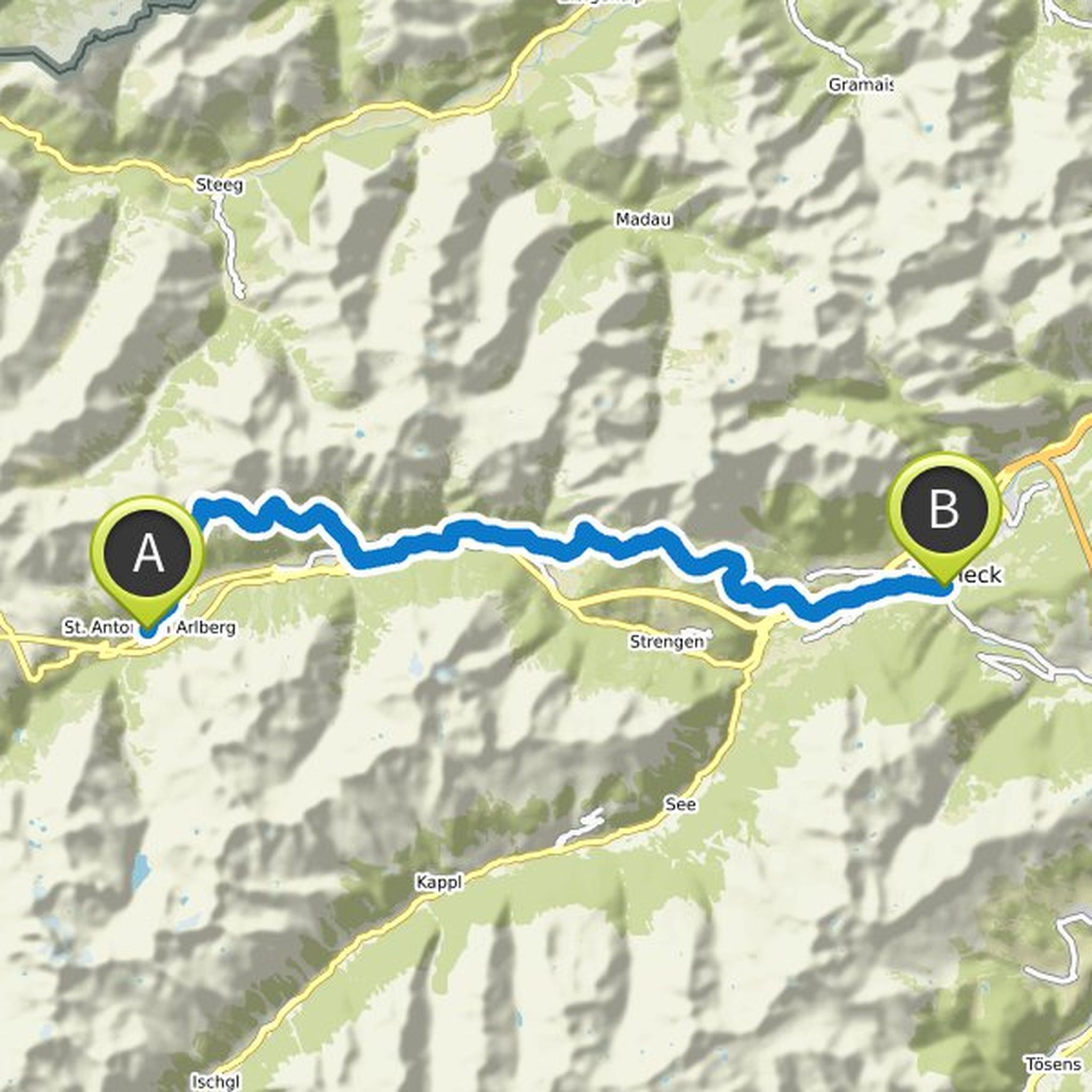
August 25, 2019
Distance 39.2 km, altitude ascent 1981 Hm, altitude in descent 2481 Hm
Starting in St. Anton (1282m), leaving the Inn in the Talfuß, up to the Putzenwald Here we reach the highest point of the day (2051m). From there, the stage leads over the Walcherhöhe (1940m) along the foothills of Schindlekopf and
Translated by Google •
Markus F. Weidner and Peter Wiegandt planned a run
August 25, 2019
Time
Distance
Pace
Ascent
Descent
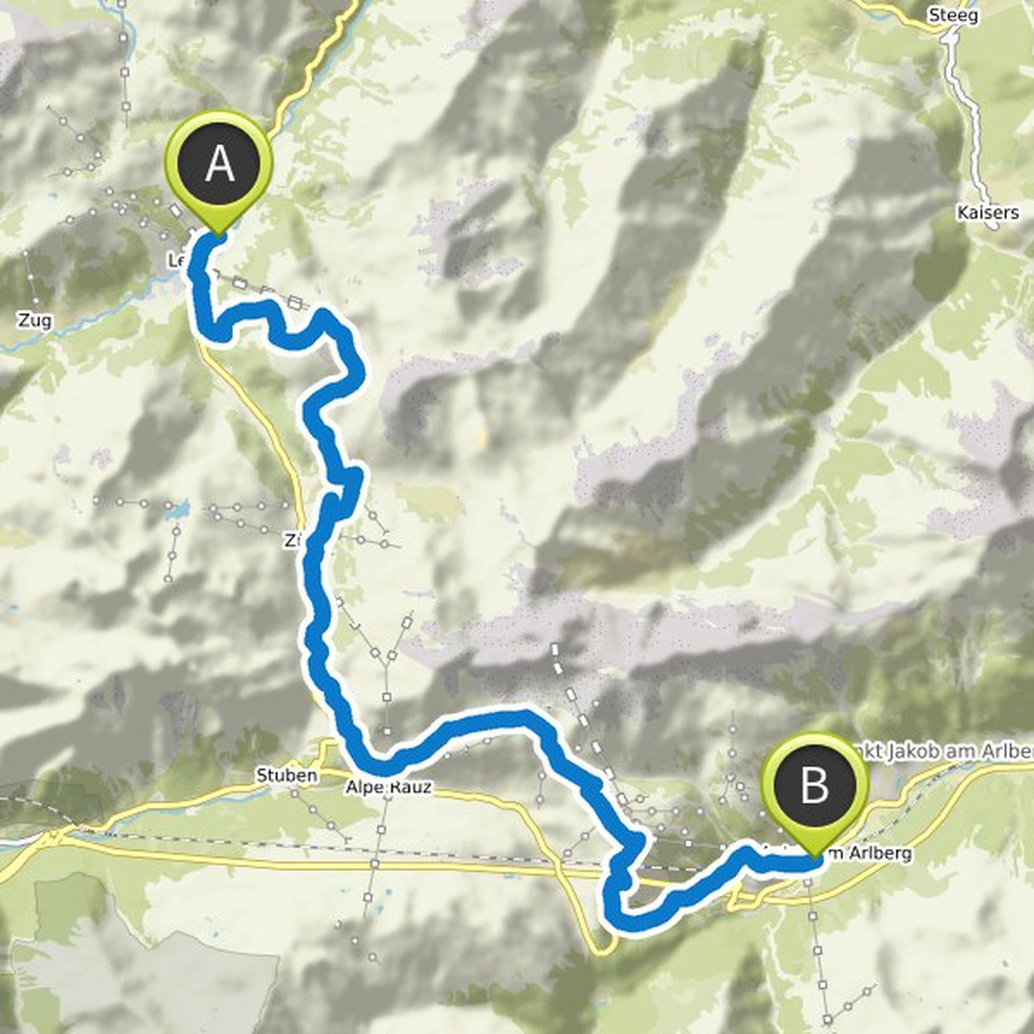
August 25, 2019
Distance 27.7 km, altitude ascent 1787 Hm, altitude in descent 1919 Hm
With start in Lech it goes over the Rüfikopf (2339m), with food station, past the Monazabon lake down to Zürs (1717m) and on to the Flexenpass (1773m) with the second board. Through the Hölltobel and the Flexenmulde we come to Alpe
Translated by Google •
Markus F. Weidner and Peter Wiegandt planned a run
August 25, 2019
Time
Distance
Pace
Ascent
Descent
August 25, 2019
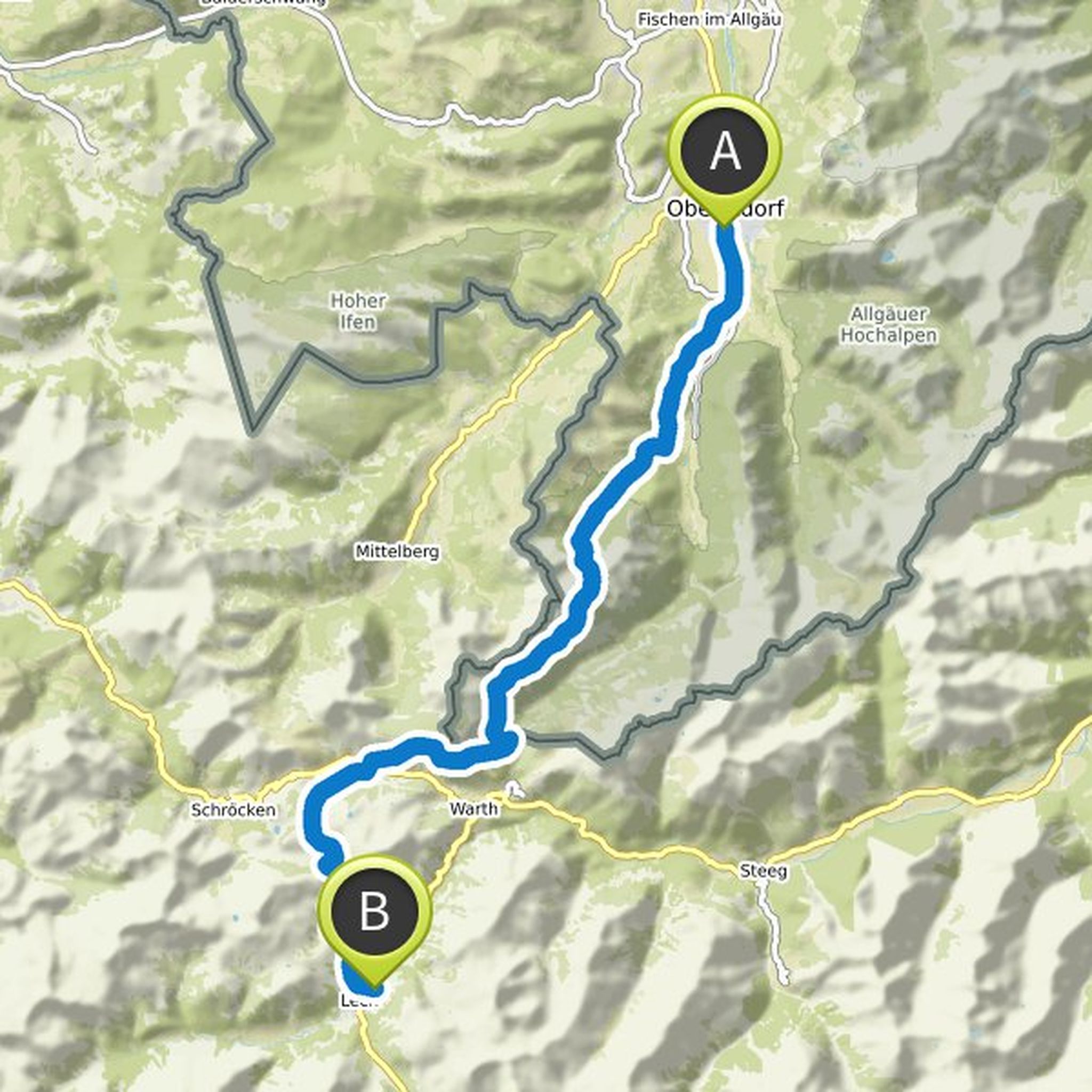
Distance 39.4 km, altitude ascent 2343 Hm, altitude in descent 1714 Hm
The TRANSALPINE RUN 2019 starts in Oberstdorf in the Allgäu. About the Warmatsgund where the first food station is, we walk on alpine paths up to Rossgundscharte (2005m). Below the Schafalpkopf is the highest point of the stage (2061m
Translated by Google •
Peter Wiegandt planned a run
July 22, 2019
Time
Distance
Pace
Ascent
Descent
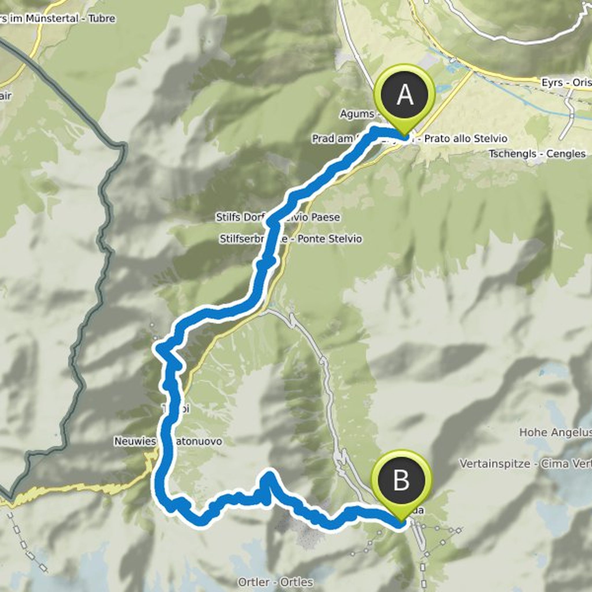
August 25, 2019
Distance 31 km, altitude in ascent 2591 Hm, altitude in descent 1655 Hm
From Prad am Stilfserjoch we start again to a huge alpine cap. Passing through the Heart of Jesus Chapel, pass Patzleid (1075m) and take the panoramic mountain trail to Stilfs (1314m). From the first refreshment station, the route
Translated by Google •