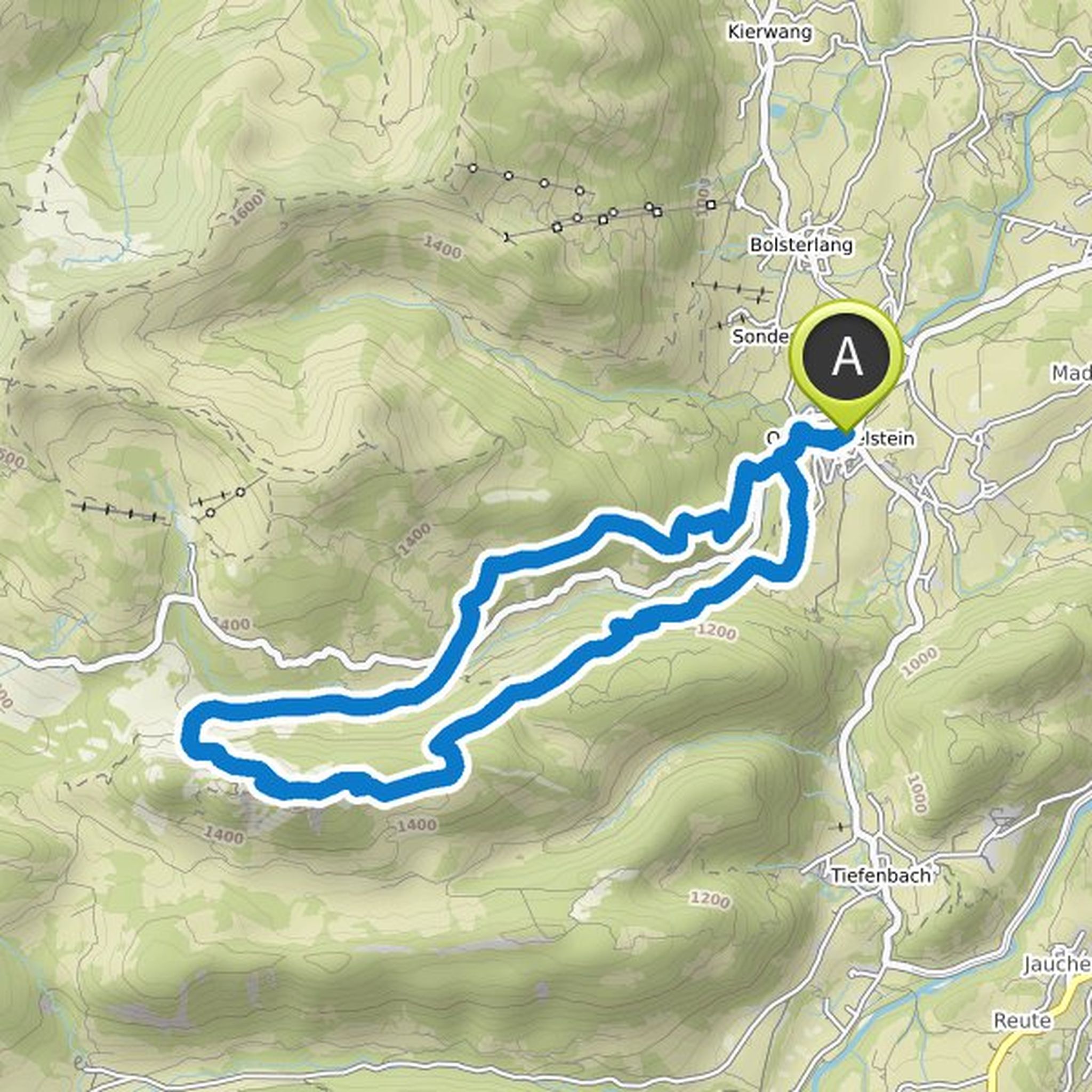
Timeline
Till planned a hike
August 24, 2021
Time
3h32m
Distance
10.2km
Speed
2.9km/h
Ascent
530m
Descent
530m
Map data © OpenStreetMap contributors
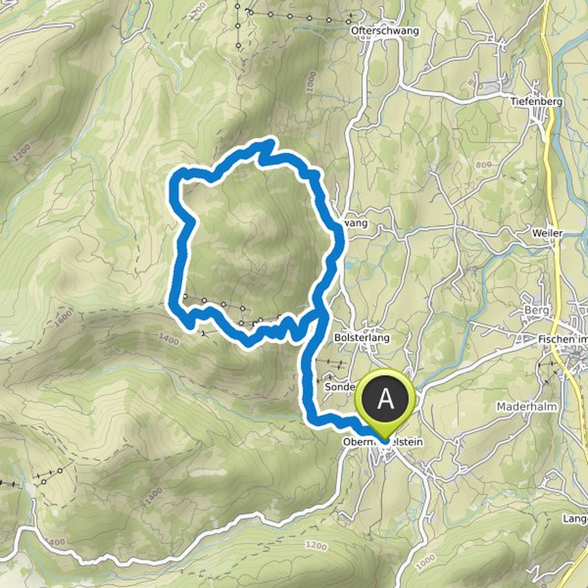
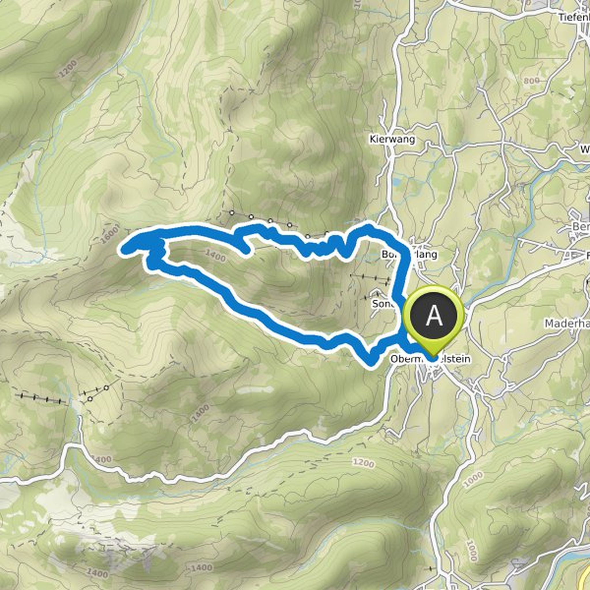
Till planned a hike
August 24, 2021
Time
1h26m
Distance
4.50km
Speed
3.1km/h
Ascent
170m
Descent
170m
Map data © OpenStreetMap contributors
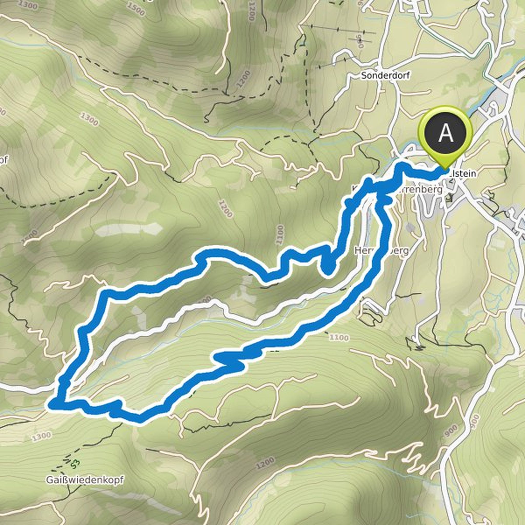
Till planned a hike
August 24, 2021
Time
6h17m
Distance
16.5km
Speed
2.6km/h
Ascent
980m
Descent
980m
Map data © OpenStreetMap contributors
Till planned a hike
August 24, 2021
Time
5h48m
Distance
15.9km
Speed
2.7km/h
Ascent
830m
Descent
830m
Map data © OpenStreetMap contributors
Till planned a hike
August 24, 2021
Time
4h51m
Distance
13.5km
Speed
2.8km/h
Ascent
680m
Descent
680m
Map data © OpenStreetMap contributors
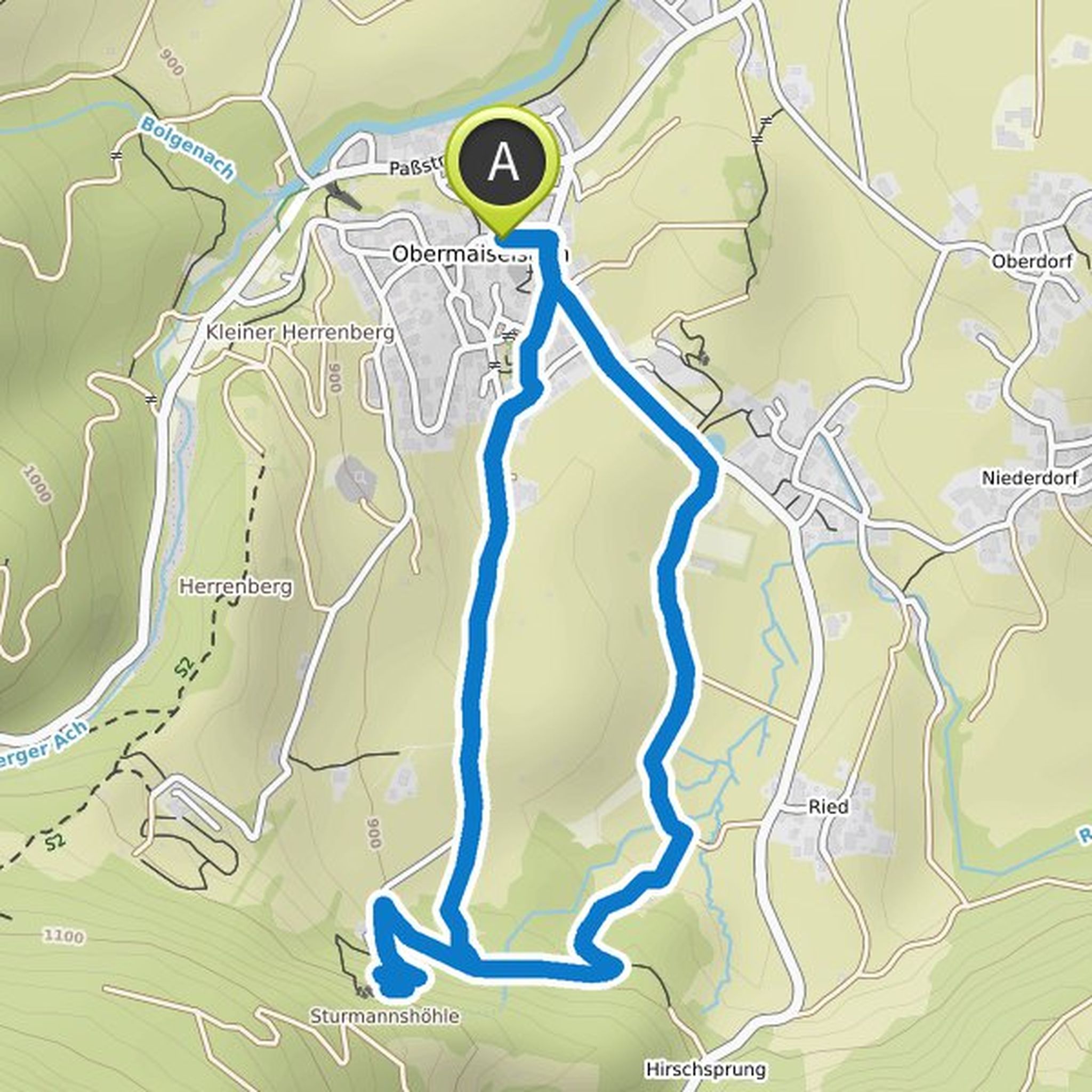
Ho and others planned a hike
August 11, 2019
Time
0h35m
Distance
1.81km
Speed
3.1km/h
Ascent
120m
Descent
10m
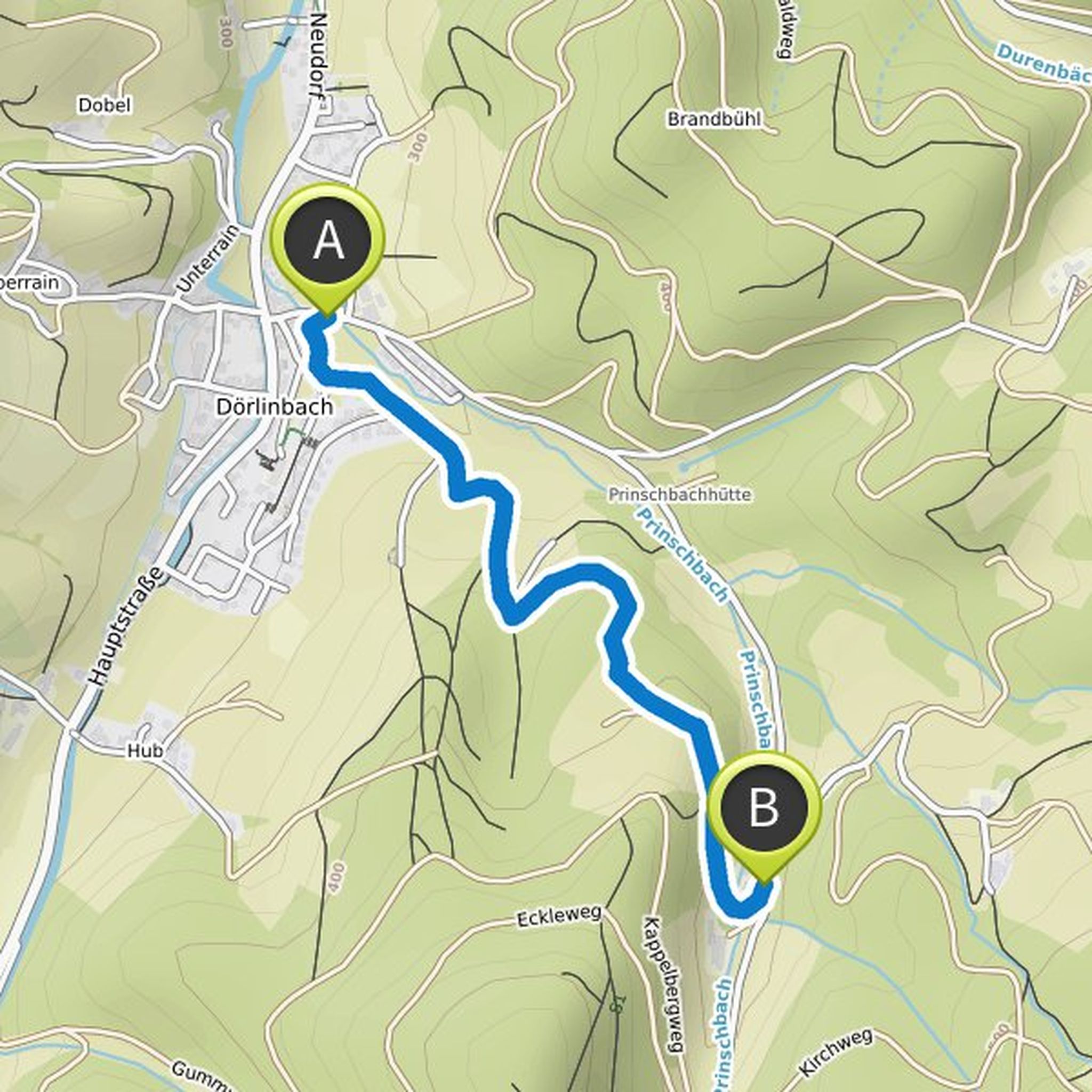
Map data © OpenStreetMap contributors
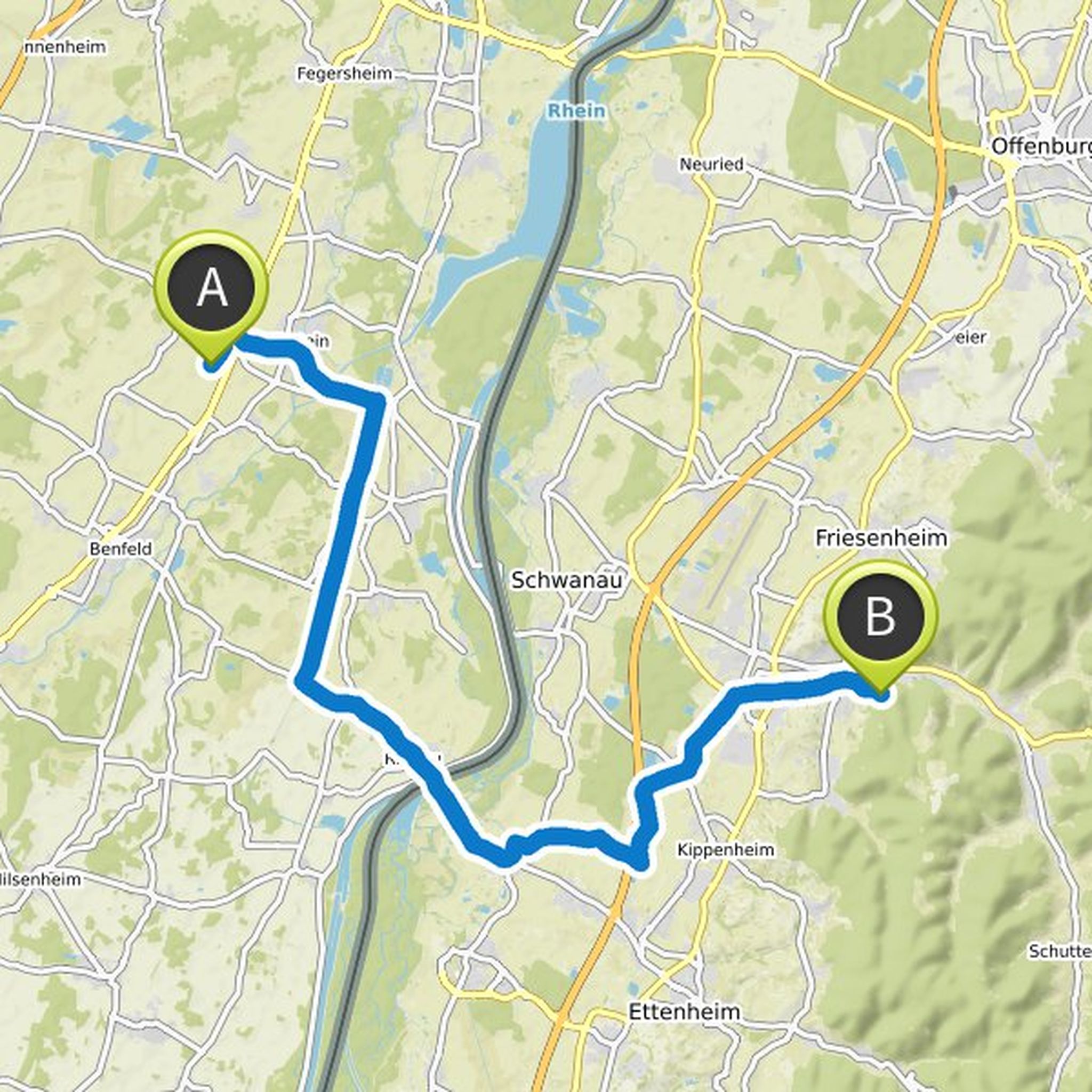
Time
2h05m
Distance
25.9km
Speed
12.4km/h
Ascent
40m
Descent
60m
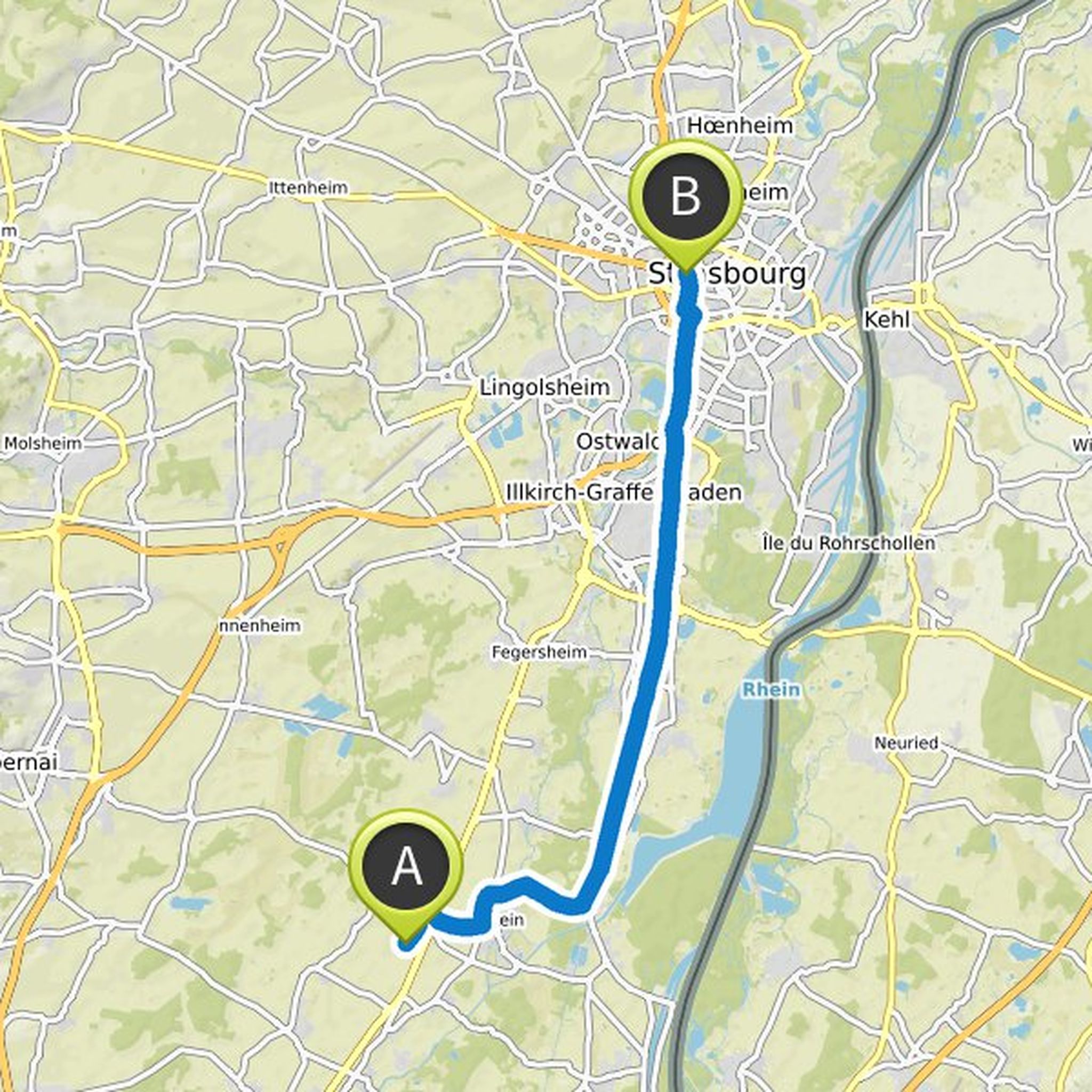
Map data © OpenStreetMap contributors
truemarmalade likes this.