Timeline
Vikos-Aoos UNESCO Global Geopark planned a hike
January 10, 2022
Time
Distance
Speed
Ascent
Descent

Vikos-Aoos UNESCO Global Geopark planned a hike
January 10, 2022
Time
Distance
Speed
Ascent
Descent
January 10, 2022
English:
The viewpoint offers one of the best panoramic views of the majestic Vikos gorge. Sheer limestone cliffs rise up in front of the visitor, revealing the stratigraphy of their rock layers.
German:
The lookout point offers visitors one of the best panoramic views of the majestic Vikos Gorge. Steep
Translated by Google •
Vikos-Aoos UNESCO Global Geopark planned a hike
January 10, 2022
Time
Distance
Speed
Ascent
Descent

January 10, 2022
English:
This is a trail on alpine-subalpine terrain. The process of limestone erosion due to temperature changes is intense here. Flint lenses, scattered due to the weathering processes acquire concentric alterations and create the impression of fossilized trees. Drakolimni alpine lake is a form created
Translated by Google •
Vikos-Aoos UNESCO Global Geopark planned a hike
January 10, 2022
Time
Distance
Speed
Ascent
Descent

January 10, 2022
English:
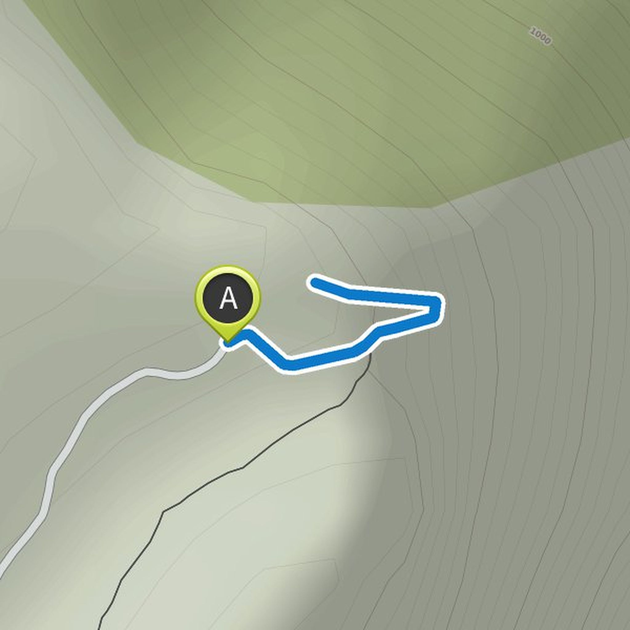
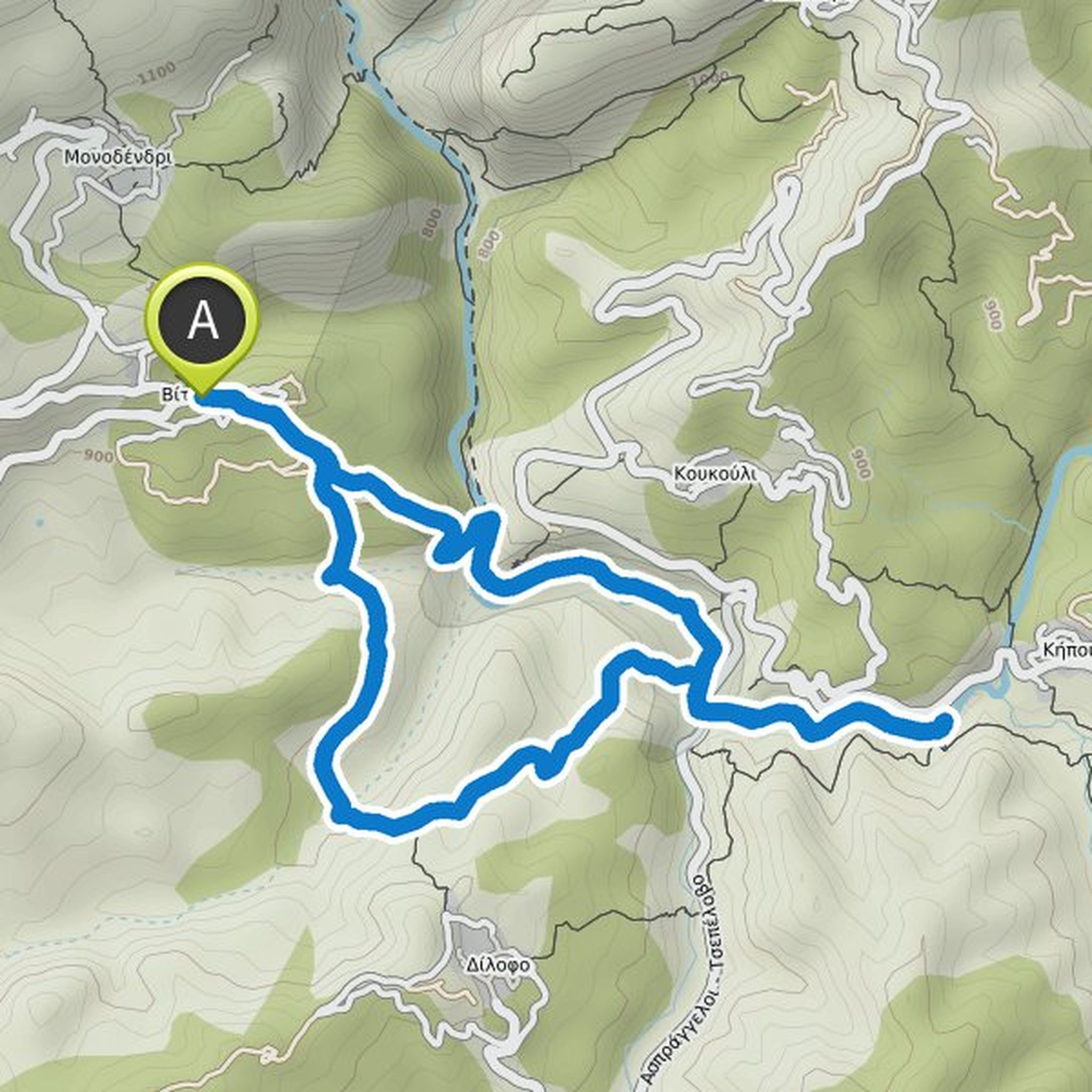
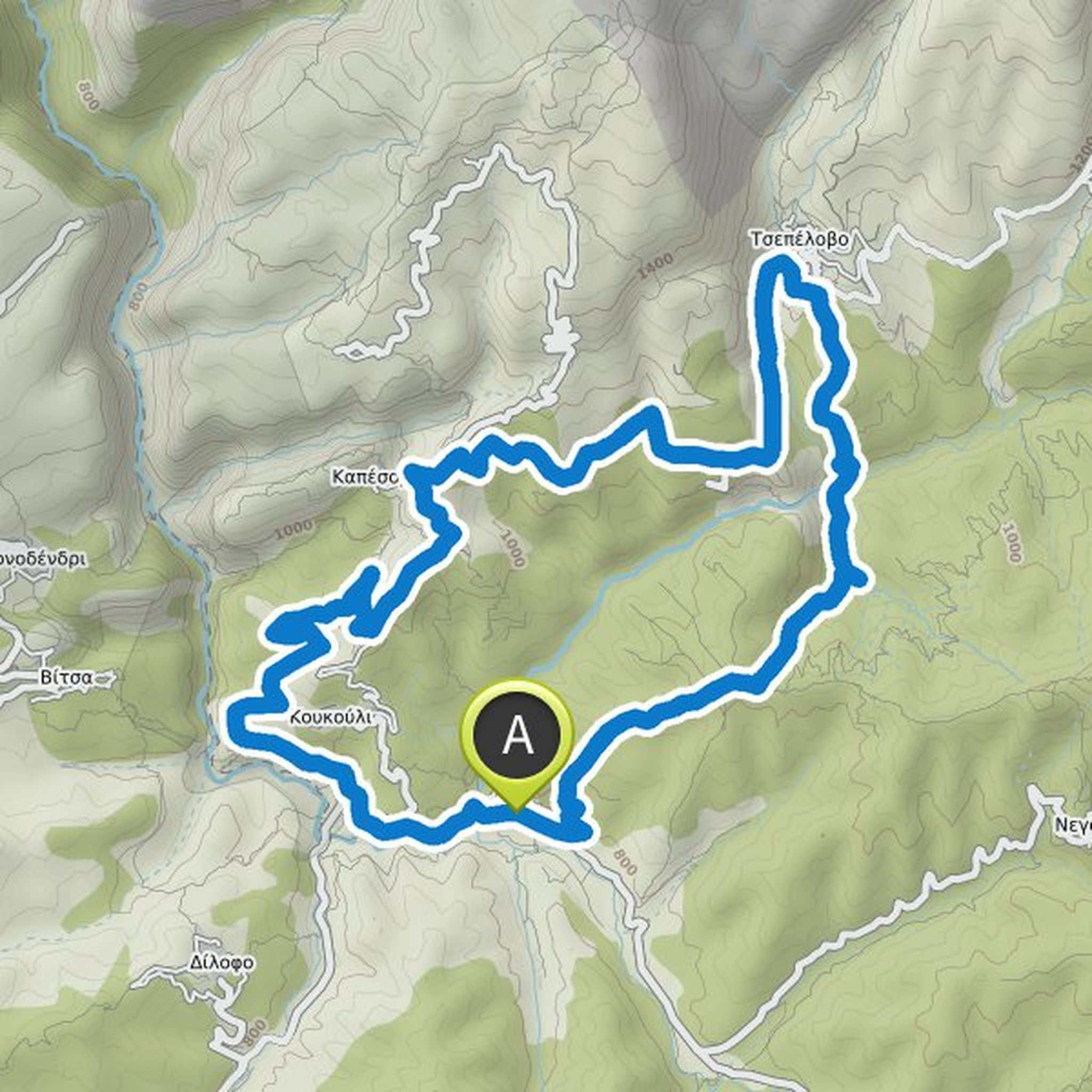
A pleasant hike with beautiful views. Especially at monastery Agia Paraskevi you have an impressing panoramic view into the gorge. A detour to the village square in Vitsa is highly recommended, as you have a great view to Monodendri from there.
German:
A pleasant hike with beautiful views. Especially
Translated by Google •
Vikos-Aoos UNESCO Global Geopark planned a hike
January 7, 2022
Time
Distance
Speed
Ascent
Descent

January 7, 2022
English:
The erosive power of water reveals the geological history of the area. At the bottom of the Vikos gorge, limestones were formed 160 million years ago; the younger ones at the top 20 million years ago. Aside from the grandeur of the sculptural ensembles formed by water, the visitor has the opportunity
Translated by Google •
Vikos-Aoos UNESCO Global Geopark planned a hike
December 16, 2021
Time
Distance
Speed
Ascent
Descent
Vikos-Aoos UNESCO Global Geopark planned a hike
December 16, 2021
Time
Distance
Speed
Ascent
Descent

Vikos-Aoos UNESCO Global Geopark planned a hike
December 16, 2021
Time
Distance
Speed
Ascent
Descent

Vikos-Aoos UNESCO Global Geopark planned a hike
December 16, 2021
Time
Distance
Speed
Ascent
Descent
Vikos-Aoos UNESCO Global Geopark planned a hike
December 16, 2021
Time
Distance
Speed
Ascent
Descent

Vikos-Aoos UNESCO Global Geopark planned a hike
December 16, 2021
Time
Distance
Speed
Ascent
Descent

January 11, 2022
English:
Impressive old river terraces structures on either side of the Aoos riverbed. Another point of interest is the “Mana Nerou” spring.
German:
The old river terraces of the Aoos are morphologically impressive. The important Mana Nerou spring is also located here.
Translated by Google •
Vikos-Aoos UNESCO Global Geopark planned a hike
December 16, 2021
Time
Distance
Speed
Ascent
Descent

January 11, 2022
English:
This is the area of the Pindos belt overthrust on the Ionian belt. One can see typical compression structures with well-shaped Ionian limestone folds and normal faults resulting from the area’s neotectonic activity. In Kavasila the deep circulation of the groundwater, coming from the Mt Timfi
Translated by Google •
Vikos-Aoos UNESCO Global Geopark planned a hike
December 16, 2021
Time
Distance
Speed
Ascent
Descent

January 11, 2022
English:
Area with spectacular neotectonic changes. The fault of Konitsa created the great depression of the relief, and the Aoos and Voidomatis rivers followed this development over time. The geomorphological processes are intense; River terraces and beautifully shaped alluvial fans have developed along
Translated by Google •
Vikos-Aoos UNESCO Global Geopark planned a hike
December 15, 2021
Time
Distance
Speed
Ascent
Descent

January 11, 2022
English:
The interest of this trail lies in the impressive potholes that are the result of vertical karstification of limestones and the presence of faults. Another important sight is the residual moraine forms from the latest ice age. The potholes found here are unique and especially deep, and are subject
Translated by Google •
Vikos-Aoos UNESCO Global Geopark planned a hike
December 15, 2021
Time
Distance
Speed
Ascent
Descent

January 11, 2022
English:
The main springs of Voidomatis river lie along the trail. Their occurrence is the result of the river’s vertical erosion that revealed the water table along the faults. As a big part of the route goes through the river it would be advisable to avoid it, especially in winter time.
German:
The main
Translated by Google •
January 10, 2022
English:
This point is exceptional for viewing the gorge, particularly towards the north and west. The area is approachable from the village of Vradeto, from where a 2 km walk, taking about 40 minutes, leads to the viewpoint.
German:
The Beloi viewpoint provides a very nice view of the northern and western
Translated by Google •