Timeline
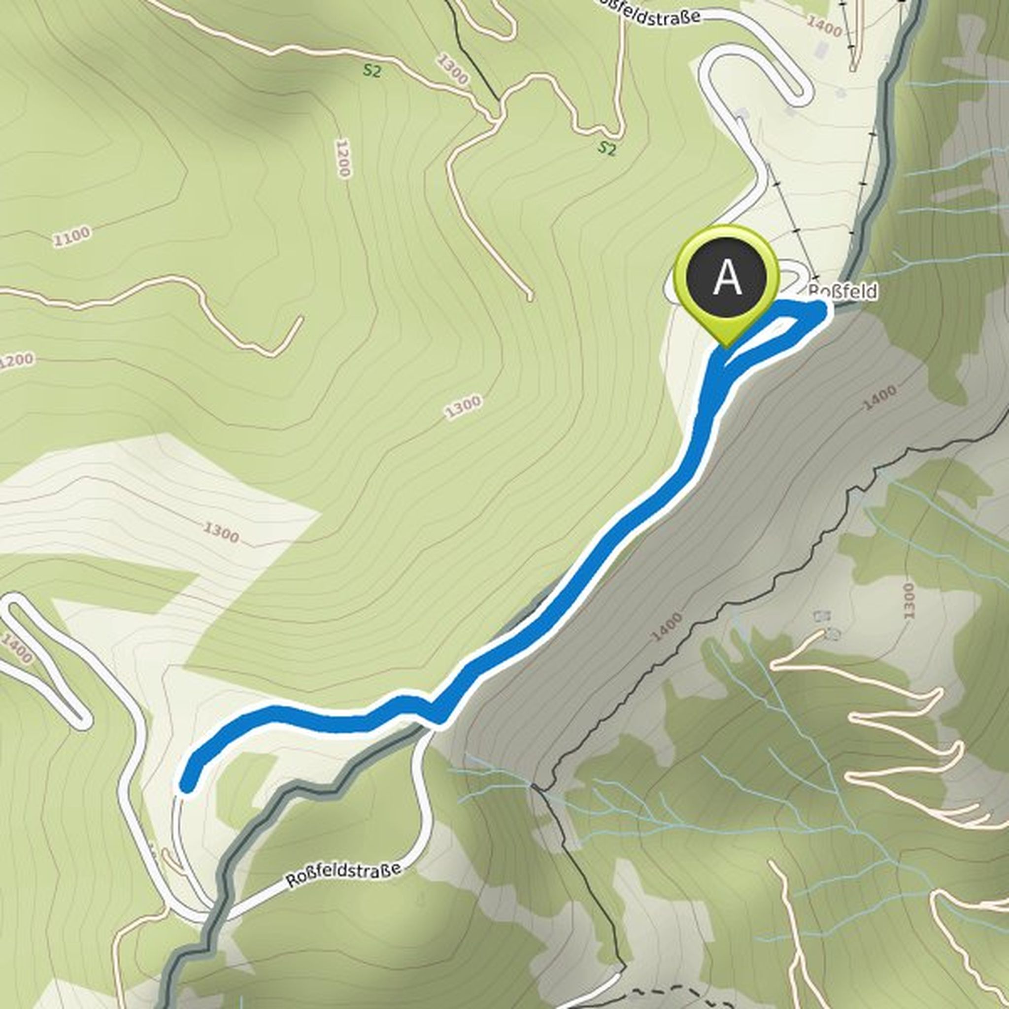
frank.kohlgraf planned a hike
October 10, 2022
Time
3h16m
Distance
9.10km
Speed
2.8km/h
Ascent
1,420m
Descent
90m
Map data © OpenStreetMap contributors
frank.kohlgraf planned a hike
May 29, 2022
Time
1h52m
Distance
7.05km
Speed
3.8km/h
Ascent
60m
Descent
60m
Map data © OpenStreetMap contributors
frank.kohlgraf planned a hike
May 28, 2022
Time
1h08m
Distance
4.15km
Speed
3.6km/h
Ascent
70m
Descent
70m
Map data © OpenStreetMap contributors
frank.kohlgraf planned a hike
May 28, 2022
Time
3h20m
Distance
13.0km
Speed
3.9km/h
Ascent
50m
Descent
50m
Map data © OpenStreetMap contributors
frank.kohlgraf planned a hike
February 10, 2022
Time
7h57m
Distance
27.2km
Speed
3.4km/h
Ascent
720m
Descent
720m

Map data © OpenStreetMap contributors
frank.kohlgraf planned a hike
January 29, 2022
Time
2h34m
Distance
9.03km
Speed
3.5km/h
Ascent
200m
Descent
200m

Map data © OpenStreetMap contributors
frank.kohlgraf planned a hike
December 26, 2021
Time
0h59m
Distance
3.90km
Speed
3.9km/h
Ascent
10m
Descent
10m

Map data © OpenStreetMap contributors
frank.kohlgraf planned a hike
October 16, 2021
Time
3h53m
Distance
14.1km
Speed
3.6km/h
Ascent
240m
Descent
240m

Map data © OpenStreetMap contributors
frank.kohlgraf planned a hike
June 11, 2021
Time
0h58m
Distance
3.63km
Speed
3.7km/h
Ascent
50m
Descent
40m

Map data © OpenStreetMap contributors
frank.kohlgraf planned a hike
June 11, 2021
Time
0h58m
Distance
3.63km
Speed
3.7km/h
Ascent
50m
Descent
40m
Map data © OpenStreetMap contributors