Timeline
alberto planned a bike ride
September 5, 2023
Time
Distance
Speed
Ascent
Descent
alberto planned a hike
July 4, 2020
Time
Distance
Speed
Ascent
Descent
alberto planned a hike
July 4, 2020
Time
Distance
Speed
Ascent
Descent
July 4, 2020
The area:
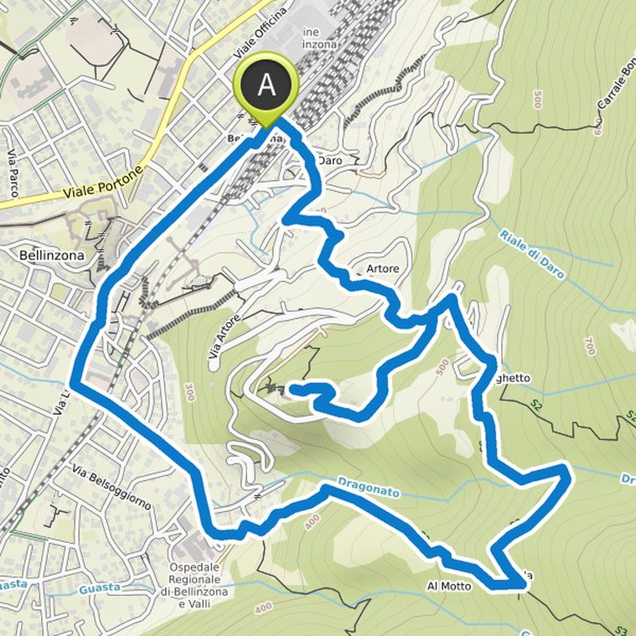
Peaceful silence rests over the lonely forest landscape of Prada above Bellinzona. But suddenly the idyll tilts into the ghostly. Piles of rubble and crumbling stone walls appear between the trees. At this point there was once a village with stately stone houses and simple huts. When the plague
Translated by Google •
alberto planned a hike
July 4, 2020
Time
Distance
Speed
Ascent
Descent
July 4, 2020
The area:
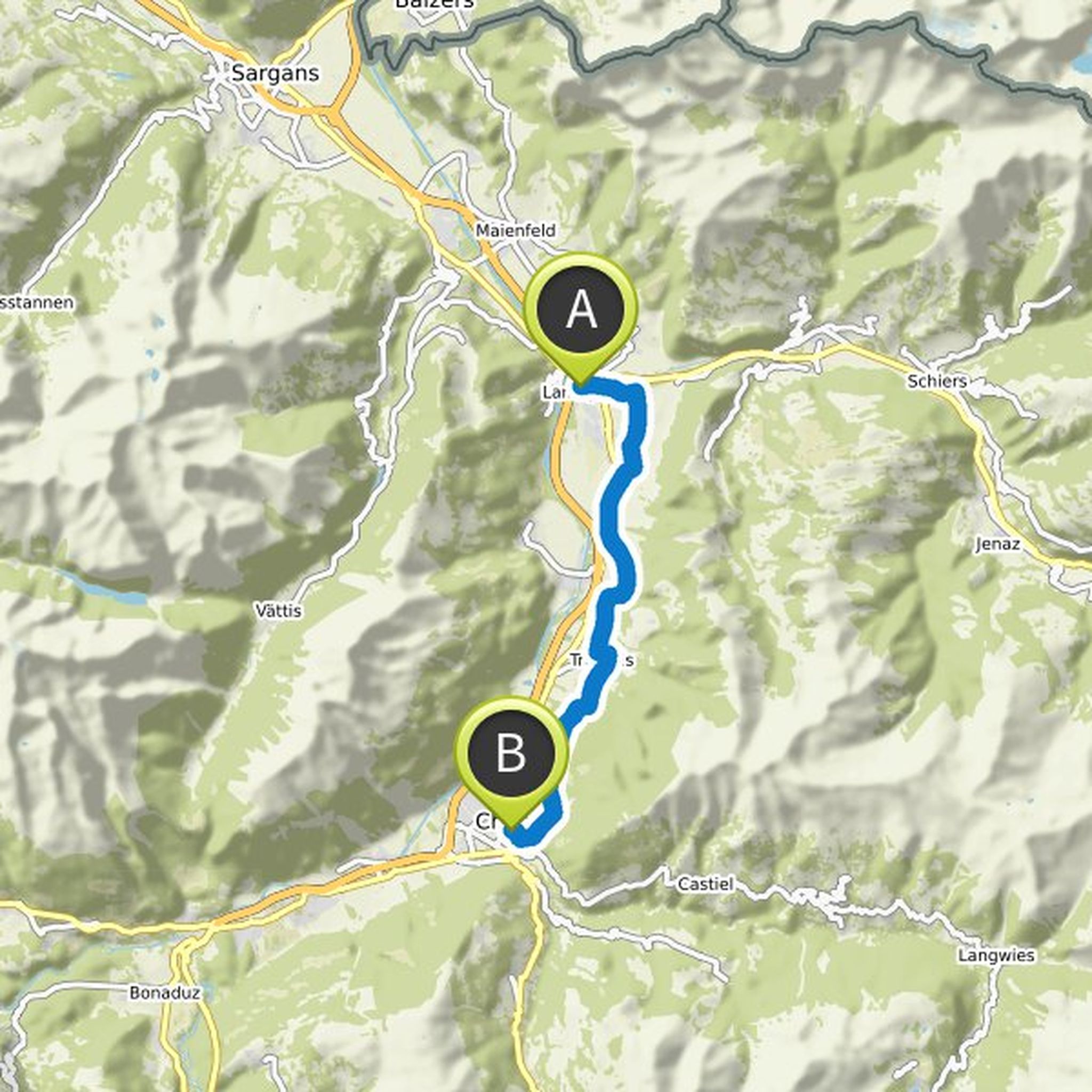
Graubünden is not entirely mountainous - with the Rhine Valley, the canton also has an extensive lowland. Thanks to the location of the foehn, the area has a favorable climate and is therefore ideal for viticulture. The 30 km long wine hiking trail runs through the length. The northern half
Translated by Google •
alberto planned a hike
July 4, 2020
Time
Distance
Speed
Ascent
Descent
July 4, 2020
The area:
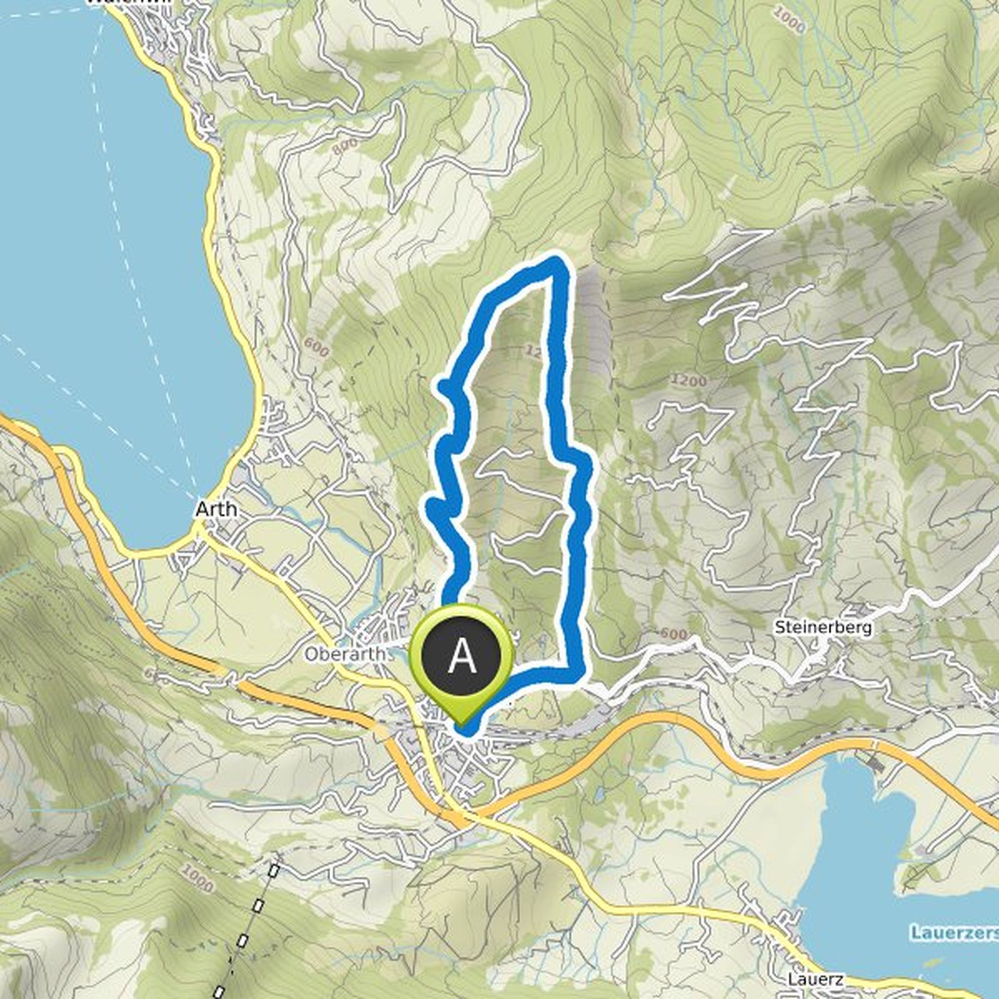
On the north side, the Rossberg slopes gently towards the Zugerberg area, while the south side slopes down with a sharp edge. Here the Goldau landslide broke loose in 1806: huge masses of rock spilled the valley floor and killed 457 people. A technically demanding mountain hiking trail runs
Translated by Google •
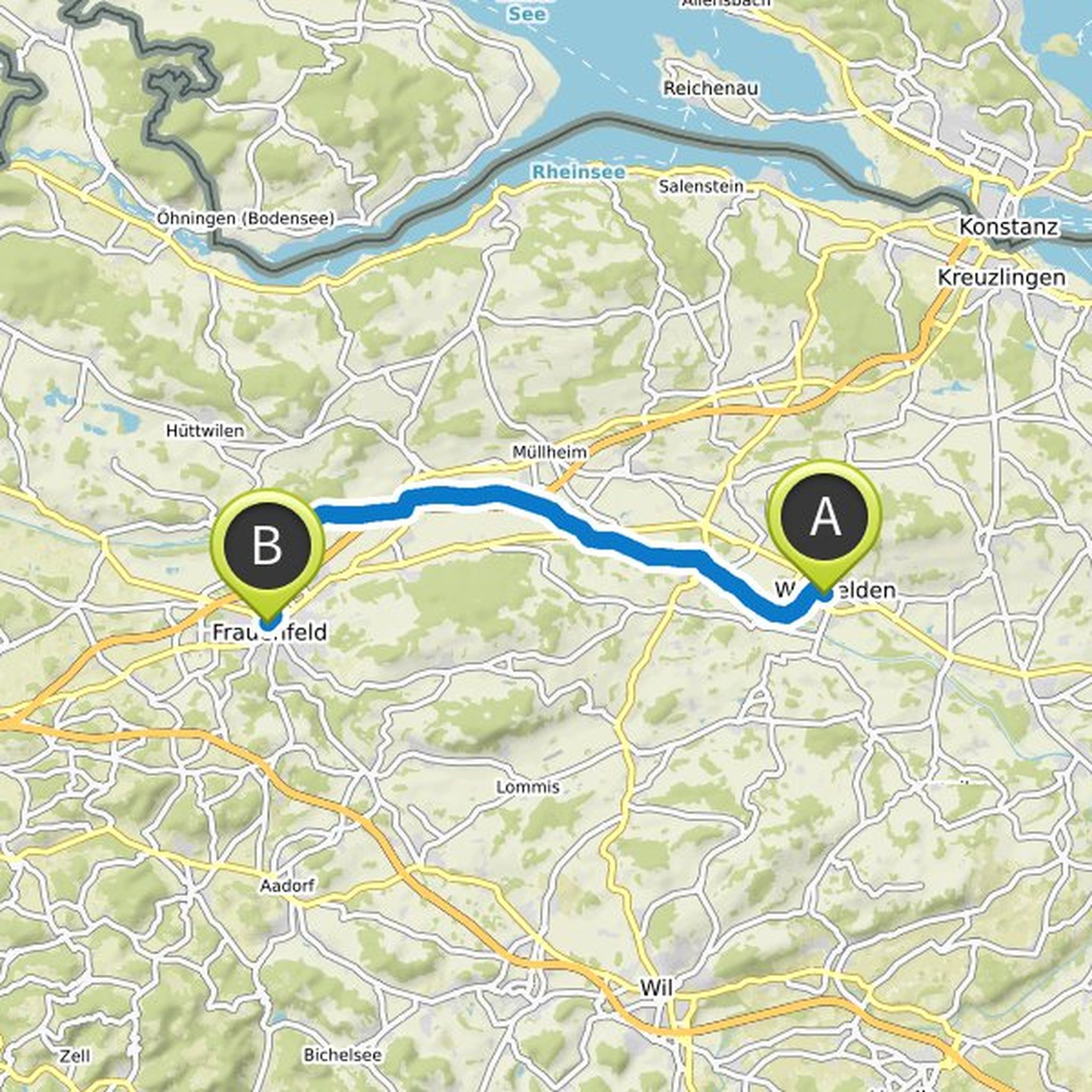
alberto planned a hike
July 4, 2020
Time
Distance
Speed
Ascent
Descent
July 4, 2020
The area:
The river, to which the canton of Thurgau owes its name, has been straightened in various sections and bordered by dams. But if you follow your course, you will still experience a lot of nature. The Thurweg is available to hikers for this purpose. Between Weinfelden and Frauenfeld it runs mostly
Translated by Google •
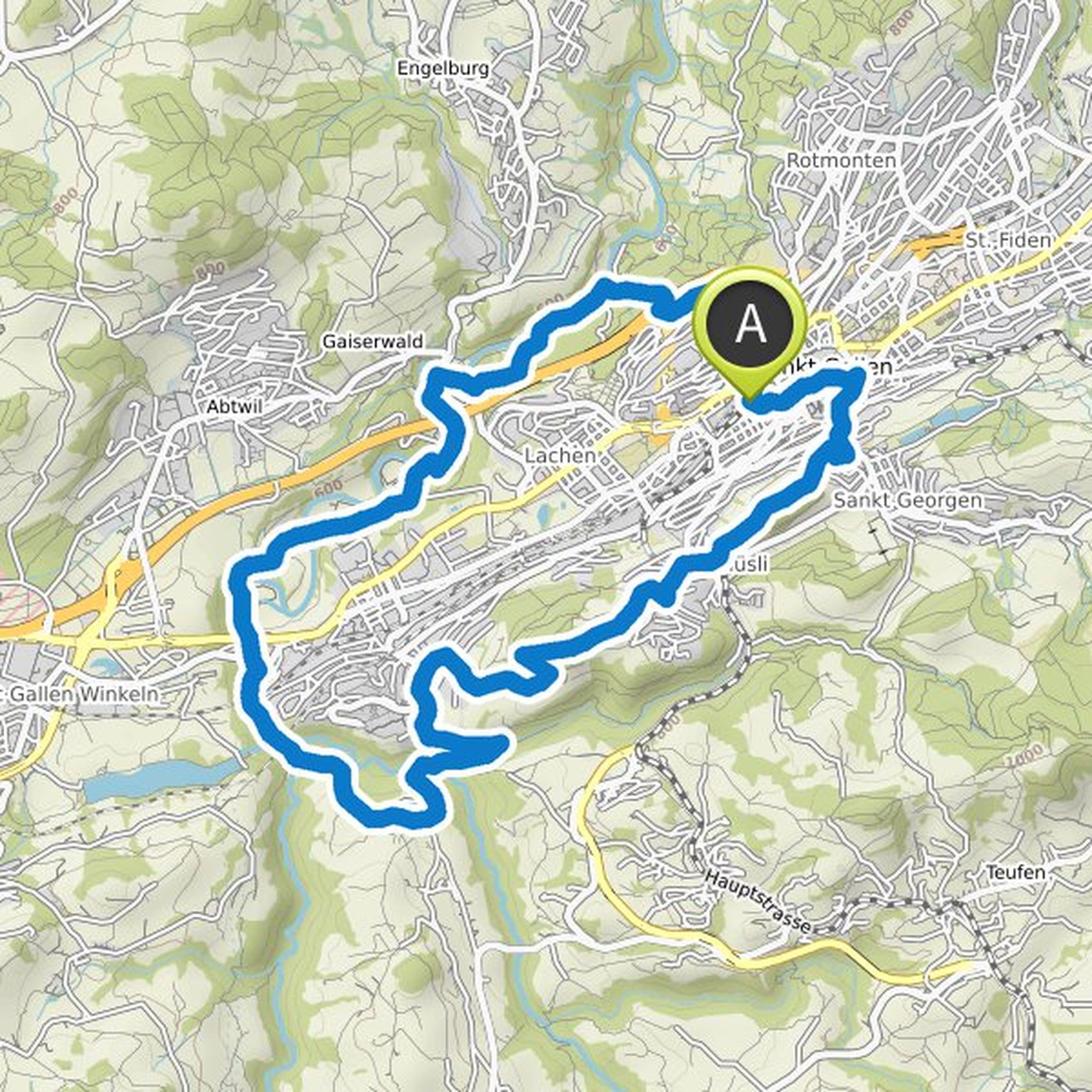
alberto planned a hike
July 4, 2020
Time
Distance
Speed
Ascent
Descent
July 4, 2020
The area:
Only a range of hills separates the largest city in Eastern Switzerland from the Appenzellerland. It offers a beautiful view of the Alpstein area and attractive views of the Gallus town. The landscape west of it is quite different in the valleys of Urnäsch and Sitter, where a number of traffic
Translated by Google •
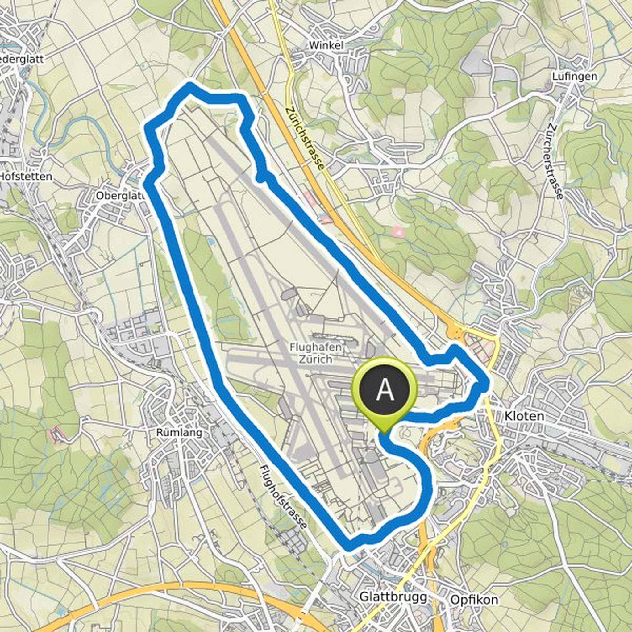
alberto planned a hike
July 4, 2020
Time
Distance
Speed
Ascent
Descent
July 4, 2020
The area:
Concrete and steel dominate the landscape around the terminals at Zurich Airport. The slope area is completely different: where you only take off and land, there is plenty of free space - and a surprising natural diversity. Litter meadows, flat bogs and ponds provide a habitat for rare plant
Translated by Google •
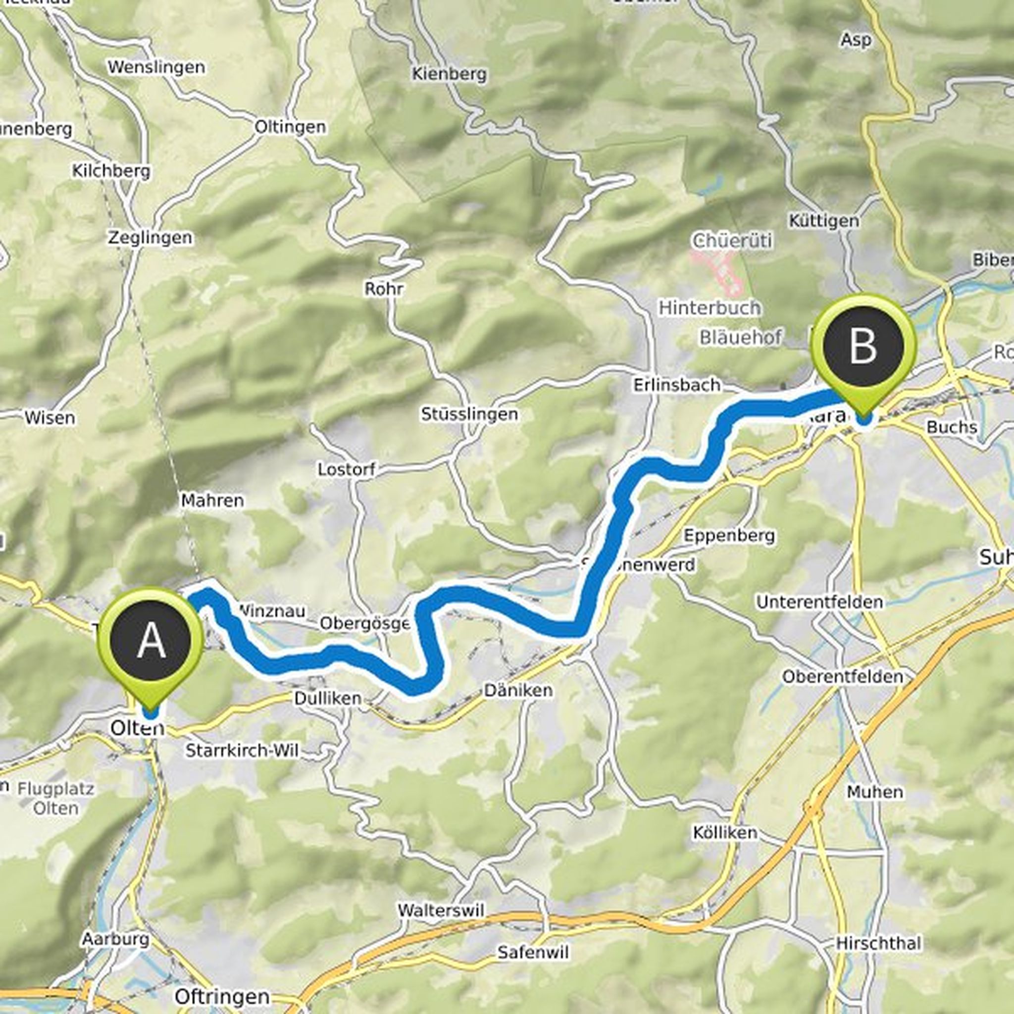
alberto planned a hike
July 4, 2020
Time
Distance
Speed
Ascent
Descent
July 4, 2020
The area:
In the middle of the densely built-up plateau, wide and lonely floodplain forests still characterize the Aare's watercourse. A very nice section is roamed on the hike from Olten to Aarau. The riverside paths follow the natural course of the Aare for longer distances, away from parallel power
Translated by Google •
alberto planned a hike
July 4, 2020
Time
Distance
Speed
Ascent
Descent
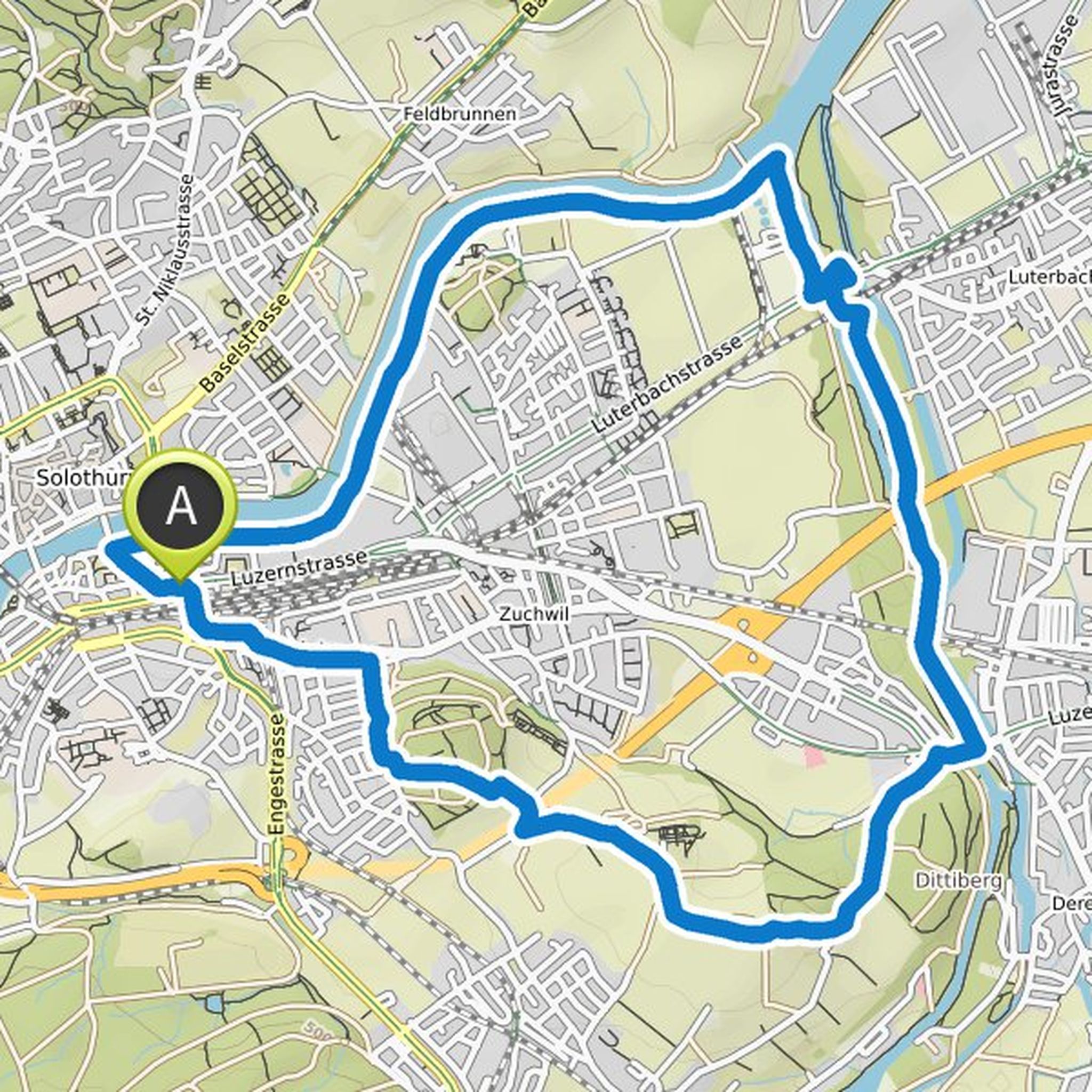
July 4, 2020
The area:
As typically Bernese as the Emmental may be, the Emme is also a Solothurn river: between Zuchwil and Luterbach, below the canton's capital, it flows into the Aare. Emmenspitz is called the place of confluence. It can be reached on an easy, varied circular hike that leads over hilly country
Translated by Google •
alberto planned a hike
July 4, 2020
Time
Distance
Speed
Ascent
Descent
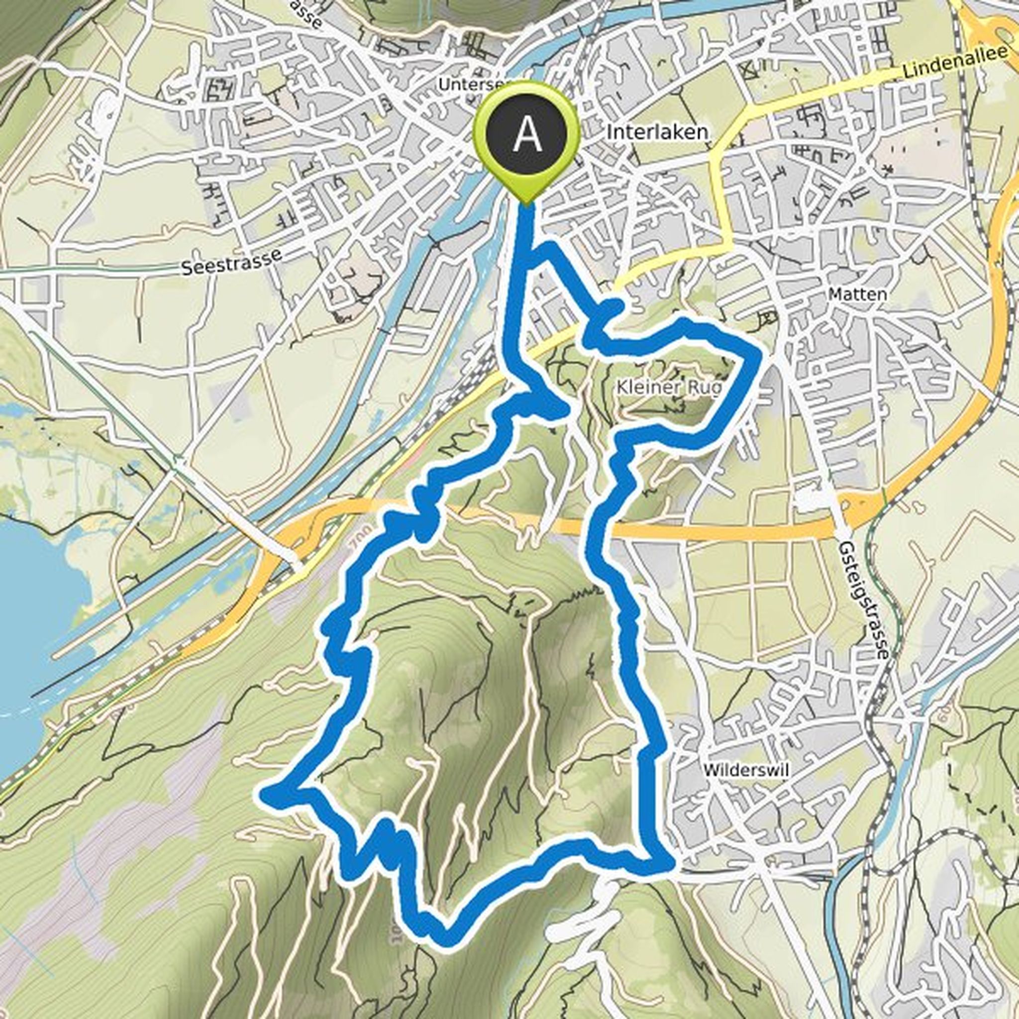
July 4, 2020
The area:
In Interlaken, evening is not just a time, but also a location: When you talk about the Abendberg there, you mean a hill in the southwest of the urban village. It offers a beautiful view of Lake Brienz and the "Bödeli", the flat alluvial floor of the Lütschine with the settlement areas of the
Translated by Google •
alberto planned a hike
July 4, 2020
Time
Distance
Speed
Ascent
Descent
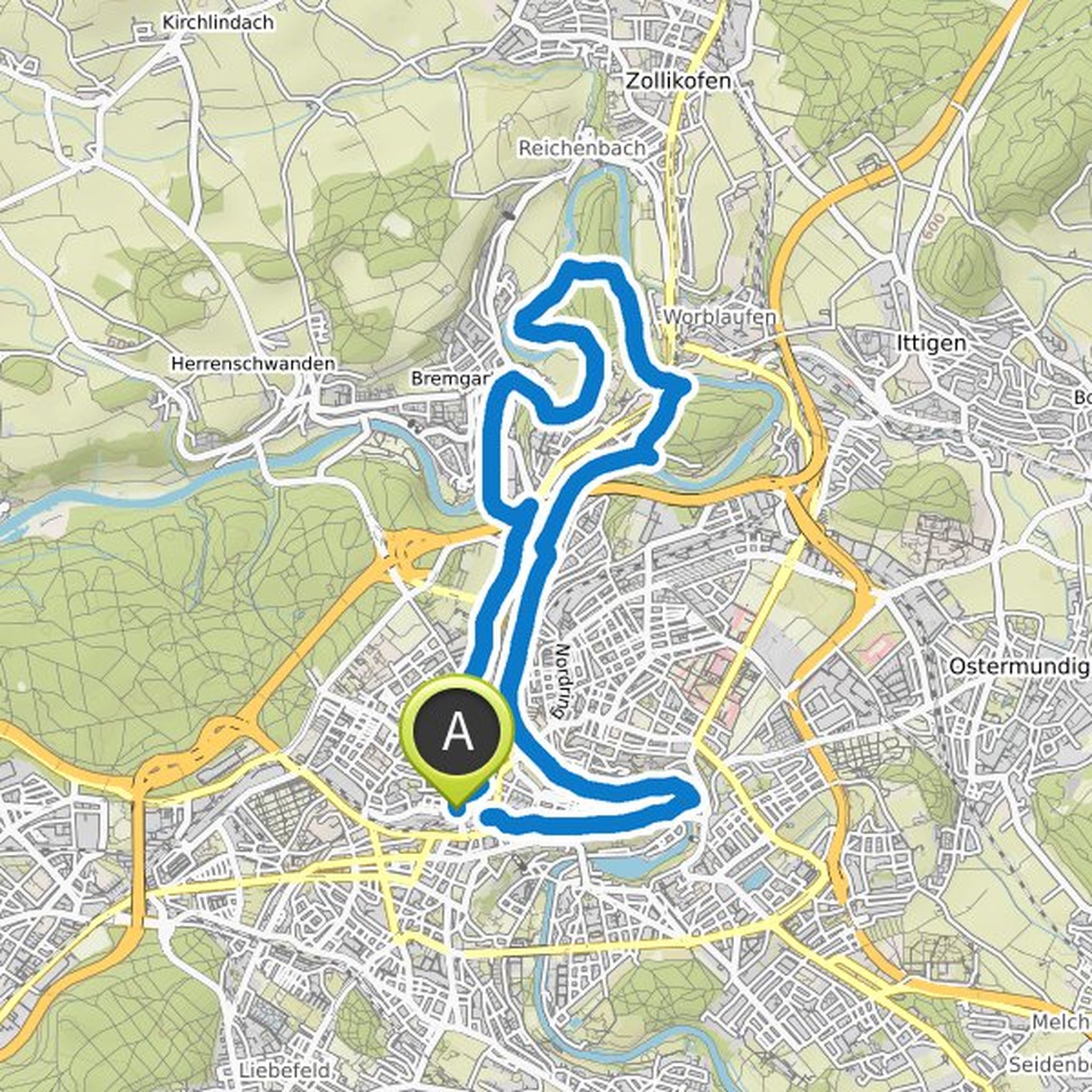
July 4, 2020
The area:
The Aare winds through and past the federal city in several loops. Shore paths follow the adventurous topography on both sides in complicated lines. The peninsula is a world in itself. Despite being close to the city, there is a lot of untouched river landscape and lonely nature. The sandstone
Translated by Google •
alberto planned a hike
July 4, 2020
Time
Distance
Speed
Ascent
Descent
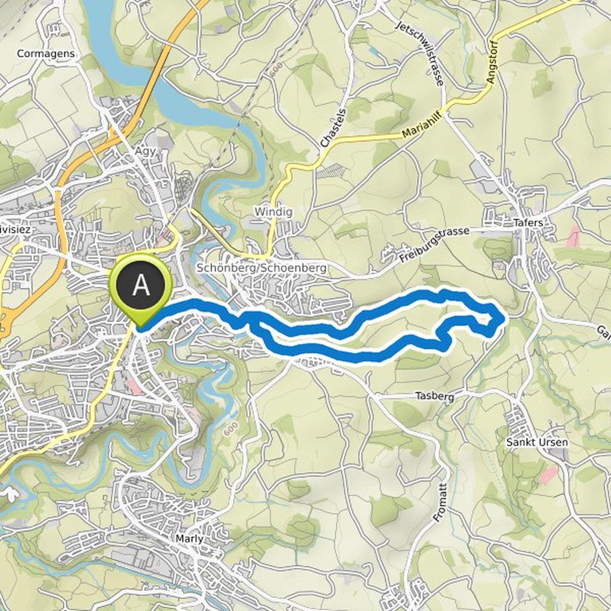
July 4, 2020
The area:
The plateau is flat and wide east of Freiburg - with one great exception. At the lower end of the old town, the Galterengraben (Le Gottéron), lined with mighty sandstone cliffs, opens. The valley, which was initially open, is increasingly narrowed into a wild gorge. It is opened up by a charming
Translated by Google •
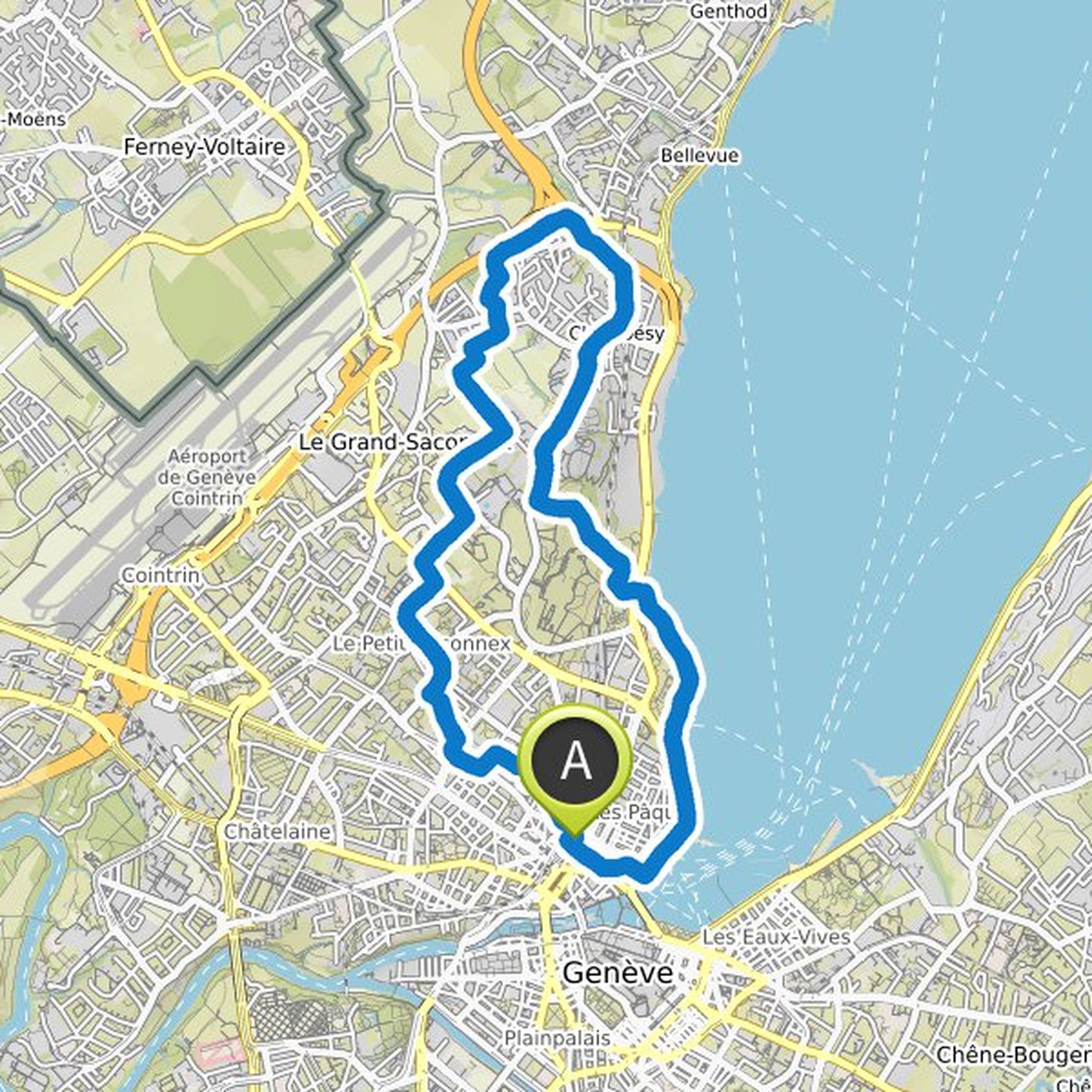
alberto planned a hike
July 4, 2020
Time
Distance
Speed
Ascent
Descent
July 4, 2020
The area:
The city of Geneva and its surrounding areas are densely built up in many places, but also have a number of green islands. It is predestined for varied city walks. The circular tour from the center to the Chambésy suburb conveys a contrasting picture of the westernmost and most international
Translated by Google •
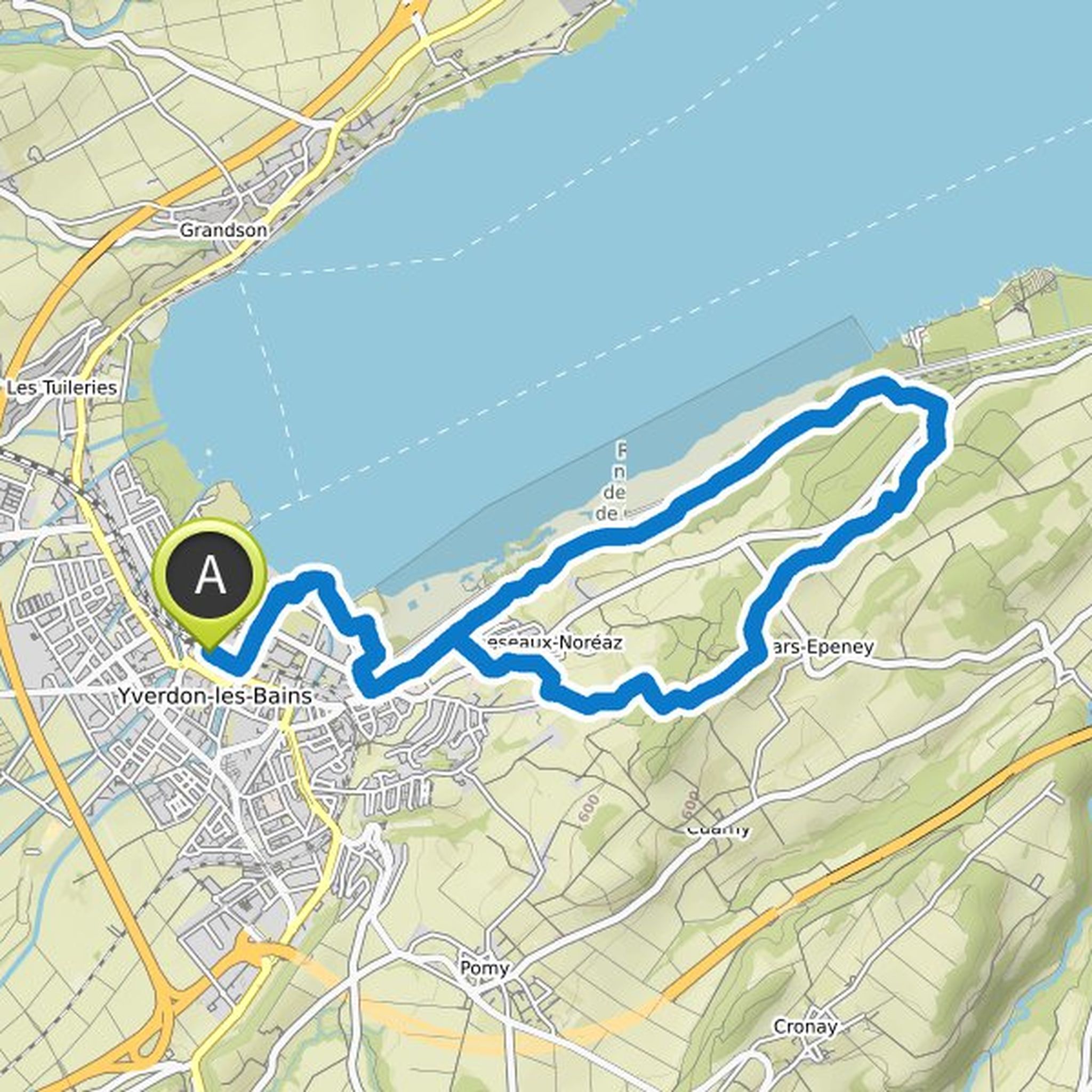
alberto planned a hike
July 4, 2020
Time
Distance
Speed
Ascent
Descent
July 4, 2020
The area: The Alignment of Clendy is one of the largest megalithic facilities in Switzerland. The two prehistoric stone rows at the southwestern end of Lake Neuchâtel came to light after the Jura water correction. They comprise a total of 45 standing stones. Some of them have considerable dimensions
Translated by Google •
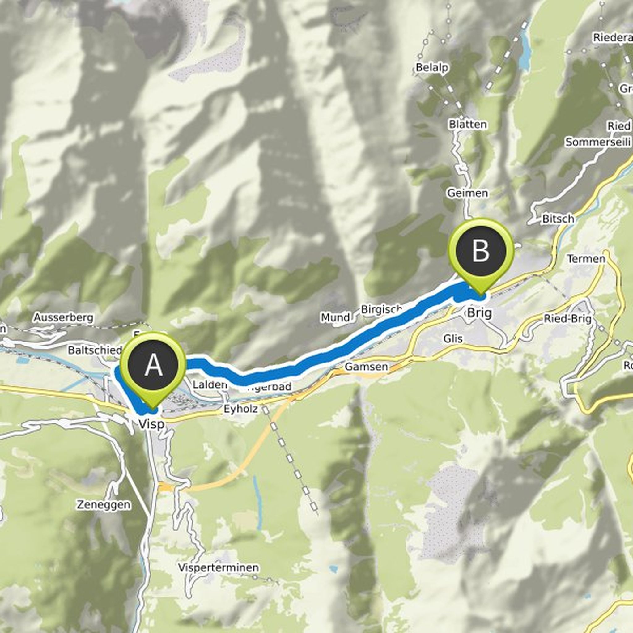
July 4, 2020
The area:
The high-altitude hike on the Lötschberg south ramp is divided into two parts. The route from Hohtenn to Ausserberg is known as a classic. The eastern continuation from Eggerberg to Brig has only been signaled for a few years. The high path on the sunny slope offers beautiful views of the valley
Translated by Google •