Timeline
Spessart Bu planned a hike
July 16, 2017
Time
Distance
Speed
Ascent
Descent

Michael Sekanina likes this.
Spessart Bu planned a hike
February 23, 2017
Time
Distance
Speed
Ascent
Descent

Susanne likes this.
Spessart Bu planned a bike ride
June 17, 2016
Time
Distance
Speed
Ascent
Descent

Spessart Bu planned a hike
September 26, 2015
Time
Distance
Speed
Ascent
Descent

Claudia likes this.
September 26, 2015
Habichsthal - meadows via Habichsthal Weg H2, Spessartbundweg X, Hase Nature Park Trail, Bike Forest Route 4. The path leads through the idyllic Birklergrund to Wiesen. It goes back along the Aubachtals, while a small bridge crosses the Aubach. It is worth a visit to the excavation site of the foundations
Translated by Google •
Spessart Bu planned a hike
September 20, 2015
Time
Distance
Speed
Ascent
Descent

September 20, 2015
Small round through and around Habichsthal. On numerous boards one learns how the life in the small Spessartdorf used to be. A small forest playground for the "little ones" provides additional incentive.
Translated by Google •
Spessart Bu planned a hike
September 20, 2015
Time
Distance
Speed
Ascent
Descent

September 20, 2015
Around Habichsthal mostly along the corridor border via NP-Weg Hase, Habichsthal Weg H 1, NP-Weg Baum. Great views of the area.
Translated by Google •
Spessart Bu planned a hike
September 19, 2015
Time
Distance
Speed
Ascent
Descent

September 19, 2015
Connection Habichsthal-Lohr on the trail of the Snow White Trail.
Translated by Google •
Spessart Bu planned a hike
September 19, 2015
Time
Distance
Speed
Ascent
Descent

September 19, 2015
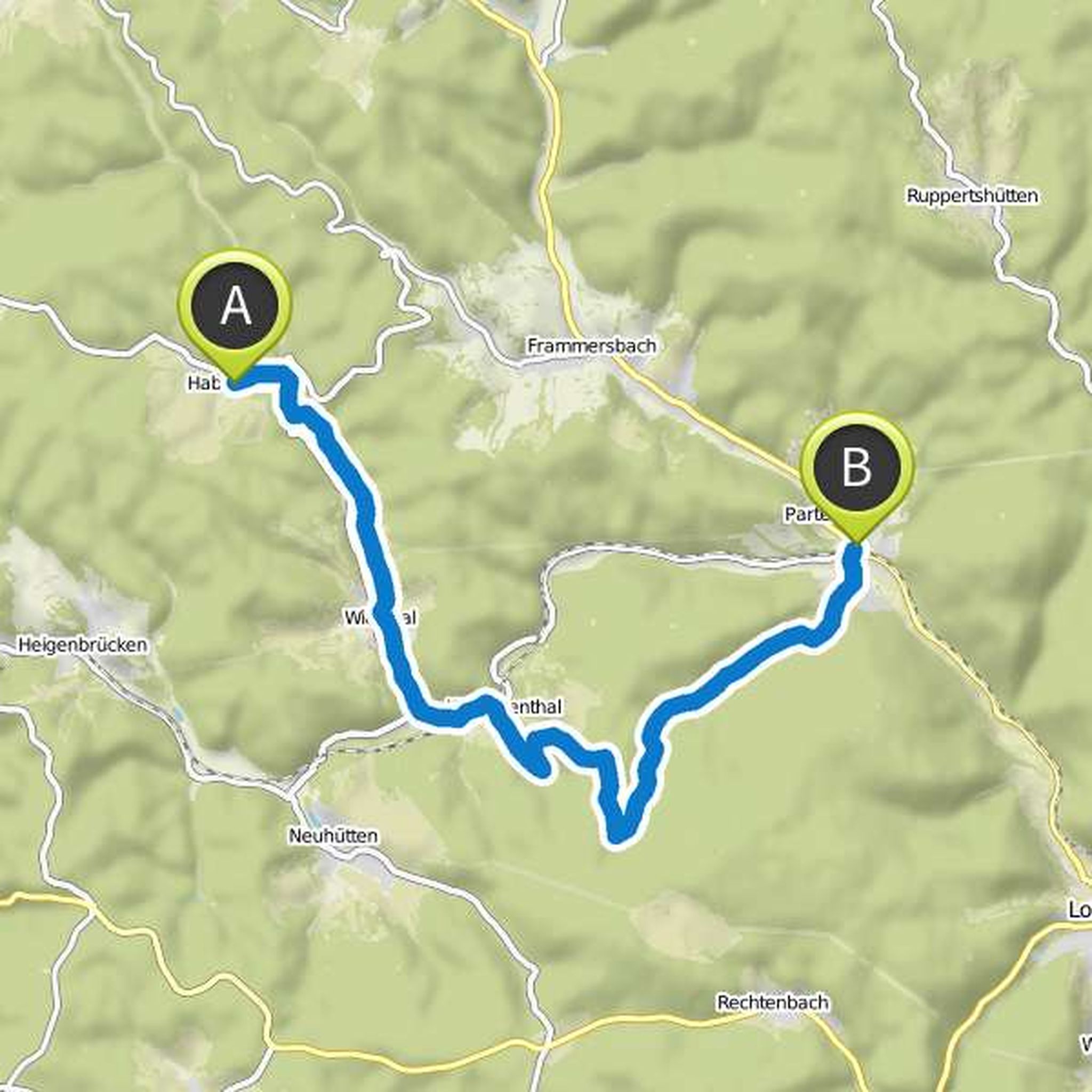
Connection Habichsthal-Partenstein via NW7 and Schneewitchenweg.
Translated by Google •
Spessart Bu planned a hike
September 19, 2015
Time
Distance
Speed
Ascent
Descent
September 19, 2015
Connection Habichsthal-Partenstein via Kulturweg, Spessartbundweg inclined beams, crossbeams. Caution way slanted beam runs on a path that is not recognized by komoot, so it runs in this planning above Krommenthal slightly different.
Translated by Google •
Spessart Bu planned a hike
September 19, 2015
Time
Distance
Speed
Ascent
Descent
September 19, 2015
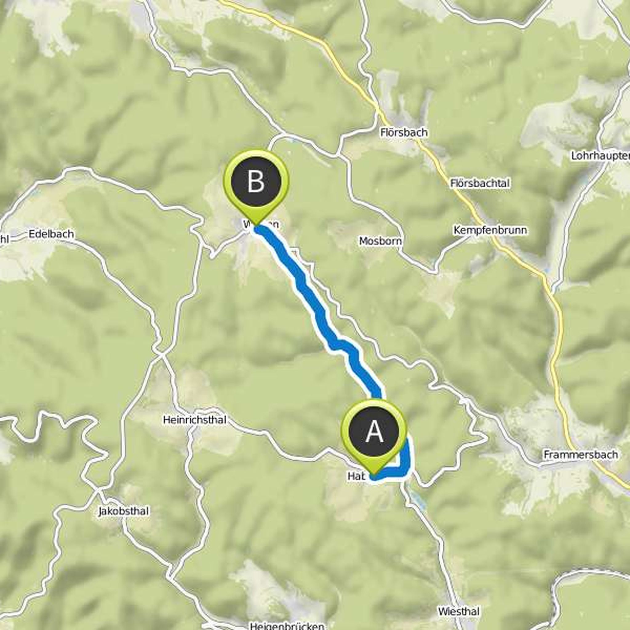
Connection Habichsthal-meadows via Bikewald Route 4, NW-Weg Hase.
Along and through the Aubachtal, or nature reserve Spessartwiesen with a small bridge over the Aubach.
Translated by Google •
Spessart Bu planned a hike
September 19, 2015
Time
Distance
Speed
Ascent
Descent
September 19, 2015
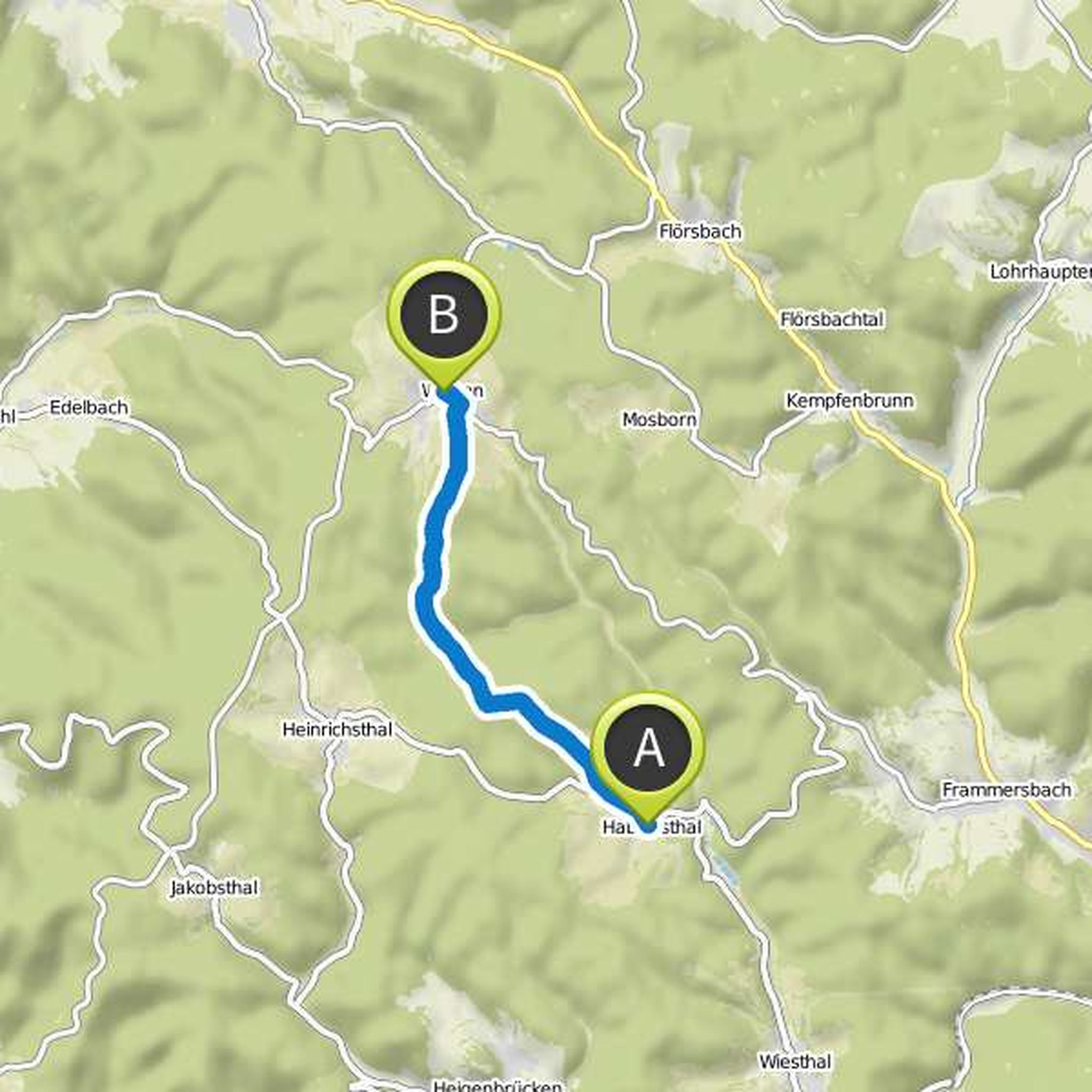
Connection Habichsthal Wiesen via Habichsthal H2 and Spessartbundweg Kreuz.
Past Grotto Birklergrund and close to the foundations of historic glassworks.
Translated by Google •
Spessart Bu planned a hike
September 19, 2015
Time
Distance
Speed
Ascent
Descent

September 19, 2015
Connection Habichsthal-Frammersbach via St. Kreuzkapelle to the center of Frammersbach.
Translated by Google •
Spessart Bu planned a hike
September 19, 2015
Time
Distance
Speed
Ascent
Descent

September 19, 2015
Habichsthal-Kreuzkapelle-Frammersbach via Spessartbundweg Dreieck, Fuhrmannsweg, Hauptstraße, Schwartler Tal, NW7. Past the historic Kreuzkapelle.
Refreshments: Habichsthal, Frammersbach.
Translated by Google •
Spessart Bu planned a hike
September 19, 2015
Time
Distance
Speed
Ascent
Descent

Spessart Bu planned a hike
September 19, 2015
Time
Distance
Speed
Ascent
Descent
September 19, 2015
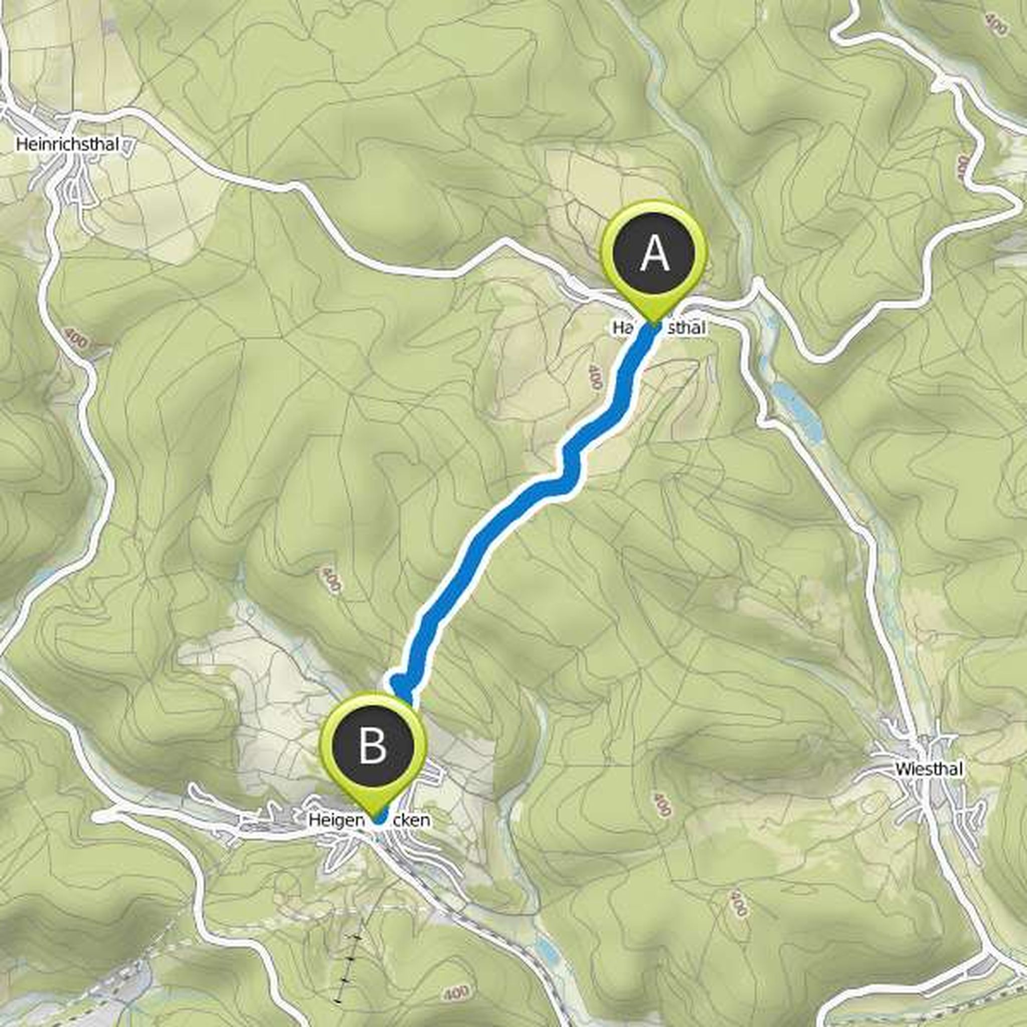
Connection Habichsthal-Heigenbrücken via Spessartbundweg crossbar.
Translated by Google •
September 26, 2015
Habichsthal-Frammersbach-Runde past the Kreuzkapelle and back via Wiesthal.
Start: Habichsthal Church / Linde.
Hiking trails: NordicWalking7, Schneewitchenwanderweg, "Kreuzkapelle", down to Frammersbach and then to the center, Spessartbundweg (= SB) "Doppelkreuz red", "Fußballehütte", Schneewittchenweg
Translated by Google •