Timeline
Michele Elges planned a hike
May 9, 2021
Time
Distance
Speed
Ascent
Descent
Michele Elges planned a bike ride
June 11, 2020
Time
Distance
Speed
Ascent
Descent

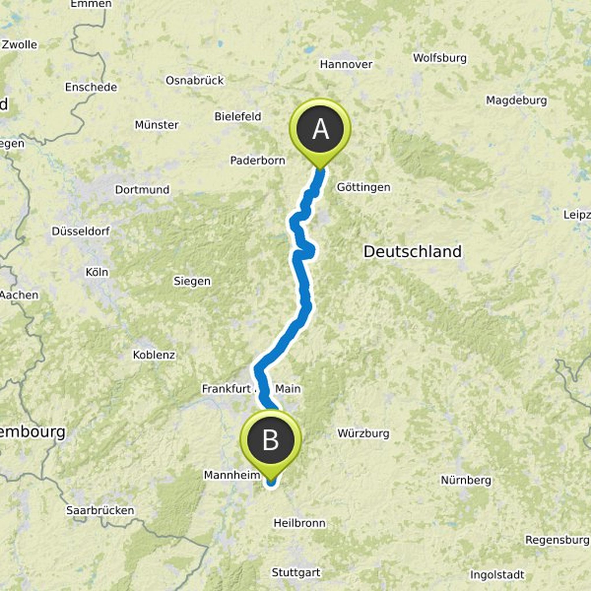
June 11, 2020
By bike from Kassel to the Edersee - that's no problem since the official opening of the Kassel-Edersee cycle path in July 2009. And just in time for the start of the 2010 cycling season, the common cycling flyer from Region Kassel-Land e.V., kassel tourist GmbH and the Touristik Service Waldeck-Ederbergland
Translated by Google •
Michele Elges planned a bike ride
June 11, 2020
Time
Distance
Speed
Ascent
Descent

Ippinger likes this.
June 11, 2020
Wolfhager Energieweg begins at Wolfhager Bahnhof or at the Schützeberger Straße / Landsberger Straße junction. First you cycle a few meters in the direction of Elmarshausen, turn right at the "Langelmühle", drive under the railway viaduct and along Siemensstrasse to the RV parking lot. If you want, you
Translated by Google •
Michele Elges planned a bike ride
June 11, 2020
Time
Distance
Speed
Ascent
Descent

June 11, 2020
The “Historical Cycle Path” around Wolfhagen leads you to some historically interesting sites and is primarily based on deserts, which mostly existed long before the city of Wolfhager was probably founded around 1223/25. However, their inhabitants probably took advantage of the security offered by the
Translated by Google •
Michele Elges planned a bike ride
June 11, 2020
Time
Distance
Speed
Ascent
Descent

Torsten likes this.
June 11, 2020
Route W 4 starts at Wolfhager Bahnhof or at the Bahnhofstraße / Schützeberger Straße junction. Turn right into Schützeberger Straße and drive towards the end of town. After the petrol station, turn left into Landsberger Straße and follow the route to the moated castle and the Elmarshausen stud station
Translated by Google •
Michele Elges planned a bike ride
June 11, 2020
Time
Distance
Speed
Ascent
Descent

June 11, 2020
The circular tour W3 begins at the corner of Lynkerstraße and Sudentenstraße. If you start from Wolfhager Bahnhof, follow the blue pictogram up to this point.
From here you cycle towards Kurfürstenstraße and over the new roundabout exit towards Bründersen. You pass the petrol station and turn the second
Translated by Google •
Michele Elges planned a bike ride
June 11, 2020
Time
Distance
Speed
Ascent
Descent

Ippinger likes this.
June 11, 2020
Route W 2 begins at Wolfhager Bahnhof or at the Bahnhofstraße / Schützeberger Straße junction. Follow the little wolf across Lynkerstrasse to the Wolfhager adventure pool. In the summer months you can immerse yourself in water up to 28 ° C.
Through a meadow valley you reach Kreisstraße 102 to Philippinenburg
Translated by Google •
Michele Elges planned a bike ride
June 11, 2020
Time
Distance
Speed
Ascent
Descent

June 11, 2020
Route W 1 begins at Wolfhager Bahnhof or at the Bahnhofstraße / Schützeberger Straße junction. First, it follows the Schützeberger Straße through the old town of Wolfhagen. Cycle past the beautiful half-timbered houses and visit the Wolfhager Marktplatz with the fairy tale fountain "Wolf und Geißlein
Translated by Google •
Michele Elges planned a bike ride
May 1, 2012
Time
Distance
Speed
Ascent
Descent
June 11, 2020
The Hessian R4 is one of nine long-distance cycle paths that conveys the variety of Hessian landscapes from north to south. The 415 km longest Hessian cycle route leads the cyclists from the Weser in Bad Karlshafen over the Habichtswald, through the Schwalm, the Vogelsberg, the Wetterau, the Rodgau and
Translated by Google •
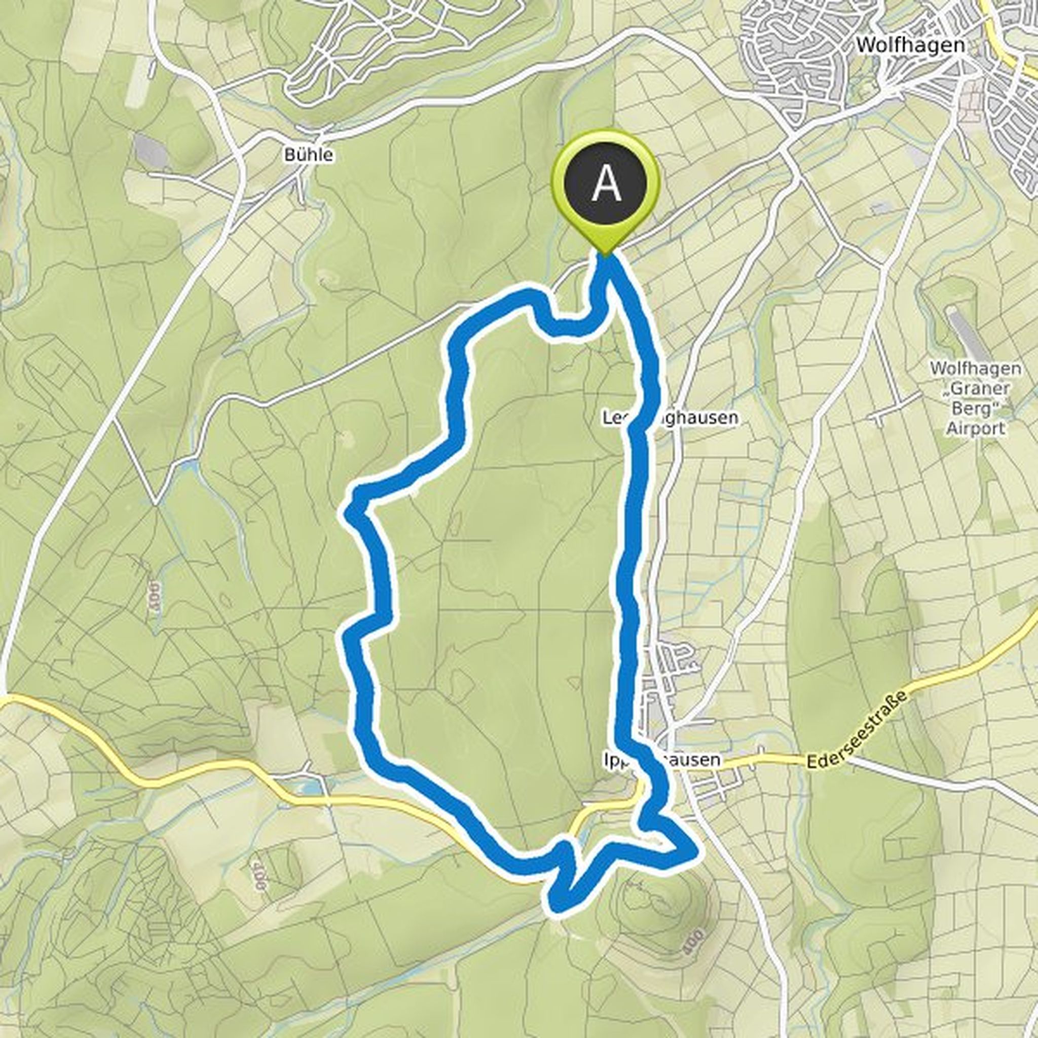
May 9, 2021
In the land of giants: The excellent tour leads on natural paths through deep beech forests and dark coniferous forests, along eventful forest edges, past sites of history. It is something for leisurely hikers, something for rangers who want to be inspired. Sometimes feelings long believed lost are awakened
Translated by Google •