비토리오 베네토 최고의 워킹 & 하이킹 경로
4.4
(1338)
6,697
등산객
248
하이킹
정확한 경로를 찾는 것이 때로는 어렵지만 비토리오 베네토에서 하이킹을 하면 다양한 경치를 마음껏 감상할 수 있답니다. 비토리오 베네토에서 가장 멋진 하이킹과 워킹 중에서 마음에 드는 활동을 시작해보세요.
마지막 업데이트: 10월 10, 2026
4.5
(99)
514
등산객
5.44km
01:30
90m
90m
Embark on the Sentiero del Lago Morto e Laghi Blu loop trail for an easy hike through the Val Lapisina, near Vittorio Veneto. This route spans 3.4 miles (5.4 km)…
4.4
(92)
487
등산객
4.21km
01:07
40m
40m
Embark on an easy hike around Lago Morto, a tranquil loop that offers a refreshing escape into nature. This route spans 2.6 miles (4.2 km) with a gentle elevation gain…

4.6
(80)
281
등산객
11.1km
04:04
590m
590m
Embark on a moderate hike along V2 - The Loop of the Two Hillsides, a 6.9-mile (11.1 km) route that takes about 4 hours and 4 minutes to complete. You…
4.6
(76)
261
등산객
11.1km
03:53
500m
500m
V2 - The Tour of the Two Coasts offers a moderate hiking experience, spanning 6.9 miles (11.1 km) with a significant elevation gain of 1642 feet (501 metres). You can…
4.5
(55)
174
등산객
9.47km
03:27
430m
430m
Embark on the Monte Baldo Loop from Serravalle, a moderate hiking route that spans 5.9 miles (9.5 km). You will experience a diverse landscape, transitioning from Mediterranean-like vegetation to dense…
더 다양한 경로와 다른 탐험가들의 추천을 살펴보세요.
이미 komoot 계정이 있나요?
투어 추천은 다른 사람들이 komoot에서 완료한 수천 개의 활동을 바탕으로 구성되어 있습니다.



커뮤니티 팁

역사적인 분위기가 있는 아늑한 장소입니다.
1
0

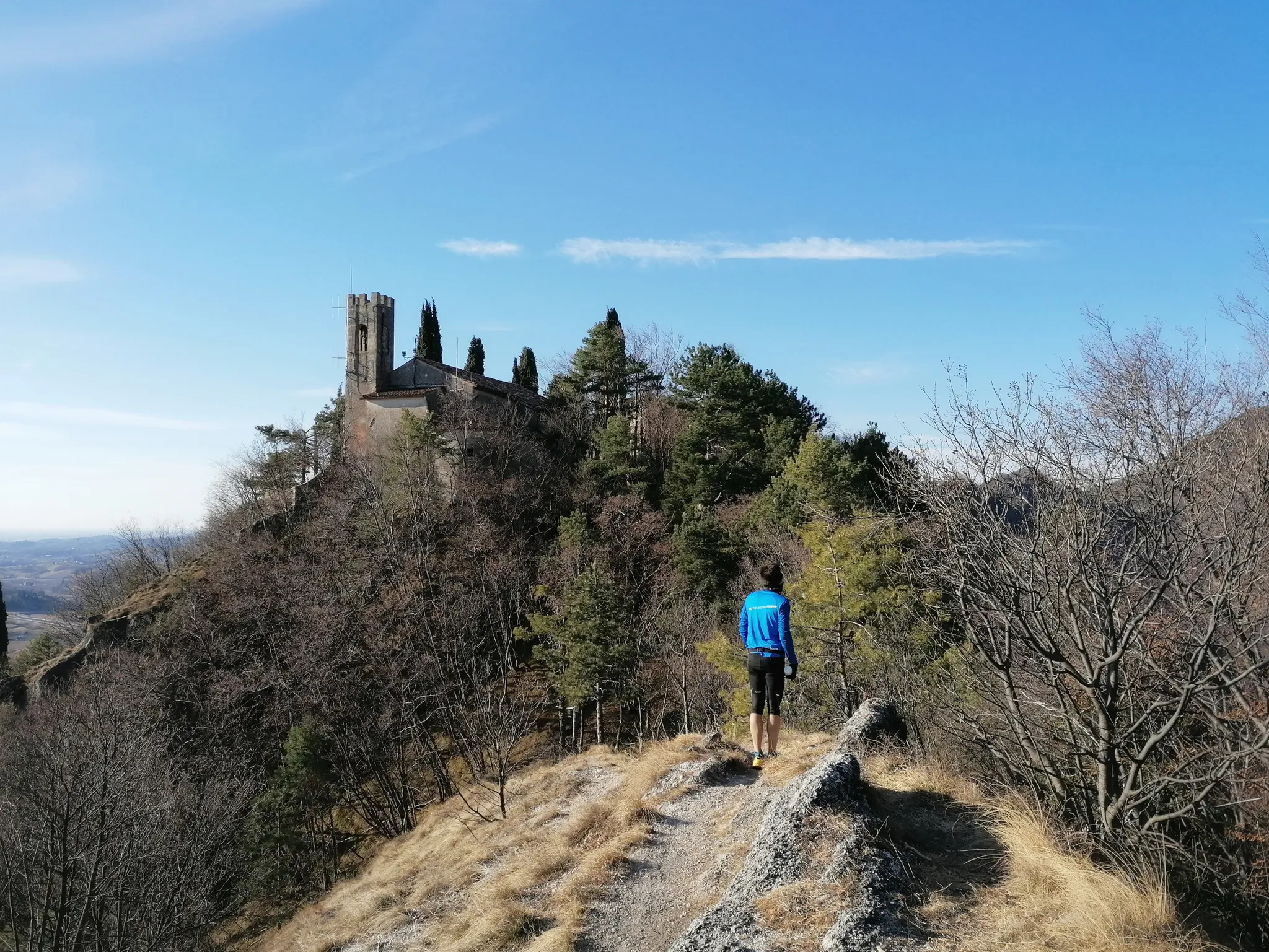
Sant’Augusta 계단은 Serravalle 대성당 뒤편 Via Calcada에서 시작하여 같은 이름의 성지로 이어지는 보행로입니다. 지난 세기 30년대에 지어진 기념비적인 작품으로, 중앙에 분수가 발달 축을 나타내는 대칭형 이중 경사 계단으로 이루어져 있습니다. 계단과 계단참은 시멘트 자갈로 만든 난간으로 둘러싸여 있습니다. 이중 계단은 아치를 갖춘 벽 부분으로 끝나며, 이곳을 통해 고지대의 목적지로 이동할 수 있으며, 동시에 경로의 첫 번째 부분을 닫고 구획하는 건축적 요소를 만듭니다. 이 첫 번째 시작 부분을 지나면, 숭배 경로는 단순하고 좁으며 갑작스러운 헤어핀 벤드로 이어지는 구간으로 발전합니다. 이곳에서는 "Codolà"(자갈) 포장재가 하류에서는 나무 울타리로, 상류에서는 경사면으로 둘러싸여 있습니다. 가장 가파른 지점에서는 조잡한 석조 건축물이 자연 지형을 지탱합니다. 수년에 걸쳐 이 경로의 이 부분은 통제되지 않은 식물 성장으로 인해 영향을 받았으며, 이는 보행 표면에 손상을 입혔습니다. 계단 상류의 긴 경로는 붉은 돌 단일 블록으로 만들어진 세 개의 전체 너비 계단으로 중단된 직선 구간으로 특징지어지며, 마지막으로 성지가 보이는 마지막 계단으로 마무리됩니다.
1
0

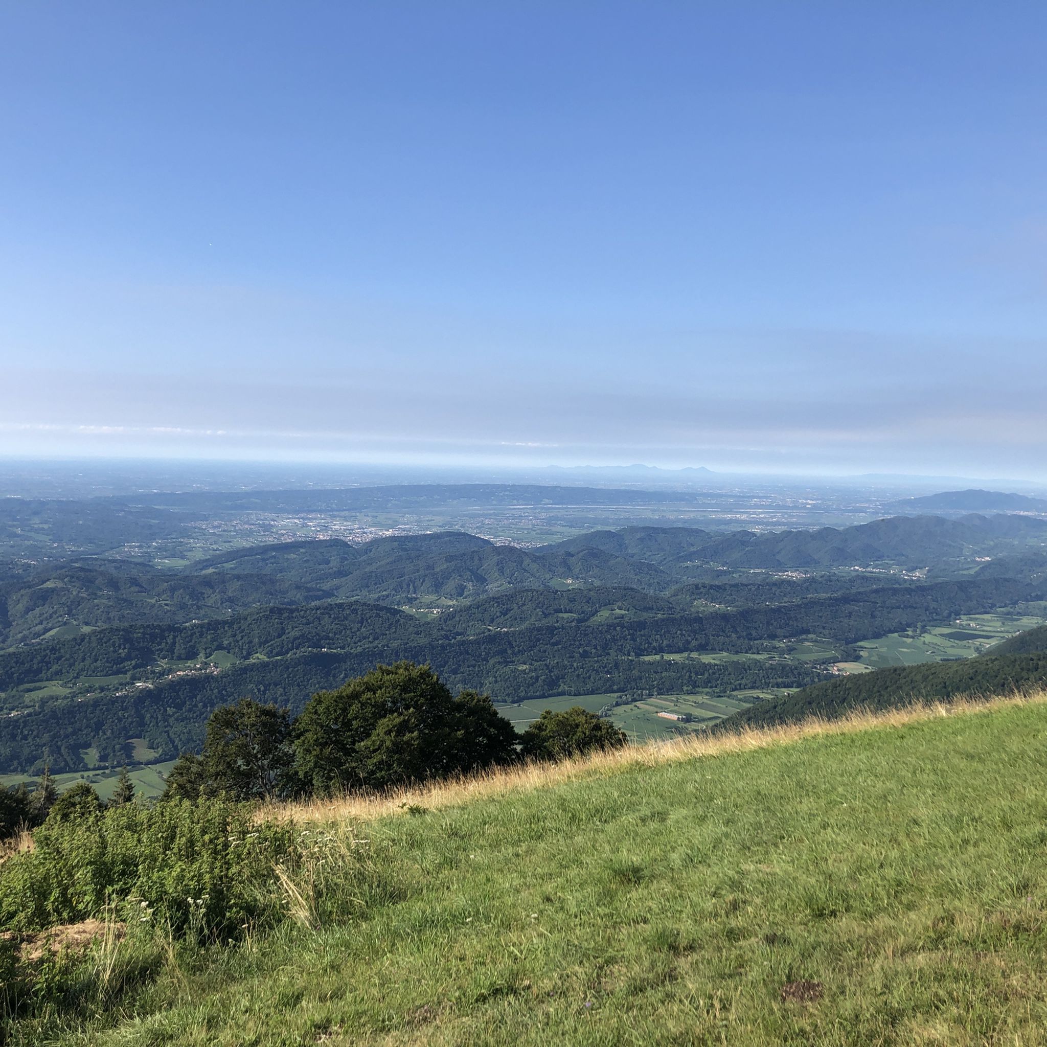
해발 599미터에 달하는 타르초의 몬테 발도는 노가롤로 마을과 레비네 호수 위로 솟아 있는 파노라마 언덕입니다. 높이는 낮지만 전략적인 위치 덕분에 베네치아 석호에서 돌로미티 봉우리까지 360도 전망을 제공합니다. 정상의 초원과 밤나무 숲이 특징인 이 산은 아래 호수의 225미터 높이에서 올라오는 트레일을 따라 하이킹과 산악자전거를 즐기기에 이상적인 장소입니다. 이 곳은 자연과 역사를 결합하여 고대 농촌 전통의 흔적을 보존하고 있으며, 알프스 이전의 풍경과 때묻지 않은 아름다움과의 직접적인 접촉을 찾는 사람들에게 회복력 있는 고독을 제공합니다.
0
0

excellent in winter for the sunny exposure and the view
0
0


A long avenue lined with cypress trees leads to the Pieve di Sant'Andrea di Bigonzo, isolated in a clearing that once served as a cemetery. The term pieve indicates an early church, equipped with a baptistery, which was responsible for the Christianization of a territory, and this corresponds to the foundation of Sant'Andrea in the 4th or 5th century, at the time of the martyrdom of Saint Augusta. The building in question was however rebuilt in Romanesque style and consecrated in 1303 with great prominence in the chronicles of the time. The façade has a five-lobed rose window in the center and two sepulchral canopies. On the south side stands the 17th-century bell tower while opposite is a small Renaissance portico. The interior, very suggestive, has a single nave covered by trusses, with four elegant canopies at the corners. The decorative set is noteworthy: frescoes mostly from the 15th and 16th centuries (Antonello da Serravalle, Francesco da Milano, Palma); sculptures (baptismal font with monolithic basin from the 11th century, two wooden crucifixes from the 14th and 15th centuries, a Renaissance altar with Saint Catherine), wooden tabernacle and polyptych from the Titian school; paintings attributed to Palma the Younger (1548-1628) and Francesco Frigimelica (ca. 1560-1649). Extract from «Vittorio Veneto e le Prealpi Trevigiane»
0
0


더 살펴보기
다른 지역의 최고의 하이킹를 살펴보세요.
