코르닐리오 최고의 워킹 & 하이킹 경로
4.5
(984)
5,361
등산객
136
하이킹
정확한 경로를 찾는 것이 때로는 어렵지만 코르닐리오에서 하이킹을 하면 다양한 경치를 마음껏 감상할 수 있답니다. 코르닐리오에서 가장 멋진 하이킹과 워킹 중에서 마음에 드는 활동을 시작해보세요.
마지막 업데이트: 10월 10, 2026
4.6
(28)
128
등산객
7.30km
03:24
530m
540m
Embark on a moderate 4.5-mile (7.3 km) loop from Rifugio Lagdei, offering a rewarding hike through the Northern Apennines. This route, which typically takes around 3 hours and 23 minutes to complete, leads you through dense beech forests that gradually open up to reveal low blueberry bushes and wildflowers. A highlight is Lago Santo Parmense, the largest glacial lake in the province of Parma, with its clear waters nestled in a serene basin. You will also ascend to Monte Orsaro, where you can enjoy panoramic views of the Tuscan-Emilian Apennines and sometimes even the Ligurian Sea.
To begin your adventure, head to Rifugio Lagdei, which serves as the starting point for this classic Apennine circuit. The trail is generally accessible, but some sections, particularly the climb to Monte Orsaro, can be steep and require good physical fitness and sure-footedness. While there are no specific permits or fees mentioned, it is always wise to check local conditions before you go. Both Rifugio Lagdei and Rifugio Giovanni Mariotti, located on the shores of Lago Santo, offer services like meals and refreshments, making them convenient stops along your journey.
This area is rich in history and natural beauty; Monte Orsaro is named after bears that once roamed here until the 17th century. The historic Rifugio Mariotti, inaugurated in 1882, adds to the trail's charm. Beyond the stunning landscapes, the region around Lagdei is ecologically significant, featuring a small peat bog and rare species, remnants of its glacial past. You will find extensive blueberry bushes, especially as you near the summit of Monte Orsaro, adding a unique touch to the diverse terrain.
4.7
(11)
73
등산객
12.3km
05:15
760m
760m
Embark on a challenging hike through the Parco Regionale delle Valli del Parma e del Cedra, often called the "Park of the Hundred Lakes." This difficult 7.6-mile (12.3 km) loop tour demands very good fitness and sure-footedness, taking approximately 5 hours and 14 minutes to complete. You will ascend 2503 feet (763 metres) through varied terrain, including mountain paths and alpine sections, encountering spectacular rocky walls and gentler slopes covered in blueberry moorlands. Look for the numerous glacial lakes and peat bogs nestled in basins, offering a unique visual experience.
Planning your visit to this region means preparing for a demanding experience. The park is known for its "hard hikes," and some routes, like this one, are categorized for expert hikers. While the research does not specify trailhead access or parking for this exact loop, the park generally offers diverse entry points. Always check local conditions before you go, especially regarding weather, as the region is one of Italy's rainiest, which contributes to its abundant water features. Ensure you have appropriate gear for varied mountain terrain.
The Parco Regionale delle Valli del Parma e del Cedra is a testament to ancient glaciations, preserving significant evidence of the last two ice ages in its unique topography of glacial lakes and moraines. This protected area is a vital habitat for diverse flora and fauna; you might spot golden eagles soaring above or even catch a glimpse of a wolf, as they have recolonized the Apennines. The park is also home to rare species like the Apennine primrose, endemic to this area, and features ancient chestnut groves, adding to its rich natural and ecological significance.

4.4
(17)
91
등산객
5.99km
02:12
310m
310m
Embark on the Lagoni and Badignana Huts Loop, a moderate hike that guides you through the diverse landscapes of the Appennino Tosco Emiliano National Park. This route covers 3.7 miles (6.0 km) with an elevation gain of 1013 feet (309 metres), typically taking around 2 hours and 11 minutes to complete. You will start near Rifugio Lagoni, following a cobbled path before ascending into ancient beech forests, enjoying splendid views of the Lagoni Lakes and passing by the distinctively dark Lago Scuro.
Access to the trailhead is straightforward, usually starting from Rifugio Lagoni itself. Be prepared for varied terrain, which includes accessible paths, mountain trails, and some unpaved sections. It is wise to wear appropriate footwear, as certain areas, particularly the peat bogs, can be wet and marshy, requiring careful footing.
This loop offers a continuous change of scenery within the Parco dei Cento Laghi, showcasing not only the lakes but also expansive pastures and unique peat bogs. The return journey often follows a wide mule track, providing a different perspective on the natural beauty of the region. It is a rewarding experience for anyone looking to explore the rich ecosystems of this national park.
4.8
(6)
22
등산객
14.7km
04:54
710m
710m
Scenic ridge walk through wild horse pastures to Monte Navert's 360-degree Apennine panorama.
5.0
(2)
8
등산객
5.28km
02:10
320m
320m
Hike the moderate 3.3-mile Monte Tavola Summit Trail from Rifugio Lagdei (via CAI 725) for panoramic views and forest paths.
더 다양한 경로와 다른 탐험가들의 추천을 살펴보세요.
이미 komoot 계정이 있나요?
투어 추천은 다른 사람들이 komoot에서 완료한 수천 개의 활동을 바탕으로 구성되어 있습니다.
오늘 무료 계정으로 시작하세요
다음 모험이 기다리고 있어요.






커뮤니티 팁

휴식을 취하며 시간을 보내기에 아주 좋은 곳입니다. Lagoni의 임도를 따라 도보 또는 MTB로 쉽게 접근할 수 있습니다.
3
0

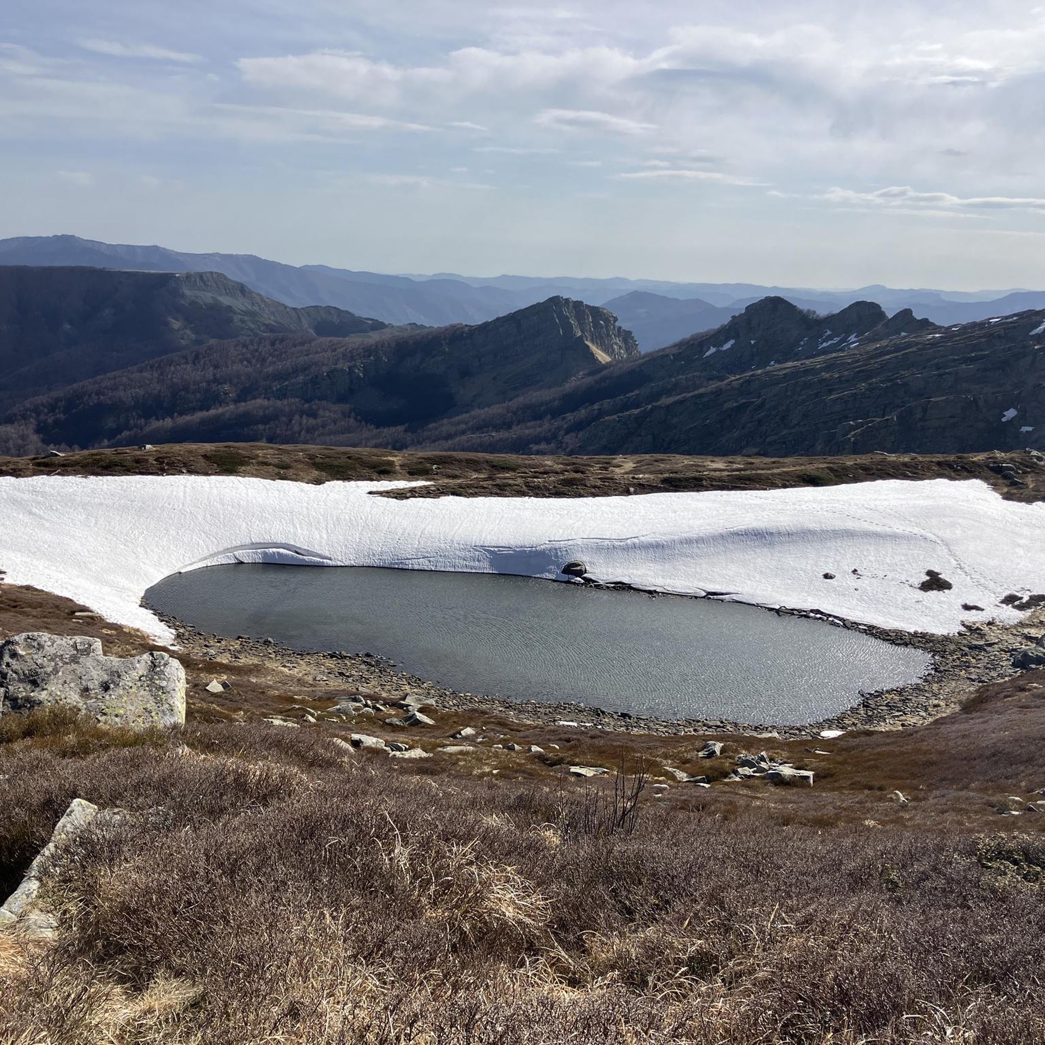
파르마의 산토 호수는 에밀리아-로마냐에서 가장 넓은 빙하 호수이며 북부 아펜니노 산맥 전체에서 가장 큰 자연 수역입니다. 해발 1,507미터에 위치한 코르니글리오 코무네에 있으며, 면적은 81,000제곱미터가 넘고 최대 깊이는 22.5미터에 달합니다. 토스카나-에밀리아 아펜니노 국립공원(센토 라기 공원으로도 알려짐) 내에 있으며 마르마냐 산의 절벽이 내려다보입니다.
1
0

아름다운 장소입니다. 차로 산장에 가려면 인내심을 가지세요. 마지막 구간은 비포장도로입니다(페달링하기 좋습니다).
0
0
십자가에 도달하는 것은 어느 계절에나 즐겁습니다.
0
0
A refuge on Lago Santo Parmense. Located in a magnificent setting, it's a delightful place to stop. It's managed; all the information is on the website. It can be reached on foot or by chairlift from Lagdei.
2
0
There's not much to say here. Lago Santo is on the list of top places in our Apennines. A quick web search and a few photos are all it takes to understand what it's all about.
3
0


you can admire its lake (Gemio inferiore) and everything that surrounds it, you have to go there to see it in person
3
0


더 살펴보기
다른 지역의 최고의 하이킹를 살펴보세요.
