4의 스루크로스 저수지가지 명소 & 주요 장소
주변의 최고의 명소와 볼거리는 워시번 밸리에 있는 중요한 자연 지형인 스러스크로스 저수지 자체입니다. 이곳은 4개의 저수지 중 가장 북쪽에 있고 가장 높은 곳에 위치하며, 외딴 경치 좋은 풍경을 제공합니다. 이 지역은 주변의 황야, 삼림, 그리고 침수된 웨스트 엔드 마을의 역사 유적지로 유명합니다. 방문객들은 다양한 풍경과 역사적 흔적을 탐험할 수 있습니다.
스러스크로스 저수지 주변 최고의 명소와 볼거리
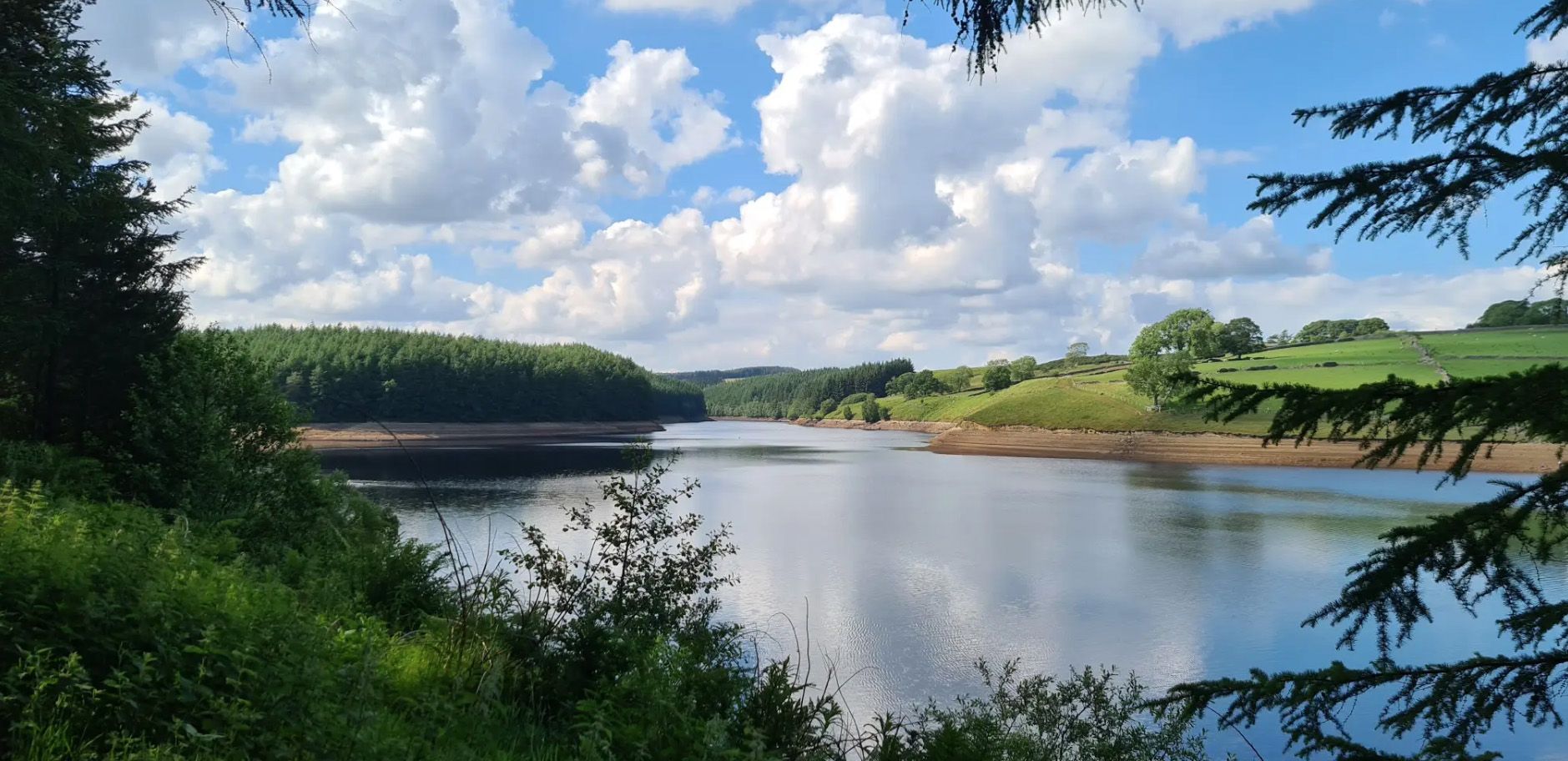
- 가장 인기 있는 명소는 외딴 위치 덕분에 워시번 저수지 중 가장 고요한 전망대인 스러스크로스 저수지입니다. 저수지 도로에서 특히 멋진 전망을 감상할 수 있는…
마지막 업데이트: 8월 18, 2026
Thruscross 저수지
하이라이트 • 전망대
팁에 의해

스러스크로스 저수지에 있는 웨스트 엔드 마을의 폐허
하이라이트 • 정착지
팁에 의해

이런 장소를 발견하려면 지금 가입하세요
최고의 싱글 트랙, 봉우리 및 다양한 흥미로운 야외 장소에 대한 추천을 받아보세요.
무료 회원 가입
Scot Lane 호숫가 산책로
하이라이트 • 트레일
팁에 의해
Thruscross 저수지 주차장
하이라이트 • 주차장
팁에 의해

Holme Field Head 유적지
하이라이트 • 전망대
팁에 의해
오늘 무료 계정으로 시작하세요
다음 모험이 기다리고 있어요.
로그인 또는 가입하기
스루크로스 저수지 주변의 다른 모험

커뮤니티 팁

Imposing and deserted building overlooking the northern end of Thruscross Reservoir. Recorded by the Yorkshire Vernacular Buildings Group in 1976: "The 1841 census return shows it to have been occupied by a young unmarried woman called Ann Young farming over 200 acres; a family with the same surname contemporaneously occupied Whit Moor Farm with a similar acreage."
1
0
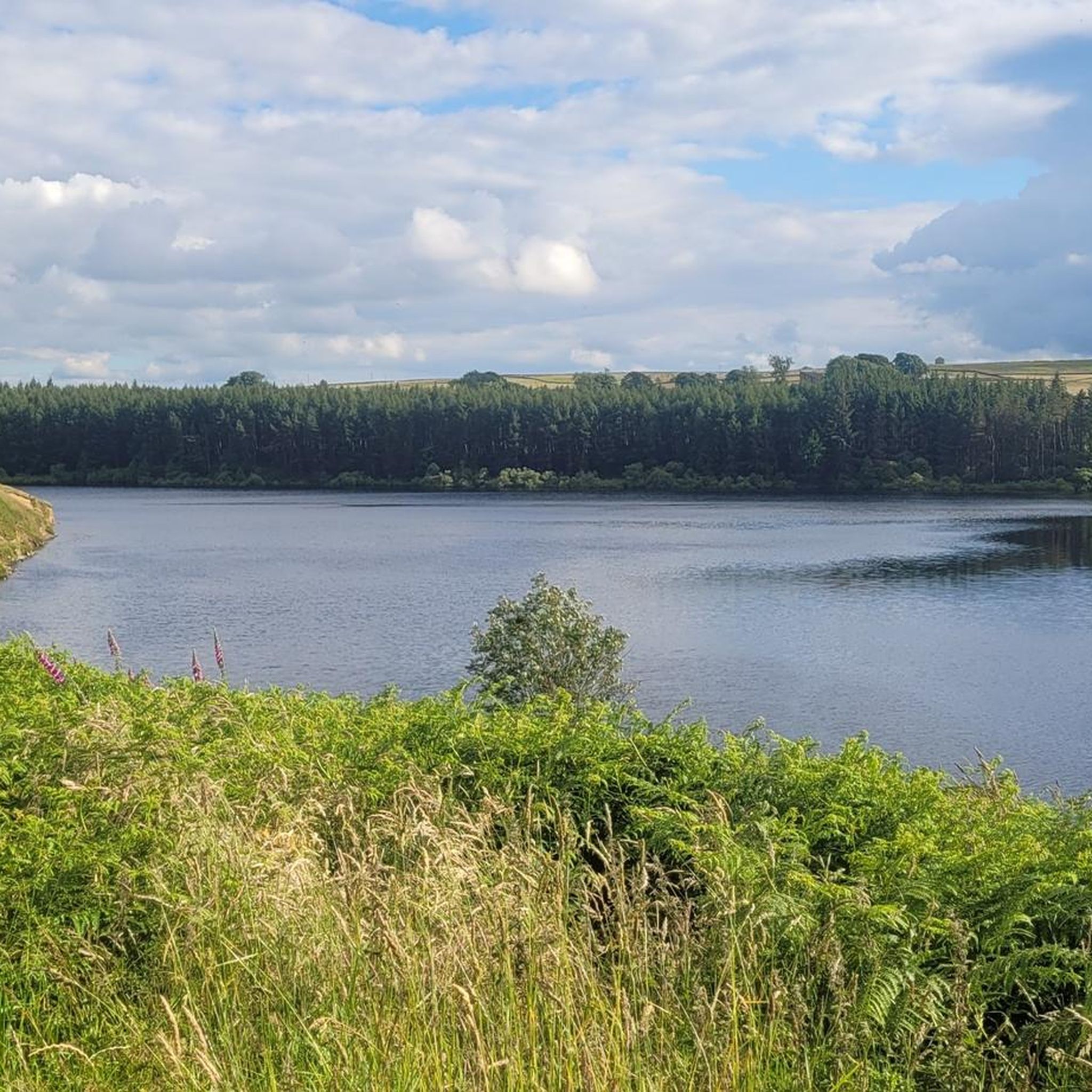
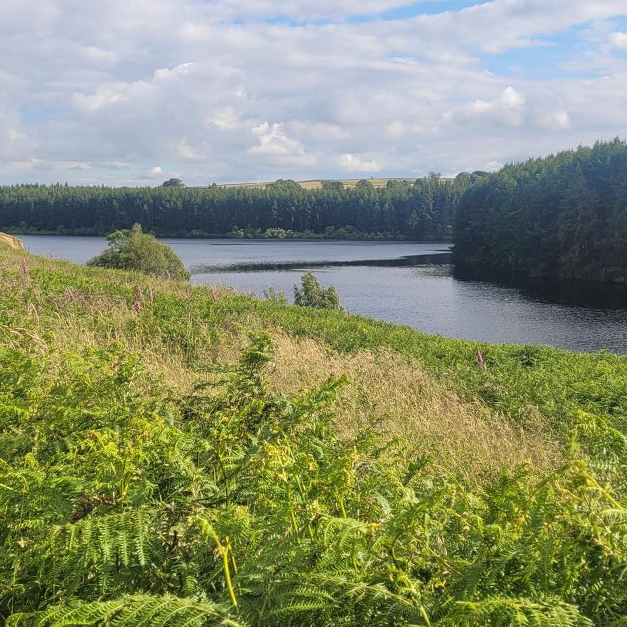
Undoubtedly the most scenic of the Washburn reservoirs with the moorland backdrop to the north. The circular route around the reservoir from the car park is about 5 miles, the track on the southwestern side runs along the edge of plantations and offers some shade from the sun and shelter from the elements. The track on the northeastern side is more exposed, and if you do the whole circuit you will cross over Far Comb Hill and the plantation along the edge of the reservoir at Whit Moor - a great route.
0
0
Fair sized and well-maintained car park with space for at least 30-40+ vehicles. Few picnic tables at the south-eastern end of the car park. There is also space for a few cars if you park off-road next to Thruscross Reservoir Lodge, on Reservoir Road on the eastern side of the dam, but these spots tend to fill up quickly.
1
0
Different experience on each side of the reservoir. The track on the west / southwestern side is shaded and slightly elevated, running along the edge of plantations, and Scot Lane on the eastern side is a bit more exposed. A full circular route of the reservoir is around 5 miles or so.
1
0
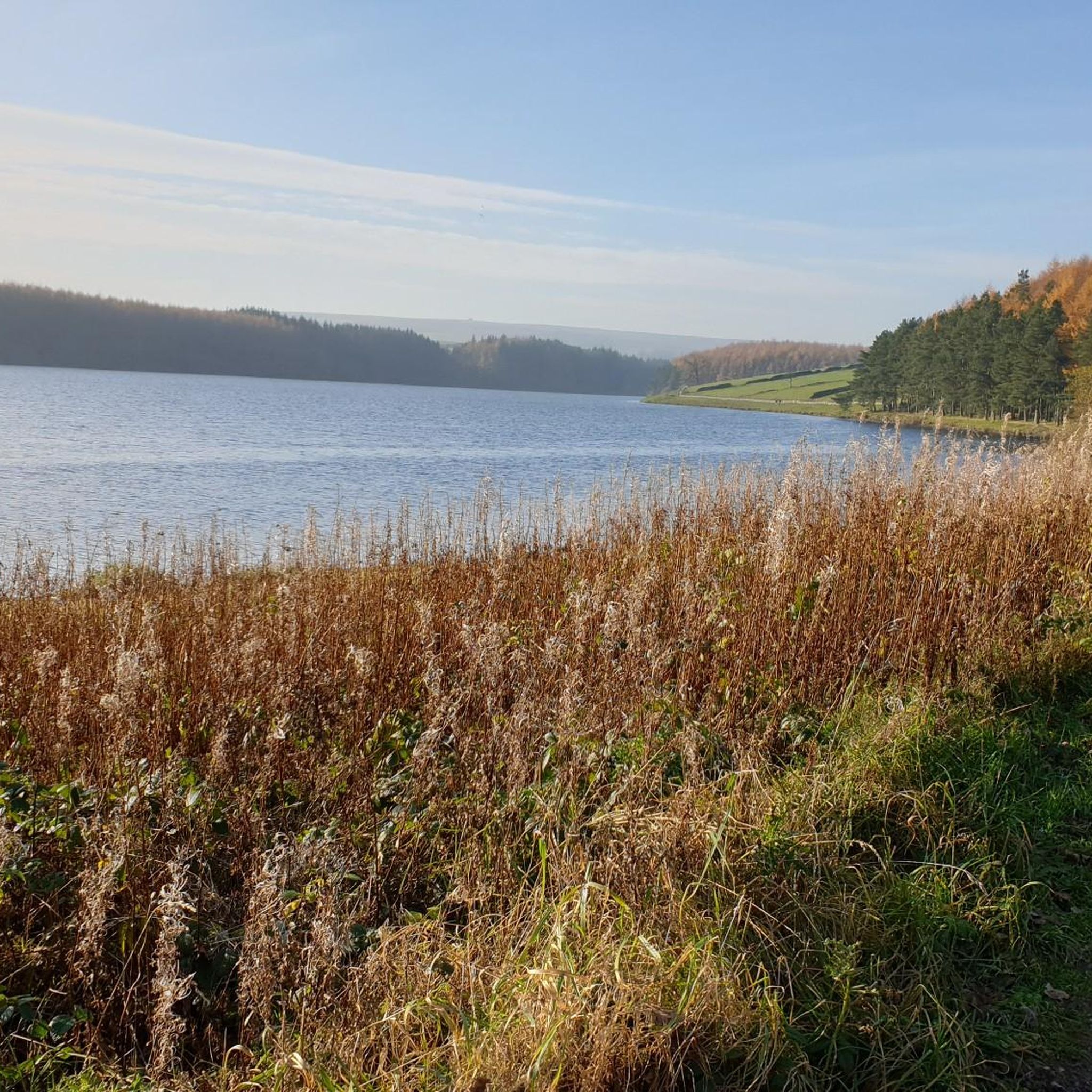
The walk from the large car park at Thruscross Reservoir dam up the west side of the reservoir to Cloggers Lane is magical and gives far better views than the tracks along Scot Lane on the eastern side. The track meanders along the edge of coniferous plantations, giving dappled shade on a sunny day and unobstructed views across the reservoir.
1
0

Scot Lane runs on the northern bank of the reservoir. A pleasant, relatively newly planted hedge runs along this bank, and the views of the reservoir are lovely; you will be able to make out the dam from here on the opposite side of it.
0
0
It is very odd to think that an entire village once existed here, but that's what you're looking at here. The entire village of West End. Cloggers Lane dropped here towards Patrick's Mill, the Butcher's Arm and a church, all of which vanished under the Thruscross Reservoir in the mid 1960s. A curious, eerie sight.
0
0
There are four reservoirs in the Washburn Valley, and this one is the northernmost. What distinguishes this one from the other three is also the fact that this one was built in 1966 while the other ones in the 19th century. The reservoir belongs to Yorkshire Water, the water company. From Reservoir Road in particular, the views of the reservoir are stunning - particularly given that you are high above. Sunsets here are just something else!
0
0
자주 묻는 질문
스러스크로스 저수지 주변에서 어떤 역사 유적지를 탐험할 수 있나요?
가장 중요한 역사 유적지는 스러스크로스 저수지의 웨스트 엔드 마을 유적입니다. 이 마을은 1966년 저수지 건설 시 수몰되었으며, 오래된 건물 기초와 옛 방적 공장의 잔해가 낮은 수위 기간 동안 드러납니다. 또한 저수지 북쪽 끝을 조망하는 인상적인 폐허 건물인 홈 필드 헤드 유적과 더 넓은 워시번 계곡의 선사 시대 정착지 흔적도 찾을 수 있습니다.
스러스크로스 저수지 주변에 산책로가 있나요?
네, 스러스크로스 저수지는 산책으로 매우 인기가 많습니다. 저수지 주변의 7.2km(4.5마일) 길이의 험준한 순환 코스는 숲, 황무지, 목초지를 통과하는 다양한 지형을 제공합니다. 좀 더 완만한 옵션을 원하시면, 물가로 이어지는 숲을 통과하는 2.4km(1.5마일) 길이의 접근 가능한 순환 경로가 있습니다. 북쪽 제방에 있는 스콧 레인 호숫가 길은 멋진 경치를 제공합니다.
스러스크로스 저수지와 그 주변의 최고의 전망은 어디에서 찾을 수 있나요?
저수지 자체는 특히 높은 곳에 있는 저수지 도로에서 멋진 전망을 제공합니다. 스콧 레인 호숫가 길은 댐을 향한 물 건너편의 훌륭한 시야를 제공합니다. 더 넓은 지역의 파노라마 전망을 원하시면, 더 도전적인 사이먼스 시트와 로킹 홀 루프를 고려해 보세요.
스러스크로스 저수지가 이 지역의 다른 저수지와 비교하여 독특한 점은 무엇인가요?
스러스크로스는 워시번 계곡에 있는 네 개의 저수지 중 가장 북쪽에 있고 가장 높은 곳에 있어 더욱 외딴하고 고요한 느낌을 줍니다. 가장 독특한 특징은 웨스트 엔드 수몰 마을로, 수위가 낮을 때 유적이 드러나 과거를 엿볼 수 있는 잊혀지지 않는 광경을 선사합니다. 이 지역은 또한 다크 스카이 디스커버리 사이트로 지정되어 있어 별 관측에 탁월합니다.
스러스크로스 저수지에는 접근 가능한 경로 또는 시설이 있나요?
네, 숲을 통과하는 2.4km(1.5마일) 길이의 접근 가능한 순환 경로는 물가로 이어지며, 좀 더 완만한 산책을 원하는 분들에게 적합합니다. 주요 스러스크로스 저수지 주차장은 꽤 넓고 잘 관리되어 있으며 휠체어 접근이 가능하고 피크닉 테이블이 마련되어 있습니다.
스러스크로스 저수지 근처에는 어떤 야외 활동과 경로를 이용할 수 있나요?
저수지 순환 산책 외에도 이 지역은 다양한 야외 활동을 제공합니다. 쉬운 "스러스크로스 저수지 및 클로거스 레인 루프"와 더 도전적인 "사이먼스 시트 및 로킹 홀 루프"를 포함한 수많은 하이킹 트레일을 찾을 수 있습니다. 산악자전거 애호가를 위해 "덴턴 무어 – 레드 게이트 트레일 루프"와 같은 여러 경로가 있습니다. 스러스크로스 저수지 주변 하이킹 및 스러스크로스 저수지 주변 MTB 트레일 가이드 페이지에서 더 많은 옵션을 탐색해 보세요.
스러스크로스 저수지를 방문하기 가장 좋은 시기는 언제인가요?
스러스크로스 저수지는 연중 아름다움을 선사합니다. 봄과 여름은 울창한 삼림과 황무지를 즐기기에 이상적입니다. 가을은 풍경에 생생한 색감을 더합니다. 물에 잠긴 웨스트 엔드 마을의 잔해를 볼 기회를 얻으려면, 연중 어느 때나 발생할 수 있는 가뭄과 낮은 수위 기간이 가장 좋습니다. 이 지역은 빛 공해가 거의 없어 맑은 밤에는 별 관측에도 탁월합니다.
스러스크로스 저수지는 가족이나 반려견 산책객에게 적합한가요?
네, 이 지역은 일반적으로 가족 및 반려견 산책객에게 적합합니다. 1.5마일 길이의 접근 가능한 순환 경로는 가족과 함께하는 부드러운 산책에 좋습니다. Scot Lane Lakeside Path 또한 즐거운 선택지입니다. 많은 산책로가 반려견 동반이 가능하지만, 특히 가축과 야생동물 주변에서는 항상 반려견을 통제하에 두도록 하십시오.
스러스크로스 저수지 근처에서 별을 볼 수 있나요?
물론입니다. 스러스크로스 저수지 주변 지역, 특히 주차장은 다크 스카이 디스커버리 사이트로 지정되어 있습니다. 이는 빛 공해가 거의 없다는 것을 의미하며, 맑은 밤에 별과 천체를 관측하기에 훌륭한 장소입니다.
스러스크로스 저수지 주변에서 어떤 야생동물을 볼 수 있나요?
스러스크로스 저수지는 야생동물, 특히 새들의 안식처입니다. 도요새, 물떼새, 그리고 가끔 보이는 붉은 솔개와 같은 종들을 볼 수 있어 조류 관찰에 좋은 장소입니다. 주변의 삼림과 황무지는 또한 다양한 지역 토착 동물들을 서식지로 삼고 있습니다.
숙련된 보행자를 위한 더 도전적인 하이킹 코스가 있나요?
네, 도전을 추구하는 숙련된 보행자를 위해 "Simon's Seat and Rocking Hall loop"는 13.3마일(21.4km) 길이의 상당한 고도 상승이 있는 하이킹 코스로, Simon's Seat에서 파노라마 전망을 제공합니다. 이 경로는 더 넓은 황무지 풍경을 더욱 힘든 탐험으로 안내합니다.


더 살펴보기
찾고 있는 하이라이트를 아직 못 찾으셨나요? 다른 지역의 주요 명소 가이드를 확인해보세요:
