마우이 카운티 주변 최고의 화산 하이킹 & 워킹 코스
4.6
(527)
8,949
등산객
8
하이킹
화산 하이킹 트레일은 화산 활동으로 형성된 마우이 카운티의 풍경을 가로지르며, 고지대 분화구부터 해안 용암 지대까지 다양한 생태계를 특징으로 합니다. 이 지역은 거대한 할레아칼라 화산과 그 다채로운 스코리아 원뿔 및 용암 지대, 그리고 울창한 열대우림과 극적인 능선선이 특징입니다. 이 다양한 지형은 화산 분지 안으로의 도전적인 하강부터 해안을 따라 걷는 경치 좋은 산책까지 다양한 경험을 제공합니다.
마우이 카운티 최고의 화산 하이킹 트레일
- 가장 인기 있는 화산 하이킹 경로는 슬라이딩 샌즈와 할레아칼라 트레일 루프로, 14.2마일(22.8km) 길이이며 완료하는 데 7시간 13분이 소요됩니다. 이…
마지막 업데이트: 9월 14, 2026
5.0
(18)
129
등산객
22.8km
07:13
910m
910m
The Sliding Sands and Halemau'u Trail Loop offers an unparalleled journey through Haleakalā National Park's volcanic heart, starting with a descent into the crater that feels like stepping onto another…
5.0
(1)
5
등산객
14.8km
04:30
530m
530m
If you're seeking a quintessential Mount Rainier experience, the Skyline Trail delivers with its stunning alpine scenery and diverse terrain. This moderate 9.2-mile (14.8 km) hiking loop takes you through…

5.0
(1)
4
등산객
9.78km
02:54
300m
300m
Embark on the Mamane Trail and Waipoli Road Loop for a moderate hiking experience that takes you through varied terrain. You will encounter smooth paths and more technical sections with…
4.9
(17)
205
등산객
14.5km
04:58
780m
780m
보통 하이킹. 좋은 체력 필요. 실력과 관계없이 누구나 쉽게 갈 수 있는 길.
4.8
(9)
183
등산객
5.78km
01:44
190m
190m
초급용 하이킹. 모든 체력 수준에 적합. 실력과 관계없이 누구나 쉽게 갈 수 있는 길.
더 다양한 경로와 다른 탐험가들의 추천을 살펴보세요.
이미 komoot 계정이 있나요?
투어 추천은 다른 사람들이 komoot에서 완료한 수천 개의 활동을 바탕으로 구성되어 있습니다.


커뮤니티 팁


Actually a hiking trail, but it shouldn't stop you...start as early as possible!
1
0
It's rather unusual to run at this altitude, but it's still MEGA
1
0

This is a wonderful drive on an excellent road up to 3060 m altitude. We drove partly through clouds and short before the summit it cleared up and we got awarded with an outstanding view around the island.
0
0

Haleakalā's summit currently resides at 10,023 feet. It is believed that it once sat at 15k feet, but it is so heavy that the volcano is sinking into the earth's crust. Today, the volcano is 28,000 feet above the sea floor making it the THIRD tallest mountain on earth!
0
0
This volcanic rock road/trail takes you to the majestic peak and offers uninterrupted views the entire way! Being that you are on a ridge line, you can see almost the entirety of Maui at different point as you climb the volcano.
0
0

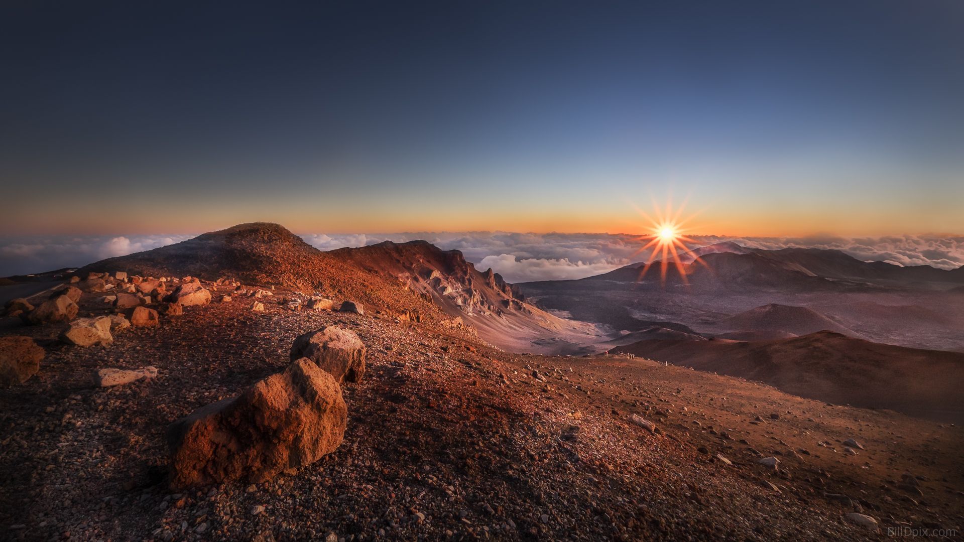
This trail leads into the crater of Haleakalā Volcano, also known as Keonehe'ehe'e. This most stunning route section offers panoramic views that defy the imagination. As you continue your run down the trail, be aware of the loose gravel, as it can cause loose rocks and sand to find their way into your shoes. The descent can also be deceiving, so watch your energy for the challenge back to the trailhead.
0
0
Split Rock is a large rock cut in half, and the Keonehe'ehe'e trail passes between the two parts. Here, the endangered Haleakala silverswords grow, and it's crucial to avoid touching them. These delicate 'ahinahina live for 3-90 years, producing a stunning flowering stalk before scattering their seeds. Park staff protect them by fencing out silversword-munching ungulates, removing non-native plants, and educating visitors to stay on trails and avoid stepping on fragile seedlings.
0
0
자주 묻는 질문
마우이 카운티에는 몇 개의 화산 하이킹 트레일이 있나요?
Komoot에는 마우이 카운티에 7개의 전용 화산 하이킹 트레일이 있으며, 쉬운 산책부터 도전적인 종일 트레킹까지 다양합니다. 이 루트는 주로 할레아칼라 국립공원의 독특한 풍경을 탐험합니다.
마우이 카운티의 화산 하이킹 난이도는 어떤가요?
다양한 난이도를 경험할 수 있습니다. 쉬운 트레일 2개, 보통 난이도 루트 3개, 어려운 하이킹 2개가 있습니다. 도전적인 경험을 원하시면, 할레아칼라 분화구 깊숙이 내려가는 슬라이딩 샌즈 및 할레마우 트레일 루프를 고려해 보세요.
이 화산 트레일에서 어떤 독특한 자연 경관을 볼 수 있나요?
마우이 카운티의 화산 트레일은 놀라운 지질학적 다양성을 제공합니다. 다채로운 모래와 송이 원뿔이 있는 할레아칼라 분화구의 화성 같은 화산 풍경을 탐험할 수 있습니다. 케오네헤에헤 트레일(슬라이딩 샌즈)은 이러한 독특한 지형의 대표적인 예입니다. 은검초와 같은 희귀 식물을 만날 수도 있습니다.
마우이 카운티에 가족 친화적인 화산 하이킹 코스가 있나요?
네, 가족에게 적합한 여러 옵션이 있습니다. 파노라마 망원경 건물 – 할레아칼라 방문자 센터 루프와 같은 쉬운 트레일은 관리하기 쉬운 거리와 적은 고도 상승으로, 극심한 노력 없이 화산 풍경을 경험하려는 가족 나들이에 완벽합니다.
마우이 카운티의 화산을 하이킹하기에 가장 좋은 시기는 언제인가요?
마우이의 기후는 일반적으로 일 년 내내 쾌적하지만, 특히 할레아칼라와 같은 고지대의 화산 하이킹의 경우 건기(4월~10월)에 하늘이 더 맑고 날씨가 더 안정적인 경우가 많습니다. 그러나 정상 부근에서는 날씨가 급변할 수 있으므로 계절에 관계없이 항상 서늘한 기온과 잠재적인 비에 대비해야 합니다.
마우이 카운티에서 화산 하이킹 시 무엇을 입어야 하나요?
특히 할레아칼라 국립공원에서는 상당한 고도 변화가 있으므로 여러 겹으로 옷을 입는 것이 중요합니다. 해수면에서 따뜻하더라도 정상 부근의 기온은 특히 일출 시 영하로 떨어질 수 있습니다. 튼튼한 하이킹 신발, 바람막이, 모자, 그리고 충분한 물을 챙기세요.
순환형 화산 루트가 있나요?
네, 루프 트레일을 선호하는 분들을 위해 슬라이딩 샌즈 및 할레마우 트레일 루프는 할레아칼라 국립공원 내에서 도전적이지만 보람 있는 순환 경험을 제공합니다. 또 다른 보통 난이도 옵션으로는 마마네 트레일 및 와이폴리 로드 루프가 있습니다.
다른 하이커들은 마우이 카운티의 화산 하이킹에 대해 무엇을 가장 좋아하나요?
Komoot 커뮤니티는 이 트레일에 대해 평균 4.65점의 높은 점수를 부여하고 있습니다. 하이커들은 할레아칼라 분화구의 비현실적인 풍경, 숨 막히는 파노라마 전망, 그리고 구름 위에서 경험하는 독특한 경험에 대해 자주 칭찬합니다. 희귀 토종 동식물을 볼 수 있는 기회 또한 많은 사람들에게 하이라이트입니다.
화산 트레일 근처에 시설이나 방문자 센터가 있나요?
네, 할레아칼라 국립공원 내에는 시설, 정보 및 종종 레인저 프로그램을 제공하는 할레아칼라 방문자 센터가 있습니다. 정상 건물 또한 놀라운 전망을 제공하며 주요 랜드마크입니다.
화산 하이킹, 특히 할레아칼라 일출을 위해 허가증이나 예약이 필요한가요?
할레아칼라 국립공원에서의 일반적인 하이킹은 항상 특정 하이킹 허가증이 필요한 것은 아니지만, 일출을 보기 위해 오전 3시부터 오전 7시 사이에 정상 지구에 차량을 진입하려면 예약이 필수입니다. 방문 전에 가장 최신 요구 사항을 확인하려면 항상 공식 할레아칼라 국립공원 웹사이트를 확인하는 것이 가장 좋습니다.
화산 트레일로 가는 대중교통이 있나요?
할레아칼라 국립공원 정상까지 직접 가는 대중교통 옵션은 매우 제한적입니다. 대부분의 방문객은 자가용을 이용하거나 투어를 이용합니다. 일반적으로 트레일 시작점 접근 및 더 넓은 지역 탐험을 위해 렌터카를 계획하는 것이 좋습니다.
화산 하이킹 지역 근처에 폭포가 있나요?
할레아칼라 정상 지구의 주요 화산 트레일은 건조한 분화구 풍경으로 유명하지만, 할레아칼라 국립공원의 키팔룰루 지구(하나 로드를 통해 접근 가능)는 울창한 숲과 폭포로 유명합니다. 이곳에서 400피트 높이의 장엄한 와이모쿠 폭포를 볼 수 있습니다.
마우이 카운티에서 가장 인기 있는 명소


찾고 계신 것을 찾지 못하셨나요?
마우이 카운티에서 더 많은 하이킹를 확인하고 목적지에서 완벽한 경로를 찾아보세요.
