경로

플래너

기능

업데이트

App

로그인 또는 가입

앱 다운로드

로그인 또는 가입

경로
하이킹
꼬모

꼬모 호수

꼬모 호수 주변 최고의 가족 하이킹 & 워킹 코스

4.4

(5374)

28,616

등산객

298

하이킹

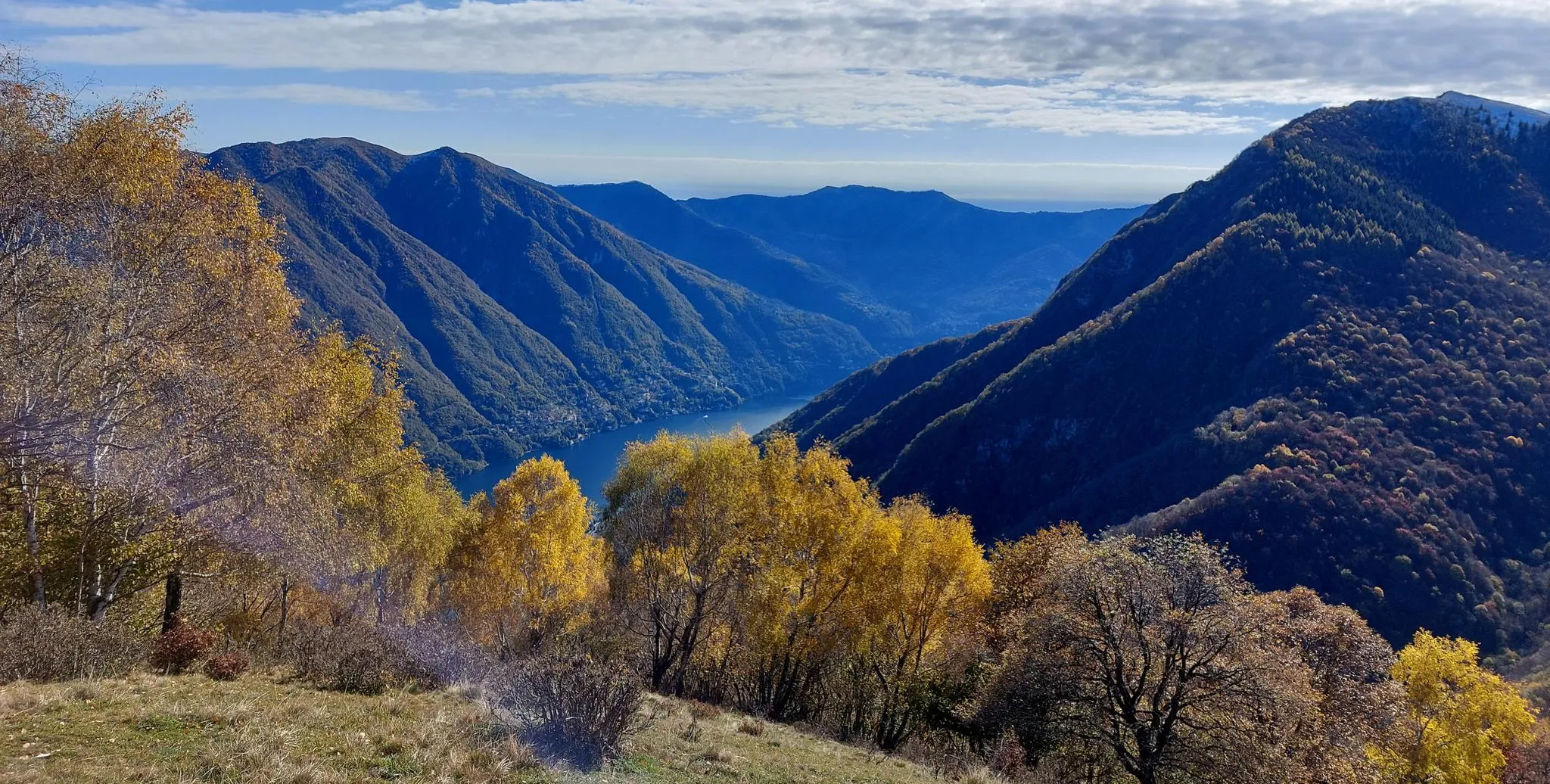
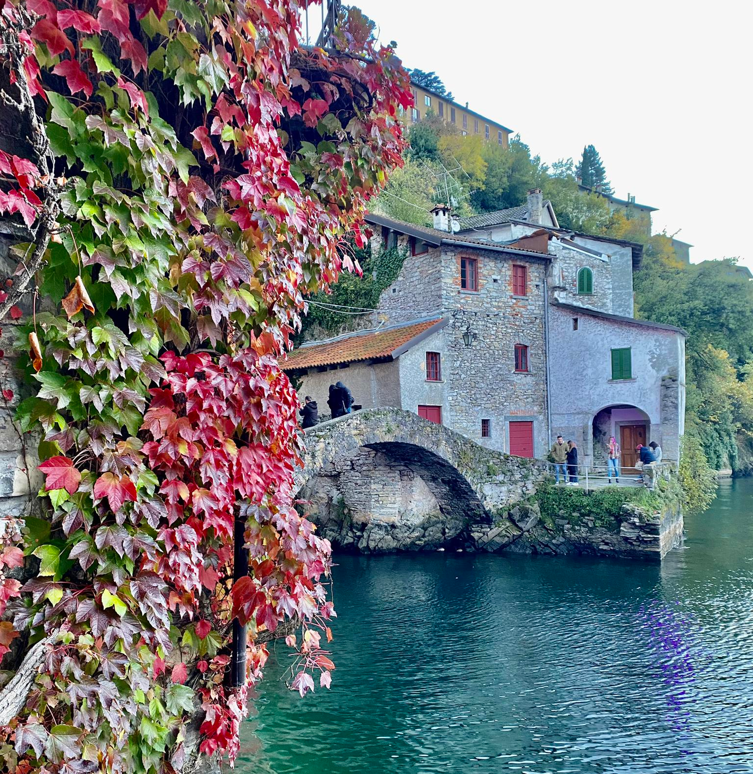
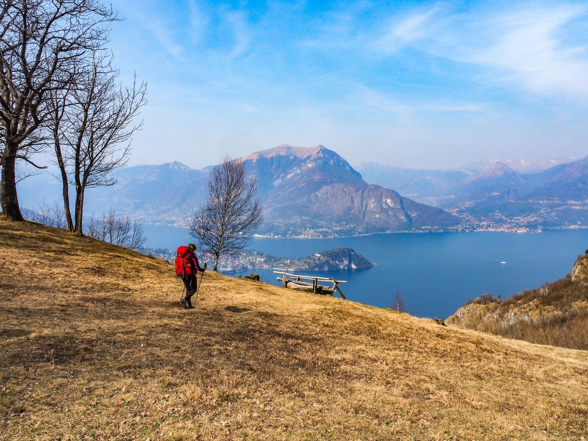
코모 호수 주변의 가족 친화적인 하이킹 트레일은 완만한 호숫가 길부터 주변 산으로 올라가는 루트까지 다양한 지형을 제공합니다. 이 지역은 깊고 푸른 물속으로 떨어지는 가파른 산들로 특징지어지며 극적인 풍경을 만들어냅니다. 하이커들은 삼림, 올리브 과수원, 포도밭을 탐험할 수 있으며, 종종 호수 위 높은 곳에 위치한 길에서 파노라마 전망을 마주하게 됩니다. 보호된 자연 지역과 알프스 산기슭은 이 지역의 하이킹 경험을 더욱 정의합니다.

코모 호수 주변 최고의 가족 친화적인 하이킹 트레일

  • 가장 인기 있는 가족 친화적인 하이킹 루트는 코모 호수 그린웨이로, 11.0km(6.8마일) 길이이며 완료하는 데 3시간 2분이 소요됩니다. 이 적당한 난이도의 루트는 오래된 돌길과 조용한 거리를 따라 이어지며, 웅장한 정원과 역사적인 빌라의 전망을 제공합니다.
  • 현지 하이커들 사이에서 또 다른 인기 있는 코스는 빌라 멜치 정원과 벨베데레 온 벨라지오 – 루프 투어로, 9.8km(6.1마일) 길이의 적당한 난이도 코스입니다. 이 루트는 매력적인 정원을 탐험하고 벨라지오 주변의 경치 좋은 전망 지점을 제공합니다.
  • 현지 하이커들은 또한 방랑자의 길: 리에르나에서 바렌나까지 (하단 변형)를 좋아하는데, 16.5km(10.2마일) 길이의 이 트레일은 고대 마을을 통과하고 동쪽 해안을 따라 이어지며, 종종 약 6시간 45분 만에 완료됩니다.
  • 코모 호수 주변 하이킹은 극적인 호수 전망, 다양한 삼림, 역사적인 마을 연결로 특징지어집니다. 이 네트워크는 다양한 능력 수준에 맞는 옵션을 제공하며, 많은 가족 친화적인 하이킹 트레일을 포함합니다.
  • 코모 호수의 루트는 komoot 커뮤니티에서 4,700개 이상의 리뷰에서 평균 4.4점의 높은 평가를 받고 있습니다. 25,000명 이상의 하이커가 komoot를 사용하여 코모 호수의 다양한 지형을 탐험했습니다.

마지막 업데이트: 7월 12, 2026

4.6

(81)

476

등산객

#1.

코모호 그린웨이 – 콜로노에서 렌노까지

11.0km

03:03

200m

200m

Embark on the Lake Como Greenway, a moderate hike that guides you along the western shore of Lake Como. This 6.8-mile (11.0 km) route, with an elevation gain of 646 feet (197 metres), offers a delightful journey through charming villages like Colonno and Ossuccio. You will experience diverse scenery, from ancient hamlets and historic villas to beautiful gardens, all while enjoying splendid views of the lake's emerald waters and the surrounding dramatic mountains. Expect to complete this scenic walk in about 3 hours and 2 minutes.

Planning your visit is straightforward, as the Greenway is generally considered an easy hike suitable for most fitness levels. You can easily access different sections of the route using the C10 bus service or local ferries, which provides flexibility if you wish to shorten or extend your walk. Parking is also available in the various villages you will pass through along the way. Consider starting your hike earlier in the day to enjoy the tranquility and avoid peak crowds.

The Lake Como Greenway is notable for its blend of natural beauty and cultural heritage, showcasing the rich history of the region. As you follow the path, you will encounter sections right along the shoreline and others on hills above the lake, offering varied perspectives of this iconic Italian landscape. You even have the option to detour and visit the magnificent Villa del Balbianello, adding a touch of grandeur to your outdoor adventure.

기기에서 길안내

휴대폰으로 전송

저장

보통

Embark on a moderate hike around Bellagio, exploring the historic Gardens of Villa Melzi and panoramic viewpoints. This loop tour covers 6.1 miles (9.8 km) with an elevation gain of 1481 feet (452 metres), taking about 3 hours and 15 minutes to complete. You will walk on varied terrain, including well-maintained paths within the gardens, gravel sections, paved roads, and natural trails through mixed forests, offering a diverse experience from serene botanical beauty to stunning lake vistas.

This trail is easily accessible from Bellagio's town center, making it a convenient option for many visitors. The paths within the Villa Melzi gardens are particularly easy to navigate, while the broader loop requires good fitness but is suitable for most skill levels. You will find sections with steps and paths leading through charming, less-known hamlets like San Giovanni, Vergonese, and Mulini del Perlo, adding to the local charm of your journey.

The Gardens of Villa Melzi are a true highlight, renowned for their neoclassical design and rich history, commissioned by Francesco Melzi d'Eril. As you wander through, you will discover a long avenue of plane trees, a tranquil Japanese pond, and a charming Moorish temple. Beyond the gardens, the route offers continuous panoramic views of Lake Como, the Tremezzo mountains, and the mountains surrounding Lecco, providing a unique blend of cultural heritage and natural splendor.

보통
guide_signup
저희가 komoot 모바일 앱로 길을 안내해 드리겠습니다.
무료 komoot 계정로 끝없는 야외 모험을 손쉽게 찾고, 맞춤 설정하며 길안내할 수 있어요.

무료 회원 가입

4.5

(65)

295

등산객

The Wayfarer's Path from Lierna to Varenna presents a challenging hiking experience with continuous, sweeping views over Lake Como. You will traverse ancient mule tracks and wooded sections, winding through chestnut forests and charming stone villages. This difficult route covers 10.2 miles (16.5 km) and involves a significant elevation gain of 3020 feet (921 metres). Plan for approximately 6 hours and 45 minutes to complete the journey, enjoying the diverse landscapes. As you near Varenna, keep an eye out for the iconic Castello di Vezio, a prominent landmark overlooking the lake.

Accessing this section of the Wayfarer's Path is straightforward, thanks to the railway line that runs along Lake Como's eastern shore. This makes it easy to reach the starting point in Lierna and return from Varenna by train once you finish your hike. The convenience of public transport allows you to focus on the trail without worrying about car logistics. Consider starting early to make the most of the daylight, especially given the route's duration.

This segment of the historic Wayfarer's Path offers a unique perspective on Lake Como, showcasing its natural beauty and ancient pathways. Beyond the physical challenge, you will discover the rich history embedded in the trail's design, connecting various communities along the lake. The route provides a rewarding experience, culminating in the picturesque town of Varenna, known for its charming streets and lakeside allure. Don't miss the magnificent vista from the Eremo Gaudio Terrace as you approach the end.

어려움

Embark on The three peaks of Monte Barro and Monte San Michele loop tour, a difficult hike spanning 5.7 miles (9.2 km) with a significant elevation gain of 2323 feet (708 metres). This challenging route typically takes 4 hours and 30 minutes to complete, leading you through varied terrain of mixed earth, rock, and steep grassy slopes. You will traverse lush woods, open meadows, and rocky areas, requiring sure-footedness and sturdy shoes for some technical sections. The reward is spectacular scenery, including panoramic views of several lakes like Garlate and Lake Como, as well as distant mountains such as Resegone. Make sure to visit the Monte Barro Summit for a full 360-degree panorama. You can also enjoy views from the Alpini Memorial at Pian Sciresa and the Sasso della Vecchia Viewpoint. This route offers some of the most incredible views in Lombardy.

This loop is classified as a hard hike, requiring good fitness, sure-footedness, and some alpine experience. Certain sections may require you to use your hands for balance, particularly on steep ascents. If you are less experienced, consider alternative paths around some peaks to avoid the most technical parts. The trail is accessible for different skill levels, but this specific loop is demanding.

Monte Barro is recognized for its high biodiversity, making the area a Site of Community Importance due to its unique flora on limestone cliffs and meadows. Beyond the natural beauty, the trail offers cultural insights with points of interest like the unfinished 17th-century Sanctuary of San Michele. The region also features an Archaeological Park and an Ethnographic Museum, highlighting its rich history. On clear days, you might even catch glimpses of Milan from the higher viewpoints.

어려움

4.6

(53)

330

등산객

Embark on the Lake Como Greenway, a difficult hiking route that promises continuous panoramic views of Lake Como and the dramatic mountains surrounding it. This trail winds through charming ancient villages like Colonno and Ossuccio, offering you glimpses of local life and historic architecture. As you hike, you will pass picturesque olive groves and meadows, with notable sights such as the historic Church of Saints James and Philip in Ossuccio. The entire route spans 13.5 miles (21.7 km) and involves a significant elevation gain of 1762 feet (537 metres). Expect to spend around 6 hours and 17 minutes completing this challenging journey, immersing yourself in the stunning scenery and rich cultural tapestry of the region.

Planning your visit to the Lake Como Greenway is straightforward, as the route is well-maintained and clearly marked with blue signs and metal Greenway markers. You will find public transport, including the C10 bus and various ferry services, readily available in the towns along the route. This offers convenient options for starting and ending your hike, allowing you to tackle shorter sections if you prefer. The flexibility of transport also makes it easy to return to your starting point after completing your chosen segment of the trail.

The Lake Como Greenway traces parts of the ancient Via Regina, adding a layer of historical depth to your walk through this beautiful region. This connection to an old Roman road highlights the trail's significance beyond just its natural beauty. The route's design allows you to experience both the natural splendor of Lake Como and the rich heritage embedded in its lakeside communities. Consider exploring the unique character of each village you pass, as they each contribute to the trail's distinct charm.

어려움
무료 회원 가입 후 꼬모 호수 주변 하이킹 경로를 294개 더 확인하세요

더 다양한 경로와 다른 탐험가들의 추천을 살펴보세요.

무료 회원 가입

이미 komoot 계정이 있나요?

투어 추천은 다른 사람들이 komoot에서 완료한 수천 개의 활동을 바탕으로 구성되어 있습니다.

오늘 무료 계정으로 시작하세요

다음 모험이 기다리고 있어요.
로그인 또는 가입하기

꼬모 호수 주변 인기 장소

로마인부터 전쟁까지 — 이탈리아 코모호의 파노라마 트레일

Lake Como 영리 - 이리나바화한다 7또니

과거의 자취를 따라 - 코모호 스트라다 레지아

코모호 변의 오래된 마라티에레를 따라 – 비안던테 길

리스본으로 가는 길 – 알프스, 피레네, 피코스 데 에우로파를 바이크 패킹

프로 자전거 경기에 이렇게 이별인사를 드리며 - 코모에서 레키까지 두 일 만에

이탈리아-스위스 국경의 호수 사이 - 인텔비 계곡의 루프

Up & down — mountain passes and singletracks for experts

꼬모 호수 주변의 다른 모험

로마인부터 전쟁까지 — 이탈리아 코모호의 파노라마 트레일

하이킹 컬렉션 에 의해

Anna_Orsatti

커뮤니티 팁

angelo fornier
6월 25, 2026, Vezio

골목, 작은 상점, 특색 있는 모퉁이로 가득한 매우 아름다운 역사적인 마을입니다. 성은 유료로 방문할 수 있습니다.

번역: Google

0

0

A small Romanesque church overlooking the lake. Dating between the 10th and 12th centuries, the building retains almost its entire original appearance. The extensive frescoed areas (both inside and on the side façade) are noteworthy: they are the remains of a cycle dating back to the 11th century. Other frescoes belong to a second decorative phase, between the 15th and 16th centuries.

번역: Google

0

0

Immersed in the beautiful natural landscape of the western shore of Lake Como, the Greenway is a pleasant walk suitable for everyone and all seasons. It covers a route of approximately 10 km through the villages of Colonno, Sala Comacina, Ossuccio, Lenno, Mezzegra, Tremezzo, and Griante, sometimes following the Antica Via Regina.

번역: Google

0

0

Perfect route for a beautiful winter day, very few people, splendid landscapes.

번역: Google

0

0

Very touristy but really beautiful.

번역: Google

0

0

blackrat
9월 30, 2025, Vezio

The church of Vezio has a beautiful bell tower.

번역: Google

0

1

In June 2025, a section of the trail was washed away, making it quite difficult to continue for a short distance.

번역: Google

0

0

The road is closed, but can be traveled with caution. Officially closed. July 2025

번역: Google

0

0

자주 묻는 질문

코모 호수 주변에는 얼마나 많은 가족 친화적인 하이킹 트레일이 있나요?

코모 호수는 가족 친화적인 하이킹 트레일이 다양하게 준비되어 있습니다. 280개 이상의 루트가 있으며, 그중 120개 이상이 쉬움 등급, 115개가 보통 등급으로 분류되어 모든 가족의 편안함 수준에 맞는 코스를 찾을 수 있습니다.

코모 호수 지역의 가족 하이킹에서는 어떤 종류의 지형을 예상할 수 있나요?

코모 호수 주변의 가족 친화적인 트레일은 다양한 지형을 특징으로 합니다. 완만한 호숫가 산책로, 매력적인 마을을 통과하는 길, 숲길, 그리고 탁 트인 전망을 제공하는 약간의 경사가 있는 루트도 있습니다. 많은 트레일이 오래된 돌길이나 조용한 거리를 따라 이어져 가족들이 즐기기에 좋습니다.

어린 아이나 유모차를 동반한 가족에게 적합한 쉽고 짧은 산책 코스가 있나요?

네, 쉽고 짧은 산책 코스가 여러 가지 있습니다. 코모 호수 그린웨이는 마을들을 잇는 편안한 구간을 제공하며, 코모, 벨라지오, 바렌나와 같은 마을의 호숫가 산책로는 일반적으로 평탄하고 쉽습니다. 플리니아나 하이킹 트레일은 정원을 통과하는 30분 길이의 쉬운 산책 코스이기도 합니다.

트레일을 따라 어떤 유명한 랜드마크나 자연 지형을 볼 수 있나요?

많은 트레일에서 호수와 주변 산의 멋진 전망을 감상할 수 있습니다. 역사적인 빌라, 매력적인 마을, 아름다운 정원을 만날 수 있습니다. 특별한 하이라이트로는 바렌나의 연인의 길, 네소 협곡, 그리고 그림 같은 메나지오 마을이 있습니다. 일부 루트는 고대 석관(Massi Avelli) 옆을 지나 보호된 자연 지역을 엿볼 수 있는 기회를 제공하기도 합니다.

가족에게 적합한 순환 코스가 있나요?

네, 순환 코스가 있습니다. 예를 들어, 멜지 빌라의 정원과 벨라지오의 벨베데레 – 루프 투어는 훌륭한 선택입니다. 몬테피아토 트레일은 경치 좋은 전망을 감상하며 숲을 통과하는 중간 수준의 루프 코스를 제공합니다.

도중에 피크닉 장소나 쉴 곳을 찾을 수 있는 트레일이 있나요?

물론입니다. 많은 가족 친화적인 트레일은 카페와 레스토랑을 찾을 수 있는 매력적인 마을을 통과하거나 근처를 지나갑니다. 호숫가 산책로에는 종종 벤치가 있으며, 자연 지역은 피크닉을 즐길 수 있는 경치 좋은 장소를 많이 제공합니다. 다양한 풍경은 잠시 멈춰 경치를 즐길 수 있는 많은 기회를 보장합니다.

코모 호수 주변에서 가족과 함께 하이킹하기 가장 좋은 시기는 언제인가요?

봄(4월-5월)과 가을(9월-10월)은 일반적으로 코모 호수 주변에서 가족 하이킹을 하기에 가장 좋은 시기로 간주됩니다. 날씨가 쾌적하고 기온이 온화하며, 꽃이 피거나 가을 색으로 물드는 풍경이 특히 아름답습니다. 여름은 더울 수 있지만, 호숫가 산책은 여전히 즐겁습니다.

이 지역에 개와 함께 갈 수 있는 가족 하이킹 코스가 있나요?

코모 호수 주변의 많은 트레일은 개와 함께 갈 수 있으며, 특히 호숫가 길과 숲길, 마을을 통과하는 덜 힘든 루트가 그렇습니다. 특히 인구 밀집 지역이나 야생 동물 근처에서는 개를 목줄에 매고, 물을 휴대하는 것이 항상 권장됩니다. 특정 지역에 대한 현지 규정을 항상 확인하십시오.

가족 친화적인 트레일은 대중교통이나 자동차로 얼마나 쉽게 접근할 수 있나요?

호수를 따라 마을을 연결하는 인기 있는 가족 친화적인 트레일 중 다수는 페리와 버스를 포함한 대중교통으로 잘 연결되어 있습니다. 내륙이나 더 외딴 지역의 루트의 경우, 운전과 주차가 필요할 수 있습니다. 주차는 일반적으로 마을과 트레일 시작 지점 근처에서 가능하지만, 성수기에는 붐빌 수 있습니다.

다른 하이커들은 코모 호수에서의 가족 하이킹에 대해 가장 무엇을 즐기나요?

이 지역은 komoot 커뮤니티에서 평균 4.4점의 높은 평가를 받고 있습니다. 리뷰어들은 종종 멋진 호수 전망, 길을 따라 만나는 매력적인 마을, 그리고 편안한 산책부터 더 모험적인 길까지 다양한 가족의 능력에 맞는 트레일의 다양성을 칭찬합니다.

폭포나 독특한 자연 지형을 볼 수 있는 트레일이 있나요?

네, 이 지역에는 아름다운 자연 지형이 있습니다. 네소 협곡은 폭포를 볼 수 있는 주목할 만한 자연 하이라이트입니다. 모든 가족 트레일이 주요 폭포로 직접 이어지는 것은 아니지만, 코모 호수의 극적인 풍경은 특히 비가 온 후 작은 폭포와 인상적인 암석 지형을 특징으로 합니다.

꼬모 호수 주변에서 가장 인기 있는 경로

꼬모 호수 하이킹

꼬모 호수 주변에서 가장 인기 있는 명소

Places to see

Store rating

komoot 모바일 앱으로 영감을 받아보세요

무료 komoot 계정로 끝없는 야외 모험을 손쉽게 찾고, 맞춤 설정하며 길안내할 수 있어요.

또는

지금 komoot에 가입하세요

Store rating

더 살펴보기

다른 지역의 최고의 하이킹를 살펴보세요.

Plis Sorgenti Torrente Lura델 세그리노 호수Riserva Naturale Pian Di Spagna E Lago Di MezzolaParco naturale Spina Verde di ComoParco Valle Del LanzaRiserva Naturale Lago Di Piano레이크 피아노Riserva Naturale Valsolda몬토르파노 호수알세리오 호수

근처 어드벤처 가이드

그란테 즐길거리

background

새로운 정복을 위한 준비를 하세요

무료로 가입하기

탐험하기
경로경로 플래너기능하이킹MTB 트레일로드 사이클링 경로바이크패킹사이트맵
앱 다운로드
소셜 미디어에서 팔로우하기

© komoot GmbH

개인 정보 보호 정책