뷔르셀렌 주변 최고의 가족 하이킹 & 워킹 코스
4.4
(1919)
9,772
등산객
139
하이킹
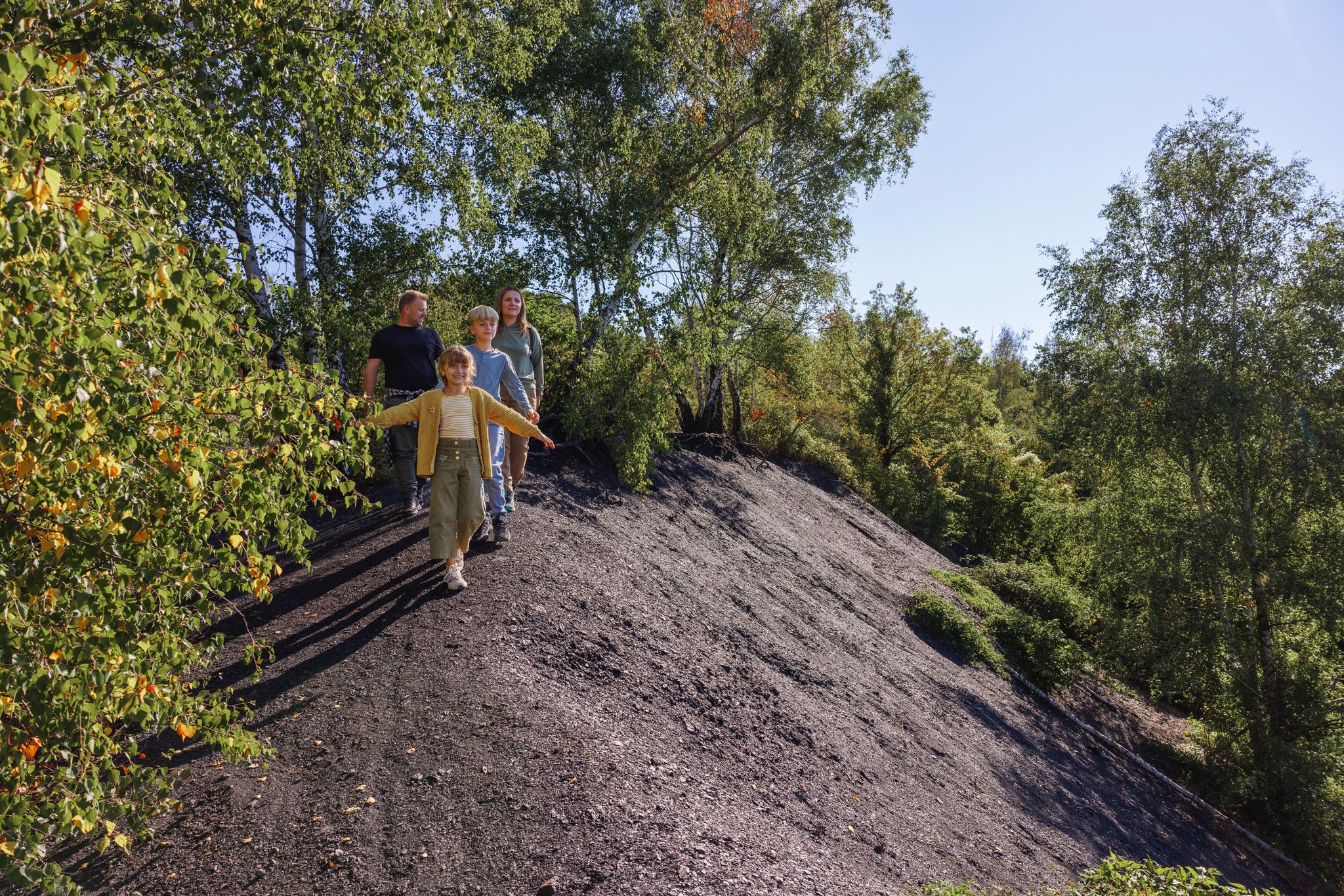
가족 친화적인 하이킹 트레일은 아이펠 국립공원 가장자리의 다양한 풍경 속에 자리 잡고 있으며, 구불구불한 언덕, 울창한 숲, 고요한 강줄기가 특징입니다. 이 지역에는 빔 계곡(Wurm Valley)과 브로히바흐 계곡(Broichbach Valley)과 같은 유명한 자연 지역이 있어 야외 활동을 위한 다양한 지형을 제공합니다. 뷔르셀렌의 도시 숲은 추가적인 표지판이 있는 경로를 제공하여 다양한 선호도와 체력 수준에 적합한 경로 네트워크에 기여합니다.
뷔르셀렌 주변 최고의 가족 친화적인 하이킹 트레일
- 가장 인기 있는 가족 친화적인 하이킹 경로는 Gouley Tour Würselen-Morsbacher Heide로, 3.0마일(4.9km) 길이이며 완료하는 데 1시간 20분이…
마지막 업데이트: 9월 3, 2026
4.2
(46)
165
등산객
4.92km
01:20
70m
70m
초급용 하이킹. 모든 체력 수준에 적합. 실력과 관계없이 누구나 쉽게 갈 수 있는 길.
4.8
(410)
1,702
등산객
6.21km
01:39
70m
70m
초급용 하이킹. 모든 체력 수준에 적합. 실력과 관계없이 누구나 쉽게 갈 수 있는 길.

4.8
(333)
1,436
등산객
5.13km
01:22
60m
60m
초급용 하이킹. 모든 체력 수준에 적합. 실력과 관계없이 누구나 쉽게 갈 수 있는 길.
4.7
(89)
386
등산객
9.18km
02:30
140m
140m
보통 하이킹. 좋은 체력 필요. 실력과 관계없이 누구나 쉽게 갈 수 있는 길.
4.6
(54)
207
등산객
3.28km
00:55
70m
70m
초급용 하이킹. 모든 체력 수준에 적합. 실력과 관계없이 누구나 쉽게 갈 수 있는 길.
더 다양한 경로와 다른 탐험가들의 추천을 살펴보세요.
이미 komoot 계정이 있나요?
투어 추천은 다른 사람들이 komoot에서 완료한 수천 개의 활동을 바탕으로 구성되어 있습니다.
오늘 무료 계정으로 시작하세요
다음 모험이 기다리고 있어요.

커뮤니티 팁

Beautiful view of fields and meadows along the Wurm river
0
0

The picnic area at Wilhelmstein Bridge is a peaceful, almost natural resting spot in the landscape where water, greenery, and history converge. The bridge spans the Wurm River here, forming a natural transition between banks while the surrounding valley opens up in soft lines of grass, shrubs, and trees. It's a place that invites you to sit down for a moment, put down your backpack, and relax. From the picnic area, your gaze follows the rippling water beneath the bridge, while birds and the rustling of leaves create the backdrop. The proximity of Wilhelmstein also evokes a sense of history: not far from here lies the rocky plateau with the remains of the old castle that overlooked this same valley for centuries. This combination of nature and history gives the place added depth without being obtrusive. It is precisely its simplicity that makes this picnic area special. No crowds, no grand views, but a sheltered spot where the landscape does its work. It is a moment of rest along the route where walking briefly turns into staying and where the environment tells its story undisturbed and at its own pace.
0
0
The Wetterpilz in the Wurmtal is a striking natural phenomenon and artistic object, notable for its unique shape and location in the Wurm Valley just south of Herzogenrath. The Wetterpilz, which literally means "weather mushroom," is often a sheltered path or small natural structure resembling a giant mushroom, making it both a landmark and a refuge for hikers. The Wetterpilz stands amidst a diverse landscape of deciduous and coniferous forests along the Wurm River, which meanders through the valley. It offers visitors a unique opportunity to pause and enjoy the tranquility while simultaneously enjoying excellent views of the surrounding flora and fauna. The object often also reflects a playful element of landscape art, where natural forms and human imagination merge.
0
0
The entrance to the Gouley mine tunnel, also known as the Stollenmundloch, is located in the picturesque Wurmtal valley near Würselen/Morsbach in Germany. This tunnel was an important part of Grube Gouley, one of the oldest coal mines in the Aachen region, first mentioned in 1599 under the name "Gute Ley." Gouley was one of the longest-operating coal mines in the region, with mining operations continuing until 1969. The tunnel was originally used for coal extraction and later for dewatering the mine, as underground mines often caused water problems. Today, water still flows from the tunnel into the Wurm, a clear sign of the landscape's industrial past. Although the tunnel is not open to visitors, the entrance itself is a tangible industrial monument and bears witness to centuries of mining tradition. Over the centuries, Gouley has enjoyed a rich and eventful history. In the 19th century, the mine was modernized with steam engines for water and coal extraction. In 1834, a sudden ingress of water led to a serious mining accident in which several miners died. This tragedy resulted in stricter safety measures in the Aachen region. Later in the 19th and 20th centuries, the mine was further expanded with rail and coal transport, and it became a major employer in the region. Following the declining demand for coal and the changing energy market, Gouley finally closed its doors on March 31, 1969. Today, the area around the tunnel is part of hiking trails through the Wurmtal, where visitors can discover traces of the industrial past: remnants of old railway lines, railway bridges, workers' houses, and the contours of former mining sites. This combination of nature and industrial heritage makes the area particularly attractive for hikers and cyclists. The Wurmtal itself offers a beautiful river landscape where forests, streams, and valleys blend harmoniously, creating a serene experience of Gouley's historical context. The Gouley Mine Tunnel symbolizes the region's long mining tradition and illustrates how an industrial landscape can transform into a place of natural recreation and remembrance. Walkers along the path alongside the tunnel literally experience the traces of the past while enjoying the tranquility of the watercourse and the surrounding green landscape. It is a place where history, nature, and culture converge, telling the story of human endeavor, technological progress, and the resilience of the landscape.
0
0
Deep in the green belt of the Wurmtal, just south of Herzogenrath, a quiet forest path winds alongside the gently meandering Wurm River. The path leads through a landscape where nature and history intertwine: ancient forest edges, slopes thick with fern thickets, and clearings where sunlight breaks through the treetops, illuminating the moss. The Wurm itself always murmurs softly in the background, amidst rippling plants and rocky outcrops that recall the valley's mining past.
0
0
The Wurm Valley, the valley around the Wurm River near Aachen/Würselen (Germany), boasts a rich and fascinating industrial past. Coal was mined in this valley from very early times, and mining played a major role well into the 20th century. What was once synonymous with industrial smoke and coal railways has now been transformed: slag heaps, old tunnels, abandoned tracks, and a green landscape bear witness to what has been. Below is an overview of the historical legacy and current experience. Written sources mention coal mining in the Wurm Valley as early as the 12th century, according to the annals of the abbey in Klosterrath. In (the later) area around present-day Würselen, coal mining began in the Middle Ages primarily through open-pit mining or very shallow excavation, where the coal seams lie relatively close to the surface. The real transition to large-scale industrial coal mining did not occur until the 19th century. The establishment of associations and mining companies (including the Association for Coal Mining in the Wurm Valley in 1836) allowed production to be concentrated and expanded. Mines such as Grube Teut (now completely gone) and Grube Gouley were important production centers. The Gouley mine was the largest in the Wurm region at its peak in the early 19th century. Mining was not without risk. For example, in 1834 at the Gouley mine, a collapse caused by water pressure claimed the lives of dozens of miners. Over the course of the 20th century, coal mining in the Wurm Valley became less profitable due to competition from deep mining and a changing economy. The last shafts closed in 1969. Stoves (slag heaps) at various locations in the Wurm Valley now lie green hills: former coal heaps (slag heaps) that give the landscape a distinctive relief. These "halden" were later reclaimed and are now walking and recreational areas. Old railway lines and viaducts where coal trains once ran have been converted into walking paths and cycling routes. For example, the route from the former railway line to the Gouley mine is now part of a walking and cycling network.
1
0

The discarded trolley reminds of the region's mining past
5
0
자주 묻는 질문
뷔르젤렌 주변에는 가족 친화적인 하이킹 트레일이 몇 개나 있나요?
뷔르젤렌은 가족 친화적인 하이킹 트레일이 환상적으로 많으며, 특히 가족을 위해 맞춤 제작된 100개 이상의 쉬운 코스가 있습니다. 총 140개 이상의 하이킹 투어가 이 지역에 있어 모든 연령과 체력 수준에 맞는 다양한 옵션을 제공합니다.
뷔르젤렌에서 가족 하이킹 시 어떤 지형을 예상할 수 있나요?
뷔르젤렌 주변 지역은 다양한 풍경을 자랑하며 가족 모험에 완벽합니다. 구불구불한 언덕, 울창한 숲, 그리고 특히 부름(Wurm) 강과 브로이히바흐(Broichbach) 강을 따라 펼쳐지는 고요한 강 계곡을 만날 수 있습니다. 많은 트레일은 잘 관리되어 있으며 완만한 오르막길을 제공하여 어린 하이커에게 적합합니다.
뷔르젤렌에 유모차 친화적인 산책로가 있나요?
네, 뷔르젤렌에는 유모차를 이용하기에 적합한 여러 길이 있습니다. 예를 들어, 브로이히바흐(Broichbach) 계곡에는 잘 표시된 무장애 노드 시스템이 있어 유모차로 이동하기가 더 쉽습니다. 가장 편안한 경험을 위해서는 '쉬움'으로 설명되고 고도 변화가 최소한인 코스를 찾아보세요.
이러한 가족 친화적인 하이킹에 반려견을 데려갈 수 있나요?
뷔르젤렌 및 그 주변의 많은 트레일은 반려견 친화적이므로, 여러분의 네 발 달린 가족 구성원도 모험에 함께할 수 있습니다. 특히 자연 보호 구역이나 야생 동물이 있는 지역에서는 항상 반려견을 목줄에 묶어두고, 배설물은 반드시 치워주세요. komoot의 특정 코스 상세 정보에는 종종 해당 트레일이 반려견에게 적합한지 표시되어 있습니다.
트레일을 따라 어떤 자연 경관이나 랜드마크를 볼 수 있나요?
다양한 자연의 아름다움과 역사적인 관심 지점을 발견할 수 있습니다. 부름(Wurm) 계곡은 푸르른 녹지와 구불구불 흐르는 부름 강을 제공하는 하이라이트입니다. 또한 Gouley Tour Würselen-Morsbacher Heide와 같은 과거 채굴 지역과 같은 역사적인 장소도 만날 수 있습니다. 더 넓은 경치를 보려면 근처의 중요한 명소인 바일스베르크 삼국 접경 지점을 방문하는 것을 고려해 보세요.
가족에게 적합한 순환 코스가 있나요?
물론입니다! 뷔르젤렌의 많은 가족 친화적인 트레일은 순환 코스로 설계되어 있어 같은 지점에서 시작하고 끝낼 수 있으며, 왔던 길을 되돌아갈 필요가 없습니다. 예를 들어, 뷔르젤렌 근처 부름 강 – 테우터호프 루프는 강을 따라 5km의 즐거운 산책을 제공합니다.
뷔르젤렌에서 가족 하이킹하기 가장 좋은 시기는 언제인가요?
봄, 여름, 초가을은 일반적으로 뷔르젤렌에서 가족 하이킹하기 가장 좋은 시기입니다. 이 계절에는 날씨가 온화하고 풍경이 생동감 넘치며, 트레일은 보통 건조하고 잘 관리되어 있습니다. 겨울도 아름다울 수 있지만, 일부 길은 진흙투성이거나 얼어 있을 수 있으므로 출발 전에 상태를 확인하는 것이 좋습니다.
아주 어린 자녀가 있는 가족을 위한 짧은 산책로가 있나요?
네, 아주 어린 자녀가 있는 가족에게 완벽한 여러 짧고 쉬운 산책로가 있습니다. Old Mill Bardenberg 루프는 3km가 조금 넘는 거리로, 어린 다리에도 부담 없는 거리입니다. 뷔르젤렌의 도시 숲에는 1.5km에서 5km까지 다양한 길이의 표지판이 있는 4개의 코스가 있습니다.
뷔르젤렌의 가족 친화적인 트레일에 대해 다른 하이커들은 어떻게 말하나요?
뷔르젤렌 주변의 가족 친화적인 트레일은 komoot 커뮤니티에서 높은 평가를 받고 있으며, 평균 평점은 별 5개 중 4.4점입니다. 하이커들은 잘 관리된 길, 평화로운 자연 환경, 그리고 강 계곡부터 완만한 언덕까지 다양한 풍경을 자주 칭찬하며, 가족 나들이에 이상적이라고 말합니다.
이 하이킹 트레일의 주차는 어디서 할 수 있나요?
뷔르젤렌 및 그 주변의 많은 트레일 시작 지점에는 편리한 주차 옵션이 있습니다. 예를 들어, Old Mill Bardenberg – Ginsterweg Trailhead Parking 루프는 시작 지점에 주차 공간이 있다고 명시되어 있습니다. 출발하기 전에 komoot에서 특정 코스의 상세 정보를 확인하여 주차 정보를 알아보는 것이 좋습니다.
자연과 역사적 요소를 결합한 트레일이 있나요?
네, 뷔르젤렌의 역사는 그 풍경 속에 녹아 있습니다. Gouley Tour Würselen-Morsbacher Heide와 같은 트레일은 역사적인 채굴 지역을 통과하며 자연을 즐기면서 지역의 과거를 엿볼 수 있게 합니다. 'Dinotour Würselen' 또한 자연과 인공적인 요소의 조화를 약속합니다.
뷔르셀렌 주변에서 가장 인기 있는 명소


더 살펴보기
다른 지역의 최고의 하이킹를 살펴보세요.
