경로

플래너

기능

업데이트

App

로그인 또는 가입

앱 다운로드

로그인 또는 가입

로그인 또는 가입

경로
Places to see
Waterfalls
독일
바덴뷔르템베르크

발덴부르크

발덴부르크‬에서 가장 멋진 ‪2‬개의 폭포

발덴부르크 주변 최고의 폭포는 역사적 명소와 자연 경관으로 유명한 슈바벤-프랑코니아 숲 자연공원 내에 있습니다. 발덴부르크 자체는 중세적 특징으로 유명하지만, 주변 지역은 여러 수경을 제공합니다. 여기에는 협곡, 자연 폭포, 강 급류가 포함되어 방문객에게 다양한 자연 명소를 제공합니다. 이 지역의 다양한 지형은 다양한 야외 체험에 기여합니다.

발덴부르크 주변 최고의 폭포

  • 가장 인기 있는 폭포는 작은 테라스가 있는 시냇물을 따라 이어지는 길을 특징으로 하는 협곡인 에셀스클링 협곡입니다. 이 깊고 자연적인 계곡은 특히 비나 눈이 온 후에는 힘들 수 있습니다.
  • 또 다른 꼭…

마지막 업데이트: 5월 13, 2026

에젤스클링게 협곡

하이라이트 (구간) • 협곡

Very nice path that leads along the stream, sometimes very demanding!
After rain or snow, sturdy shoes and sticks are recommended!

번역자 Google •

에 의해

하이킹 보기

휴대폰으로 전송

저장

쇤탈러 바흐의 폭포

하이라이트 • 폭포

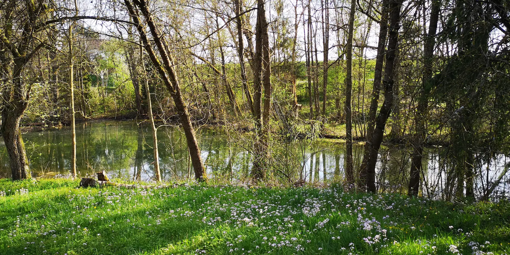
Small waterfall on the Schöntaler Bach directly on the hiking trail towards Rottal.

번역자 Google •

에 의해

저장

이런 장소를 발견하려면 지금 가입하세요

최고의 싱글 트랙, 봉우리 및 다양한 흥미로운 야외 장소에 대한 추천을 받아보세요.

무료 회원 가입

Bach collects lime from the Gipskeuper west of Gailenkirchen. This falls out at barriers and lime sinter is formed. This forms the small waterfalls. (Hohenlohian "Pamukkale") :)

번역자 Google •

에 의해

저장

오늘 무료 계정으로 시작하세요

다음 모험이 기다리고 있어요.

로그인 또는 가입하기

발덴부르크 주변 인기 장소

Family hiking with the adventure factor in the 'Süden ganz oben'

Aktiv in die längeren Tage – Frühlingsradeln im Norden Baden-Württembergs

발덴부르크 하이킹

발덴부르크 사이클링

발덴부르크 로드 사이클링 경로

발덴부르크 러닝 트레일

발덴부르크 MTB 트레일

발덴부르크 주변 그래블 라이딩

발덴부르크 주변의 다른 모험

Family hiking with the adventure factor in the 'Süden ganz oben'

하이킹 컬렉션 에 의해

Im Süden ganz oben

커뮤니티 팁

Kristian
4월 12, 2025, Waterfalls on the Schöntaler Bach

Small waterfall on the Schöntaler Bach directly on the hiking trail towards Rottal.

번역: Google

6

0

The Eselsklinge is an approximately one kilometre long, east-facing forest valley in the Hohenlohe district of Baden-Württemberg on the edge of the Waldenburg region.

번역: Google

1

0

Very nice idyllic creek tour and so close to town. 🤩

번역: Google

3

0

Fantastic! 😍

번역: Google

1

0

Bach collects lime from the Gipskeuper west of Gailenkirchen. This falls out at barriers and lime sinter is formed. This forms the small waterfalls. (Hohenlohian "Pamukkale") :)

번역: Google

1

0

Very nice route, unfortunately not mobile, through many fallen trees, some of which are difficult to overcome. The path is also very narrow and slippery in places.

번역: Google

0

0

A beautiful hiking trail. Climb over tree trunks and now and then through a ford. Beautifully natural.

번역: Google

1

0

There's a magnificent waterfall at this spot! With enough water, it's truly a small spectacle, something you'd never expect here. In addition to the relatively large waterfall, there are a few other smaller waterfalls to admire along the Schöntaler Bach. -------- The Schöntaler Bach is a stream in the Mainhardt Forest in northern Baden-Württemberg, approximately 3 km long from its source furthest from its mouth. It flows into the middle reaches of the Fichtenberger Rot from the right and southwest, just downstream of the former Hankertsmühle (mill) in Mainhardt, on the municipal and district border between Großerlach in the Rems-Murr district and Mainhardt in the Schwäbisch Hall district, and flows into the middle reaches of the Fichtenberger Rot from the right and southwest. Sources: The Schöntaler Bach originates on the spring-rich northeast slope and foot of the almost entirely forested Hohe Brach, with its summit at 586.9 m above sea level, the highest elevation in the entire Swabian-Franconian Forest. Two springs at the origin of the main stream rise close together at only about 510 m above sea level; the outflow of a nearby third soon strengthens the young stream. The highest spring, with a noticeably longer branch, rises at about 570 m above sea level, just about 400 meters northwest of the high point of the flat mountain cap on the edge of the K 1903 county road from Großerlach to Grab. Its half-kilometer-long and thus noticeably longer branch runs northeast down the slope and joins the main stream branch at the west-southwest tip of an elongated clearing around the Großerlacher Schöntalhöfle, also called Schertelshöfle. Course: The stream then flows for approximately 750 meters along the southern edge of the clearing to the Buch forest area on the lower slope of the Brach, passing through a quarter-hectare pond with a small island near the Schöntalhöfle. A second long slope branch, the Fuchsklingenbach, joins it from the right, emerging from the mountain forest, this time even more than a kilometer long. It rises near the eastern subsidiary peak of the Brach and the hamlet of Hohenbrach, also next to the county road. Shortly thereafter, the stream passes under the access road from Grab to the Schöntalhöfle at approximately 460 meters above sea level. Here it turns northeast, flowing between the Schöntalhöfle on the left slope of the hill and the Schöntalsägmühle on the right bank, and immediately enters the Schöntal Forest permanently. At a small clearing, the district and municipal border with Mainhardt reaches the stream from the north and then follows it to its mouth. At a multiple fork in a forest path that now follows the stream to the left, the Limes route, accompanied by the Limes hiking trail, crosses the small valley from Grab in the south-southeast to Mainhardt in the north-northwest. On the section from Grab, the Säugraben, a striking notch in the terrain, several times as deep and wide as a typical sunken road and sometimes drained by a small trickle, lies here on the dead-straight old border line. Shortly afterward, the last significant tributary, the Güldenklinge, flows in, also from the right, towards Schönbronn in the southeast. After crossing under a small farm track along the edge of the Rottal valley, the Schöntaler Bach flows from the right into the middle course of the Fichtenberger Rot, which flows eastward here in a narrow, open forest valley floor, between the now deserted sites of the Mainhardt Hankertsmühle (main mill) and the Schönbronn Sägmühle (saw mill) downstream. Source: https://de.wikipedia.org/wiki/Sch%C3%B6ntaler_Bach

번역: Google

2

2

자주 묻는 질문

발덴부르크 주변의 가장 주목할 만한 폭포는 무엇인가요?

발덴부르크 자체는 역사적 명소와 전망으로 더 잘 알려져 있지만, 바로 근처에는 매력적인 자연 수경이 몇 군데 있습니다. 에셀스키링 협곡(Eselsklinge Gorge)은 작은 테라스와 깊고 자연적인 계곡을 따라 흐르는 시냇물을 따라 매우 힘든 길을 제공합니다. 또 다른 하이라이트는 쇤탈러 바흐(Schöntaler Bach)의 폭포로, 물이 충분할 때에는 등산로를 따라 여러 개의 폭포수가 흐르는 작은 장관을 이룰 수 있습니다.

발덴부르크 지역에 가족 친화적인 폭포나 수경이 있나요?

좀 더 가족 친화적인 경험을 원하신다면, 겔빙엔(Gelbingen)의 코허 급류(Kocher Rapids)를 고려해 보세요. 이곳은 물새 관찰에 적합한 작은 급류입니다. 또 다른 옵션은 가일렌키르헨(Gailenkirchen) 근처의 석회화 폭포로, 석회 침전물이 작은 폭포를 만들어내는 독특한 자연 기념물이며, 때로는 '호엔로에의 파묵칼레'라고도 불립니다.

에셀스키링 협곡(Eselsklinge Gorge)을 방문할 때 어떤 지형을 예상할 수 있나요?

에셀스키링 협곡(Eselsklinge Gorge)은 시냇물을 따라 이어지는 매우 힘든 길을 특징으로 합니다. 비가 오거나 눈이 온 후에는 잠재적으로 어려운 조건 때문에 튼튼한 신발과 등산 스틱을 강력히 권장합니다. 이곳은 아름다운 시냇물 테라스가 있는 깊고 자연적인 계곡입니다.

쇤탈러 바흐(Schöntaler Bach)의 폭포는 무엇이 특별한가요?

쇤탈러 바흐(Schöntaler Bach)의 폭포는 등산로 바로 옆에 있는 작은 폭포입니다. 물이 충분할 때에는 장엄한 광경이 되며, 이 지역에서 많은 방문객들이 예상치 못하는 작은 장관을 선사합니다. 주요 폭포 외에도 시냇물을 따라 여러 개의 작은 폭포를 감상할 수 있습니다.

발덴부르크의 폭포 근처에서 탐험할 만한 다른 자연 경관은 무엇이 있나요?

폭포 자체 외에도 발덴부르크 지역은 슈바벤-프랑켄 숲 자연공원(Swabian-Franconian Forest Nature Park)의 일부입니다. 울창한 숲, 쇤탈러 바흐(Schöntaler Bach)와 같은 강, 그리고 자연 기념물을 찾을 수 있습니다. 예를 들어, 에셀스키링 협곡(Eselsklinge Gorge)은 시냇물과 숲 환경이 있는 깊고 자연적인 계곡의 대표적인 예입니다.

이 폭포와 관련된 하이킹 트레일이 있나요?

네, 에셀스키링 협곡쇤탈러 바흐 폭포 모두 하이킹 트레일 바로 옆에 있습니다. 에셀스키링을 통과하는 길은 매우 어렵다고 알려져 있으며, 쇤탈러 바흐를 따라가는 트레일은 중간 난이도로 간주됩니다. 특히 비가 온 후에는 항상 적절한 신발을 착용하세요.

발덴부르크 주변 폭포 근처에서 어떤 야외 활동을 할 수 있나요?

발덴부르크 주변 지역은 특히 사이클링을 포함한 다양한 야외 활동을 제공합니다. 다양한 종류의 자전거를 위한 수많은 코스를 찾을 수 있습니다. 예를 들어, 발덴부르크 주변의 교통 없는 자전거 도로나 그림 같은 호엔로에 평원과 주변 숲을 통과하는 발덴부르크 주변의 로드 사이클링 코스를 탐험해 보세요.

방문객들이 에셀스키링 협곡에서 가장 좋아하는 것은 무엇인가요?

방문객들은 종종 에셀스키링 협곡의 목가적인 계곡 투어와 도심과의 근접성을 칭찬합니다. 작은 테라스가 있는 아름다운 시냇물과 매우 깊고 자연적인 계곡은 길이 매우 어렵다는 점에도 불구하고 주요 명소로 자주 언급됩니다.

폭포 근처에 역사적 또는 문화적 유적지가 있나요?

발덴부르크 자체는 역사적인 랜드마크가 풍부하며 잘 보존된 중세적 특징과 호엔로에 평원의 탁 트인 전망으로 유명합니다. 폭포는 자연적인 특징이지만, 방문 시 마을의 역사적인 명소를 함께 둘러볼 수 있습니다.

발덴부르크 주변 폭포를 방문하기 가장 좋은 시기는 언제인가요?

폭포, 특히 쇤탈러 바흐 폭포는 비가 온 후 수위가 높아져 더 인상적인 광경을 연출할 때 가장 좋습니다. 하이킹을 위해서는 봄과 가을이 쾌적한 온도와 활기찬 풍경을 제공하지만, 특히 비가 온 후에는 항상 튼튼한 신발을 권장합니다.

발덴부르크 주변에서 가장 인기 있는 경로

발덴부르크 하이킹

발덴부르크 주변에서 가장 인기 있는 명소

Places to see

Store rating

komoot 모바일 앱으로 영감을 받아보세요

무료 komoot 계정로 끝없는 야외 모험을 손쉽게 찾고, 맞춤 설정하며 길안내할 수 있어요.

또는

지금 komoot에 가입하세요

Store rating

더 살펴보기

조금 더 멀리 여행할 준비가 되셨나요? 그러면 발덴부르크 주변의 최고의 폭포를 위한 이 가이드를 살펴보세요:

브레츠펠트페델바흐외링겐포르히텐베르크쇤탈츠바이플링겐

근처 어드벤처 가이드

미셸펠트 즐길거리

background

새로운 정복을 위한 준비를 하세요

무료로 가입하기

탐험하기
경로경로 플래너기능하이킹MTB 트레일로드 사이클링 경로바이크패킹사이트맵
앱 다운로드
소셜 미디어에서 팔로우하기

© komoot GmbH

개인 정보 보호 정책