경로

플래너

기능

업데이트

App

로그인 또는 가입

앱 다운로드

로그인 또는 가입

경로
하이킹
아이슬란드

아이슬란드 산맥

경로
하이킹
아이슬란드

아이슬란드 산맥

아이슬란드 산맥 주변 최고의 폭포 하이킹 & 워킹 코스

4.5

(9486)

76,760

등산객

60

하이킹

아이슬란드 산맥의 엄선된 폭포 하이킹과 워킹 코스를 통해 경이로운 자연을 경험하세요. 시원하게 떨어지며 장관을 이루는 폭포부터 조용히 흘러가는 귀여운 시냇물까지, 폭포가 있는 아이슬란드 산맥 최고의 하이킹 트레일을 살펴보세요.

마지막 업데이트: 9월 2, 2026

4.7

(561)

4,049

등산객

#1.

Þingvellir에서 출발하는 외사라포스 – 플로사가이 균열 순환 코스

4.90km

01:18

50m

50m

초급용 하이킹. 모든 체력 수준에 적합. 실력과 관계없이 누구나 쉽게 갈 수 있는 길.

기기에서 길안내

휴대폰으로 전송

저장

초급

어려운 하이킹. 모든 체력 수준에 적합. 튼튼한 신발을 신고 미끄러지지 않게 조심해야 하며, 높은 산을 오른 경험이 있어야 함.

어려움
guide_signup
저희가 komoot 모바일 앱로 길을 안내해 드리겠습니다.
무료 komoot 계정로 끝없는 야외 모험을 손쉽게 찾고, 맞춤 설정하며 길안내할 수 있어요.

무료 회원 가입

어려운 하이킹. 모든 체력 수준에 적합. 튼튼한 신발을 신고 미끄러지지 않게 조심해야 하며, 높은 산을 오른 경험이 있어야 함.

어려움

보통 하이킹. 모든 체력 수준에 적합. 대부분 갈 수 있는 길. 미끄러지지 않게 조심해야 함.

보통

보통 하이킹. 좋은 체력 필요. 실력과 관계없이 누구나 쉽게 갈 수 있는 길.

보통
무료 회원 가입 후 아이슬란드 산맥 하이킹 경로를 56개 더 확인하세요

더 다양한 경로와 다른 탐험가들의 추천을 살펴보세요.

무료 회원 가입

이미 komoot 계정이 있나요?

투어 추천은 다른 사람들이 komoot에서 완료한 수천 개의 활동을 바탕으로 구성되어 있습니다.

오늘 무료 계정으로 시작하세요

다음 모험이 기다리고 있어요.
로그인 또는 가입하기

아이슬란드 산맥 주변 인기 장소

라우가베구르 — 아이슬란드를 걸어다니는 6일

Glamping Adventures on Foot

성스러운 산과 그 이야기

아이슬란드 디바이드의 용암 밭, 빙하 및 강 교차

The Westfjords Way — Bikepacking Iceland's most REMOTE COASTLINE

라이드 베이온드 크루: 아이슬란드 디바이드 - 불과 얼음 사이

안장 속의 고독 - 아이슬란드 디바이드

아이슬란드 고원 - 켈루르와 북서 코 만

그래빌: 아일랜드 웨스트포르데

아이슬란드 산맥의 다른 모험

라우가베구르 — 아이슬란드를 걸어다니는 6일

하이킹 컬렉션 에 의해

komoot

커뮤니티 팁

Bumble-Bee
10월 28, 2025, Þingvallavatn

It's much quieter here by the lake than near the parking lots. It's also a lovely spot for a break with a beautiful view.

번역: Google

1

0

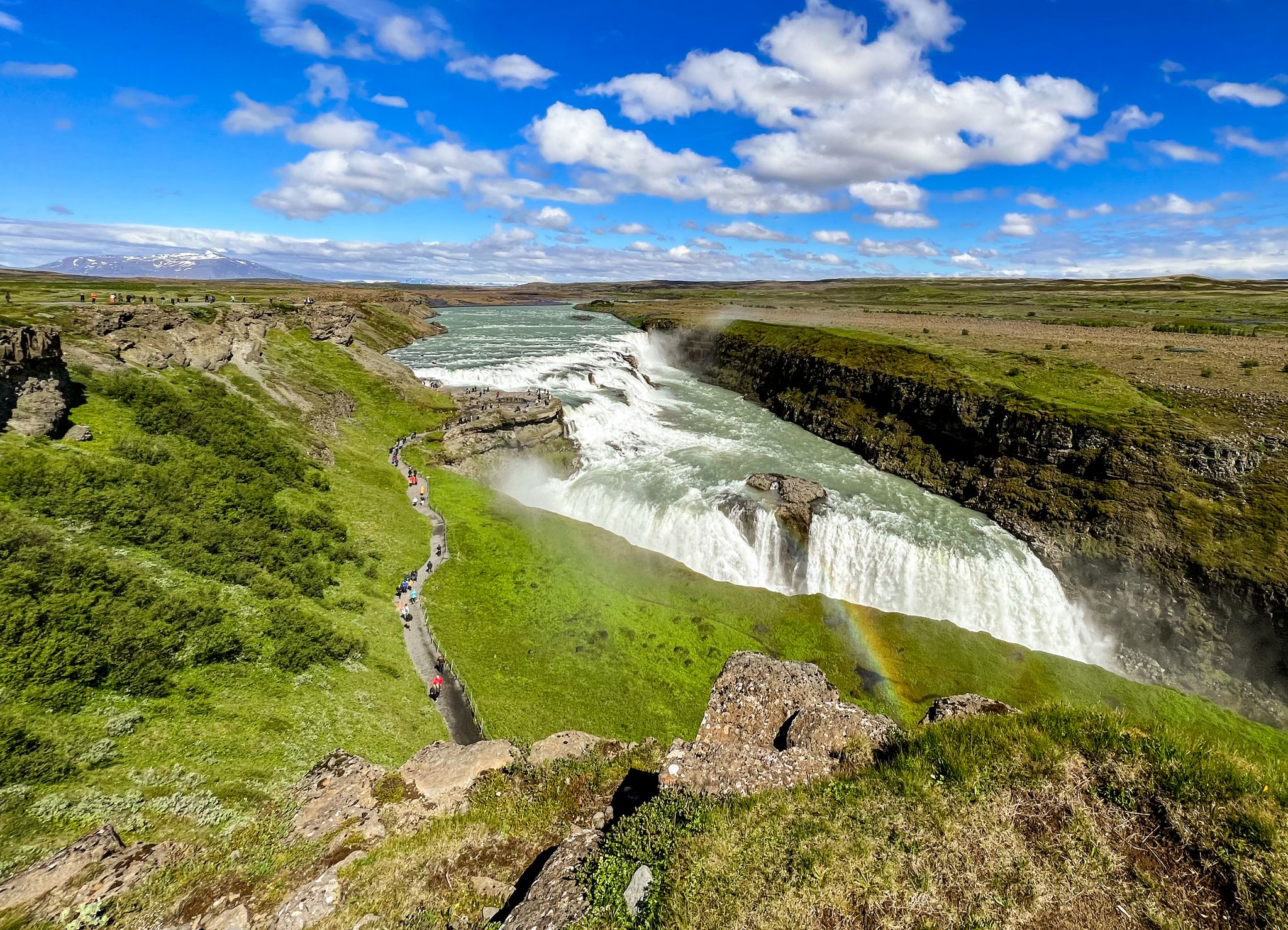
About halfway between Akureyri and Lake Mývatn lies the Goðafoss waterfall. Although only a modest 12 meters high, the thunderous cascade is impressive with its masses of water plunging across a wide gorge. The waterfall's edge was formed at the edge of the Frambruni lava flow, which erupted from the shield volcano Trölladyngja around 8,000 years ago and reached a length of 105 km. The waterfall's name is likely related to the Ljósvetninga saga. In the year 1000, the gode Þorgeir, as law speaker at the Þing meeting, ensured the adoption of Christianity as the official religion. He likely acted primarily for political reasons, fearing the timber embargo threatened by the Norwegian King Olaf if the Icelanders remained pagans. This, however, would have meant the end of vital shipbuilding. Relieved after the successful Þing session, Þorgeir sank his idols in the nearest waterfall, which has since been called Goðafoss, or Gods Waterfall.

번역: Google

0

0

🚶‍♂️ Dead Man Walking in Þingvellir Imagine: In the past, you didn't come here to hike, but because the Alþingi had decided that your final adventure awaited you – beheading, drowning, or hanging. A natural idyll with a twist. While today tourists stroll along the wooden walkways with selfie sticks, back then, condemned prisoners walked their final journey to Drekkingarhylur. "Wellness in a glacial stream" just sounded a little less relaxing back then. Who needs Game of Thrones when reality here in the 17th century was much more brutal?

번역: Google

0

0

A great highlight

번역: Google

0

1

Easily accessible and well-maintained wooden path that immediately immerses you in the impressive area around Pingvellir. Here, you can easily imagine the tectonic plates drifting apart.

번역: Google

0

0

Karsten
5월 29, 2025, Þingvallavatn

The lake lies in the so-called Þingvellir Rift and is surrounded by four active volcanic systems: Prestahnúkur and Hrafnabjörg in the northeast, and Hengill and Hrómundartindur in the southwest. The lake is estimated to be about 12,000 years old, making it the first glacial lake to have formed at the end of the last ice age. It was initially a glacial lake. At the end of the last ice age, the glacier blocked the water's outflow. Eventually, the glaciers retreated, the land beneath the Hengill volcano rose, and the lake deepened.

번역: Google

1

0

The scenery is still beautiful, but it becomes a little quieter here. However, the route is a bit difficult to integrate into a loop if you want to avoid the roads.

번역: Google

1

1

In terms of landscape, this is actually the most beautiful part of the national park (perhaps apart from the wide view over the valley), as the combination of river with rapids and rocks with green meadows in between just works.

번역: Google

1

0

아이슬란드 산맥에서 가장 인기 있는 경로

아이슬란드 산맥 하이킹

아이슬란드 산맥에서 가장 인기 있는 명소

Natural Monuments

Store rating

komoot 모바일 앱으로 영감을 받아보세요

무료 komoot 계정로 끝없는 야외 모험을 손쉽게 찾고, 맞춤 설정하며 길안내할 수 있어요.

또는

지금 komoot에 가입하세요

Store rating

더 살펴보기

다른 지역의 최고의 하이킹를 살펴보세요.

Þjóðgarðurinn á Þingvöllum싱발라바튼미르달슈레푸르Skógafoss올푸스Sveitarfélagið Hornafjörður레이캬비크가르다바이르아파바튼그룬다르피야르다르바에르스나이펠스베어코파보구르ReykjanesfólkvangurVatnajökulsþjóðgarður블라피욜스카프타레푸르Lundey셀티아르나르네스하프나르피요르뒤르Blikastaðakró - Leiruvogur모스펠스베어브레이다피요르뒤르플리요츠달셰라드스베이타르펠라지드 스카가피요르뒤르아크라레푸르

근처 어드벤처 가이드

후나바트넨슈레푸르 즐길거리

background

새로운 정복을 위한 준비를 하세요

무료로 가입하기

탐험하기
경로경로 플래너기능바우처 사용하이킹MTB 트레일로드 사이클링 경로바이크패킹사이트맵
앱 다운로드
소셜 미디어에서 팔로우하기

© komoot GmbH

개인 정보 보호 정책