슈바이그하우젠 주변 최고의 그래블 라이딩 코스
4.6
(42)
474
자전거 타는 사람
78
라이딩
슈바이그하우젠 주변의 엄선된 그래블 라이딩 코스에서 거친 라이딩의 매력을 경험하세요. 도전정신을 자극하는 업힐 코스이든 아름다운 풍경 트레일이든, 슈바이그하우젠 주변 최고의 그래블 라이딩 경로를 살펴보세요.
마지막 업데이트: 10월 19, 2026
3.7
(3)
38
자전거 타는 사람
41.0km
02:51
790m
790m
어려운 자갈길 타기. 우수한 체력 필요. 대부분 포장된 지면. 실력과 관계없이 누구나 갈 수 있음.
4.5
(2)
19
자전거 타는 사람
25.4km
01:59
720m
720m
어려운 자갈길 타기. 우수한 체력 필요. 투어 중 자전거를 끌고 가야 하는 구간이 있을 수 있음.

4.0
(1)
6
자전거 타는 사람
27.0km
01:53
330m
330m
보통 자갈길 타기. 좋은 체력 필요. 대부분 포장된 지면. 실력과 관계없이 누구나 갈 수 있음.
4.5
(2)
7
자전거 타는 사람
34.7km
01:56
100m
100m
어려운 자갈길 타기. 모든 체력 수준에 적합. 투어 중 자전거를 끌고 가야 하는 구간이 있을 수 있음.
14
자전거 타는 사람
97.2km
07:23
2,560m
2,560m
어려운 자갈길 타기. 우수한 체력 필요. 대부분 포장된 지면. 실력과 관계없이 누구나 갈 수 있음.
더 다양한 경로와 다른 탐험가들의 추천을 살펴보세요.
이미 komoot 계정이 있나요?
투어 추천은 다른 사람들이 komoot에서 완료한 수천 개의 활동을 바탕으로 구성되어 있습니다.
오늘 무료 계정으로 시작하세요
다음 모험이 기다리고 있어요.
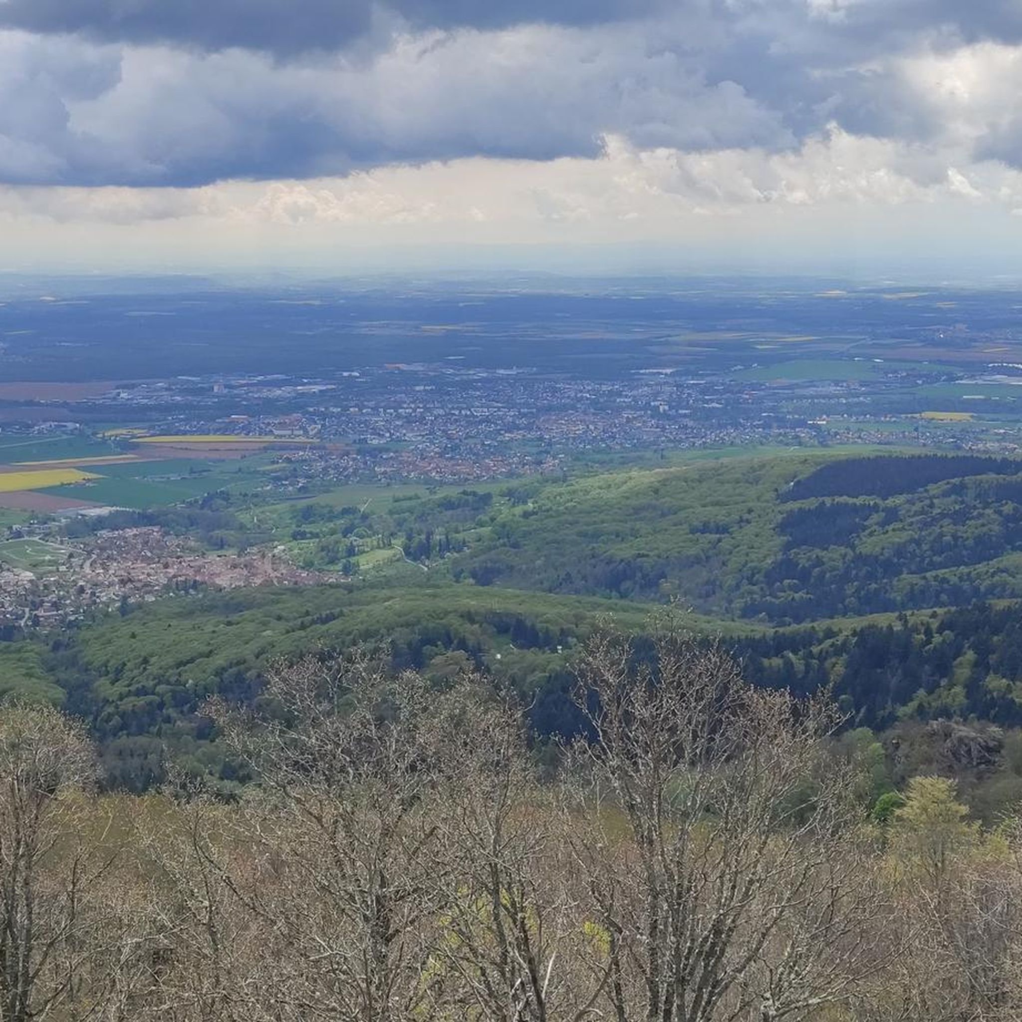
커뮤니티 팁

Route des Crêtes에서 Le Grand Ballon으로 향하는 길에 Col du Haag(1233m) 고개를 거의 눈치채지 못하고 지나치게 됩니다. 그럼에도 불구하고 이 고개는 보주 산맥에서 가장 높은 산의 남쪽 경사면에서 특별한 지점을 표시합니다. 이곳에서 Thurdal에서 오는 가파른 도로들이 울창한 경사면을 벗어나 산괴의 탁 트인 고지대에 도달합니다. 고개에서부터 산악 목초지, 흩어져 있는 농가, 탁 트인 전망이 있는 전형적인 보주 산맥 풍경이 펼쳐집니다. Grand Ballon의 근접성은 어디에서나 느껴집니다. 인상적인 정상은 고개 위로 솟아 있으며 마지막 오르막 몇 킬로미터의 자연스러운 목표를 형성합니다. 사이클리스트에게 Col du Haag는 특히 계곡에서 오는 힘든 오르막길이 보주 산맥의 가장 높은 지점으로 계속 올라가기 전에 합쳐지는 지점으로 잘 알려져 있습니다.
6
0
Le Markstein (1184 m) is meer dan alleen een kruispunt op de Route des Crêtes. Het is echter een echte bergpas en het hoogste punt van de oversteek tussen het Lauch- en Thurdal. Het ligt in het hart van het Vogezenmassief, midden een populair wintersportgebied dat nauw verbonden is met de Grand Ballon
6
0
Le Markstein is a well-known winter sports and outdoor resort in the High Vosges, located at an altitude between 1020 and 1268 meters. The resort is situated directly on the iconic Route des Crêtes and forms an important crossroads and recreational area within the municipalities of Oderen and Lauw (near Wildenstein). At Le Markstein, you will find several traditional Fermes-Auberges and hotels where you can taste the local repas marcaire (a traditional hearty meal from the Vosges). Additionally, the location has gained significant fame in cycling; it is regularly the setting for tough mountain stages in the Tour de France (and the Tour de France Femmes), often as the final challenge after the climbs of Petit Ballon and Platzerwasel.
6
0
Route des Crêtes(Rothenbach 근처 D430에서)는 유럽에서 가장 아름다운 능선 도로 중 하나입니다. 이 도로는 원래 1914년 프랑스군이 제1차 세계 대전 당시 전선의 병력에게 보급하기 위해 건설했습니다. 오늘날 이곳은 보주 산맥의 주요 봉우리들을 연결하는 상징적인 파노라마 도로입니다.
1
0
Route des Crêtes (Rothenbach 근처 D430에서 이어지는)는 유럽에서 가장 아름다운 능선 도로 중 하나입니다. 이 도로는 원래 1914년 프랑스 군대에 의해 제1차 세계 대전 당시 전선의 병력에게 보급품을 공급하기 위해 건설되었습니다. 오늘날에는 보주 산맥의 주요 봉우리들을 연결하는 상징적인 파노라마 도로입니다.
6
0
콜 드 브라몽 정상 자체에는 레스토랑이나 카페가 없습니다. 그러나 이 고개는 전략적 교차점 역할을 합니다. 고개 정상에서 유명한 크레테스 루트(D431)로 바로 연결될 수 있으며, 이 루트는 보주 산맥의 주요 봉우리들을 연결합니다. 이를 통해 콜 드 라 슐루트, 호넥, 그랑 발롱과 같은 주변의 더 큰 명소로 쉽게 자전거를 타거나 걸어갈 수 있습니다. 남쪽 경사면(크뤼트)의 12개 헤어핀 커브 때문에 오르막길이 재미있습니다.
7
0
오르막은 비교적 완만하게 시작됩니다. 처음 4.5km는 Kruth-Wildenstein 저수지를 따라 완만하게 구불거리는 길로 거의 눈에 띄는 경사가 없습니다. 그 후에야 약 3.5~4km 구간에서 본격적인 오르막이 시작됩니다. 그 시점부터 길은 12개의 특징적인 헤어핀 커브를 따라 구불구불 이어집니다. 이 구간의 경사는 매우 일정하며 거의 지속적으로 5~6%를 유지하므로 일정한 리듬을 찾기에 이상적입니다. 도로는 아스팔트가 잘 포장되어 있으며 울창한 소나무 숲으로 완전히 둘러싸여 있습니다. 이 덕분에 그늘에서 즐겁게 라이딩할 수 있지만, 정상과 오르막 구간의 빽빽한 초목 때문에 계곡의 탁 트인 전망은 거의 없습니다. 정상(955m)에 도달하면 바로 북쪽 La Bresse 방향으로 내려가거나, 유명한 Route des Crêtes에 합류하여 Col de la Schlucht 또는 Grand Ballon까지 라이딩을 연장할 수 있습니다.
6
0

이 오래된 예배당은 프랑스 혁명 이후 Thann로 가는 옛길에 세워졌으나 시간이 지남에 따라 황폐해졌습니다. 1932년에 지역 사회는 재건축을 결정했습니다. 오늘날의 작은 건물은 단순한 본당, 개방형 현관, 종이 있는 작은 지붕탑을 갖추고 있습니다. 예배당 앞에는 성모 마리아상이 서 있으며, 이곳의 순례 및 기도 장소로서의 성격을 강조합니다. 이 예배당은 "선한 도움의 성모"에게 헌정되었으며 남부 알자스의 전형적인 작은 종교 기념물 중 하나입니다.
1
0
슈바이그하우젠 주변에서 가장 인기 있는 명소


더 살펴보기
다른 지역의 최고의 그래블 라이딩를 살펴보세요.
