로스트레보 숲 최고의 워킹 & 하이킹 경로
4.5
(496)
3,540
등산객
37
하이킹
로스트레보 숲 에서 인기 있는 워킹과 하이킹을 찾으시나요? 그렇다면 아름다운 Newry And Mourne 숲 주변에 있는 경로 컬렉션을 아래에서 살펴보세요. 로스트레보 숲에 있는 하이킹 및 워킹 트레일 중에서 마음에 드는 곳을 선택해 언제든지 야외 활동을 하면 돼요.
마지막 업데이트: 10월 24, 2026
4.7
(12)
48
등산객
11.9km
03:33
370m
370m
Embark on the Fallows Trail for a moderate hiking adventure that spans 7.4 miles (11.9 km) and includes a significant elevation gain of 1201 feet (366 metres). You can expect to complete this route in about 3 hours and 33 minutes, navigating through diverse forested areas and rugged sections. The trail offers rewarding panoramic views from Slievemeel Summit, where you can gaze across Carlingford Lough and the majestic Mourne Mountains, and also features the scenic Yellow Water River gorge.
Planning your visit to the Fallows Trail is straightforward, with parking conveniently available at Kilbroney Park. This route is classified as a Category 4 mountain trail, meaning it features steeper inclines and rugged terrain, making it best suited for experienced walkers. Before you head out, it is always a good idea to check for any potential parking fees or seasonal recommendations that might affect your trip.
The Fallows Trail is a notable route within Kilbroney Park, distinguished by its challenging yet rewarding character. Its path takes you through varied landscapes, from dense woodlands to open vistas, highlighting the natural beauty of the region. The opportunity to witness the expansive views of Carlingford Lough and the Mourne Mountains from Slievemeel Summit makes this trail a standout choice for those seeking a memorable outdoor experience.
4.0
(4)
23
등산객
7.94km
02:44
430m
430m
Embark on the Rostrevor Forest Slievemartin Trail, a moderate hike spanning 4.9 miles (7.9 km) with an elevation gain of 1405 feet (428 metres), typically taking around 2 hours and 43 minutes to complete. As you ascend, you will pass through ancient oakwood and coniferous forests, eventually reaching the summit of Slieve Martin. From this high point, you are rewarded with panoramic views of Carlingford Lough, the village of Rostrevor, and across to Carlingford and O'Meath. The paths are generally accessible, though some sections are steep and stony, requiring sturdy footwear. You will find the terrain varied, moving from forest roads to well-trodden paths and occasionally rough moorland.
Planning your visit is straightforward, as the route is popular and offers convenient parking, especially at the upper car park near Cloughmore. The trail is suitable for those with good fitness, and while there are steep ascents, particularly towards Slieve Martin, the overall experience is rewarding. Be prepared for potentially strong winds at the summit. This trail is a great option for a day out, offering both a good workout and stunning scenery.
This trail is notable for its diverse features, including the impressive Cloughmore Stone, a 50-ton erratic granite boulder with a legendary connection to Finn McCool. You can also discover Fiddler's Green, a serene spot perfect for a break, and the 200-year-old Invisible Tree, a local symbol for environmental protection. The area's profound beauty, with its dramatic landscapes and ancient woodlands, is even said to have inspired C.S. Lewis's Narnia. On clear days, you can see the Irish Sea and other Mourne peaks, making this a truly memorable hike.

4.8
(5)
17
등산객
12.9km
04:10
540m
530m
Embark on the Slievemeen, Slievemeel & Slievemartin loop, a moderate hike covering 8.0 miles (12.9 km) with an elevation gain of 1768 feet (539 metres), typically taking 4 hours and 10 minutes. The trail begins with attractive woodland and forest tracks, transitioning to stony paths and rough moorland as you ascend. You will experience steep sections, particularly through the forest, which offer a good cardio workout. From the summits of Slievemeen and Slievemartin, you are treated to panoramic views of Carlingford Lough, Rostrevor, and the distant Cooley Mountains. Keep an eye out for other Mourne peaks like Slieve Donard and Slieve Binnian on clear days.
This circular route is generally considered accessible and suitable for beginners and family groups, thanks to its well-defined paths to Slievemeen and Slievemartin. However, the initial ascents can be steep and demanding, so good fitness is required. Be aware that strong winds can be a factor at the summits. If you plan to extend your hike to include Crenville, be prepared for significantly more challenging terrain, including boggy patches and a lack of clear paths, requiring strong navigational skills.
One of the most notable aspects of this trail is the incredible panoramic views from the summits of Slievemeen and Slievemartin. Slievemartin is particularly popular due to its accessibility and the quality of its paths. The trail's proximity to Kilbroney Park, Rostrevor, also allows you to visit the ancient Cloghmore Stone, a massive boulder steeped in Irish legend. This spot offers a great place for a picnic with views overlooking Carlingford Lough.
4.2
(6)
14
등산객
3.51km
01:13
200m
190m
Embark on the easy Cloughmore Trail, a 2.2-mile (3.5 km) hike that typically takes about 1 hour and 12 minutes to complete. You will gain 646 feet (197 metres) in elevation as you explore diverse terrain and ancient oakwood forests. Look out for the impressive 50-tonne Cloughmore Stone and enjoy panoramic vistas from viewpoints like "Kodak Corner" overlooking Carlingford Lough and the Mourne Mountains. The route offers a blend of natural beauty and rewarding views.
While the trail is generally considered easy, be prepared for some steep sections, especially during the initial ascent from the car park towards the Cloughmore Stone. This hike is manageable for most people in reasonable health. Kilbroney Forest Park serves as an excellent starting point, providing ample parking for your convenience. The circular nature of the route means you will finish where you began.
The Cloughmore Trail is a favorite among those who enjoy walking and running, providing a fulfilling outdoor experience within Kilbroney Forest Park. The massive Cloughmore Stone itself is not just a geological feature; it is also steeped in local folklore, adding a layer of historical intrigue to your journey. This trail stands out for its combination of accessible hiking and significant natural landmarks.
4.7
(11)
47
등산객
10.4km
03:11
350m
350m
보통 하이킹. 좋은 체력 필요. 대부분 갈 수 있는 길. 미끄러지지 않게 조심해야 함.
더 다양한 경로와 다른 탐험가들의 추천을 살펴보세요.
이미 komoot 계정이 있나요?
투어 추천은 다른 사람들이 komoot에서 완료한 수천 개의 활동을 바탕으로 구성되어 있습니다.
오늘 무료 계정으로 시작하세요
다음 모험이 기다리고 있어요.



커뮤니티 팁

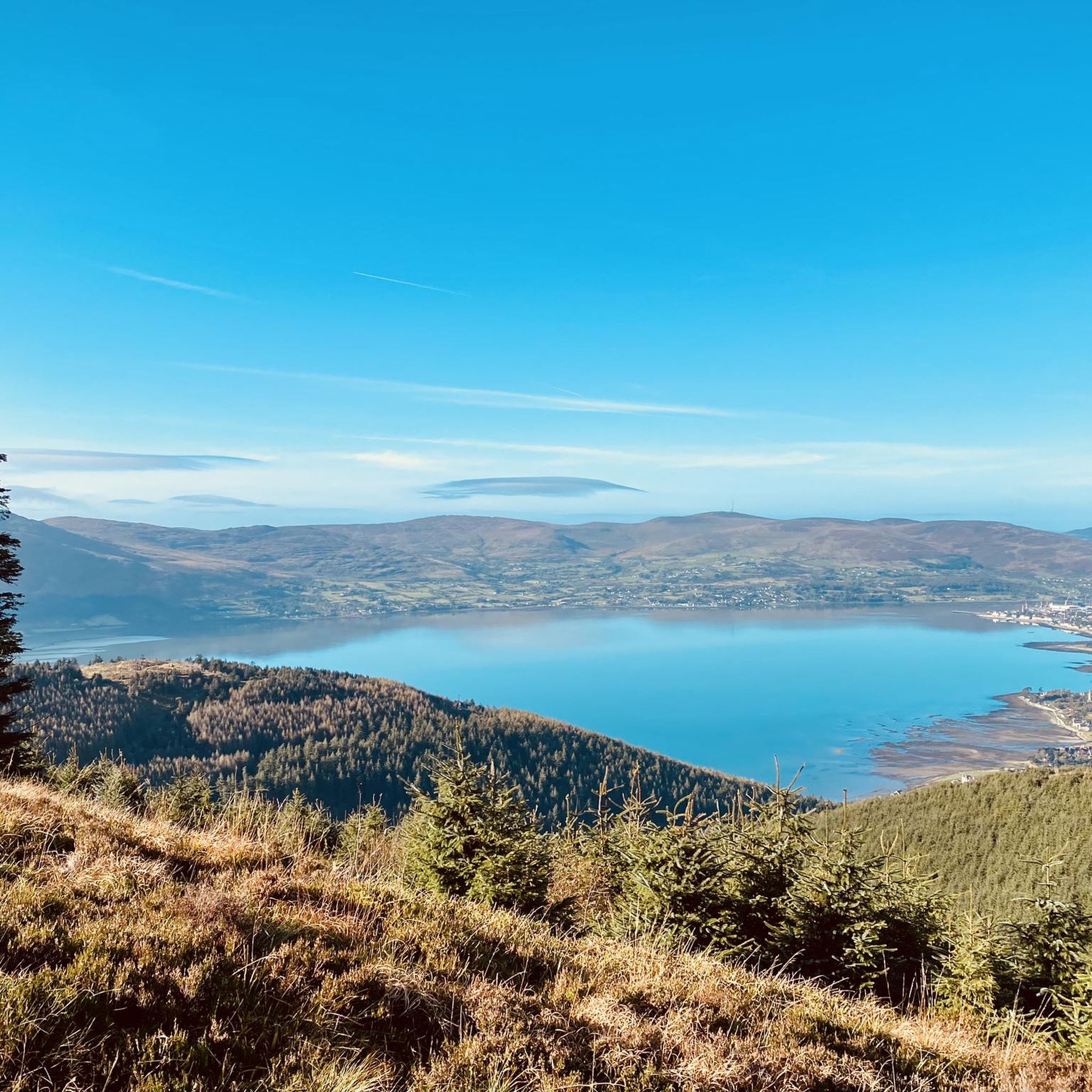
The hike to the Cloghmór Stone feels like a journey through time. Over 10,000 years ago, the ice brought this massive granite block from Scotland here, and now, weighing an estimated 50 tons, it towers majestically over the landscape. But it's not just the geology that's fascinating - according to legend, it was the giant Finn McCool who threw this enormous stone over Carlingford Lough. To be honest, the legend is a much more exciting explanation, isn't it? Once you've reached the top, you'll not only be greeted by the imposing boulder, but also by a fantastic view of Carlingford Lough and the surrounding hills. It's the perfect place to pause for a moment, take in the vastness and enjoy the peace that this place exudes.
0
0

A beautiful round stone, there is a legend about it but unfortunately we could not find out
0
0
A beautiful forest with good views of the sea
0
0
Designated viewpoint, with a nice bench to relax
0
0

A beautiful secluded clearing in the Oak forest. The message on the bench is pretty apt for any trail runners who have slogged up the hill!
1
0
A lovely small clearing with a few picnic tables and the Yellow Water river running beside it. The small car park is a good place to leave the car for one of the many walks in this area.
0
0
Lovely quite spot to take a break. Or be sure to get up for the Setting The Scene event of Fiddlers Green Festival every Summer for music and stories!
0
0
로스트레보 숲 주변에서 가장 인기 있는 명소


더 살펴보기
다른 지역의 최고의 하이킹를 살펴보세요.
