Λίμνη Κουρνά Δήμου Γεωργιούπολης 최고의 라이딩 경로
4.3
(43)
470
자전거 타는 사람
28
라이딩
Λίμνη Κουρνά Δήμου Γεωργιούπολης 최고의 로드 사이클링 경로를 찾으시나요? 그렇다면 아름다운 하니아 자연공원 주변의 라이딩 컬렉션을 아래에서 살펴본 후, Λίμνη Κουρνά Δήμου Γεωργιούπολης의 여러 가지 모습을 직접 만나보세요.
마지막 업데이트: 8월 13, 2026
4.1
(8)
93
자전거 타는 사람
72.6km
04:07
1,630m
1,630m
어려운 도로 자전거 타기. 우수한 체력 필요. 지면 대부분이 잘 포장되어 있고 라이딩하기 쉬움.
4.8
(5)
49
자전거 타는 사람
55.0km
03:06
1,150m
1,150m
어려운 도로 자전거 타기. 우수한 체력 필요. 지면 대부분이 잘 포장되어 있고 라이딩하기 쉬움.

무료 회원 가입
5.0
(1)
25
자전거 타는 사람
89.9km
05:14
2,110m
2,120m
어려운 도로 자전거 타기. 우수한 체력 필요. 지면 대부분이 잘 포장되어 있고 라이딩하기 쉬움.
3.0
(1)
16
자전거 타는 사람
52.2km
02:44
850m
850m
보통 도로 자전거 타기. 좋은 체력 필요. 투어 중 라이딩하기 어려운 비포장 구간이 있을 수 있음.
9
자전거 타는 사람
23.0km
01:14
370m
370m
보통 도로 자전거 타기. 좋은 체력 필요. 지면 대부분이 잘 포장되어 있고 라이딩하기 쉬움.
더 다양한 경로와 다른 탐험가들의 추천을 살펴보세요.
무료 회원 가입
이미 komoot 계정이 있나요?
투어 추천은 다른 사람들이 komoot에서 완료한 수천 개의 활동을 바탕으로 구성되어 있습니다.
오늘 무료 계정으로 시작하세요
다음 모험이 기다리고 있어요.
로그인 또는 가입하기
Λίμνη Κουρνά Δήμου Γεωργιούπολης 주변 인기 장소
커뮤니티 팁

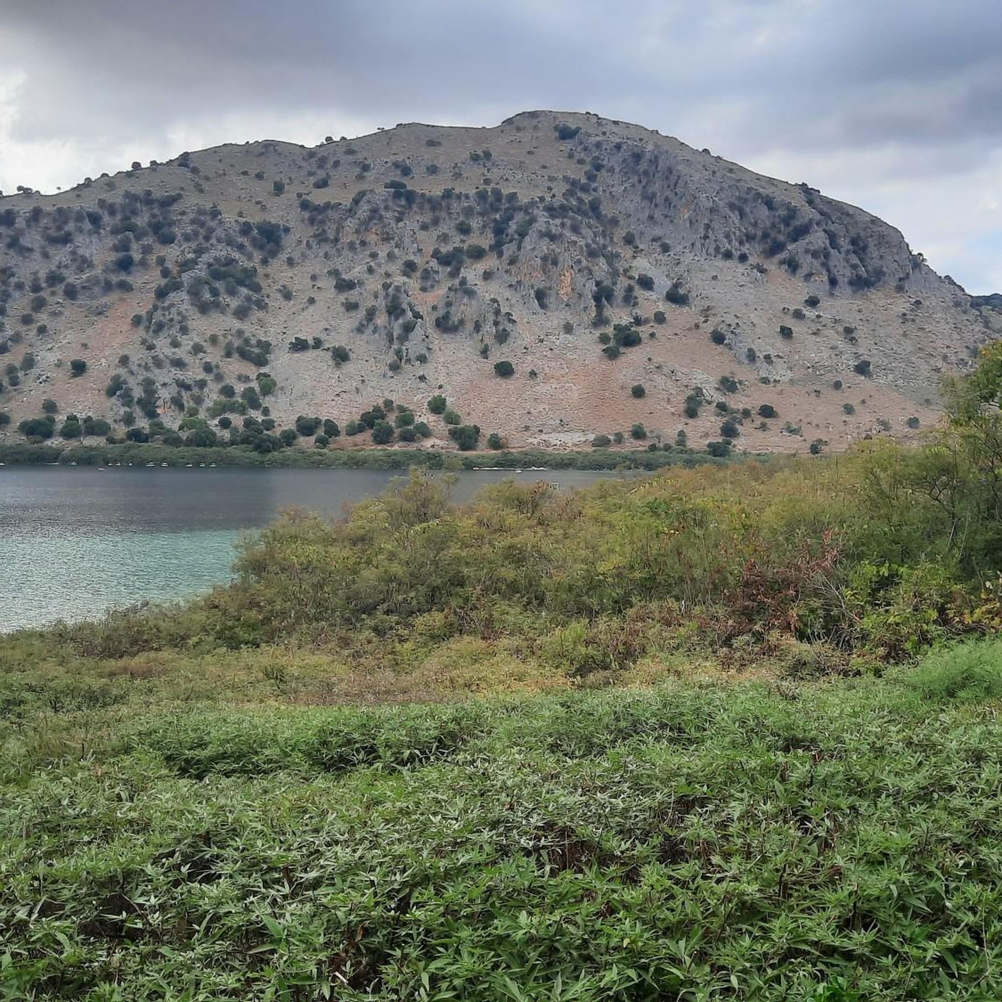
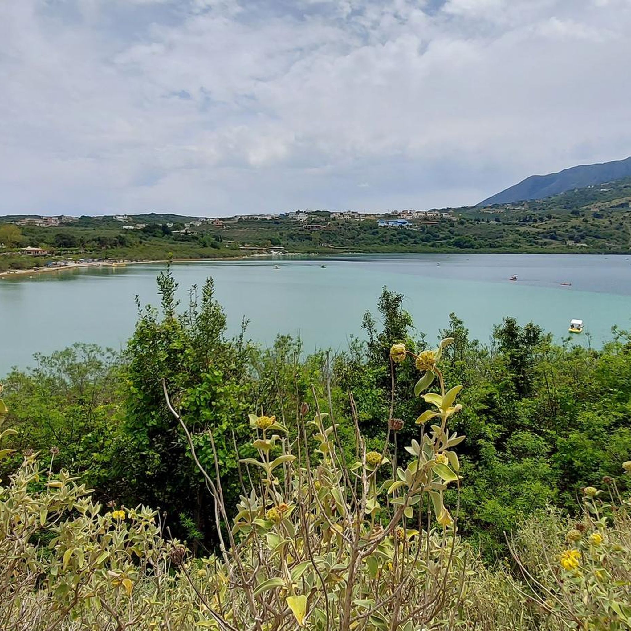
쿠르나스 호수는 오늘날 크레타 섬의 유일한 대형 자연 호수이며 마법 같은 풍경 속에 자리 잡고 있습니다. 높은 산과 올리브 과수원으로 둘러싸여 있습니다. 게오르기우폴리 해변에서 남동쪽으로 2.5km, 하니아에서 동쪽으로 43km, 레팀논에서 서쪽으로 20km 떨어진 쿠르나스 마을 옆에 있습니다. 쿠르나스 호수와 그 주변은 그리스에 매우 중요한 생태계를 이룹니다. 쿠르나스는 수년에 걸쳐 엄청난 양의 담수가 축적된 크레타 섬의 몇 안 되는 지역 중 하나입니다. 그렇기 때문에 나투라 2000 프로그램의 보호를 받고 있습니다. 호수 한쪽에는 호수를 조망할 수 있는 카페와 레스토랑이 있습니다. 여름철 수위가 낮아지면 카페 옆으로 하얀 모래로 된 작은 해변이 형성됩니다. 방문객들은 이 해변에서 수영을 하고 파라솔을 대여할 수 있습니다. 방문객들은 또한 페달 보트와 카약을 탈 수 있습니다. 물이 멋진 색을 띠고 잔잔해지는 오후 시간에 이상적인 선택입니다. 호수는 산에서 오는 지하수가 모여 형성되었습니다. 물은 여름에는 호수 수면 위에 있고 겨울에는 수면 아래에 숨겨져 있는 아마트(Amati) 또는 마티(Mati)라고 불리는 샘에서 솟아납니다. 두 번째 샘은 일년 내내 수면 아래에 있습니다. 호수는 작고 둥글며 면적은 570 에이커, 최대 깊이는 22.5미터, 길이는 1080미터, 너비는 880미터입니다. 여름에는 호수에 750만 입방미터의 물이 있습니다. 호수는 델피나스 강에 의해 공급됩니다. 출처: cretanbeaches.com/de/str%C3%A4nde-in-kreta/str%C3%A4nde-auf-chania-west-kreta/kournas-see-chania
2
0
쿠르나스 호수는 오늘날 크레타 섬에 있는 유일한 큰 자연 호수이며 마법 같은 풍경 속에 자리 잡고 있습니다. 높은 산과 올리브 과수원으로 둘러싸여 있습니다. 게오르기우폴리스 해변에서 남동쪽으로 2.5km, 하니아에서 동쪽으로 43km, 레팀논에서 서쪽으로 20km 떨어진 쿠르나스 마을 옆에 있습니다. 쿠르나스 호수와 그 주변은 그리스에 매우 중요한 생태계를 이룹니다. 쿠르나스는 수년에 걸쳐 엄청난 양의 담수가 축적된 크레타 섬의 몇 안 되는 지역 중 하나입니다. 그렇기 때문에 나투라 2000 프로그램의 보호를 받고 있습니다. 호수 한쪽에는 호수를 조망할 수 있는 카페와 레스토랑이 있습니다. 여름철 수위가 낮아지면 카페 옆으로 하얀 모래의 작은 해변이 형성됩니다. 방문객들은 이 해변에서 수영을 하거나 파라솔을 대여할 수 있습니다. 방문객들은 이곳에서 페달 보트와 카약을 탈 수도 있습니다. 물이 멋진 색을 띠고 잔잔해지는 오후 시간에 이상적인 선택입니다. 호수는 산에서 내려오는 지하수가 모여 형성되었습니다. 물은 아마티 또는 마티("눈"을 의미)라고 불리는 샘에서 솟아나는데, 여름에는 호수 수면 위에 있지만 겨울에는 수면 아래에 숨겨져 있습니다. 두 번째 샘은 일년 내내 수면 아래에 있습니다. 호수는 작고 둥글며 면적은 570에이커, 최대 깊이는 22.5미터, 길이는 1080미터, 너비는 880미터입니다. 여름에는 호수에 750만 입방미터의 물이 있습니다. 호수는 델피나스 강에서 공급됩니다. 출처: https://www.cretanbeaches.com/de/str%C3%A4nde-in-kreta/str%C3%A4nde-auf-chania-west-kreta/kournas-see-chania
2
0

마을 광장의 교회 뒤에 있는 아름다운 전통 선술집입니다. 하지만 이곳에 종종 대규모 가이드 쿼드 무리가 몰려들면, 안타깝게도 목가적인 분위기는 금방 사라집니다.
0
0

The road is beautifully laid out, has wonderful views, and is not very busy, but with gradients of up to 19%, it's not for everyone ;-)
0
0

Quäldich Pass Description: Southern Ascent from Kapsodasos 6.7 km | 643 m elevation gain | 9.6% (~10.4%) The southern ascent begins in the village of Kapsodasos at an altitude of approximately 100 m. The turnoff to Kallikratis is signposted (as of 2018 on a very weathered sign). The route initially heads north for a little over half a kilometer before a veritable hairpin bend festival unfolds over the next five kilometers. The road winds its way up a barren rocky slope via a total of 27 hairpin bends. There is virtually no vegetation along the route, which has its own charm and offers consistently wonderful views, especially of the hairpin bends already conquered and the Libyan Sea shimmering in the distance. The gradient is inconsistent over these first 5.5 kilometers, averaging just over 10%, but quite steep. In addition to battling the steep incline, the author also encountered a rather strong headwind on the ascent, which swept down the slope and added to the effort. After completing the switchbacks, the worst is over, and the route continues relatively flat for half a kilometer northwards before the remaining 700 meters to the highest point of the route, where the final meters of elevation gain must be conquered at a manageable gradient. Once at the top, the route descends for about a kilometer, followed by a gentle climb of almost three kilometers towards Kallikrátis. From there, however, more elevation gain awaits, as one must either tackle the easy western ascent to the Bourolos Pass or the 560-meter climb of the eastern ascent to the Asfendos Pass. Northern Ascent 1 km | 64 m elevation gain | 6.4% (~8.8%)
0
0
Quäldich Pass Description: The Kallikratis-Kapsodasos Pass lies not far from the south coast of Crete, between Kapsodasos and Kallikratis. As is often the case in Crete, there is unfortunately no pass sign and therefore no official name for the crossing. It is also not marked on local maps. The owner of Olympic Bike in Rethymnon informed the author that the crossing is known locally as the Kapsodasos Pass, or simply Kapsodasos Pass, based on the starting point of the southern ascent. Elsewhere, it is referred to as the Kallikratis Climb. We cannot and do not wish to commit to a definitive name. This is not a pass in the conventional sense, as the road does not connect two valleys, but rather leads from the south coast parallel to a gorge, climbing a slope into the island's interior. However, like a pass, it does cross a high point. Consequently, the southern ascent can involve a considerable amount of elevation gain, while the northern ascent involves only a slight difference in altitude. As of 2018, the entire route is in excellent condition and has a much better road surface than the surrounding roads. Only in the lower section of the southern approach were there occasionally some stones on the road, which only required extra caution on the descent. Furthermore, the road is mostly single-lane, hardly used, and therefore a real pleasure to drive.
0
0
Asfendos Pass Description: The Asfendos Pass lies slightly east of the Lefka Ori (White Mountains) and connects the summit of the Imbros Pass in the west with the village of Kallikratis in the east over a distance of 14.8 kilometers. Those starting on the south coast of Crete and then climbing the Asfendos Pass via the Imbros Pass can cover a total of 1100 meters of elevation gain in one go. The ascent from the east, however, is initially undulating and only begins with a longer climb after the village of Asfendos (municipality of Arkalokefali?). Since this pass, like the Imbros Pass, has no official name, a name is required, and here it is, in reference to the aforementioned village – ta-da! – Asfendos Pass. As of 2018, the road is in quite good condition. Apart from a little vegetation along the eastern approach, the landscape is extremely barren, which has its own unique charm. From the pass summit, there is a beautiful view of the Lefka Ori (White Mountains) massif. QD Editorial Note: From the pass, the road continues higher, a paved track leading to the 1220-meter summit of Akones.
0
0
Bourolos Pass 818 m Quäldich Pass Description: Anyone traveling from the Rethymnon area towards the Imbros or Kallikratis-Kapsodasos Passes must first conquer the Bourolos Pass, unless they choose a longer detour via Sellia along the south coast of Crete. The pass runs roughly west-east, with two ascents from the east. The southern ascent offers several options at the beginning. The eastern ascents are quite scenic, while the pass summit itself is barren and unspectacular.
0
0
Λίμνη Κουρνά Δήμου Γεωργιούπολης 주변에서 가장 인기 있는 경로
Λίμνη Κουρνά Δήμου Γεωργιούπολης 주변에서 가장 인기 있는 명소


더 살펴보기
다른 지역의 최고의 로드 사이클링 경로를 살펴보세요.
