20의 자자가지 명소 & 주요 장소
자자에는 둘러볼 만한 장소가 많답니다. 하이킹 또는 사이클링을 좋아한다면 자자에 숨겨진 20
가지 보석을 만날 수 있을 거예요. 이 지역의 주요 명소를 살펴보면서 다음 모험을 계획해보세요.
마지막 업데이트: 8월 26, 2026


이런 장소를 발견하려면 지금 가입하세요
최고의 싱글 트랙, 봉우리 및 다양한 흥미로운 야외 장소에 대한 추천을 받아보세요.
무료 회원 가입


GR-11.1 트레일
하이라이트 • 트레일
번역자 Google •
팁에 의해
무료로 가입하여 자자 주변의 더 많은 명소를 발견하세요.
무료 회원 가입
이미 komoot 계정이 있나요?
오늘 무료 계정으로 시작하세요
다음 모험이 기다리고 있어요.
로그인 또는 가입하기

커뮤니티 팁

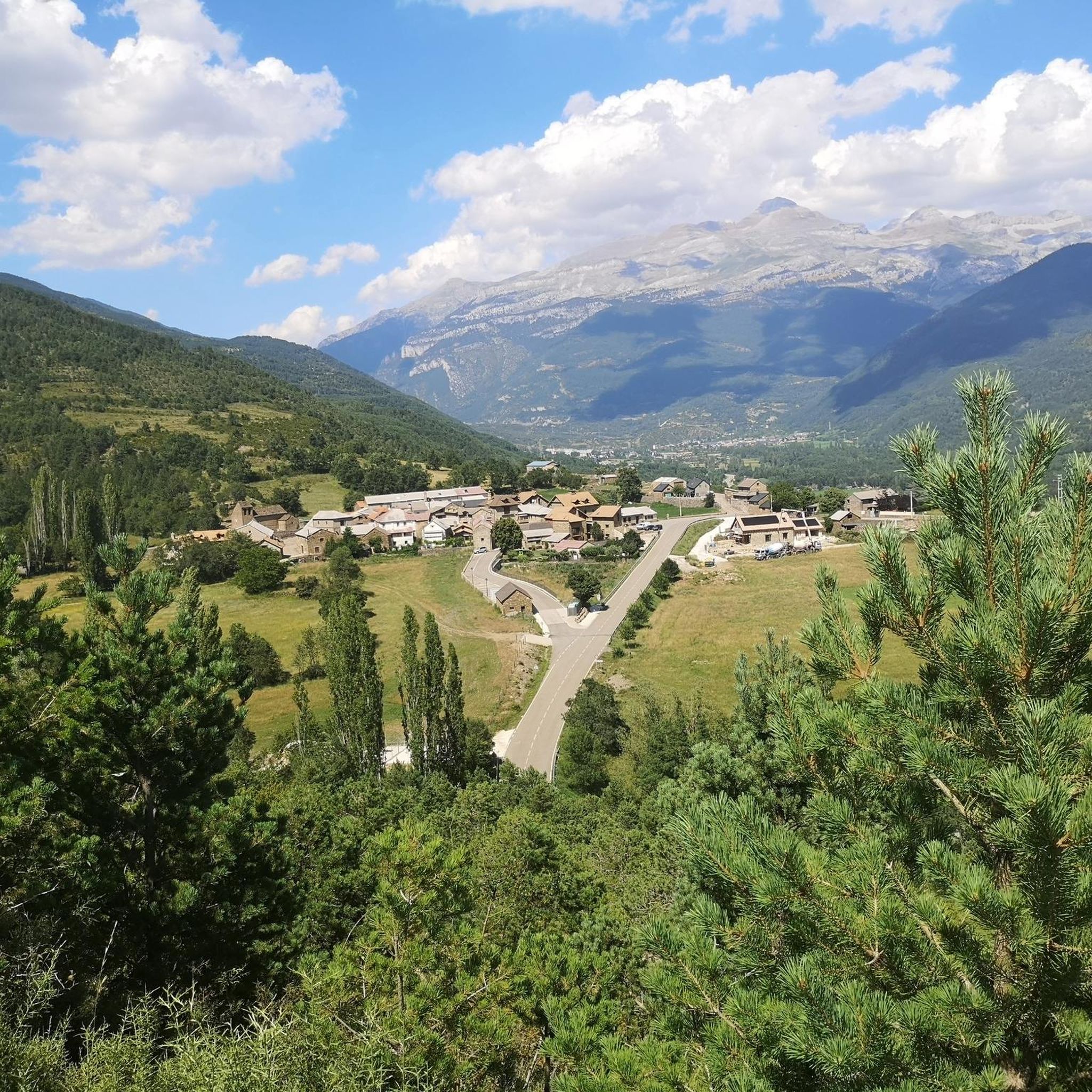
멋진 파노라마 전망을 갖춘 아름다운 공터에 위치한 산장. 많은 하이킹을 위한 훌륭한 출발점입니다.
0
0
이 지역 등반을 위한 아름다운 출발점. 여러 날의 트레킹을 위한 경유지이기도 하며, 아름다운 위치에 있으며 차로 편리하게 접근할 수 있습니다
0
0

A good place to rest. Refurbished and in use in 2026.
0
0

No cell phone reception in or around the hut. There's a free hot shower!
0
0

A refuge located in the Aragüés-Jasa Valley, one of the four valleys of the Natural Park declared in 2006. Located at the western end of the Aragonese Pyrenees and covering an area of 34,000 hectares, it encompasses a great diversity and richness of both fauna and geology, making it a great place for studying and practicing nature activities.
0
0

The Garbadito refuge is known for its welcoming atmosphere. Its 45 available beds are divided into six rooms. It offers catering service for guests and passers-by. Those staying there also have a kitchen for free use.
1
0

The path passes by Fuente de los Abetazos and continues along the Villanúa forest track towards the Gabardito sheepfold. On the Carnicerías mountain there is a monumental pine tree at the turn-off for the Carnicerías peak (1,464 m). The path post indicates ten minutes to the metal house that marks the summit, but with snow the time is unpredictable because the terrain is uncomfortable and chaotic. The visit to the summit is worthwhile to contemplate the Canfranc Valley from a bird's eye view. The track returns to the main path at the giant tree and at the edge of the forest there is the post that indicates the entrance to the Gabardito sheepfold, just after passing the start of the descent path through the pegs of the Agüare ravine. The mountain becomes friendly and welcoming, there are no trees and in the clearing the eastern towers of the Aisa mountain range appear for the first time during the climb. The path continues straight ahead along the GR-11.1, the milestones are usually covered by snow and the reference is the Gabardito Refuge. The long-distance path passes by the refuge but the footprint can be on any side seeking to soften the hill of the sheepfold to enter the Añaza ravine and begin the second section of the route. The red and white marks of the path are painted on the trunks of the trees and in some places they take a while to appear, it is advisable to follow the virtual line of the track or follow the footprint opened by the passage of other mountaineers when possible. The path skirts the mountain inside a pine forest for a kilometre and new steep slopes begin to avoid the Campon ravine, on the edge of the Western Valleys Natural Park.
0
0
The village of Canfranc is a street with houses on either side, there is no room for much else, the mountain slopes grow from the banks of the Aragón River and do not stop until they exceed two thousand metres in altitude, the valley is a perfect mountain architecture. In the square there is a bar and there is the church of the Assumption, from the 12th century, rustic and rural, a traditional landmark of asylum and protection for the pilgrims from Santiago de Compostela who passed through the Somport pass on their way to Jaca. In another building there is the mountain hostel and little else, there are several tourist accommodations but Canfranc is still a quiet mountain village, isolated from the bustle generated by the alpine ski resorts in the upper part of the valley, it is stuck in time. A good place to start the track is the church square, you have to cross the French road that goes up towards Canfranc-Estación and look for the GR-11.1 post at the beginning of the path of the Gabardito sheepfold. The path is fabulous, it doesn't seem like there could be a path with a pleasant layout in a forest wall of inhospitable and inaccessible appearance. The path climbs between walls of moss-covered stones and mountain huts along the Arones ravine, crosses the stream by a dam regulating the stream and marks several switchbacks on the slope of boxwood and fir trees until the Villanúa track. At the crossroads there are signs for the local trails and the GR-11.1 towards Gabardito and Lizara. The route in winter is ideal for walking on snowshoes.
0
0
자자 주변에서 가장 인기 있는 명소


더 살펴보기
찾고 있는 하이라이트를 아직 못 찾으셨나요? 다른 지역의 주요 명소 가이드를 확인해보세요:
