메질락 최고의 라이딩 경로
4.5
(72)
1,541
자전거 타는 사람
52
라이딩
메질락의 로드 사이클링 경로를 찾으시나요? 그렇다면 메질락 로드 라이딩 컬렉션 중에서 가장 멋진 라이딩 장소를 아래에서 살펴보세요.
마지막 업데이트: 10월 18, 2026
5.0
(2)
88
자전거 타는 사람
58.6km
03:13
1,240m
1,240m
어려운 도로 자전거 타기. 우수한 체력 필요. 지면 대부분이 잘 포장되어 있고 라이딩하기 쉬움.
4.7
(3)
78
자전거 타는 사람
73.0km
04:05
1,630m
1,630m
어려운 도로 자전거 타기. 우수한 체력 필요. 투어 중 라이딩하기 어려운 비포장 구간이 있을 수 있음.

5.0
(1)
42
자전거 타는 사람
148km
08:23
3,410m
3,410m
어려운 도로 자전거 타기. 우수한 체력 필요. 지면 대부분이 잘 포장되어 있고 라이딩하기 쉬움.
2.5
(2)
55
자전거 타는 사람
67.9km
03:33
1,230m
1,230m
어려운 도로 자전거 타기. 우수한 체력 필요. 지면 대부분이 잘 포장되어 있고 라이딩하기 쉬움.
4.5
(2)
21
자전거 타는 사람
56.8km
03:19
1,390m
1,390m
어려운 도로 자전거 타기. 우수한 체력 필요. 지면 대부분이 잘 포장되어 있고 라이딩하기 쉬움.
더 다양한 경로와 다른 탐험가들의 추천을 살펴보세요.
이미 komoot 계정이 있나요?
투어 추천은 다른 사람들이 komoot에서 완료한 수천 개의 활동을 바탕으로 구성되어 있습니다.
오늘 무료 계정으로 시작하세요
다음 모험이 기다리고 있어요.

커뮤니티 팁

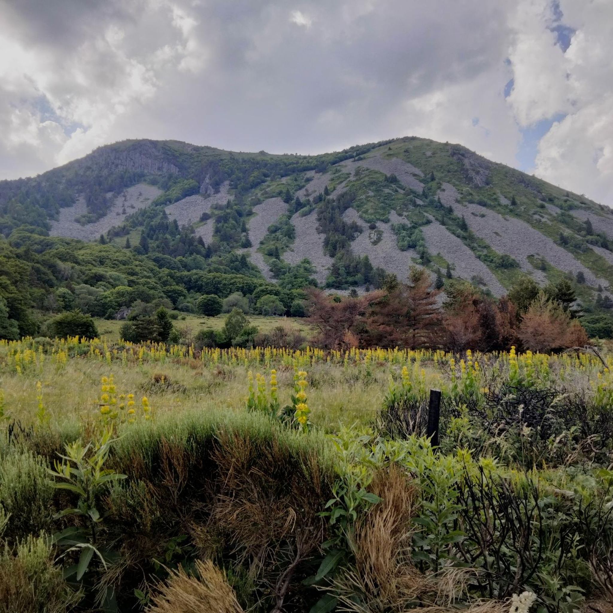
이 봉우리는 정상에 세워진 세 개의 십자가 덕분에 멀리서도 알아볼 수 있습니다. 그 경사면은 바위 자갈, 히스, 야생 블루베리로 덮여 있습니다. 능선에 위치한 덕분에 정상에서는 Sucs 산맥, Mont Gerbier de Jonc, Mont Mézenc의 360° 탁 트인 전망을 감상할 수 있으며, 맑은 날에는 알프스와 Mont Ventoux까지 보입니다.
0
0
Col du Montivernoux 1320m. Suc de Montivernoux 전설에 따르면 옛날에 같은 가족 출신의 독실한 목자 세 명이 살았습니다. 한 명은 Soutron에, 다른 한 명은 Lachamp-Raphaël에, 마지막 한 명은 Saint-Andéol-de-Fourchades에 살았습니다. 그들은 밤에 피우는 불을 통해 서로 소통했습니다. 어느 날 밤, Soutron에서는 불이 없었습니다. 다음 날, 목자는 바위 위에서 죽은 채 발견되었습니다. 그의 모범적인 삶을 기리기 위해 이 지역 주민들은 바위 위에 작은 예배당을 지었습니다. https://lachamp-raphael.fr/histoire-et-patrimoine/suc-de-montivernoux/
0
0
Located at an altitude of 1,330 meters, Lachamp-Raphaël is the highest village in the Ardèche. Dominated by the Montivernoux peak, the village offers exceptional panoramic views of the Alps and the Ardèche mountains. https://lachamp-raphael.fr/
0
0

Anyone who wants to stop for a bite to eat should stop here. There are few alternatives. A Grand Café Creme and a generous sandwich for 8 euros.
1
1
The Montivernoux peak is located in the Massif Central. It rises to an altitude of 1,441 meters in the Vivarais Mountains. It lies between the communes of Lachamp-Raphaël and Mézilhac. https://lachamp-raphael.fr/histoire-et-patrimoine/suc-de-montivernoux/
0
0
In the eastern foothills of the Massif Central, in a harsh climate, at an altitude of 1,380 meters, this former 17th-century farmhouse, built like a fortress in the heart of a windswept plateau, is now a must-see attraction located 3 kilometers from Mont Gerbier-de-Jonc. You'll admire its typical architecture, its 900 m² of phonolite slate roof (local volcanic slabs), its upside-down ship-shaped framework, and its impressive volumes (50 meters long and 10 meters wide). https://www.bourlatier.fr/FR/home.html
1
0
메질락 주변에서 가장 인기 있는 명소


더 살펴보기
다른 지역의 최고의 로드 사이클링 경로를 살펴보세요.
