コビルハのおすすめランニングルート
5.0
(1)
268
ランナー
35
ランニング
コビルハでランニングを楽しめば、このエリアをより深く知ることができます。ランニングに適した美しいルートが見つかるように、komootがコビルハでのルートのコレクション全体を評価して選び抜いた、人気ランニングトレイルをご紹介します。ルートをクリックして詳細を表示し、他のユーザーがアップロードした役立つ情報や写真を閲覧しましょう。
最終更新日: 10月 14, 2026
42
ランナー
25.5km
04:07
1,520m
1,520m
難しいジョギング. 標準以上のフィットネスレベルが必要です。 ほとんどが舗装路です。
33
ランナー
26.5km
03:50
1,040m
1,040m
難しいジョギング. 標準以上のフィットネスレベルが必要です。 安定して歩行できる技術、丈夫な靴、高標高地での登山経験が必要です。

22
ランナー
39.6km
05:11
1,230m
1,230m
難しいジョギング. 標準以上のフィットネスレベルが必要です。 ほとんどが走れる道です。足元への注意が少し必要です。
15
ランナー
47.9km
06:43
1,800m
1,800m
難しいジョギング. 標準以上のフィットネスレベルが必要です。 安定して歩行できる技術、丈夫な靴、高標高地での登山経験が必要です。
7
ランナー
7.07km
00:45
120m
120m
中程度のジョギング. ある程度のフィットネスレベルが必要です。 ほとんどが舗装路です。
さらに多くのルートや他のユーザーのおすすめ情報を確認できます。
すでにアカウントをお持ちですか?
おすすめのツアーは他のkomootユーザーが実際に経験した何千ものアクティビティに基づいています。
無料アカウントで今日から始めよう
次の冒険が待っています。


コミュニティからのヒント

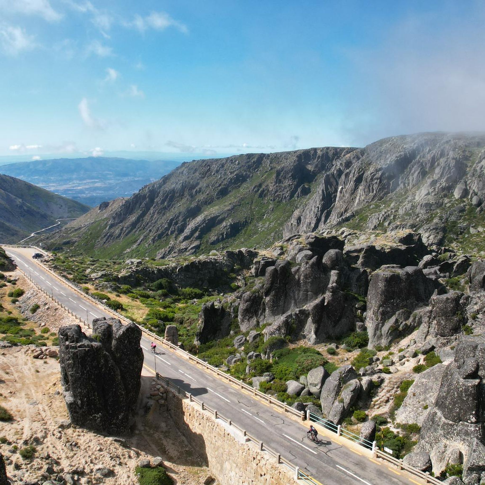
The Serra da Estrela Natural Park is something truly special. This 1,000-square-kilometer park, spread across six municipalities, was the first and currently the largest protected natural park in Portugal. It is home to the highest point on the Portuguese mainland, the country's only ski slope, the source of two important rivers, and a fascinating, alpine-like landscape formed by glaciers.
5
1

At exactly 1993 meters above sea level, Torre is the highest point in mainland Portugal, where the only ski resort is located. The landscape on the upper plateau of the Serra da Estrela is like a sprinkling of granite rocks over low scrub and patches of snow and ice, which the sun threatens to melt soon in the summer and which always returns the following winter. In winter, it sometimes becomes inaccessible.
6
0

Caminho dos Poios with views of the Vale Glaciar do Zêzere The Caminho dos Poios, or the "Poios" (agricultural terraces) Trail, offers spectacular views of the vast and imposing Vale Glaciar do Zêzere, a masterpiece of nature sculpted by ancient glaciers. This trail winds along the sides of the mountain, offering panoramic views that embrace the entire "U" valley, highlighting its grandeur and the singularity of the landscape. The route allows you to appreciate not only the glacial morphology with its steep walls and moraine deposits, but also the human ingenuity in adapting the territory, as evidenced by the terraces that characterize the landscape in some areas. It is an immersion in the wild beauty of the Serra da Estrela, with the opportunity to contemplate one of its most significant geological treasures.
2
0

This trail is short in distance but huge in challenge. Known as the vertical kilometre of Alvoco, it takes you to conquer a thousand metres of elevation in less than four kilometres, a real climb towards the top of Serra da Estrela. However, it is not at all technically difficult. Each step is demanding, but from the first metres, the reward is the breathtaking views.
4
0
The Lagoa do Peixão, sculpted by ice from ancient times, has an almost mystical aura. In spring, the spectacle becomes even more mesmerizing, with thousands of dragonflies dancing on the water, while tree frogs croak on the edge of the lake, composing a perfect natural symphony. The view from here is breathtaking. The imposing rocky peaks of Fragão do Poio dos Cães and Cântaro Gordo emerge on the horizon, reminding you of the ancient glaciers that once shaped this stunning landscape.
4
0

Beautiful panoramic views from the highest point in Portugal. You can ski here in winter, and there is sometimes snow even in summer.
4
0

Magnificent scenery. Be careful, the trails are very poorly marked and not at all maintained. The part of the trail between Luguna do Peixão and the valley leading to Mantega must be done almost exclusively using GPS.
1
0
We were lucky with the weather, bright sunshine. There was still a lot of snow in May, children were able to borrow a bobsleigh and play in the snow. At a cool 8°C!!
10
3

komootモバイルアプリでインスピレーションを得よう


さらに探索
他の地域の最高のランニングトレイル & ルートを見てみましょう。
