オスタームンディゲンのおすすめウォーキング&ハイキングルート
4.5
(25)
256
ハイカー
25
ハイキング
オスタームンディゲン周辺でのハイキングは、景色を満喫するのに最適な手段のひとつですが、適切なハイキングルートを見つけることは簡単ではありません。 オスタームンディゲン周辺の人気ハイキング&ウォーキングコースを参考にすれば、行きたいルートをすぐに見つけられます。
最終更新日: 9月 3, 2026
4.4
(7)
60
ハイカー
11.4km
03:15
260m
260m
中程度のハイキング. ある程度のフィットネスレベルが必要です。 進みやすいルートです。あらゆるスキルレベルに適しています。
3.7
(3)
39
ハイカー
5.43km
01:32
110m
110m
初級者向けハイキング. あらゆるフィットネスレベルに適しています。 進みやすいルートです。あらゆるスキルレベルに適しています。

無料新規登録
7
ハイカー
6.13km
01:49
180m
180m
初級者向けハイキング. あらゆるフィットネスレベルに適しています。 進みやすいルートです。あらゆるスキルレベルに適しています。
5.0
(2)
26
ハイカー
9.45km
02:34
130m
130m
中程度のハイキング. ある程度のフィットネスレベルが必要です。 進みやすいルートです。あらゆるスキルレベルに適しています。
5.0
(3)
17
ハイカー
11.7km
03:41
450m
450m
中程度のハイキング. ある程度のフィットネスレベルが必要です。 進みやすいルートです。あらゆるスキルレベルに適しています。
さらに多くのルートや他のユーザーのおすすめ情報を確認できます。
無料新規登録
すでにアカウントをお持ちですか?
おすすめのツアーは他のkomootユーザーが実際に経験した何千ものアクティビティに基づいています。




コミュニティからのヒント

This forest path is used by both runners and bikers. So if you're on foot, keep your eyes and ears open.
0
0

I do this tour every now and then; it's always lovely.
0
0

At 1000 meters above sea level, it's often sunny even in foggy conditions. See https://nebelkarte.ch for more information.
0
0

The arcades of Bern are one of the most distinctive features of Bern's UNESCO-protected Old Town. Brief description: * What are they? They are covered, arcade-like walkways that extend along the main streets of the Old Town at ground level. * Length: With a total length of approximately six kilometers, they form one of the longest weather-protected shopping promenades in Europe. * Origin: The arcades were created after the devastating city fire of 1405 during the reconstruction of the city using sandstone. The houses were extended forward, narrowing the alleyways and creating the arcades. * Purpose: Originally, they served as covered work and sales areas for craftsmen and merchants. Today, they protect pedestrians and shoppers from rain, snow, and sun while strolling and house numerous boutiques, cafés, and shops, often with adjoining vaulted cellars. * Architecture: They are typical of Bern's medieval sandstone buildings and contribute significantly to the distinctive charm of the old town.
2
0
Bern's Old Town has been a UNESCO World Heritage Site since 1983 and is undoubtedly an absolute highlight. The arcades with their diverse shops and cafés, as well as the small, charming alleys, invite both a short stop and a longer visit. World-famous sights such as the Federal Palace, the Minster, the Zytglogge Tower, and the Bear Pit are also just a few minutes away. Good information about the Old Town can also be found on Bern's website: https://bern.com/de/erleben/attraktionen/sehenswuerdigkeiten/berner-altstadt
0
0

Easily accessible on foot, gravel bike or mountain bike.
0
0

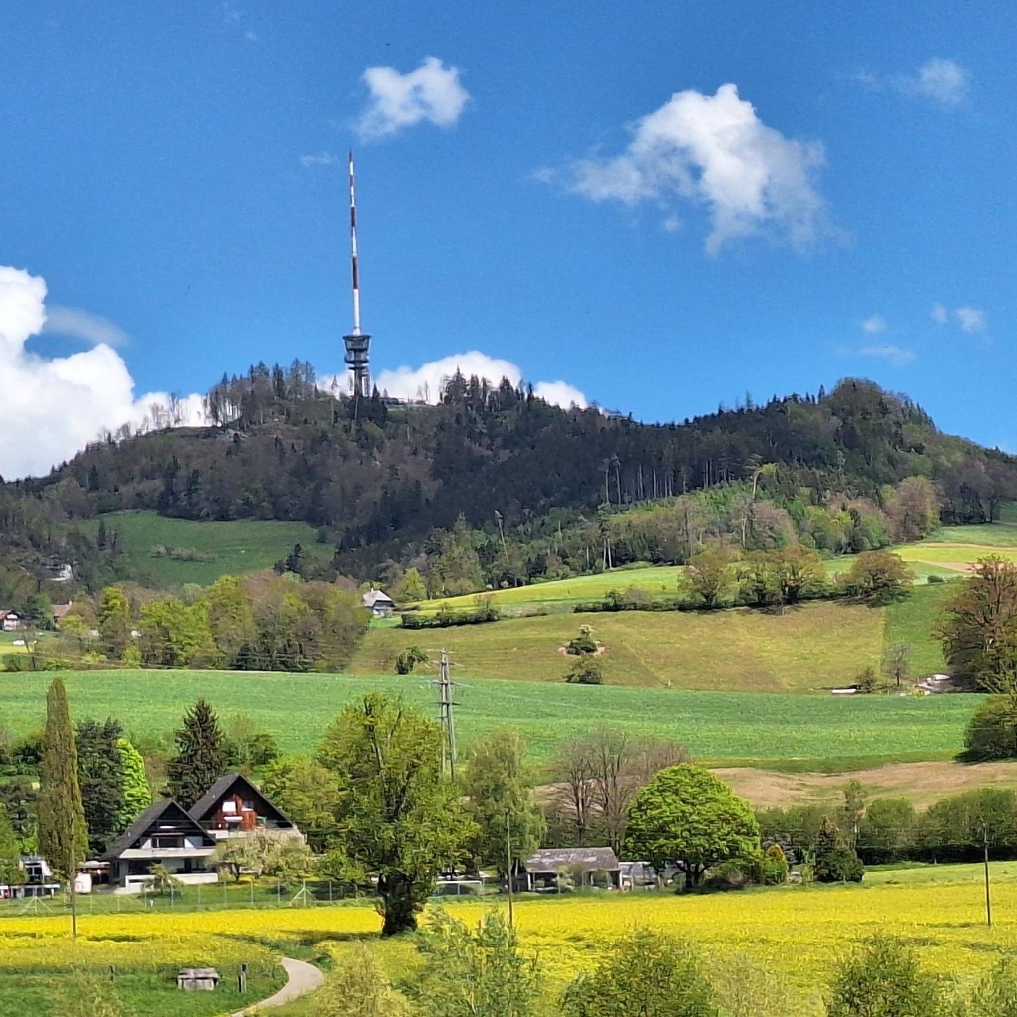
🏔️ Bantiger – Bern's local mountain with panoramic views 🌟🚶♂️ The Bantiger (947m) is located northeast of Bern and is a popular destination for hikers, bikers, and walkers. From its striking radio tower with viewing platform, you can enjoy a fantastic 360° panoramic view – from the Jura Mountains to the Bernese Alps! 🥾 Highlights: Easy ascent from Stettlen, Deisswil, or Ferenberg Observation tower: Free access to the platform below the transmission tower – incredible views of the Eiger, Mönch, and Jungfrau 🏔️ Pure nature: Quiet paths through forests and fields – ideal for a relaxing hike 🌳 Accessible all year round – a lovely place for a stroll even in winter ❄️ 🚴♀️ Also very popular with mountain bikers – with rewarding uphills and fast descents! 📍 Tip: Best in clear weather – the view is simply unbeatable! 🔭🌞
1
1

Great all-round view in all directions
1
0
オスタームンディゲンでのの人気観光スポット

komootモバイルアプリでインスピレーションを得よう


さらに探索
他の地域の最高のハイキングを見てみましょう。
