シュロップシャー周辺のおすすめファミリーハイキング&ウォーキング
4.6
(3706)
27,740
ハイカー
1,119
ハイキング
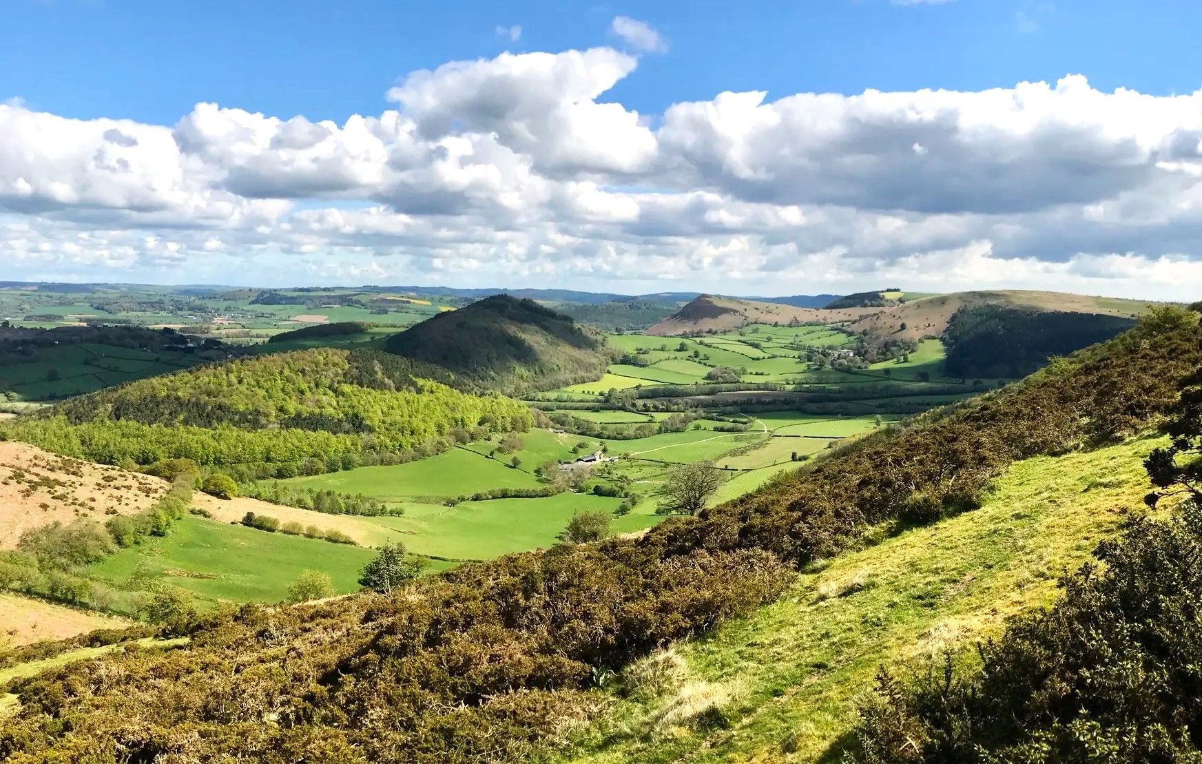
Shropshireの家族向けハイキングトレイルは、Shropshire Hills National Landscapeを含む多様な自然景観によって特徴づけられる地形を横断します。この地域には、ヒースランドの高原、古代の森、そして顕著な石英岩の尾根があります。Long Myndのような主要なエリアからは広大な景色と深い谷が望め、Wenlock Edgeは典型的な石灰岩の断崖を呈しています。変化に富んだ地形は、家族連れに様々なアウトドア体験を提供します。
Shropshireの家族向けハイキングトレイル ベスト
- 最も人気のある家族向けハイキングルートは、カーディング・ミル・バレーからのライトスポート・ホロウ滝 — シュロップシャー・ヒルズで、距離1.9マイル(3.1 km)、所要時間約1時間です。この簡単な小道は、風光明媚な谷の中にある絵のように美しい滝へと続いています。
- 地元のハイカーに人気のもう一つのルートは、カーディング・ミル・バレー&ライトスポート滝ループ — コッツウォルズで、距離4.1マイル(6.6 km)の中程度の難易度のトレイルです。このルートは谷を探検し、ライトスポート滝に到達し、変化に富んだ地形を提供します。
- 地元のハイカーに愛されているのは、ポール・バンク経由ロング・マインド・ループ — シュロップシャー・ヒルズで、距離9.0マイル(14.5 km)のトレイルは、ヒースランドの高原と谷を通り抜け、所要時間は約4時間です。
- Shropshireでのハイキングは、ヒースランドの高原、古代の森、石灰岩の断崖によって特徴づけられます。このネットワークは、穏やかな散歩からより挑戦的なルートまで、様々なレベルの能力に対応するオプションを提供します。
- Shropshireのルートは、3000件以上のレビューから平均4.5つ星の評価を得ており、komootコミュニティから高く評価されています。25,000人以上のハイカーがkomootを利用して、Shropshireの多様な地形を探検しています。
最終更新日: 10月 14, 2026
4.8
(67)
706
ハイカー
6.66km
02:06
270m
270m
Embark on the Carding Mill Valley & Lightspout Waterfall loop, a moderate hike in the Shropshire Hills Area of Outstanding Natural Beauty. This 4.1-mile (6.7 km) route features a sometimes challenging ascent, gaining 881 feet (268 metres) in elevation, and typically takes about 2 hours and 6 minutes to complete. You will follow a stream uphill through a lush valley, navigating narrow footpaths and rocky sections with crude stone steps. The highlight is the 4-meter Lightspout Waterfall, particularly impressive after rain, and from higher points on the Long Mynd, you can enjoy expansive views across Shropshire, Cheshire, and even the Black Mountains.
To begin your hike, head to Carding Mill Valley, which offers convenient visitor amenities. You will find parking, toilets, and a tea-room available, making it a comfortable and well-equipped starting point for your adventure. The trail is not recommended for wheelchairs or individuals with limited mobility due to its narrow paths and inclines, so be prepared for varied terrain.
This trail is a fantastic gateway to exploring the wider Shropshire Hills and the heather-covered Long Mynd. The area boasts a diverse ecosystem, rich in geological interest, rare plants, and abundant wildlife like stonechats and red kites. The Long Mynd itself is a historical upland heath, dotted with archaeological remains from the Bronze Age, Iron Age, and Medieval times, adding a layer of historical depth to your scenic journey.
4.8
(31)
144
ハイカー
20.1km
05:52
530m
530m
Embark on The Stiperstones Circular, a difficult 12.5-mile (20.1 km) hike that takes you through the wild and atmospheric Stiperstones National Nature Reserve. You will gain 1727 feet (526 metres) in elevation, requiring an estimated 5 hours and 52 minutes to complete. The route features a dramatic ridge of shattered quartzite tors, including the iconic Devil's Chair, offering rugged terrain and expansive views across the Shropshire Hills and into Wales.
Planning your visit requires good preparation; ensure you wear sturdy footwear due to the rocky and uneven conditions underfoot. Parking is available at the trailhead, and you can find essential facilities like refreshments, local information, and toilets at the nearby Bog Visitor Centre. Consider starting early to allow ample time to enjoy the challenging terrain and the unique landscape.
This trail is notable for its distinctive geology and rich wildlife. As you traverse the ridge, keep an eye out for local birdlife such as red grouse and buzzards soaring overhead. The Stiperstones area is a unique natural environment, making this circular route a memorable adventure for experienced hikers seeking a challenging and rewarding day out in the Shropshire Hills.

4.8
(31)
116
ハイカー
18.4km
05:34
610m
610m
Embark on a difficult 11.4-mile (18.4 km) hike through the Shropshire Hills, a journey that typically takes around 5 hours and 33 minutes to complete. This challenging loop features a significant elevation gain of 2011 feet (613 metres), leading you through varied terrain from easily accessible paths to narrow footpaths and rocky ascents. You will discover the impressive 4-meter Lightspout Waterfall, especially vibrant after rain, and traverse the glorious heather ridge of the Long Mynd, offering expansive views.
Planning your visit, be aware that this route is considered hard and requires very good fitness due to its length and considerable climbing. The trail can be slippery near the waterfall, particularly after wet weather, so wear appropriate footwear. While the research doesn't specify parking or public transport details, Church Stretton serves as a common starting point for walks in the area, including the scenic Carding Mill Valley managed by the National Trust.
This loop is notable for combining several iconic features of the Shropshire Hills into one demanding yet rewarding adventure. You will reach Pole Bank Summit, the highest point on the Long Mynd ridge, which provides spectacular views, especially west into Wales on a clear day. The area is also home to diverse wildlife, including stonechats and red kites, adding to the natural appeal of this challenging route.
4.7
(22)
109
ハイカー
14.5km
04:03
290m
290m
Embark on the Bridges & Long Mynd loop via Pole Bank, a moderate hike covering 9.0 miles (14.5 km) with an elevation gain of 938 feet (286 metres), typically taking around 4 hours and 3 minutes to complete. This route offers a challenging yet rewarding experience through varied terrain, from stony tracks to grassy paths, as you ascend to the Long Mynd. You will find expansive views, especially from Pole Bank, the highest point, where 360-degree panoramas stretch towards Wales on a clear day. The Long Mynd itself features glorious heather ridges and undulating hills, often adorned with seasonal wildflowers.
The trail is generally considered challenging, requiring good fitness, though its moderate difficulty means steep sections are often not prolonged. Be prepared for a mix of stony tracks and grassy paths, with some public rights of way potentially being muddy or involving a shallow ford. Carding Mill Valley, managed by the National Trust, is a popular area that provides facilities like a car park, information center, and cafe, making it a convenient starting point. If you are looking for refreshments or accommodation, The Bridges Pub in the village of Bridges is a well-regarded, hiker-friendly stopping point.
This loop takes you to Pole Bank, which at 516 meters (1693 feet) is the highest point on the Long Mynd, offering unrivaled panoramic vistas across the Shropshire Hills National Landscape. The Long Mynd is an expansive 7-mile-long heathland plateau, renowned for its diverse terrain and natural beauty. You will also traverse The Portway, an ancient trackway that forms part of the Shropshire Way, providing spectacular views. Keep an eye out for semi-feral ponies and sheep, which contribute to the wild and open feel of the Mynd.
4.8
(8)
87
ハイカー
3.13km
01:01
150m
150m
This easy hike to Lightspout Hollow waterfall from Carding Mill Valley is a picturesque journey through varied terrain in the Shropshire Hills. The 1.9-mile (3.1 km) route, with an elevation gain of 480 feet (146 metres), takes about 1 hour and 1 minute to complete. You will follow footpaths, navigating a fun, rocky ascent through Lightspout Hollow, which features crude pitched stone steps and rocky paths that can be slippery near the 4-meter cascade. Along the way, enjoy views of the Long Mynd, heather-covered landscapes, and a stream, keeping an eye out for wildlife like stonechats and red kites. Every turn offers beautiful scenery with small falls and babbling brooks.
Starting in Carding Mill Valley, this trail is generally considered easy and suitable for most skill levels. The area is managed by the National Trust, providing well-maintained paths and convenient facilities. You will find a visitor center, a cafe, and a car park at the trailhead, making it an accessible starting point for your adventure. While the direct path to the waterfall is easy, some sections of the ascent can be challenging due to the rocky nature of the trail.
The Lightspout Waterfall is the highlight, a 4-meter cascade that is especially impressive after heavy rainfall. Located within the Shropshire Hills Area of Outstanding Natural Beauty, the trail showcases diverse geological features and a rich ecosystem. The National Trust's management ensures the preservation of this beautiful landscape. For those seeking a longer challenge, you can extend your hike to higher points like Pole Bank, the highest point on the Long Mynd, for panoramic views of the surrounding area.
さらに多くのルートや他のユーザーのおすすめ情報を確認できます。
すでにアカウントをお持ちですか?
おすすめのツアーは他のkomootユーザーが実際に経験した何千ものアクティビティに基づいています。
無料アカウントで今日から始めよう
次の冒険が待っています。
シュロップシャー周辺で人気





シュロップシャーでのの他の冒険


コミュニティからのヒント

ケーキ、サンドイッチ、軽食が利用可能なカフェ
0
0
初めて歩きました - 素晴らしい緩やかな登り(または下り)。丘の襞を縫って小川に沿っています。
0
0

Devil's Chair 529.2m P9.7 Shropshire National Landscape Definitive List summit.
0
0

Be willing to climb to the trig point as it’s placed on top of the summit rock.
0
0

Rocky path. It is by and large stable so shouldn't cause too much of an issue but some care is required.
2
0


The Devil's Chair is a prominent rock formation located on the Stiperstones ridge in the Shropshire Hills. The ridge is part of the Stiperstones National Nature Reserve and is known for its jagged quartzite rocks, of which the Devil's Chair is the most famous. It stands at around 536 meters and offers sweeping views of the surrounding countryside, including the Welsh borderlands and the Shropshire plains.
1
0

Even when the flowers are not blooming, the landscape is spectacularly beautiful.
0
0
よくある質問
Shropshireには、家族向けのハイキングコースはいくつありますか?
シュロップシャーには、素晴らしい家族向けのハイキングコースが豊富にあります。1100以上のルートがあり、様々な年齢や体力レベルに適しています。そのうち約500は、特に簡単なコースとして分類されており、家族連れに最適です。
Shropshireには、ベビーカーでも利用できる簡単な散策コースはありますか?
はい、シュロップシャーにはベビーカーや車椅子でも利用しやすいアクセスルートがいくつかあります。カーディング・ミル・バレーやオニー・メドウズ(シュロップシャー・ヒルズ・ディスカバリー・センター内)は、美しい景色の中を穏やかな小道で散策できる素晴らしい選択肢です。
Shropshireで、滝のある家族向けの散策コースはありますか?
滝のある思い出に残る家族のアドベンチャーには、カーディング・ミル・バレー周辺のコースを検討してみてください。ライトスポート滝までのルートは特に人気があります。簡単なオプションとして、カーディング・ミル・バレーからのライトスポート・ホロウ滝を探索したり、少し長めのカーディング・ミル・バレー&ライトスポート滝ループを楽しむことができます。
Shropshireには、周回コースの家族向け散策コースはありますか?
もちろんです!シュロップシャーの家族向けルートの多くは周回コースになっており、同じ場所からスタートしてゴールできます。ポール・バンク経由のブリッジ&ロング・マインド・ループは、素晴らしい景色を楽しめる中程度の周回コースです。また、カー・カレドックやホープ・ボウドラー・ヒルにも、パノラマビューを楽しめる周回コースがあります。
Shropshireでの家族ハイキングでは、どのような景色が期待できますか?
シュロップシャーの多様な景観は、息をのむような様々な景色を楽しめることを意味します。ロング・マインドの広大なヒースランドから郡全体の眺望、スティパー・ストーンズのドラマチックな石英岩の奇岩、そしてパノラマビューが約束されるウェキン山への象徴的な登りまで、常に壮観なものがあります。ウェンロック・エッジも、その連続する森林地帯に神秘的な眺めを提供しています。
Shropshireの家族向けハイキングコースは、犬同伴可能ですか?
シュロップシャーの多くのコースは犬同伴可能ですが、特にシュロップシャー・ヒルズ国立景観のオープンアクセスランドではそうです。しかし、野生動物を保護し安全を確保するため、家畜の近くやスティパー・ストーンズのような自然保護区では、常にリードにつないでおくのが最善です。利用可能な場合は、常に特定のコースのガイドラインを確認してください。
家族ハイキング中に見られる、興味深いランドマークやアトラクションはありますか?
シュロップシャーは歴史と自然の美しさに恵まれています。ハイキング中には、ロング・マインドのポートウェイやボドベリー・リングの丘陵砦のような古代の遺跡や、ウェキン山の印象的な鉄器時代の丘陵砦に出会うかもしれません。スティパー・ストーンズ・サミットのギザギザした石英岩の奇岩、有名なデビルズ・チェアなども魅力的です。ユニークな体験としては、自然の美しさで多くの家族向けルートのハブとなっているカーディング・ミル・バレーがおすすめです。
家族向け散策コースの登山口に駐車場はありますか?
はい、シュロップシャーの家族向け散策コースの人気の出発点には、通常駐車場があります。例えば、多くの家族向けルートのハブであるカーディング・ミル・バレーには専用の駐車場があります。「ウォーカーズ・アー・ウェルカム」に指定されている多くの町でも、地元のトレイルにアクセスするための便利な駐車場が提供されています。
公共交通機関でShropshireの家族向けハイキングコースにアクセスできますか?
はい、一部のハイキングエリアには公共交通機関でアクセスできます。チャーチ・ストレトン、ビショップス・キャッスル、クラン、マチ・ウェンロックなどの町は交通の便が良く、周辺の田園地帯を探索するための素晴らしい拠点となります。これらの「ウォーカーズ・アー・ウェルカム」の町では、中心部から直接アクセスできる整備された散策路が多く、車がなくても便利です。
他のハイカーは、Shropshireでの家族ハイキングで最も楽しんでいる点は何ですか?
komootコミュニティでは、シュロップシャーでのハイキングは平均4.5つ星と高く評価されています。レビューでは、この地域の多様で印象的な自然景観、あらゆる年齢層に適した整備されたトレイル、そして豊富な野生動物観察の機会がしばしば称賛されています。ロング・マインドやウェキン山のような著名な丘からの素晴らしい眺めは、お気に入りの点として頻繁に挙げられています。
Shropshireでの家族ハイキングに最適な時期はいつですか?
シュロップシャーは一年中美しいですが、特に春と秋が家族ハイキングに快適です。春は野花が咲き、気温も穏やかになります。秋は紅葉が素晴らしいです。夏も素晴らしいですが、トレイルが混雑することがあります。冬でも、澄んだ空気とユニークな景色で魔法のようですが、寒い時期やぬかるんだ道に備える必要があります。

komootモバイルアプリでインスピレーションを得よう


探していたものは見つかりませんでしたか?
シュロップシャーの下にある他のハイキングをチェックして、目的地で完璧なルートを見つけましょう。
さらに探索
他の地域の最高のハイキングを見てみましょう。
