Περισυνάκη - Αγριοκεφάλα - Μανίκα Δήμου Σφακίωνの峠・トップ2
Les cols de montagne de Περισυνάκη - Αγριοκεφάλα - Μανίκα Δήμου Σφακίων traversent un paysage montagneux accidenté au sein des Montagnes Blanches (Lefka Ori) de Crète. Cette région se caractérise par ses paysages spectaculaires, ses gorges profondes et ses divers itinéraires de montagne. La région offre des parcours avec des dénivelés importants et des vues panoramiques, s'étendant des montagnes à la mer de Libye. Elle offre des opportunités d'explorer des terrains difficiles et de découvrir les caractéristiques naturelles de Sfakia.
…最終更新日: 8月 29, 2026
カリクラティス峠
ハイライト • 山道
役立つ情報 は

アノギア近くの峠
ハイライト • 山道
Quäldich Pass Description:
Anyone traveling from the Rethymnon area towards the Imbros or Kallikratis-Kapsodasos Passes must first conquer the Bourolos Pass, unless they choose a longer detour via Sellia along the south coast of Crete.
翻訳者 Google •
役立つ情報 は

今すぐサインアップして、こんな場所を発見しよう
最高のシングルトラック、ピーク、その他のエキサイティングなアウトドアスポットのおすすめを受け取ろう。
無料新規登録
フランゴカステロと海岸平野の眺め
ハイライト • 展望台
翻訳者 Google •
役立つ情報 は

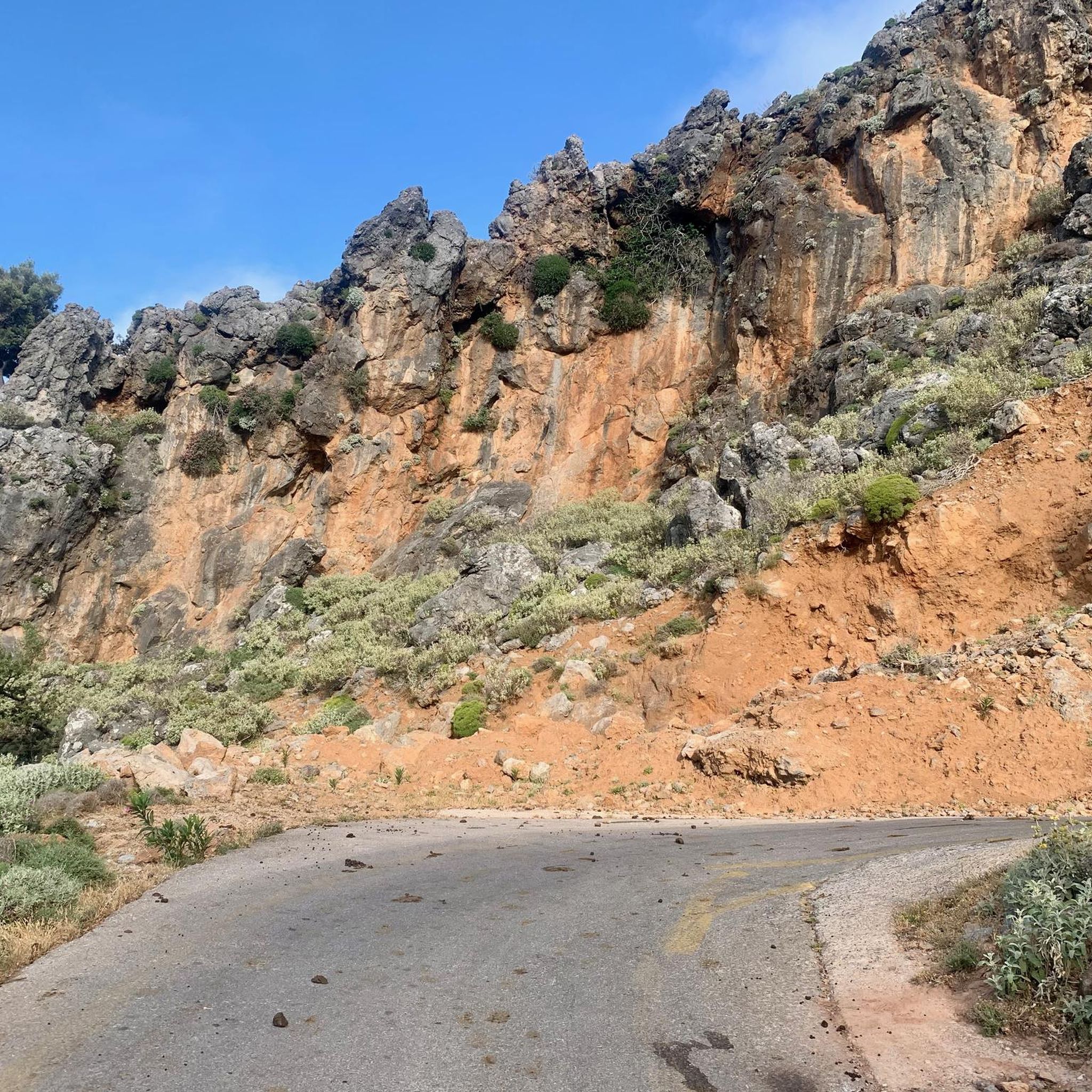
険しい山岳地帯を通るグラベルロード
ハイライト (セグメント) • トレイル
役立つ情報 は

無料アカウントで今日から始めよう
次の冒険が待っています。
ログインまたは登録
Περισυνάκη - Αγριοκεφάλα - Μανίκα Δήμου Σφακίων周辺で人気
コミュニティからのヒント

The road is beautifully laid out, has wonderful views, and is not very busy, but with gradients of up to 19%, it's not for everyone ;-)
0
0

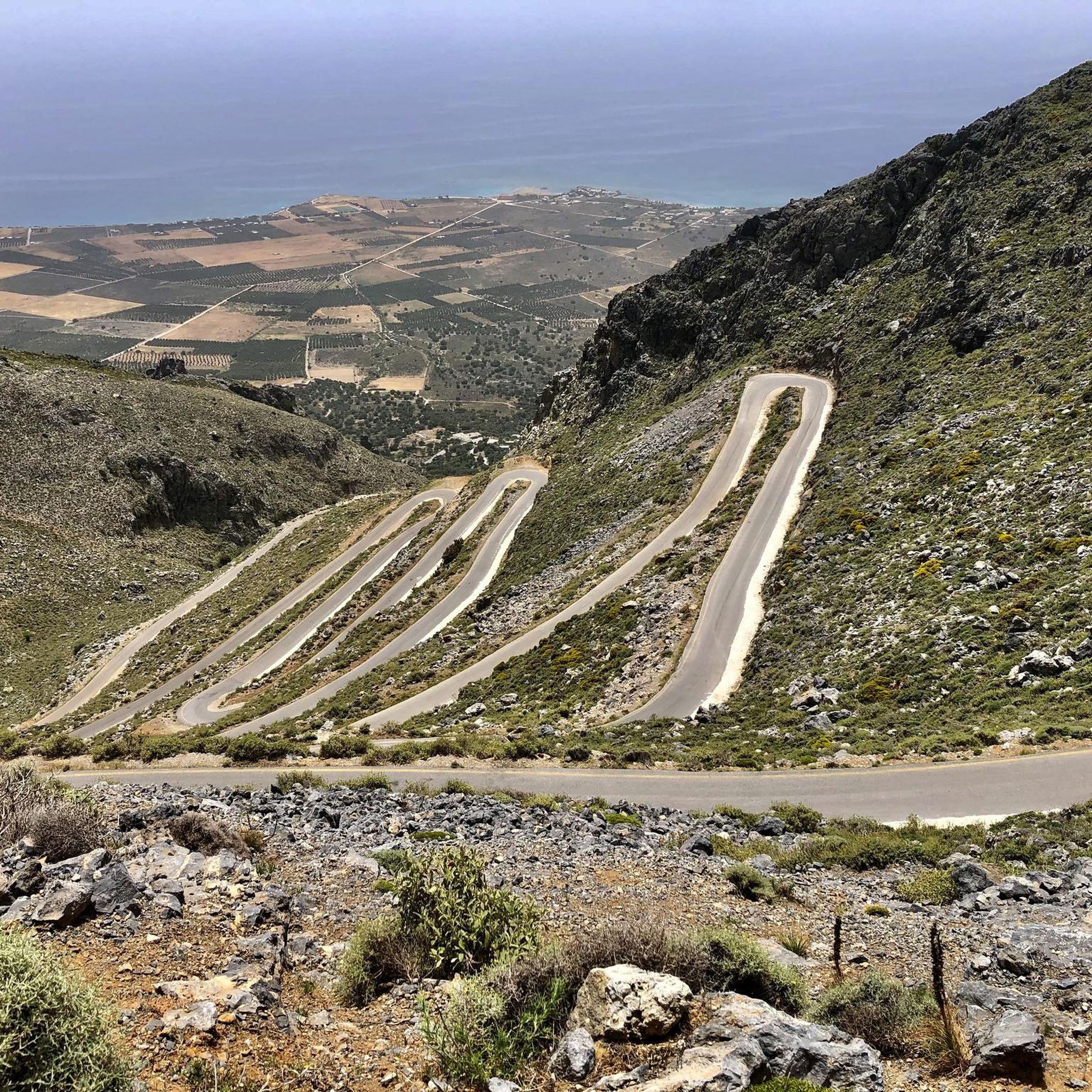
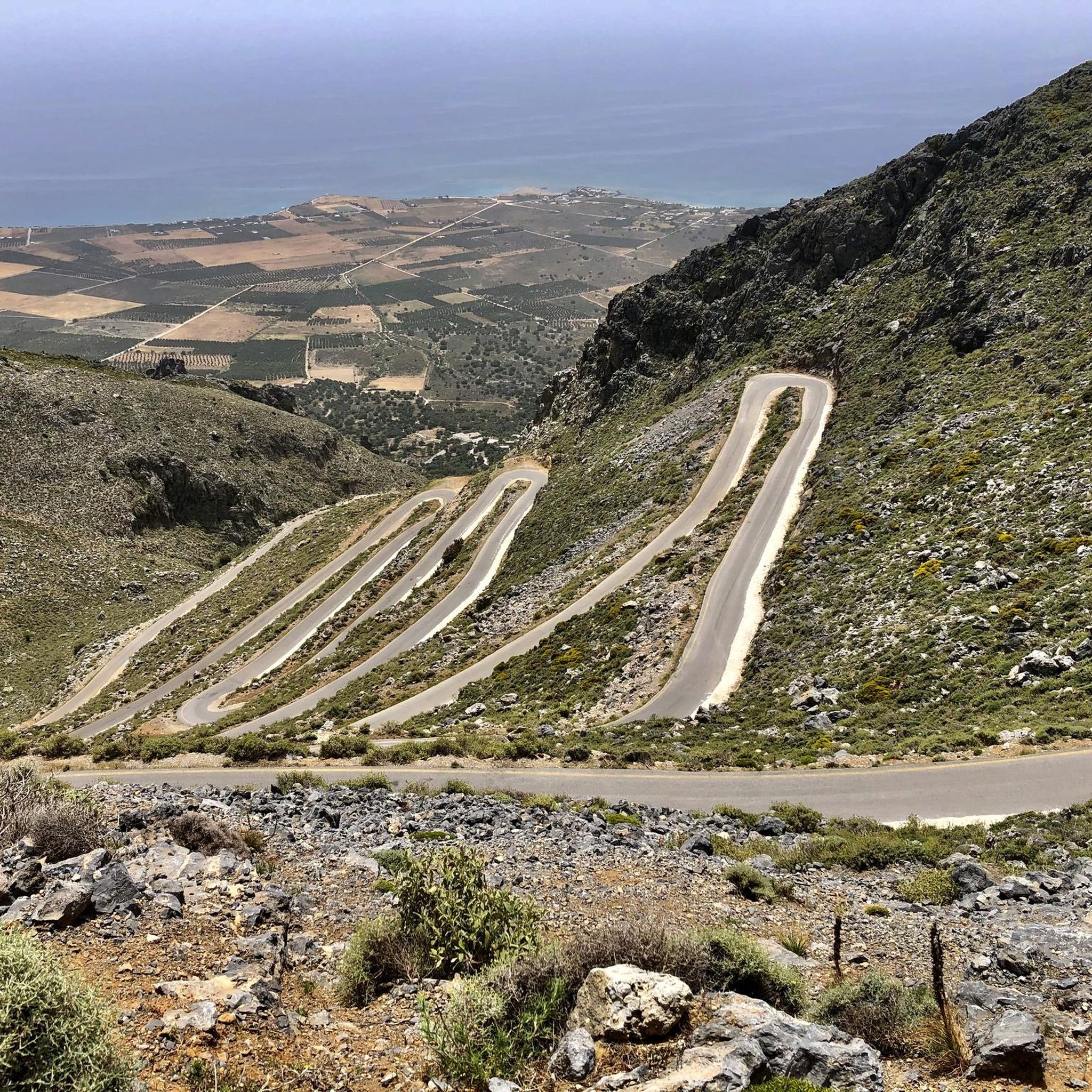
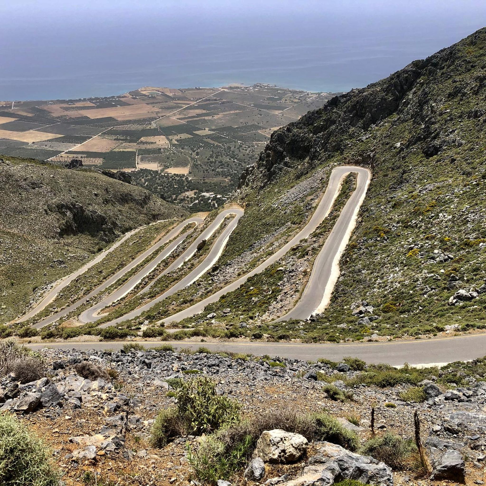
Quäldich Pass Description: Southern Ascent from Kapsodasos 6.7 km | 643 m elevation gain | 9.6% (~10.4%) The southern ascent begins in the village of Kapsodasos at an altitude of approximately 100 m. The turnoff to Kallikratis is signposted (as of 2018 on a very weathered sign). The route initially heads north for a little over half a kilometer before a veritable hairpin bend festival unfolds over the next five kilometers. The road winds its way up a barren rocky slope via a total of 27 hairpin bends. There is virtually no vegetation along the route, which has its own charm and offers consistently wonderful views, especially of the hairpin bends already conquered and the Libyan Sea shimmering in the distance. The gradient is inconsistent over these first 5.5 kilometers, averaging just over 10%, but quite steep. In addition to battling the steep incline, the author also encountered a rather strong headwind on the ascent, which swept down the slope and added to the effort. After completing the switchbacks, the worst is over, and the route continues relatively flat for half a kilometer northwards before the remaining 700 meters to the highest point of the route, where the final meters of elevation gain must be conquered at a manageable gradient. Once at the top, the route descends for about a kilometer, followed by a gentle climb of almost three kilometers towards Kallikrátis. From there, however, more elevation gain awaits, as one must either tackle the easy western ascent to the Bourolos Pass or the 560-meter climb of the eastern ascent to the Asfendos Pass. Northern Ascent 1 km | 64 m elevation gain | 6.4% (~8.8%)
0
0
Quäldich Pass Description: The Kallikratis-Kapsodasos Pass lies not far from the south coast of Crete, between Kapsodasos and Kallikratis. As is often the case in Crete, there is unfortunately no pass sign and therefore no official name for the crossing. It is also not marked on local maps. The owner of Olympic Bike in Rethymnon informed the author that the crossing is known locally as the Kapsodasos Pass, or simply Kapsodasos Pass, based on the starting point of the southern ascent. Elsewhere, it is referred to as the Kallikratis Climb. We cannot and do not wish to commit to a definitive name. This is not a pass in the conventional sense, as the road does not connect two valleys, but rather leads from the south coast parallel to a gorge, climbing a slope into the island's interior. However, like a pass, it does cross a high point. Consequently, the southern ascent can involve a considerable amount of elevation gain, while the northern ascent involves only a slight difference in altitude. As of 2018, the entire route is in excellent condition and has a much better road surface than the surrounding roads. Only in the lower section of the southern approach were there occasionally some stones on the road, which only required extra caution on the descent. Furthermore, the road is mostly single-lane, hardly used, and therefore a real pleasure to drive.
0
0
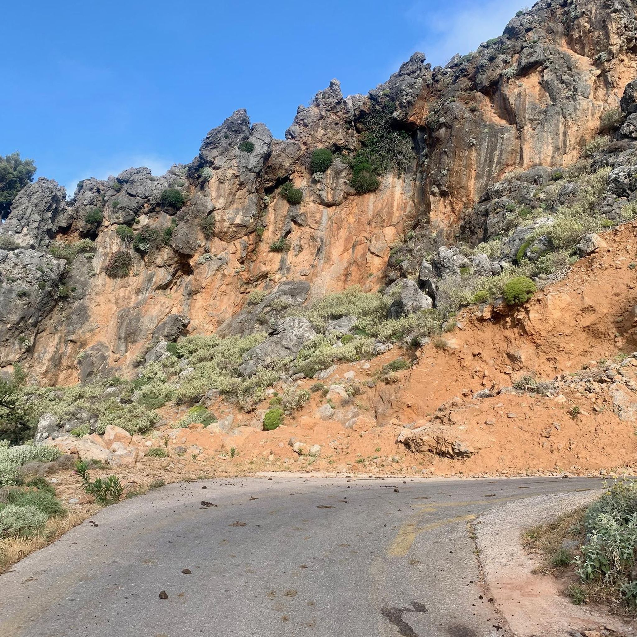
Bourolos Pass 818 m Quäldich Pass Description: Anyone traveling from the Rethymnon area towards the Imbros or Kallikratis-Kapsodasos Passes must first conquer the Bourolos Pass, unless they choose a longer detour via Sellia along the south coast of Crete. The pass runs roughly west-east, with two ascents from the east. The southern ascent offers several options at the beginning. The eastern ascents are quite scenic, while the pass summit itself is barren and unspectacular.
0
0

Great area great landscape
1
0

In fact, this "pass" isn't the highest point; it only looks that way. After a short descent, the climb continues for another 100 meters before reaching Kallikratis.
1
1

The view of Francocastello and its coastal plain is quite striking.
0
0

In case you plan to combine this one with the Imbros Pass in one tour, I would recommend to go Imbros downhill and Kallikratis uphill. There is lots of stones and sometimes fine Gravel/Sand on the road which makes descending at speed dangerous.
2
2
よくある質問
ペリシュナキ - アグリオケファラ - マニカ・ディム・スファキオンで最も注目すべき峠は何ですか?
この地域にはいくつかのドラマチックなルートがあります。カリクラティス峠は、その挑戦的なヘアピンカーブと息をのむような景色で特に有名で、アルプスの道路と比較されることもあります。もう一つの重要なルートは、アノギア近郊の峠(ブーロロス峠としても知られる)で、荒涼とした頂上にもかかわらず、風光明媚な東向きの登りを提供します。
この地域の峠からはどのような景色が期待できますか?
ペリシュナキ - アグリオケファラ - マニカ・ディム・スファキオンの峠からは、連続したパノラマビューが楽しめます。険しい白山脈(レフカ・オリ)、深い渓谷、そしてきらめくリビア海の見事な眺めが期待できます。フランゴカステロと海岸平野の眺めや、フランゴカステロ平野を見下ろすカリクラティス峠のようなハイライトからは、海岸線と下の蛇行する道路の印象的な眺めが得られます。
ペリシュナキ - アグリオケファラ - マニカ・ディム・スファキオンの峠には、挑戦的なサイクリングルートはありますか?
はい、この地域は挑戦的なサイクリングに最適です。カリクラティス峠は、その完璧なヘアピンカーブと急勾配でロードサイクリストの間で有名で、平均勾配10%の区間もあります。険しい山岳風景の中のグラベルロードのようなルートもあり、特に上り坂では、非現実的で挑戦的な体験を提供します。
これらの峠の近くにはどのようなハイキングの機会がありますか?
これらの峠周辺を含む、より広いスファキア地域には、数多くのハイキングコースが網の目のように張り巡らされています。ヨーロッパのハイキングフットパスE4もスファキアの山々を横断しています。簡単な散策からより困難なトレッキングまで、さまざまなルートを見つけることができます。例えば、カプソダス近郊の「聖ヨハネ洗礼者ヨハネ教会 – ヴィグレスタベルナのループ」のような簡単なハイキングや、インブロスからの「峡谷の狭い通路 – 峡谷の最も狭い地点のループ」のようなより困難なハイキングがあります。この地域の簡単なハイキングやバス停からのハイキングのガイドで、さらに多くのハイキングオプションをご覧ください。
ペリシュナキ - アグリオケファラ - マニカ・ディム・スファキオンの峠を訪れるのに最適な時期はいつですか?
一般的に、春(4月~5月)と秋(9月~10月)が最適な時期です。これらの期間は、サイクリングやハイキングなどのアウトドアアクティビティに快適な気候で、特に風景が鮮やかになります。夏は、特に低地では非常に暑くなることがあり、冬は白山脈の標高の高い山頂に雪が降ることがあり、一部の峠へのアクセスが困難になる可能性があります。
峠の近くに家族向けの活動やルートはありますか?
多くの峠は険しい地形を提供していますが、より広いスファキア地域には家族に適したオプションもあります。当社の簡単なハイキングガイドに記載されているような、近くのエリアにある簡単なハイキングコースを探してみてください。これらは、極端な難易度なしに自然の美しさを楽しむ機会を提供することがよくあります。カリクラティス峡谷のような峡谷にも、特定の区間によっては家族が探索できる、よく整備された道があります。
この山岳地帯にはどのようなユニークな自然の特徴がありますか?
この地域は、深い渓谷や険しい山岳景観を含む劇的な地質が特徴です。カリクラティス渓谷と有名なイムブロス渓谷は、印象的な岩石の形成と狭い通路で知られています。この地域は白山脈(レフカ・オリ)の一部であり、大きな高低差と多様な動植物相を持つ、ありのままの未開の美しさを提供しています。
ペリシュナキ - アグリオケファラ - マニカ・ディモ・スファキオンの山岳峠のどのような点が訪問者に最も楽しまれていますか?
訪問者は、険しい山々とリビア海の息をのむような遮るもののないパノラマビューを頻繁に称賛しています。挑戦的でありながらやりがいのあるサイクリングやハイキングの機会も大きな魅力です。多くの人が、観光客が多い地域から離れた隠れ家のような感覚と、クレタ島の「よりワイルドな側面」の本格的な体験を高く評価しています。特に渓谷のようなユニークな地質学的特徴も、深い印象を残します。
山岳峠には車でどのくらいアクセスできますか?駐車場はありますか?
カリクラティス峠を含む多くの山岳峠は舗装された道路で結ばれており、車でのアクセスが可能です。これらの道路はしばしば劇的なヘアピンカーブを描き、信じられないほど景色の良いドライブを提供します。駐車場の利用可能性は場所によって異なります。小さな村や特定の展望ポイントでは、通常、指定された、または非公式の駐車スペースが見つかります。ただし、ピーク時には早めに到着することをお勧めします。
山岳峠の近くにカフェやタベルナはありますか?
山岳峠自体はしばしば人里離れた場所にありますが、スファキア地域に点在する小さな村にはカフェや伝統的なタベルナがあります。これらの村は、山の中腹や海岸沿いに位置していることが多く、休憩したり、エネルギーを補給したり、地元のクレタ島のホスピタリティと料理を体験したりするのに最適な機会を提供します。
この地域には、交通量の少ないサイクリング専用ルートはありますか?
はい、この地域では交通量の少ないサイクリング体験が可能です。例えば、「カリクラティス・ロード・スイッチバックス – カリクラティス・パス・ループ」のようなルートを探索でき、これは専用のサイクリング体験を提供します。ペリシュナキ - アグリオケファラ - マニカ・ディモ・スファキオンでの交通量の少ないサイクリングルートに関するガイドで、さらに多くのオプションと詳細を見つけることができます。交通量の少ないサイクリングルート
Περισυνάκη - Αγριοκεφάλα - Μανίκα Δήμου Σφακίωνの人気ルート
Περισυνάκη - Αγριοκεφάλα - Μανίκα Δήμου Σφακίωνの人気観光スポット

komootモバイルアプリでインスピレーションを得よう


