ハウリエタの峠・トップ4
Jaurrieta周辺の最高の山岳峠はナバラ・ピレネー山脈にあり、この村は山岳地帯を探索するための拠点となります。Jaurrietaはサラサル渓谷で最も標高の高い自治体であり、様々な峠へのアクセスを提供します。この地域では、自然の美しさの中でハイキングやサイクリングの機会があります。
Jaurrieta周辺の最高の山岳峠
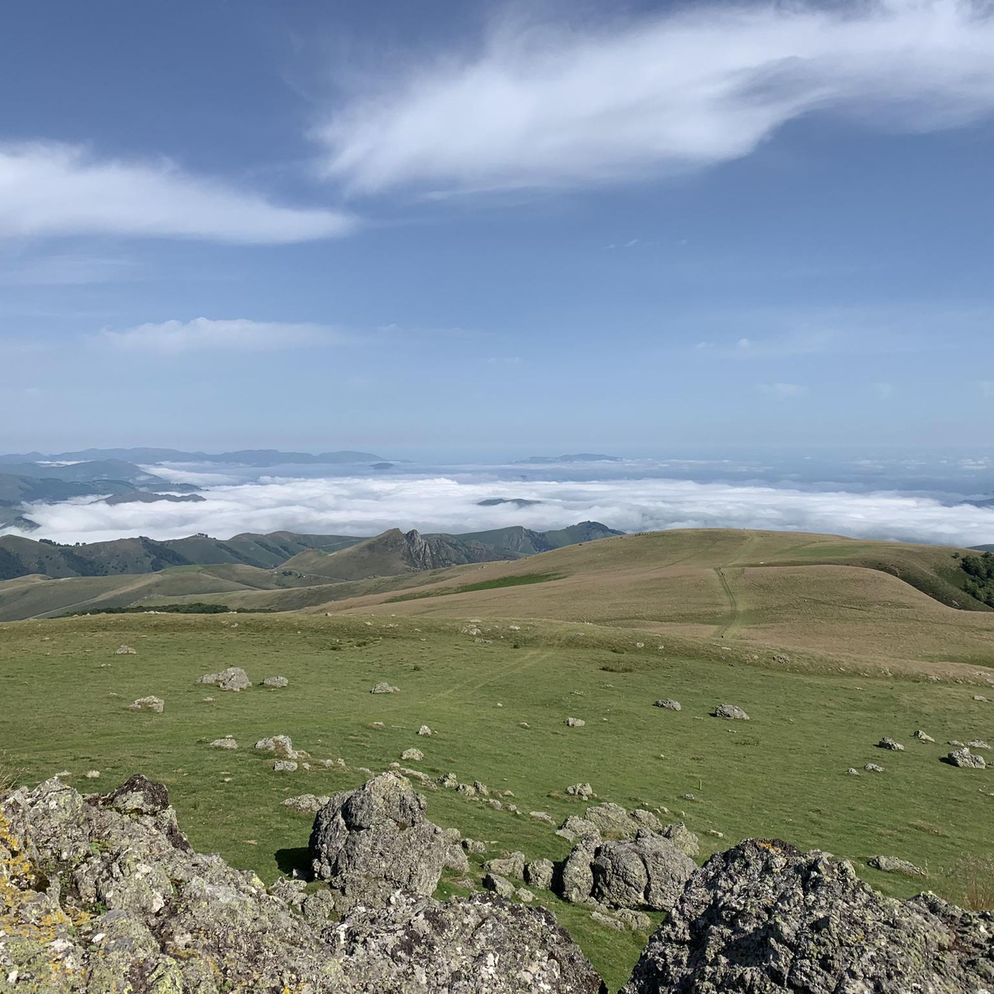
- 最も人気のある山岳峠は、イラティの森へのアクセスポイントとなる Tapla Pass です。標高1355メートルの展望台からはパノラマビューが楽しめ、様々な徒歩ツアーの出発点となります。
- もう一つの必見スポットは、草に覆われた丘の中腹に位置する山岳峠、Erroizate Pass です。
- 訪問者は、美しいブナ林と山の小川がある山岳峠、Alto de Azpegui も気に入っています。ここはフランスとの国境地点、コル・ダルペギとも呼ばれる場所へと続いています。
- Jaurrietaは、展望台、トレイル、自然の記念碑を提供する山岳峠で知られています。これらの峠は、探検のための多様な地形を提供します。
- Jaurrieta周辺の山岳峠は、39件の「いいね!」と27枚の写真が共有されており、komootコミュニティに高く評価されています。
最終更新日: 10月 18, 2026
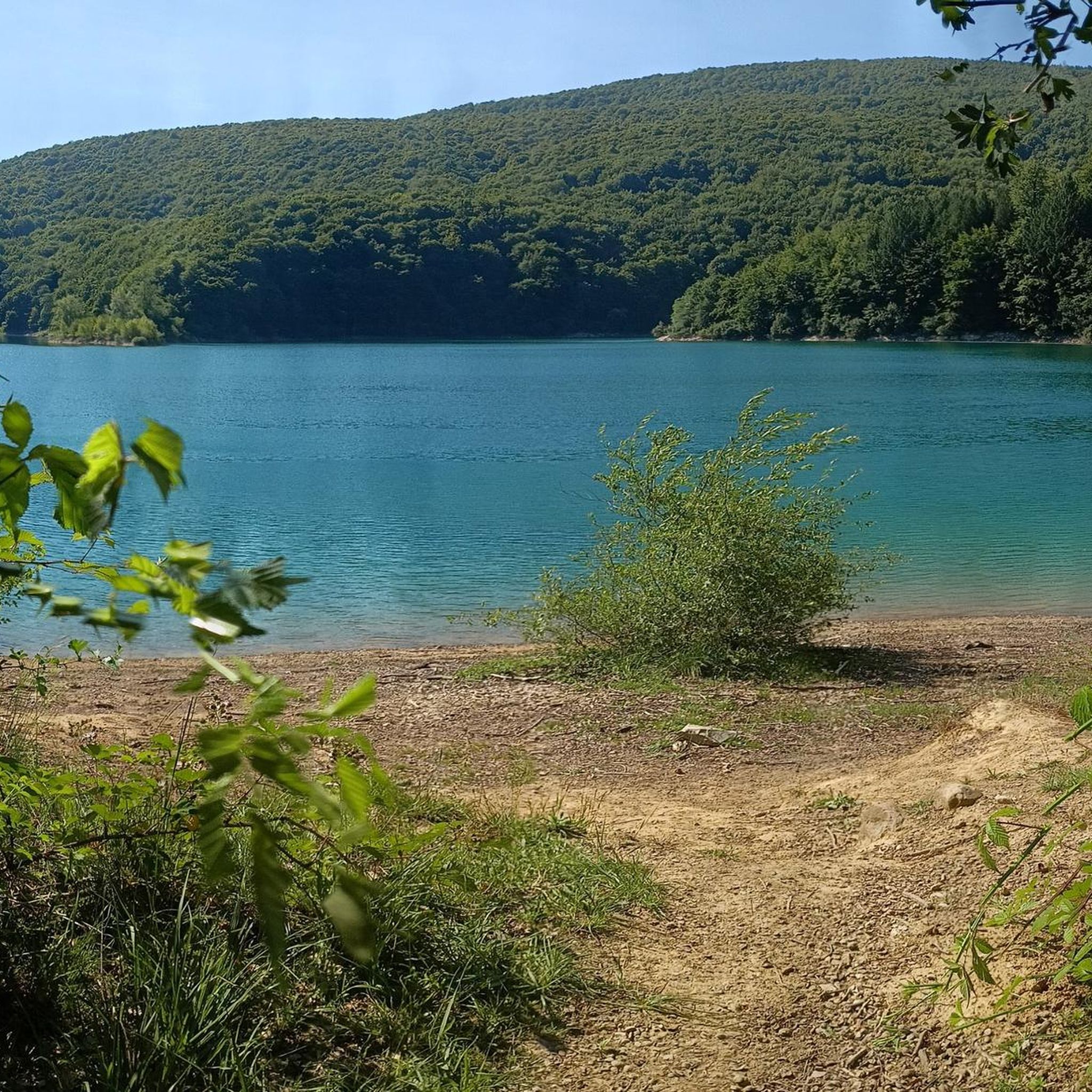
パソ・デ・タプラ
ハイライト • 山道
翻訳者 Google •
役立つ情報 は

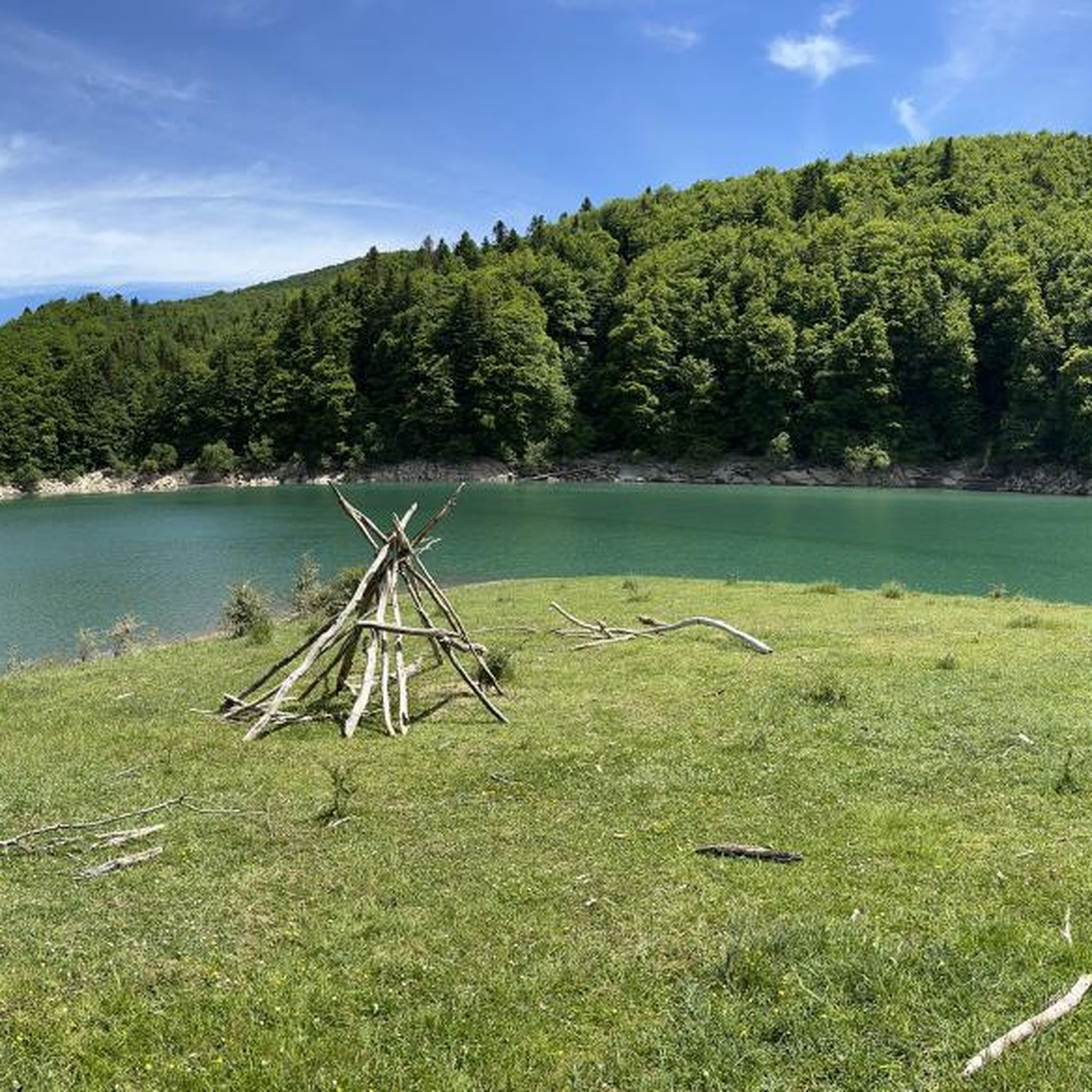
アルト・デ・アスペギ
ハイライト (セグメント) • 山道
翻訳者 Google •
役立つ情報 は

今すぐサインアップして、こんな場所を発見しよう
最高のシングルトラック、ピーク、その他のエキサイティングなアウトドアスポットのおすすめを受け取ろう。
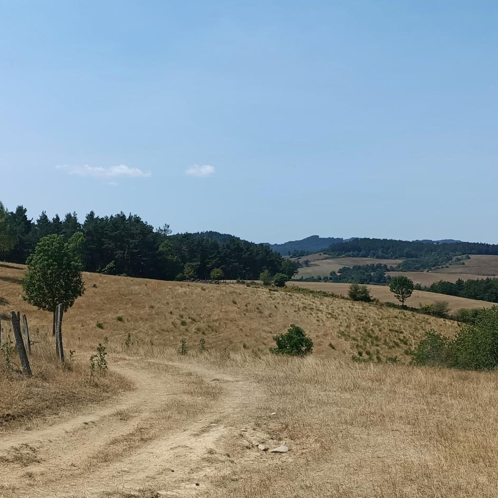
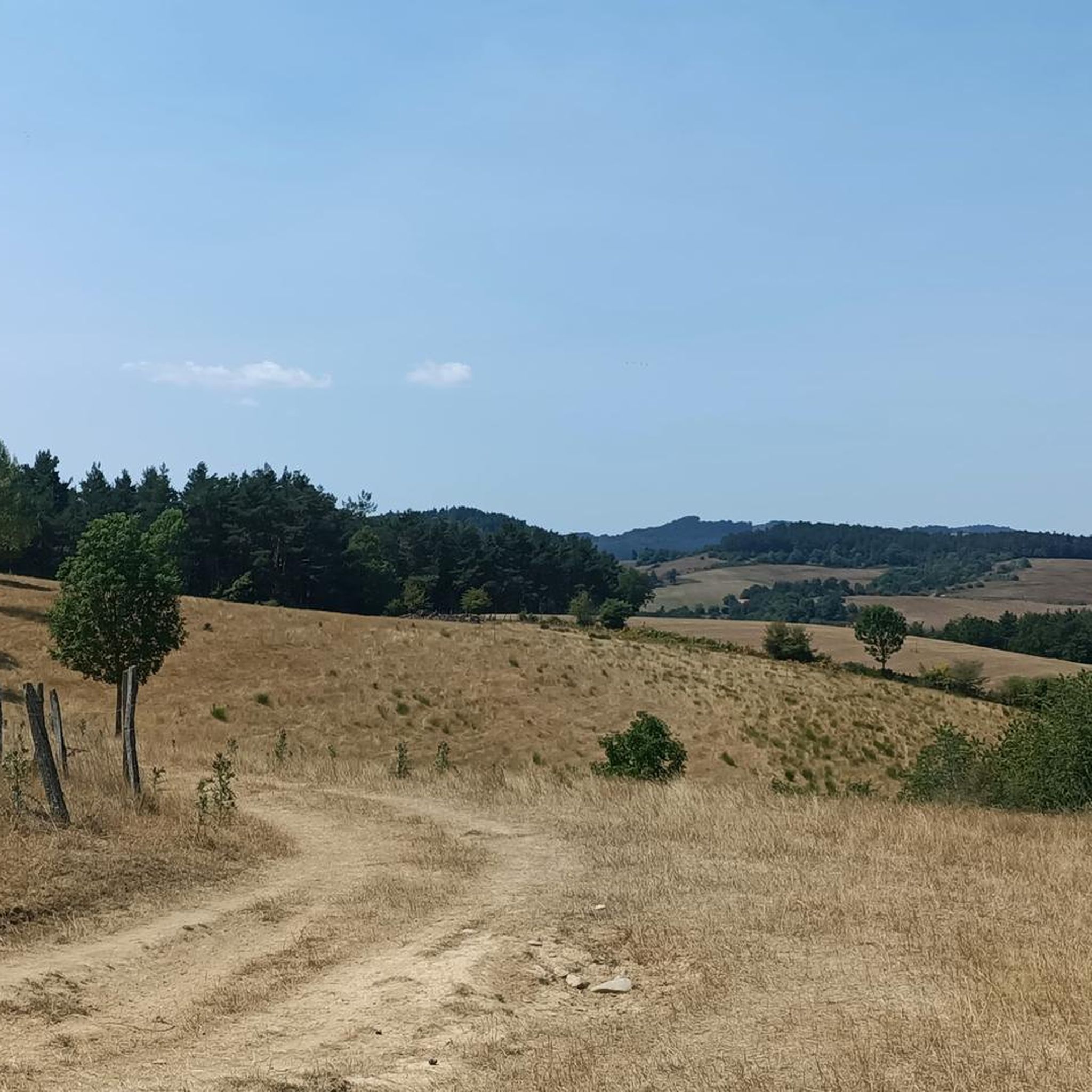
コラド・デ・エロイサテ
ハイライト • 山道
(very hot in summer, little shade, water only further down in the valley)
翻訳者 Google •
役立つ情報 は

オロトキ峠への登り
ハイライト (セグメント) • 山道
翻訳者 Google •
役立つ情報 は

アバウレガイナ峠(西側)
ハイライト (セグメント) • 山道
翻訳者 Google •
役立つ情報 は
無料アカウントで今日から始めよう
次の冒険が待っています。
コミュニティからのヒント

Olotoki Peak rises in a wild and sparsely populated corner of the Salazar Valley, where mountaineers will find numerous peaks, some quite steep. Among them are Olagato, Beortea, Santa Cruz, Peñas de Bezea, the Arburúa hermitage, and others. All of these mountains are covered with boxwood and pine trees that occupy the sunny slopes, and beech trees on the higher elevations. The climb to the pass from Izal is tremendously difficult.
0
0

The views from the top are wonderful. You have to stand quietly to enjoy the beauty, especially on sunny spring and summer days.
0
0
It is a beautiful port of about 8 - 9 km for each of its slopes that connects Ochagavía with the sanctuary of Nuestra Señora de las Nieves in the Irati Jungle, one of the entrances to the forest. It is highly recommended to try both slopes because, although similar in length and hardness, they are very different in terms of landscape. The southern slope of Ochagavía is very open, with views of the valley and the surrounding mountains at all times, crossing mountain meadows. On the other hand, on its northern slope, the climb runs through the Irati Forest surrounded by beech trees. The final part of this slope is clear, although you are inside a very charming gorge. The views from the top are simply wonderful. It is worth stopping carefully, observing the views and taking some photos. It is usually windy, so a windbreaker is essential.
0
0
It is a beautiful port and highly recommended. Starting from the Orbaitzeta weapons factory (although from Aribe the road climbs slightly), it has 2 well-differentiated sections: the first 2 km are very simple, they run next to a mountain stream and through a beech forest... truly spectacular ; The second section consists of 3 km at 9 - 10%, leaving out of the beech forest, taking a perspective of the mountain and the beauty of the port and the mountains of this part of the Pyrenees. The road is in perfect condition, with some sections on concrete, although very comfortable to ride. Once you reach Alto de Azpegui, you descend slightly and reach the border point with France, the also known Col d'Orgambide.
0
0
It is a pass with a distance of 10.3 km at a 3.3% average slope, therefore, a gentle pass where the hardest part is in the last km. The west slope is more constant than the east slope, although they are similar due to their winding road surrounded by trees and vegetation. The views from the town of Abaurregaina are very beautiful.
0
0

Before reaching Irati there is this hill with a magnificent viewpoint. If you're lucky you'll see the area's semi-wild horses up close. It is a port with a constant slope, it is long and it is beautiful
1
0

Considered one of the access gates to the Selva de Irati, this viewpoint at 1,355 meters above sea level is quite a challenge, but one that will be highly rewarded by being able to enjoy the wonderful panoramic views.
2
0
Considered one of the access gates to the Selva de Irati, this viewpoint is already a classic cyclist and the ascent to its 1355 meters above sea level is quite a challenge, but it will have a great reward to be able to enjoy the wonderful panoramic views.
2
0
よくある質問
Jaurrieta近郊で最も景色の良い峠はどこですか?
素晴らしい景色をお探しなら、イラティの森へのアクセスポイントともなっている、パノラマビューが楽しめるタプラ峠 (Tapla Pass)をご検討ください。もう一つの美しい選択肢は、ブナ林とピレネー山脈の景色で知られ、フランスとの国境へと続くアルト・デ・アスペギ (Alto de Azpegui)です。
Jaurrieta周辺に歴史的に重要な峠はありますか?
はい、Jaurrieta近郊にあるイバニェタ峠(ロンセスバーリェス峠)は歴史に深く刻まれています。ここはサンティアゴ巡礼路のフランス人の道のナバラ州における最高地点であり、778年のロンセスバーリェスの戦いで有名です。その頂上には、11世紀のサン・サルバドール・デ・イバニェタの隠修院とローランドの記念碑があります。
Jaurrieta周辺の峠を訪れるのに最適な時期はいつですか?
一般的に5月から11月が最適な時期です。この期間は、ポルト・デ・ラロー(Port de Larrau)のようなほとんどの峠が開通しています。これらの月は、ハイキングやサイクリングに適した気候ですが、状況は変動する可能性があります。特に標高の高い峠については、旅行前に必ず現地の状況をご確認ください。
これらの峠の近くでどのようなアウトドアアクティビティができますか?
Jaurrieta周辺地域は、様々なアウトドアアクティビティに最適な機会を提供しています。ポルト・デ・ラロー(Port de Larrau)周辺の挑戦的なロードサイクリングの登坂ルートや、より穏やかなオプションなど、サイクリングのための数多くのルートがあります。ランニングやハイキングのトレイルもたくさんあります。詳細なルートについては、Jaurrieta周辺のランニングトレイル、Jaurrieta周辺のロードサイクリングルート、およびJaurrieta周辺のサイクリングのガイドをご覧ください。
Jaurrieta近郊には、経験豊富なサイクリスト向けの挑戦的な峠はありますか?
もちろんです。ポルト・デ・ラロー(Port de Larrau)は、9.2マイルにわたって最大12〜14%の急勾配を持つ、挑戦的なサイクリングの登坂で有名です。経験豊富なサイクリストに人気があり、ツール・ド・フランスでも取り上げられています。オロトキ峠への登坂 (Ascent to Olotoki Pass)も、イサル(Izal)からの非常に困難な登坂として説明されており、荒涼として人口の少ない登り道を提供しています。
静かな体験ができる、あまり混雑していない峠はありますか?
ポルト・デ・ラロー(Port de Larrau)は、その挑戦的な性質にもかかわらず、他の有名なピレネーの峠と比較して、その孤立した場所と観光客の少なさから、深い静寂感を提供しています。素晴らしい自然の美しさの中で孤独を求めているなら、これは素晴らしい選択肢です。
Jaurrieta周辺の峠ではどのような自然景観が見られますか?
ポート・デ・ラロー(Port de Larrau)の深い森や高山の草原から、アルト・デ・アスペギ(Alto de Azpegui)のブナ林まで、多様な景観に出会えます。ポート・デ・ラローのような多くの峠の上部は森林限界を越え、荒々しく印象的な眺めを提供します。オロトキ峠(Olotoki Pass)は、ツゲ、松、ブナの木に覆われた斜面が特徴です。
初心者やあまり体力を使わないアクティビティに適した、簡単または中級の峠はありますか?
はい、アバウレガイナ峠(西側)(Alto de Abaurregaina (West Side))は、10.3 kmにわたる平均勾配3.3%の緩やかな峠とされており、あまり体力を使いたくない方にも適しています。道は曲がりくねっており、木々に囲まれ、アバウレガイナの町から心地よい景色を楽しめます。
これらの峠の駐車場やアクセスについて知っておくべきことは何ですか?
各峠の具体的な駐車場の詳細は常に利用可能とは限りませんが、ジャウリエッタ(Jaurrieta)は周辺の峠を探索するための優れた拠点となります。多くの峠は道路でアクセス可能ですが、特にオフピークシーズンや悪天候の後には、現地の道路状況を確認することをお勧めします。タプラ峠(Tapla Pass)のような一部の峠は、ハイキングツアーの人気の出発点となっており、近くに駐車場があることを示唆しています。
峠の近くに宿泊施設やアメニティはありますか?
ジャウリエッタ(Jaurrieta)自体はサラサル渓谷(Salazar Valley)で最も標高の高い自治体であり、峠を探索するための良い拠点としてアメニティを提供しています。峠のすぐそばにカフェやパブは少ないですが、ピレネー山脈の峠周辺の村や町、例えばイバニェタ峠(Puerto de Ibañeta)近くのロンセスバーリェス(Roncesvalles)などには選択肢があります。
イラティの森が見える峠はありますか?
はい、タプラ峠(Tapla Pass)はイラティの森(Selva de Irati)へのアクセスゲートの一つと考えられており、この重要な森を含む素晴らしいパノラマビューを提供しています。イバニェタ峠(Puerto de Ibañeta)も、ヨーロッパ最大級の未開発の森林であるイラティの森の近くにあり、自然愛好家にとっての魅力を高めています。
夏の峠の典型的な状況はどうですか?
夏の間、エルロアイテ峠(Erroizate Pass)のような峠は日陰が少なく、非常に暑くなることがあります。特に長時間のハイキングやサイクリングツアーを計画している場合は、十分な水を携帯することが重要です。谷と高地の間では常に気温が変動するため、様々な気候に対応できるよう準備してください。
ハウリエタでのの人気観光スポット

komootモバイルアプリでインスピレーションを得よう


さらに探索
これらのガイドでさらに壮大な山道を見てみましょうハウリエタでの:
