エスパルサデサラザールの峠・トップ4
エスパルサ・デ・サラサール周辺の最高の峠は、ナバラ・ピレネー山脈に nestled された景色の良いサラサール渓谷内にあります。この地域は、緑豊かな景観、鬱蒼とした森、サラサール川を特徴とし、アウトドアアクティビティのために多様な地形の高さを提供しています。このエリアは、重要な峠やイラティの森へのアクセスを含む、数多くのランドマークや自然の特徴を提供しています。
エスパルサ・デ・サラサール周辺の最高の峠
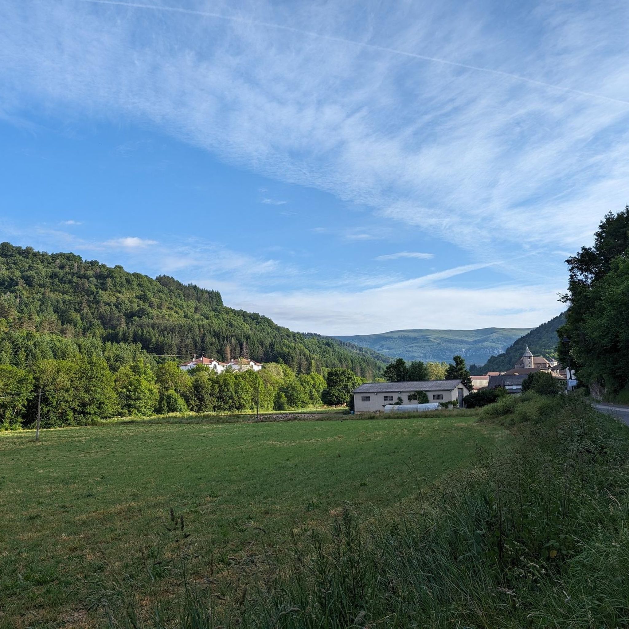
- 最も人気のある峠は、スペインのフランス国境近くにある峠、ラサ峠 (1,129 m) です。その登りは美しい森を横切り、周囲の山々の景色が開けます。ここから、森林地帯に沿ったいくつかのルートがピレネー山脈の景色を提供します。
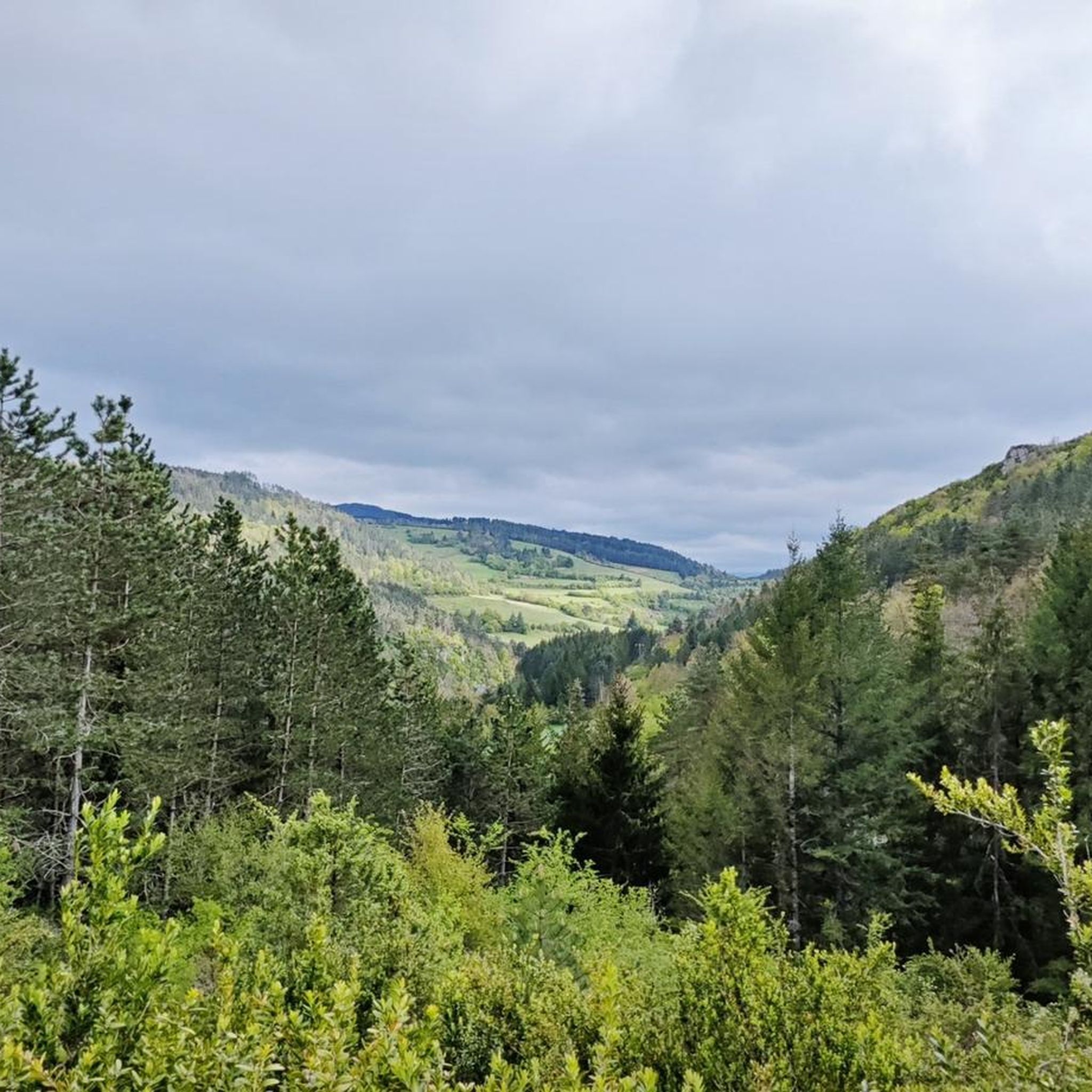
- もう一つの必見スポットは、イラティの森のパノラマビューを提供する展望台である アボディからのイラティの森の眺めです。この場所は、スペイン側のララウ峠へ向かう途中で通過する小さなクロスカントリースキーセンターです。
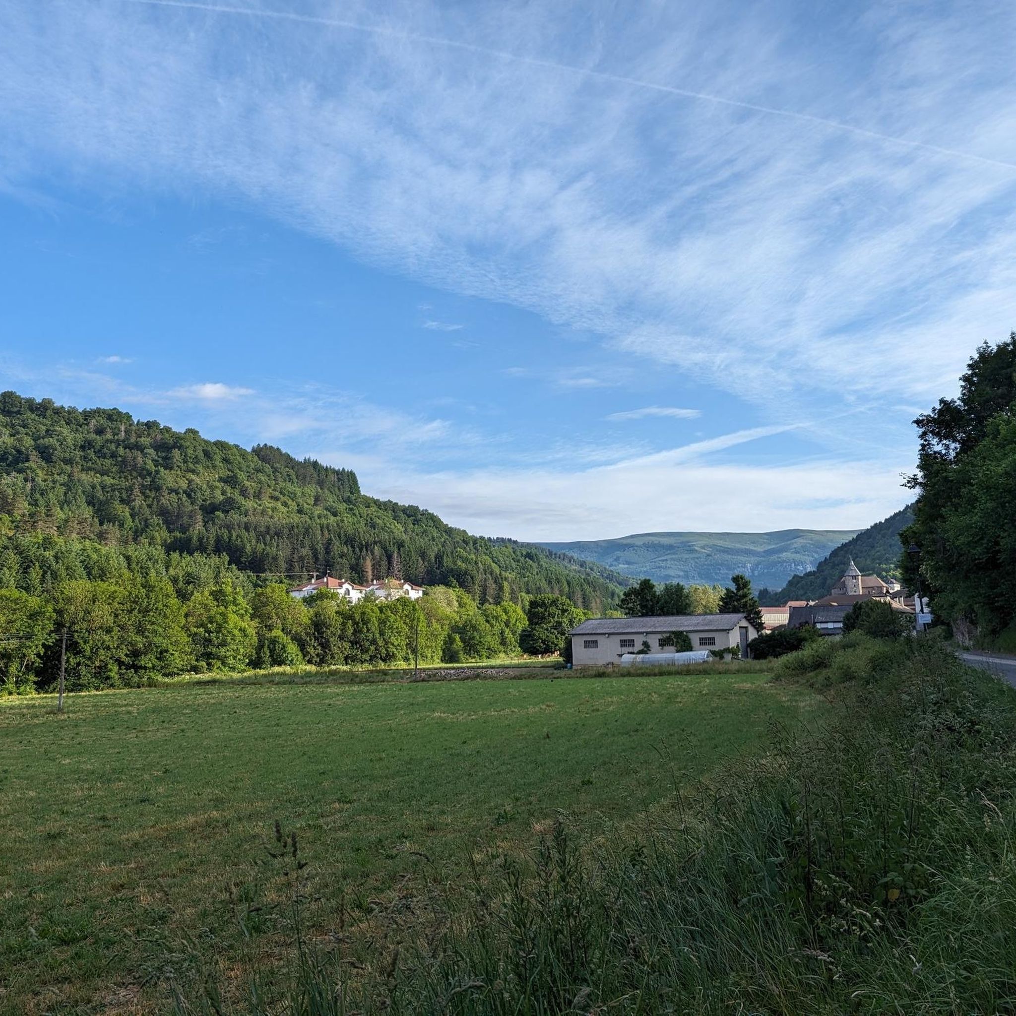
- 訪問者はまた、合計26キロメートルの登りと1,048メートルの標高上昇を伴う挑戦的な峠である イサバからのピエール・サン・マルタン峠への登りも気に入っています。このルートは、良好な路面と景色の良い眺めを特徴とし、後半にかけて勾配がきつくなります。
- エスパルサ・デ・サラサールは、挑戦的な登り、森を通る景色の良いルート、そして展望台で知られています。様々な峠は、ロードサイクリング、マウンテンバイク、ハイキングの機会を様々な難易度で提供します。
- エスパルサ・デ・サラサール周辺の峠は、komootコミュニティによって46件の「いいね!」と訪問者によって投稿された23枚の写真で高く評価されています。
最終更新日: 10月 18, 2026
ラサ峠(標高1,129 m)
ハイライト • 山道
翻訳者 Google •
役立つ情報 は

アボディから望むイラティの森
ハイライト • 展望台
翻訳者 Google •
役立つ情報 は

今すぐサインアップして、こんな場所を発見しよう
最高のシングルトラック、ピーク、その他のエキサイティングなアウトドアスポットのおすすめを受け取ろう。
イサバからコル・ド・ラ・ピエール・サン=マルタンへの登り
ハイライト (セグメント) • 山道
翻訳者 Google •
役立つ情報 は

オロトキ峠への登り
ハイライト (セグメント) • 山道
翻訳者 Google •
役立つ情報 は

アバウレガイナ峠(西側)
ハイライト (セグメント) • 山道
翻訳者 Google •
役立つ情報 は
無料アカウントで今日から始めよう
次の冒険が待っています。

コミュニティからのヒント

Olotoki Peak rises in a wild and sparsely populated corner of the Salazar Valley, where mountaineers will find numerous peaks, some quite steep. Among them are Olagato, Beortea, Santa Cruz, Peñas de Bezea, the Arburúa hermitage, and others. All of these mountains are covered with boxwood and pine trees that occupy the sunny slopes, and beech trees on the higher elevations. The climb to the pass from Izal is tremendously difficult.
0
0

Up to kilometer 12, the climb is gentle. From there, it becomes more difficult, and you'll face some slopes with a 10% gradient. The total climb is 26 kilometers, and the total ascent is 1,048 meters. During the climb, you'll find good road surfaces and beautiful scenery.
0
0

The Puerto de Laza is a small and beautiful hill that joins the valleys of Roncal (starting from Isaba) and Salazar (starting from Ochagavía) in the Navarrese Pyrenees. Both sides are very similar: a very easy start on a winding road, in perfect condition but without a hard shoulder, passing through small towns and going up the course of the respective rivers Anduña (Salazar valley) and Urbi (Roncal valley); a final stretch of 2 - 3 kms that is harder without being too much so, although there are some slopes above 10%. The Salazar valley side becomes harder when leaving behind the detour to the Larrau port. From here to the port there are 3 km with an average gradient of 7%. On the other hand, the Roncal valley side becomes harder when overcoming a bridge over the river that has been with us since we left Isaba behind. From here it is barely 2 km with an average gradient of 7%. From a landscape perspective, it is a port that I love because you can enjoy the exuberance of the vegetation of the Pyrenees, crossing narrow valleys and only with panoramic views when you reach the top, where there is a viewing point that is worth looking out at. A port that I always recommend for enjoying cycle tourism. I leave you the profile of both sides produced by the website www.cyclingcols.com --> http://www.cyclingcols.com/col/Laza
0
1
It is a small Nordic ski center that you cross on the way up to the port of Larrau on the Spanish side. The panoramic views of the Irati Forest from here to the tunnel before crowning the port are wonderful. Any time is a good time to stop and take a good photo.
0
0
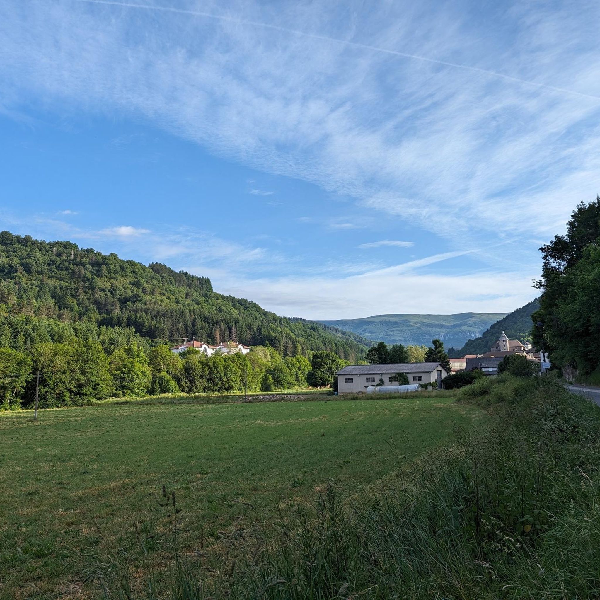
It is a pass with a distance of 10.3 km at a 3.3% average slope, therefore, a gentle pass where the hardest part is in the last km. The west slope is more constant than the east slope, although they are similar due to their winding road surrounded by trees and vegetation. The views from the town of Abaurregaina are very beautiful.
0
0

The Col de Laza is located in Spain not far from the French border and the port of Larrau. Shorter than its neighbour, its ascent takes place in the middle of a beautiful forest which opens onto lovely views of the surrounding mountains.
1
0

From here there are several routes along forest tracks with beautiful forests and good views of the Pyrenees. Especially pretty in the fall!
1
0

Small port compared to its neighboring brothers. But it can do a lot of harm when you go for the Larra-Larrau bicycle tour
1
0
よくある質問
エスパルサ・デ・サラサール周辺の峠の一般的な特徴は何ですか?
エスパルサ・デ・サラサール地域の峠、特に風光明媚なサラサール渓谷内の峠は、緑豊かな景観、鬱蒼とした森、ピレネー山脈の美しい眺めで知られています。自然の美しさと様々なアウトドアアクティビティの機会が融合しており、イラティの森のようなより大きな自然地域への入り口となることが多いです。
エスパルサ・デ・サラサール周辺の峠を訪れるのに最適な時期はいつですか?
この地域は一年中美しいですが、特に秋は、サラサール渓谷からアクセスできるイラティの森が鮮やかな黄土色と赤みがかった色合いを見せるため、息をのむほどです。春と夏はハイキングやサイクリングに快適な気候を提供しますが、冬は雪が降ることがあり、一部の峠は装備があれば寒冷な状況でも挑戦的でありながら絵のように美しいものになります。
この地域には、簡単または家族向けの峠はありますか?
多くの峠は厳しい登りを提供していますが、一部の区間や近くのルートはよりアクセスしやすい場合があります。例えば、アルト・デ・アバウレガイナ(西側)は、平均勾配3.3%の緩やかな峠として説明されています。家族向けのハイキングには、「オチャガビア・ループ(オチャガビア/オツァガビア発)」のような簡単な評価のルートを検討してください。これは、エスパルサ・デ・サラサール周辺のハイキングガイドで見つけることができます。
峠からはどのような景色が期待できますか?
周囲の山々や渓谷の素晴らしいパノラマビューが期待できます。例えば、ラサ峠(1,129 m)のような峠からは、森が開けて美しい景色が広がります。アボディからのイラティの森の眺めは、ヨーロッパ最大級のブナとモミの森の広大な眺めを提供します。
これらの峠を含む、挑戦的なサイクリングルートはありますか?
はい、この地域は挑戦的なルートを求めるサイクリストに人気があります。ラサ峠(1,129 m)や、イサバからのピエール・サン・マルタン峠への登りのような峠は、かなりの標高差があり、困難な場合があります。イザルからのオロトキ峠への登りは、非常に難しいとされています。挑戦的なサイクリングツアーは、エスパルサ・デ・サラサール周辺のサイクリングガイドで見つけることができます。
峠の近くにはどのようなハイキングの機会がありますか?
峠は、数多くの森林のトラックやトレイルの出発点となることが多いです。より広いサラサール渓谷と近くのイラティの森は、様々な難易度の無数のルートを提供しています。特定のハイキングトレイルについては、エスパルサ・デ・サラサール周辺のハイキングガイドをご覧ください。このガイドには、「ガルトショのトレイル」や「ベイエグ(1193 m)– ジャウリエッタ発のアパガ・フエゴス展望ループ」などのルートが含まれています。
エスパルサ・デ・サラサール地域では他にどのようなアウトドアアクティビティができますか?
サイクリングやハイキングの他にも、エスパルサ・デ・サラサールの山岳地帯では多様なアウトドアアクティビティの機会があります。この地域はマウンテンバイクに最適で、ランニングコースも見つかります。詳細については、エスパルサ・デ・サラサール周辺のランニングコースガイドをご覧ください。
ラサ峠が人気の目的地である理由は何ですか?
ラサ峠(1,129 m)は、美しい森林の上り坂が素晴らしい山の景色へと開けているため人気があります。サイクリストやハイカーに人気のスポットであり、特に秋には美しいいくつかの景色の良い森林トレイルの出発点となっています。また、「ラサ峠(1,129 m)– オチャガビア/オツァガビアからのオチャガビア周回コース」のような挑戦的なサイクリングループの一部でもあります。
これらの山峠からイラティの森にアクセスできますか?
はい、ヨーロッパ最大かつ最も保存状態の良いブナとモミの森の一つであるイラティの森は、エスパルサ・デ・サラサールがあるサラサール渓谷から容易にアクセスできます。アボディからのイラティの森の眺めハイライトでは、この重要な自然エリアのパノラマビューを特に楽しめます。
山峠の近くにカフェや宿泊施設のような設備はありますか?
エスパルサ・デ・サラサールやサラサール渓谷内の他の村には、地元の設備があります。峠の直接のカフェや宿泊施設は限られているかもしれませんが、近くの町や村には、冒険の後に休憩したり食事をしたりできる場所が見つかります。
山峠でどのような野生動物に遭遇する可能性がありますか?
ナバラ・ピレネー山脈の鬱蒼とした森林と自然景観は、多様な野生生物の生息地です。各峠について具体的に詳述されていませんが、特にイラティの森に隣接する地域では、さまざまな鳥類、シカ、その他の豊かな山の生態系に典型的な森林動物に遭遇する可能性があります。
サイクリングの山峠の道路状況はどうですか?
一般的に、イサバからのピエール・サン・マルタン峠への登りのような峠道の路面は良好とされています。しかし、山岳地帯であるため、木々や植生に囲まれた曲がりくねった道が多く、天候や季節によって状況は変化する可能性があります。
エスパルサデサラザールでのの人気観光スポット

komootモバイルアプリでインスピレーションを得よう


さらに探索
これらのガイドでさらに壮大な山道を見てみましょうエスパルサデサラザールでの:
