アルコンタルの天然記念物・トップ4
アルコンタール周辺の最高の自然記念物は、シエラ・デ・ロス・フィラブレース山脈とアルマンソラ渓谷に位置しています。この地域は、乾燥した丘陵地帯、山々、そしてアルマンソラ川沿いの肥沃な地域を特徴とする景観を呈しています。この地域は、高い山岳峠からユニークな地質学的構造、河川環境に至るまで、多様な自然の特徴を提供しています。広範なハイキングコース網と重要な自然のランドマークで知られています。
アルコンタール周辺の最高の自然記念物
- 最も人気のある自然記念物は、温泉で知られる自然記念物であるAljibe de Serónです。この場所は炭酸塩帯水層の物質を特徴とし、約28℃の水温の入浴スポットを提供しています。
- もう一つの必見スポットは、山岳峠であり自然記念物でもあるSierras de Baza and Los Filabresです。この人里離れた山脈には2,000メートルを超える山頂が含まれており、カラール・アルト天文台があります。
- 訪問者はまた、標高1,882メートルの自然記念物であるLa Merendera Springも気に入っています。この泉は変成岩から湧き出る新鮮な水を提供し、近くにはレクリエーションエリアと展望台があります。
- アルコンタールは、自然の泉、古代の木々、そして山岳峠で知られています。見たり探検したりできる自然記念物の多様性には、温泉、ユニークな植物標本、そして高地の展望台が含まれます。
- アルコンタール周辺の自然記念物は、komootコミュニティによって高く評価されており、訪問者から9件の「いいね!」と3件の写真が共有されています。
最終更新日: 8月 25, 2026
アルヒベ・デ・セロン
ハイライト • 自然記念物
翻訳者 Google •
役立つ情報 は

シエラ・デ・バサとシエラ・デ・ロス・フィラブレス
ハイライト • 山道
この山脈は歴史的な文化の交差点であり、その遺産にはローマ水道やアラブの城の遺跡が含まれています。
この山脈の最高地点には、遠くからでも容易に認識できる象徴的なカラール・アルト天文台(2,168m)があります。
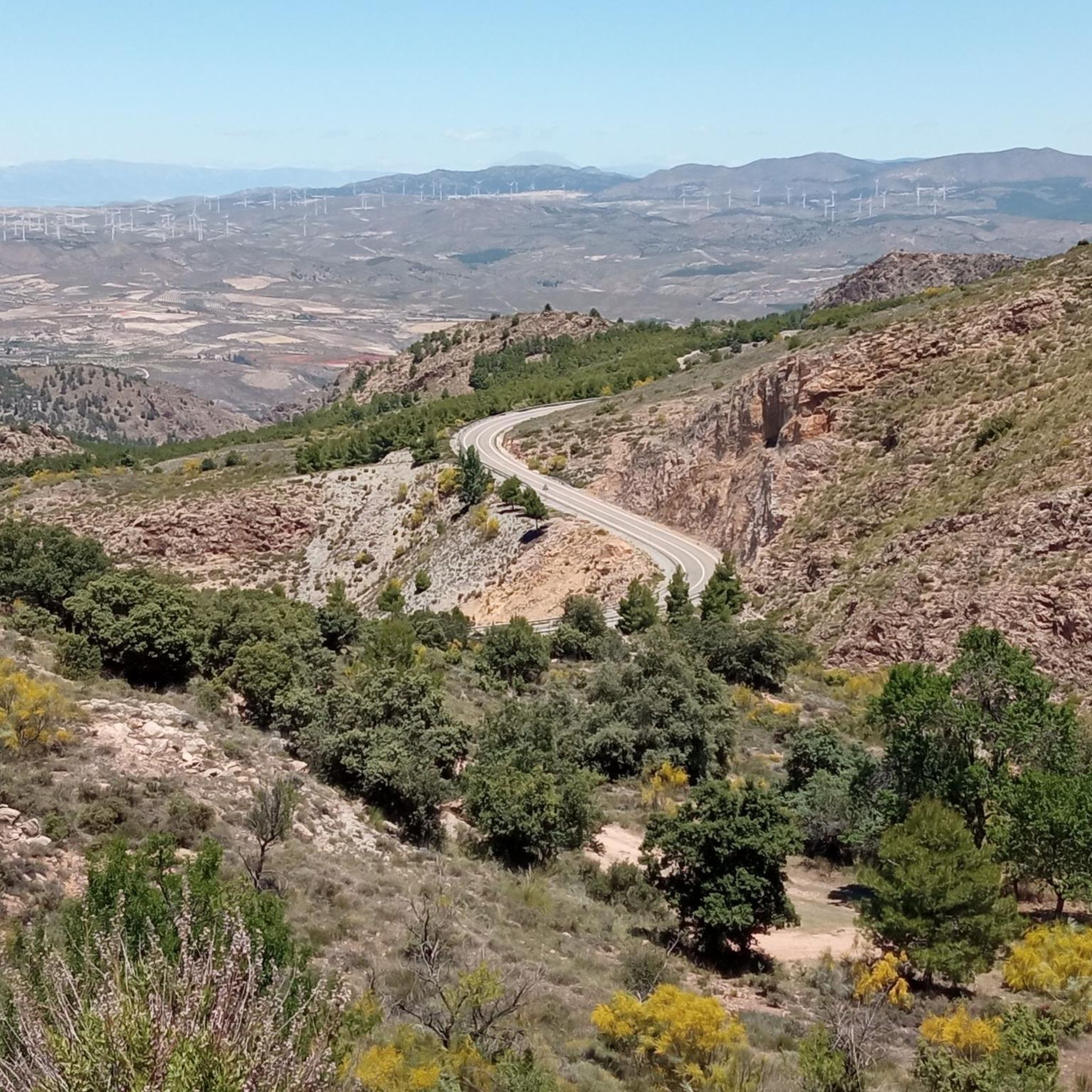
この山脈には、イベリア半島で最も象徴的で壮観な峠の一つであるエレ・プエルト・デ・ベレフィケ(1,820m)も含まれており、南側の多数のヘアピンカーブで人気があります。
シエラ・デ・ロス・フィラブレスの南端は、タベルナス砂漠の北の玄関口とされるジェルガル村に達しています。
翻訳を表示中
役立つ情報 は

今すぐサインアップして、こんな場所を発見しよう
最高のシングルトラック、ピーク、その他のエキサイティングなアウトドアスポットのおすすめを受け取ろう。
無料新規登録
フエンテ・ペリカ湧水
ハイライト • 自然記念物
翻訳者 Google •
役立つ情報 は
エル・マルチャル・デル・アボガドのエンシナ
ハイライト • 自然記念物
翻訳者 Google •
役立つ情報 は
Fuente La Merendera
ハイライト • 自然記念物
公式には飲用に適さないという標識がありますが、それでも地元の人々や多くの通行人が、その水に惹かれて容器を持って列を作っています。ただし、飲む前に水をろ過することをお勧めします。
長い休憩が必要な場合は、道路の向かい側にテーブル、バーベキュー設備、壮大な景色を望む展望台を備えたレクリエーションエリアがあります。
翻訳を表示中
役立つ情報 は

無料でサインアップして、さらに多くの自然記念物を発見しましょう アルコンタルでの。
無料新規登録
すでにアカウントをお持ちですか?
無料アカウントで今日から始めよう
次の冒険が待っています。
ログインまたは登録

コミュニティからのヒント

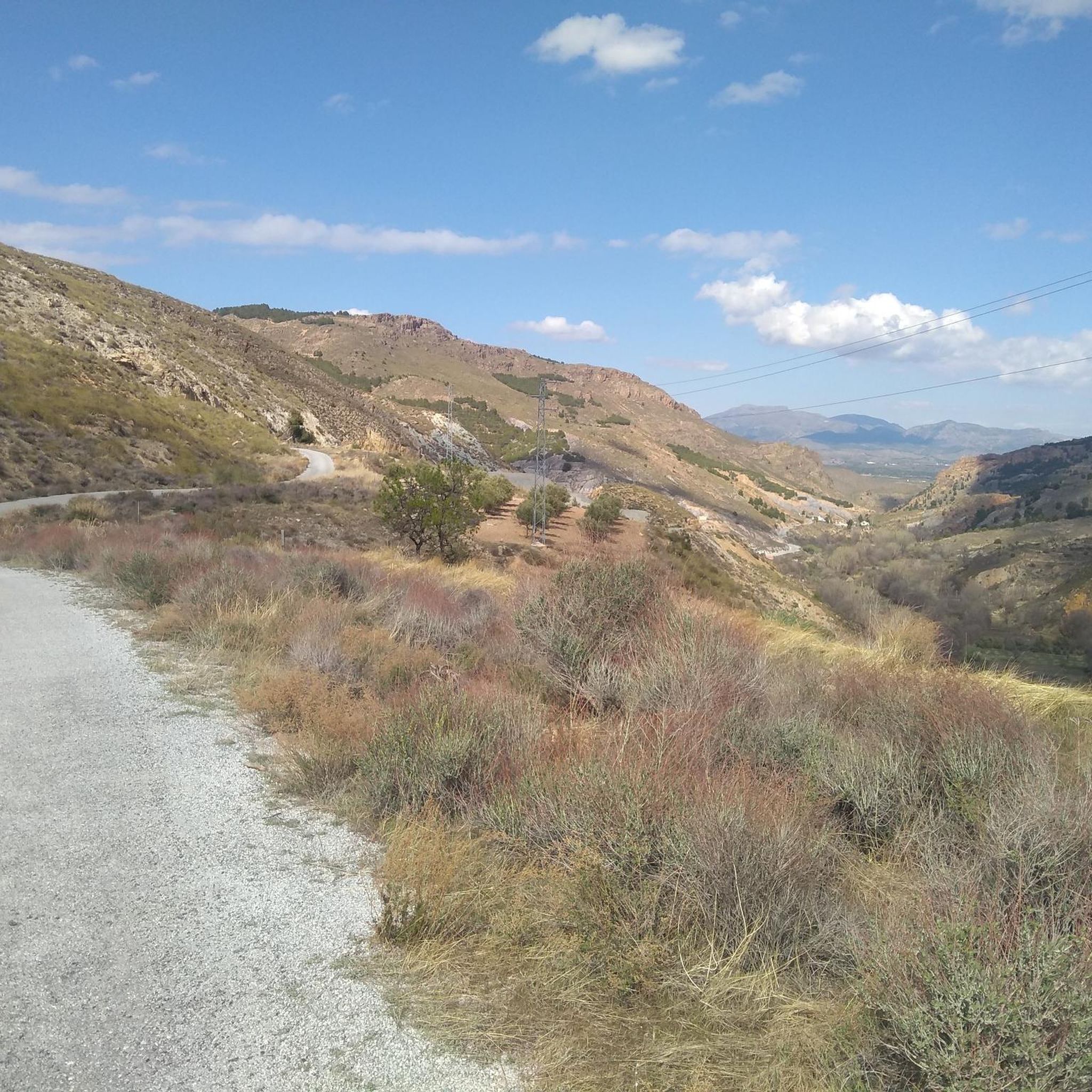
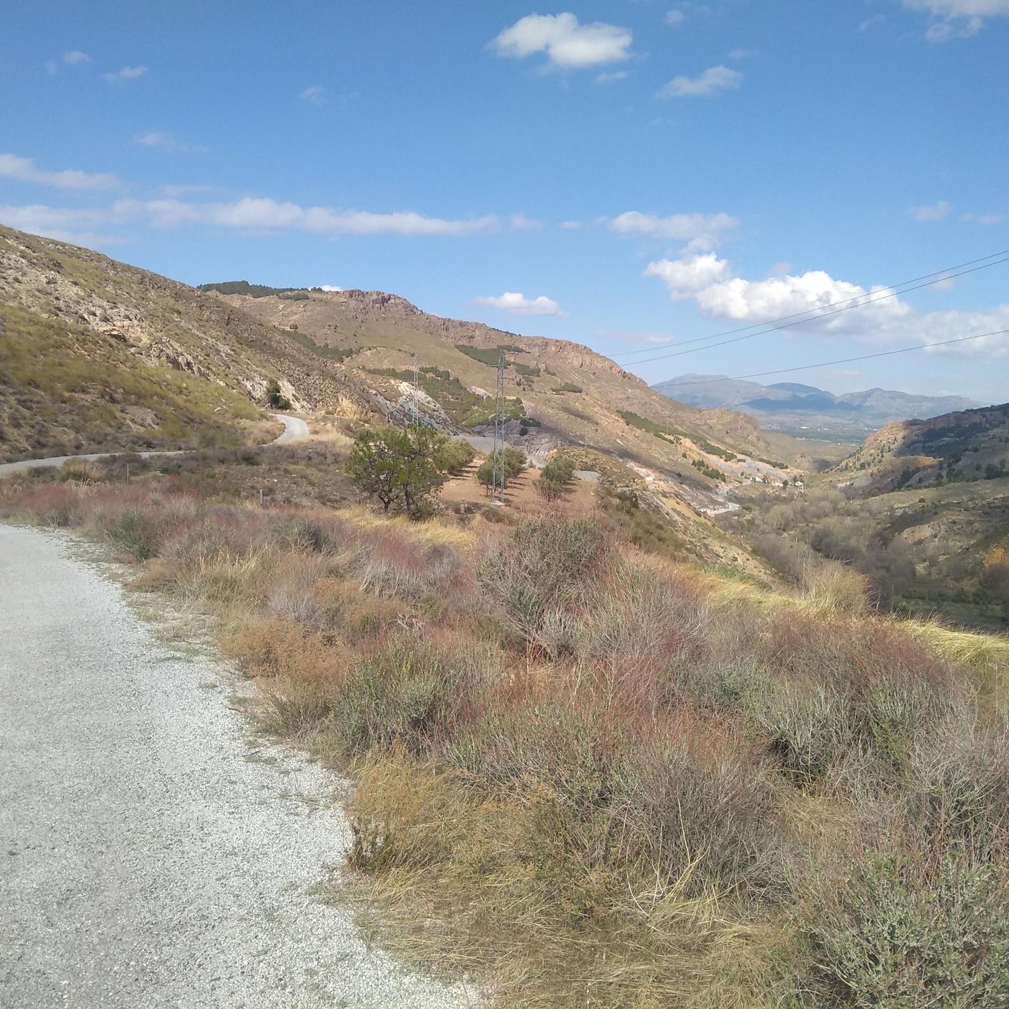
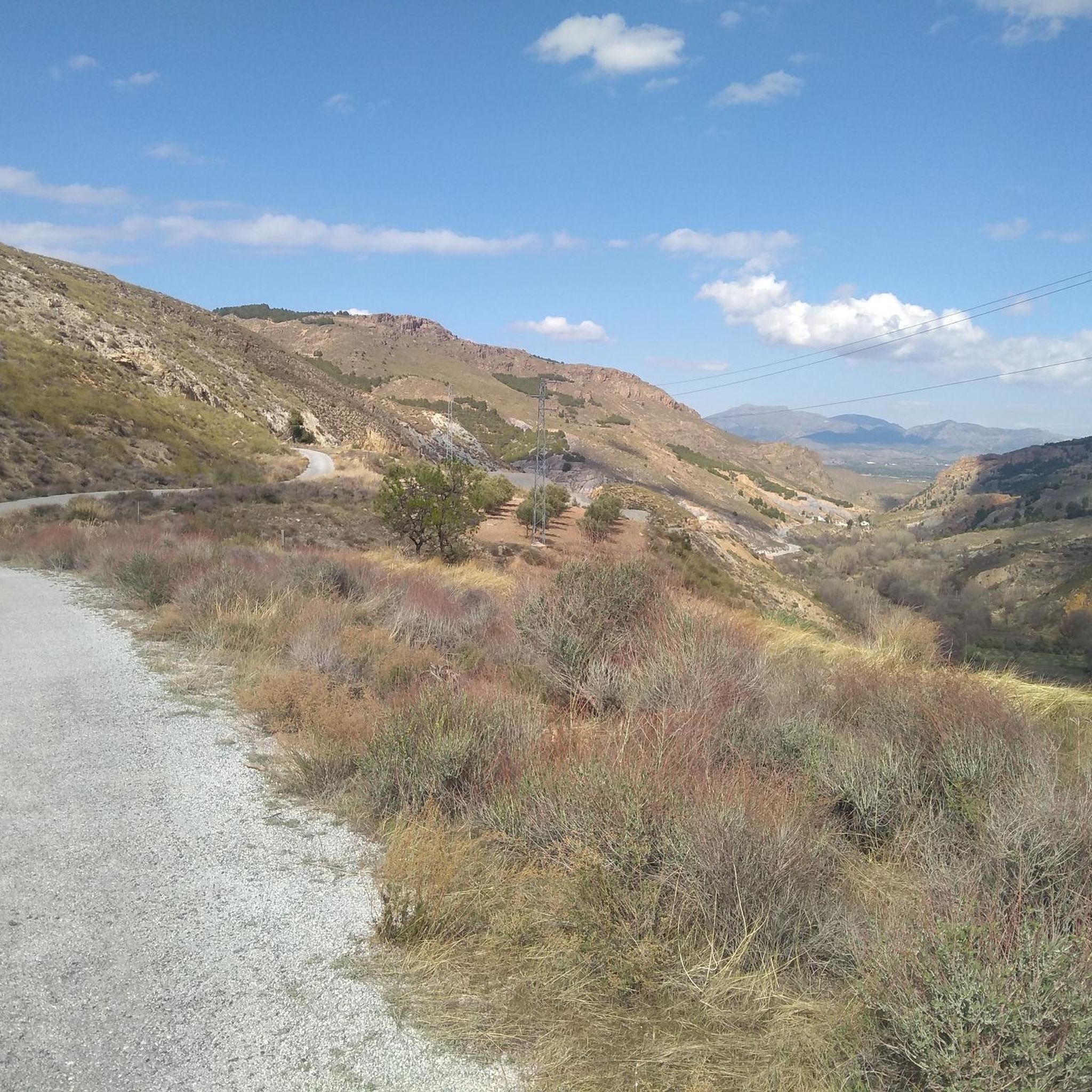
Sierra de los FilabresをCalar Altoの頂上近くで通過する場合、標高1882メートルのFuente La Merenderaはほぼ必須の立ち寄り場所です。この泉は、山脈の変成岩から湧き出る冷たい水で有名です。 公式には飲用に適さないという標識がありますが、それでも地元の人々や多くの通行人が、その水に惹かれて容器を持って列を作っています。ただし、飲む前に水をろ過することをお勧めします。 長い休憩が必要な場合は、道路の向かい側にテーブル、バーベキュー設備、壮大な景色を望む展望台を備えたレクリエーションエリアがあります。
0
0

Both mountain ranges ensure that it hardly rains in this semi-desert area.
1
0

シエラ・デ・バサとシエラ・デ・ロス・フィラブレスは、グラナダ県とアルメリア県にある標高2,000mを超える人里離れた山脈の一部であり、バッドランドで最も孤立した地域です。 この山脈は歴史的な文化の交差点であり、その遺産にはローマ水道やアラブの城の遺跡が含まれています。 この山脈の最高地点には、遠くからでも容易に認識できる象徴的なカラール・アルト天文台(2,168m)があります。 この山脈には、イベリア半島で最も象徴的で壮観な峠の一つであるエレ・プエルト・デ・ベレフィケ(1,820m)も含まれており、南側の多数のヘアピンカーブで人気があります。 シエラ・デ・ロス・フィラブレスの南端は、タベルナス砂漠の北の玄関口とされるジェルガル村に達しています。
1
0

La Encina del El Marchal del Abogado seems to emerge from a world of beings from fairy tales. It is an example of those rare botanical individuals that has survived thousands of years, witnessing the passage of time and the radical transformations of its environment. The common sense of the people, the overwhelming logic has protected them for generations and has allowed them to survive over so many years, tree species that are part of the bustle of people, peoples and their history. In the Almanzora Valley there is an important and still unknown tree mass cataloged and singled out in aspects as diverse as its longevity, a capricious morphology, height or its symbiosis with the nearby population. The Encina del El Marchal del Abogado, located in the municipality of Serón, is an obvious example due to its unique shape, since it offers a perimeter of trunk that exceeds six meters and symbolizes, together with the Poplar of El Marchal del Abogado, a set of opposites that represent the versatility of the arboreal world and evoke the well-known couple of knight and squire. Close to the Sierra de Baza Natural Park, in addition to the area's interesting monumental and ethnographic heritage (Las Menas de Serón mines), the headwaters of the Almanzora offer an interesting Greenway for non-motorized enjoyment. This unique botanical specimen is part of an excellent group of unique trees that dot the Almanzora Valley and its slopes: Acerolo del Cortijo de las Iglesias, Cornicabra del Puente de El Valle, Encina de El Marchal de El Abogado, Poplar de El Marchal de The Lawyer, Encina de la Fuente el Pino, Encina de los Trébedes and Olivo de las Lomas.
0
0
Outcrops of carbonate alpujárrides materials that are what make up the aquifer. The schists, phyllites and quartzites define the eastern and northern impervious substratum and edges, while contributing to the compartmentalization of the aquifer due to the existence of numerous tectonic scales. The southern and western limits are occupied by Miocene and Plioquaternary materials, which except those that make up the alluvial of the Almanzora River are of low permeability. The thickness of the limestone and aquifer dolomites is estimated at 300 m. The feeding of the aquifer comes from the direct infiltration of part of the rain that falls on the permeable outcrops and from the surface run-off waters, coming from the shales and phyllites of the environment. The discharge is produced by boreholes and by springs and galleries located on the southern edge. This group of springs emerges together with a group of small Triassic carbonate outcrops that emerge in the Almanzora valley, in the middle of the Miocene loamy pack. The waters of these springs present the peculiarity of being slightly thermal (28 ° C or more), the most important being Cela, Perica, Cañada y Plaza, Algibe and Huelago. This thermalism is also manifested in certain soundings, some of which are upwelling. The springs and galleries that are controlled show flows with slight decreases with a contribution of 3 to 4 Hm3 / year. The evolution of levels and flows of springs reveals the compartmentalisation of the aquifer in different blocks. Like the Cela spring, the Fuencaliente upwellings are possibly linked to the existence of an important fracture, or zone of fractures forming the "horst" of Fuencaliente, parallel to the edge of the Almanzora depression, thanks to which the emergence of water will take place, which would have circulated in depth through the carbonate formations of alpujarrides units.
2
0
The water from Fuente Perica comes from carbonated alpujárrides materials. Schists, phyllites and quartzites define the eastern and northern impermeable substrate and edges, while contributing to the compartmentalization of the aquifer due to the existence of numerous tectonic scales. The southern and western limits are occupied by Miocene and Plioquaternary materials, which, except for those that make up the Almanzora River alluvial, are of low permeability. The thickness of the aquiferous limestones and dolomites is estimated at 300 m. The supply of the aquifer comes from the direct infiltration of part of the rain that falls on the permeable outcrops and surface runoff water, coming from the surrounding schists and phyllites. The discharge occurs through boreholes and through springs and galleries located on the southern edge. This group of springs emerges together with a group of small Triassic carbonate outcrops that outcrop in the Almanzora valley, in the middle of the Miocene loamy package. The waters of these springs have the peculiarity of being slightly thermal (28 °C or more), the most important being Cela, Perica, Cañada and Plaza, Algibe and Huelago. This thermalism is also manifested in certain wells, some of which are springs. Like the Cela spring, the Fuencaliente, Perica and Algibe springs are possibly linked to the existence of an important fracture, or zone of fractures forming the Fuencaliente "horst", parallel to the edge of the Almanzora depression, thanks at which the emergence of the water that precisely would have circulated in depth will take place.
1
0
よくある質問
アルコンタール周辺で訪れるべき注目すべき自然記念物はありますか?
アルコンタール周辺地域には、いくつかのユニークな自然記念物があります。温泉のアルヒベ・デ・セロンを探検したり、独特の形態を持つ古代のエル・マルチャル・デル・アボガドのホーリーオークを発見したり、あるいは新鮮な水とレクリエーションエリアで知られる高地のラ・メレンデラ・スプリングを訪れたりすることができます。
アルコンタール近郊に家族向けの自然記念物はありますか?
はい、家族に適した自然記念物がいくつかあります。アルヒベ・デ・セロンは、入浴や温泉を楽しむのに最適な場所です。古代のエル・マルチャル・デル・アボガドのホーリーオークは、子供たちの想像力をかき立てる魅力的な自然の光景を提供します。
アルコンタール地域ではどのような自然の特徴が見られますか?
シエラ・デ・ロス・フィラブレス山脈とアルマンソラ川渓谷に nestled されたアルコンタール周辺地域は、多様な自然の特徴を誇っています。印象的な山の景観、広大な森林、肥沃な川の谷、そしてユニークな地質学的形成が見られます。ハイライトには、フエンテ・ペリカ・スプリングのような温泉や、エル・マルチャル・デル・アボガドのホーリーオークのような古代の木々があります。
これらの自然記念物の近くでどのようなアウトドアアクティビティができますか?
アルコンタールがあるシエラ・デ・ロス・フィラブレス山脈は、アウトドア愛好家にとっての楽園です。広範囲にわたるハイキング、サイクリング、マウンテンバイクを楽しむことができます。サイクリングでは、ビア・ベルデ・デル・バジェ・デル・アルマンソラのようなルートを探索してください。マウンテンバイカーは、ベレフィケ・クライムのような挑戦的なトレイルに挑むことができます。その他のルートは、アルコンタール周辺のサイクリングおよびアルコンタール周辺のマウンテンバイクトレイルガイドでご覧ください。
パノラマの景色を楽しめる展望台はありますか?
もちろんです。この地域は壮大な眺めで知られています。シエラ・デ・バサとロス・フィラブレス山脈には、標高2,168mにある象徴的なカラール・アルト天文台を含む数多くの展望台があります。ラ・メレンデラ・スプリングにも、素晴らしい景色を望むレクリエーションエリアがあります。
アルコンタール周辺の自然記念物を訪れるのに最適な時期はいつですか?
シエラ・デ・ロス・フィラブレス地域は、一般的にアウトドアアクティビティに適した快適な気候を提供しています。春と秋は、気温が穏やかで景色が鮮やかなため、ハイキングやサイクリングに最適です。夏は特に谷間では暑くなることがありますが、シエラス・デ・バサ・イ・ロス・フィラブレスのような高地は涼しい空気を提供します。冬には最高峰に雪が降ることがあり、寒い時期に備えている人には異なる種類の美しさをもたらします。
この地域の泉は何がユニークなのですか?
アルマンソラ渓谷にあるアルヒベ・デ・セロンやフエンテ・ペリカの泉などの泉は、通常28℃以上のわずかに温泉水であることで知られています。この温泉性は、水が炭酸塩岩層の奥深くまで循環してから湧き出る、この地域のユニークな地質構造に関連しています。
これらの自然記念物の近くにハイキングコースはありますか?
はい、シエラ・デ・ロス・フィラブレスは広大なハイキングコース網で有名です。多くの自然景観を通過したり、そこへ導いたりするルートを見つけることができます。例えば、シエラス・デ・バサ・イ・ロス・フィラブレス周辺の地域には無数の小道があります。アルマンソラ渓谷には、川沿いの穏やかな散策路もあります。アルコンタール周辺のサイクリングおよびアルコンタール周辺のMTBトレイルガイドでさらに多くのオプションを探索してください。これらには、ハイキングに適したセクションが含まれていることがよくあります。
シエラ・デ・ロス・フィラブレス山脈の重要性は何ですか?
シエラ・デ・ロス・フィラブレスは、約151,000ヘクタールに広がる重要な山脈で、アルコンタールの背景を形成しています。穀物平野から鬱蒼とした森林、標高2,000メートル近くに達する峰々まで、多様な地形を特徴とする本物の自然の楽園です。農村観光にとって重要な地域であり、その気候、伝統的な魅力、豊かな自然遺産で知られており、自然公園としての指定に向けて現在努力が進められています。
観察すべきユニークな木や植物の特徴はありますか?
はい、この地域には注目すべき植物の標本が生息しています。セロンにあるエル・マルチャル・デル・アボガドのヨーロッパナラは、その長寿とユニークで奇妙な形態で知られる代表的な例です。この古代の木は、アルマンソラ渓谷に点在するユニークな木の大きなグループの一部であり、この地域の樹木の多様性を示しています。
アルコンタルでのの人気観光スポット

komootモバイルアプリでインスピレーションを得よう


さらに探索
これらのガイドで、最高の洞窟を探す範囲を広げましょうアルコンタルでの:
