レ・ゼサールでののおすすめグラベルライド
4.3
(18)
129
ライダー
23
ライド
komootがまとめたレ・ゼサールでののおすすめグラベルライドを参考にして、グラベルライドの魅力を最大限に楽しみましょう。難易度の高い登り坂や絶景のトレイルなど、あらゆるルートの中から厳選したレ・ゼサールでののグラベルライドをご覧ください。
最終更新日: 8月 26, 2026
4.3
(7)
44
ライダー
45.4km
02:39
220m
220m
中程度のグラベルライド. ある程度のフィットネスレベルが必要です。 全般的に舗装された状態です。あらゆるスキルレベルに適しています。
5.0
(1)
10
ライダー
58.6km
03:49
390m
400m
中程度のグラベルライド. ある程度のフィットネスレベルが必要です。 全般的に舗装された状態です。あらゆるスキルレベルに適しています。

無料新規登録
4.0
(2)
8
ライダー
51.5km
03:06
220m
220m
中程度のグラベルライド. ある程度のフィットネスレベルが必要です。 全般的に舗装された状態です。あらゆるスキルレベルに適しています。
7
ライダー
64.7km
03:58
430m
430m
中程度のグラベルライド. ある程度のフィットネスレベルが必要です。 全般的に舗装された状態です。あらゆるスキルレベルに適しています。
3.0
(1)
7
ライダー
46.0km
02:47
160m
160m
中程度のグラベルライド. ある程度のフィットネスレベルが必要です。 全般的に舗装された状態です。あらゆるスキルレベルに適しています。
さらに多くのルートや他のユーザーのおすすめ情報を確認できます。
無料新規登録
すでにアカウントをお持ちですか?
おすすめのツアーは他のkomootユーザーが実際に経験した何千ものアクティビティに基づいています。
無料アカウントで今日から始めよう
次の冒険が待っています。
ログインまたは登録


コミュニティからのヒント

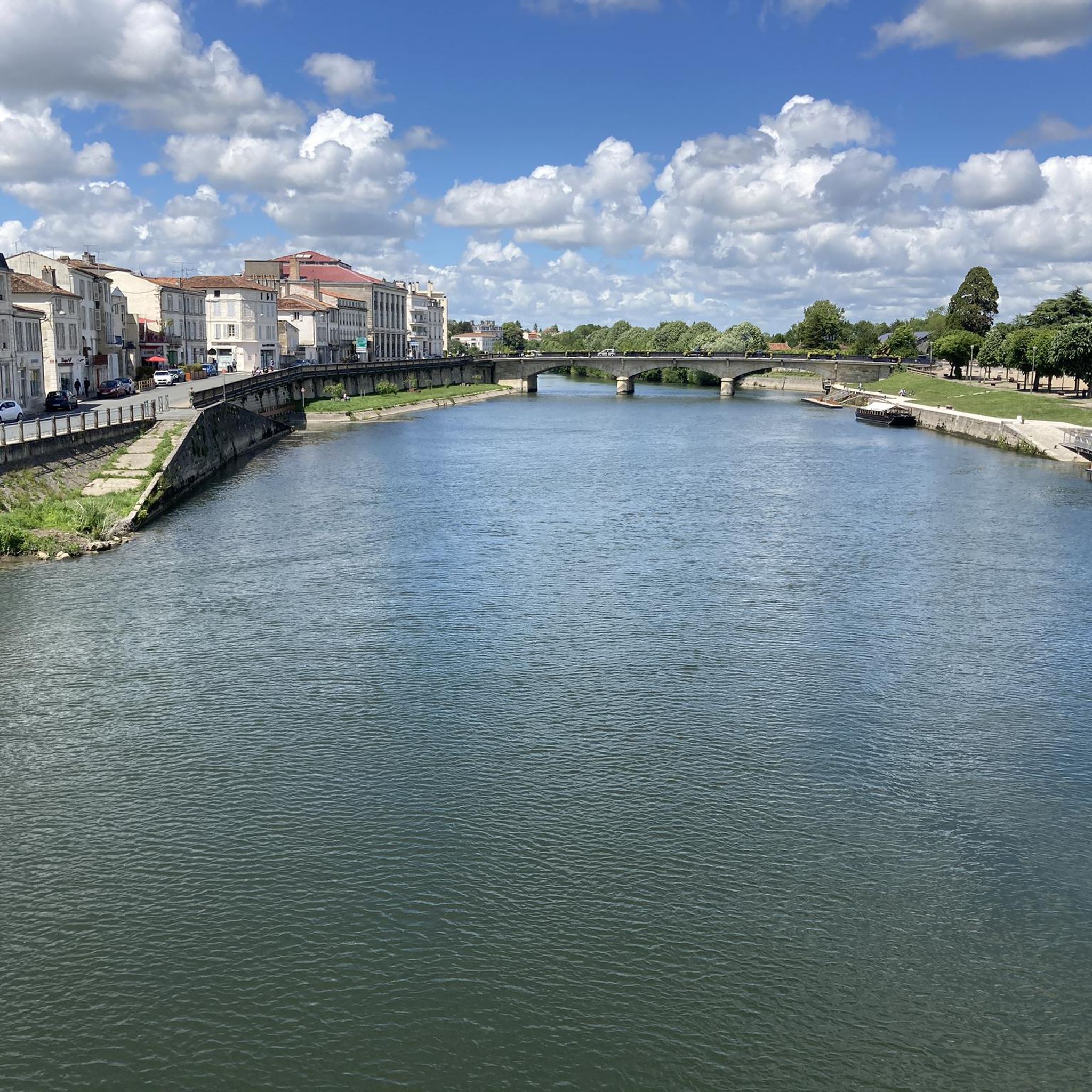
🏛️ 建設:紀元後18~19年 このアーチは、皇帝ティベリウスの治世下、紀元後18~19年頃に建設されました。リヨンとサントを結ぶアグリッパ街道の出口、シャラント川を渡るローマ橋の入り口に位置していました。 そのため、厳密には「凱旋門」ではありませんでした。それは道路の記念碑であり、ローマ領アキテーヌの首都であったメディオラヌム・サントヌムへの入り口を示す記念碑的な門でもありました。 👤 誰が建設を命じたのか? このアーチは、ローマ化されたサントン地方の有力者、ガイウス・ユリウス・ルプスによって資金提供されました。彼はそれをティベリウスと甥のゲルマニクスに捧げました。現在でも、楣(まぐさ)に刻まれた碑文によって、誰に捧げられた人物を知ることができます。 「ゲルマニクス門」という名前は、ゲルマニクスが個人的にアーチを建設したり、通過したりしたという事実からではなく、この献納に由来しています。 🏗️ かなり例外的な記念碑 アーチには2つの開口部があり、交通の流れを区別できるようにしていたと考えられています。高さは約15メートル、幅は約16メートルです。コリント式とコンポジット式の柱頭は、特に精巧なローマ建築を物語っています。 それは、サントの権力とローマ化の真の証でした。 ⚠️ アーチが消滅しかけた瞬間 これはおそらく、その歴史の中で最も興味深いエピソードです。 何世紀にもわたり、アーチは常にシャラント川右岸のローマ橋、そして中世の橋のレベルにありました。 19世紀には、古い橋は老朽化していました。1843年頃に橋の解体が決定されたとき、アーチもまた破壊の危機に瀕していました。 そこで、歴史的建造物総監であったプロスペル・メリメが登場しました。彼はその保存を主張し、アーチの解体、移設、そして新しい岸辺への再建を手配しました。 この保存には、もう一人の人物も関わっています。それは、1843年9月にサントに滞在し、メリメに対して記念碑の保存を擁護したヴィクトル・ユーゴーです。 📍 なぜアーチは正確に古代の場所になくなったのか? 今日、バソンピエール広場で見られるアーチは、そのため、元の場所にはもうありません。 河岸の改修と古い橋の消滅の際に、数十メートル移動されました。保存のために、石一つ一つに分解され、再組み立てされました。 現在、古代のローマ橋の渡り場のすぐ近くに設置されています。 🏛️ 保護 ゲルマニクス門は、最終的に1905年7月に歴史的建造物として指定されました。 興味深い補足 サント近郊にあるクラザンヌの石切り場は、この地域の古代の建造物に広く使用されていた石灰岩を供給していました。クラザンヌ産の石は、特にゲルマニクス門のような記念碑に使用されました。 要約: 18~19年 → ローマ橋の入り口にアーチが建設される ↓ 古代 → 中世 → アーチはシャラント川の渡り場に関連し続ける ↓ 1843年 → 古い橋の解体とアーチへの脅威 ↓ 1843~1844年 → メリメの介入とアーチの移設 ↓ 1905年 → 歴史的建造物に指定
0
0

サブロック修道院(Abbaye Notre-Dame de Sablonceaux)は、12世紀に建てられた歴史的なアウグスチノ修道院です。 ロマネスク様式で、一部は後のゴシック様式である建築は、特徴的な鐘楼、修道院教会の印象的な身廊、そして保存状態の良い回廊を特徴としています。 この修道院は、エキュメニカル・コミュニティであるシェマン・ヌフによって運営されています。静寂、祈り、そして出会いの場として機能しています。 修道院教会と敷地の一部は訪問者に公開されています。敷地内には、小さな展示・情報センターもあり、地元の製品や工芸品を購入することもできます。
0
0

2026年4月よりガイド付き見学が可能です! この2つの噴水は、紀元1世紀にローマ人によって建設された水道橋の水源を利用して、18世紀と19世紀に住民によって整備されました。 そこには洗濯場と水車小屋が建てられました。1993年に村の住民によって修復された水車小屋の奥には、「ローマの石畳」と呼ばれる水路を発見することができます。水はこの水道橋を通らなくなりましたが、亀裂に消えて地下の自然な水路に合流します。 1935年頃まで、この噴水は水車小屋の所有者のもので、彼は気まぐれで住民の立ち入りを禁止していました。そのため、当時の自治体は上流の古い石切り場に別の洗濯場を整備することを余儀なくされました。
0
0
The port of Ribérou is a major heritage site in Saujon, bearing witness to a prosperous maritime past linked to the salt and wine trade. Transformed in the 19th century by ambitious works, it has now been reinvented as a place for living, relaxation, and preserving local history. 🛶 Origins and the Middle Ages The port of Ribérou takes its name from the Latin word ripa ("riverbank") or the Occitan word ribèira ("river"). It is located at the head of the Seudre estuary. It existed as early as the 11th century and became an important river and sea port thanks to its strategic position at the head of the estuary, used particularly for the salt trade—then called "white gold"—a highly sought-after product for preserving food. 🚢 Medieval Period and International Trade With the opening of British markets during the reigns of Eleanor of Aquitaine and Henry II Plantagenet, ships laden with wool, salt, wine, and other goods flocked to Ribérou. In the 16th century, the port exported local wines (such as cognac and pineau) throughout Europe. In 1577, during the Wars of Religion, the port was a strategic site: troops were stationed there, and battles took place. 🏗️ Decline, Reconstruction, and the 19th Century The estuary gradually silted up, making navigation difficult. By 1691, only smaller vessels could dock there. During the French Revolution, the sale of the tidal mill, which helped remove sediment, worsened the silting, leading to the port's decline. A modernization project began in 1822, but it wasn't until 1839 that an ambitious program was launched under the impetus of Jules Dufaure—a native of Saujon and Minister of Public Works—with the construction of sturdy quays, slipways, a lock bridge (marking the boundary between fresh and salt water), and reception facilities. In 1842, the work was completed, and the main quay was named Quai Dufaure in honor of this political support. 📉 Gradual Decline and Modernization The arrival of the railway in 1876 and the persistent problems of silting led to a decline in the port's traditional commercial activity, already facing competition from other transport networks. In the 20th century, the port gradually lost its economic importance but remained active for traditional fishing and became a place for pleasure boating, leisure, and local culture. Urban and tourism development projects (particularly in 2011–2012) modernized the port while preserving its historical charm. 🌊 Today The port of Ribérou is now a small fishing and pleasure port, much appreciated for its walks along the Seudre River, water sports (canoeing, kayaking, paddleboarding, etc.), and seasonal events.
0
0


beautiful passages along the Charente with pretty monuments and small waterfront cafés in Port d’Envaux and Saintes.
0
0
The port of Ribérou is a fishing and pleasure port located at the end of the Seudre estuary, in Saujon. It is one of the two ports in the city, along with that of Breuil, a little downstream. Active since the 11th century, it took on its current appearance from 1842, under the impetus of the Minister of Public Works at the time, Jules Dufaure, a "local boy", who thus attempted to revive maritime trade and fishing activities, which were then in decline. Ideally located, on the edge of the city center, the La Lande leisure center and the preserved areas of the Seudre marshes (towpaths transformed into walking trails), it has become one of the major tourist attractions in Saujon, where theme evenings and the July 14 fireworks are organized. In 2011, the municipality began a renovation program for the port site, entrusted to the architect-urban planner Sophie Blanchet. It consists of transforming the old car parks into a pedestrian esplanade, a real meeting place with modern street furniture and, in the long term, green spaces. From the quays, lined with bourgeois buildings, small picturesque streets lined with hollyhocks allow you to crisscross the district and reach the city centre. The Ribérou lock bridge, known as the "bridge of opposing waters", was renovated in 2010. It marks the separation between the waters of the estuary (port side: brackish water) and the waters of the river (retention basin side: fresh water). Ribérou is a starting point for certain water sports (canoeing and kayaking). It is approximately 250 metres long and 40 metres wide. From Ribérou, it is possible to reach successively the ports of Breuil (Saujon), L'Éguille, Mornac, Chaillevette, Chatressac (Chaillevette), Grandes Roches and Orivol (Étaules), La Grève in Duret and Coux (Arvert), La Grève (La Tremblade) and La Cayenne (Marennes).
0
0
レ・ゼサールでのの人気観光スポット

komootモバイルアプリでインスピレーションを得よう


さらに探索
他の地域の最高のグラベルライドを見てみましょう。
