경로

플래너

기능

업데이트

App

로그인 또는 가입

앱 다운로드

로그인 또는 가입

로그인 또는 가입

경로
Places to see
Lakes
이탈리아
베네토
트레비소

타조

타조‬에서 가장 멋진 ‪16‬개의 호수

타조에서 가장 멋진 호수를 방문하고 싶나요? 호숫가의 고요한 분위기를 느끼거나 날씨가 따뜻한 날 호수에 발을 살짝 담글 수 있다면 얼마나 좋을까요? Komoot 커뮤니티가 추천한 타조의 주요 호수를 아래에서 살펴보고, 다음 모험 때 직접 찾아가보세요!

마지막 업데이트: 5월 27, 2026

라고 모르토

하이라이트 • 호수

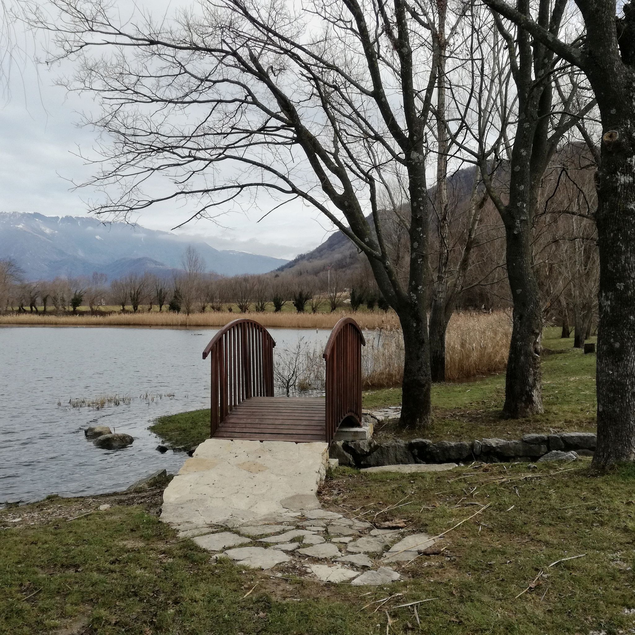
A nice vantage point on this beautiful lake.
Here is a picnic area where you can relax and enjoy a well-deserved break.

번역자 Google •

에 의해

라이딩 보기

휴대폰으로 전송

저장

라고 디라고

하이라이트 • 호수

Immersed in the Valmareno, between the Treviso Pre-Alps and the Prosecco hills, the picturesque Revine Lakes are two pools of glacial water divided between the municipalities of Revine Lago and …

번역자 Google •

에 의해

저장

이런 장소를 발견하려면 지금 가입하세요

최고의 싱글 트랙, 봉우리 및 다양한 흥미로운 야외 장소에 대한 추천을 받아보세요.

무료 회원 가입

산타 마리아 호수

하이라이트 • 호수

Along the shores of the Revine lakes there is a wonderful dirt bike path that I recommend to do with gravel bikes

번역자 Google •

에 의해

저장

라고 모르토 인근 피크닉 공간

하이라이트 • 휴식 공간

Equipped area of Borgo Piccin: reachable from the Fadalto road, but also via the dirt path around Lago Morto; the orographic right side is part of the horse trail n. …

번역자 Google •

에 의해

저장

What is impressive here is how the motorway meanders its way through the terrain.

번역자 Google •

에 의해

저장

무료로 가입하여 타조 주변의 더 많은 호수를 발견하세요.

무료 회원 가입

이미 komoot 계정이 있나요?

오늘 무료 계정으로 시작하세요

다음 모험이 기다리고 있어요.
로그인 또는 가입하기

타조 주변 인기 장소

타조 MTB 트레일

타조 사이클링

타조 하이킹

타조 로드 사이클링 경로

타조 러닝 트레일

타조 주변 그래블 라이딩

타조 등산

커뮤니티 팁

Luca N.
5월 18, 2026, Lago Morto

라고 모르토는 비토리오 베네토 코무네의 발 라피시나 계곡에 위치한 인상적인 수면으로, 파달토 고개의 트레비소 쪽 경사면 바로 아래에 있습니다. 그 특별한 이름은 독특한 지리적 특징에서 유래합니다. 바로 눈에 보이는 지표수 배출구나 유입구가 없는 호수인데, 지하 카르스트 경로를 통해서만 물이 공급되고 배출되기 때문입니다. 가파른 숲이 우거진 경사면과 인상적인 암벽으로 둘러싸인 이 분지는 깊고 시원한 물이 특징입니다. 오늘날 이 호수는 수력 발전 생산에 기본적인 역할을 하고 있으며, 위에 있는 산타 크로체 호수에서 오는 물을 활용하는 계곡의 발전소 시스템에 연결되어 있습니다. 산업적 흔적에도 불구하고 이 지역은 편안한 산책, 피크닉, 스포츠 낚시를 즐기기에 인기 있는 장소입니다.

번역: Google

0

0

트레비지아노 전알프스 사이의 그림 같은 계곡에 위치한 산타 마리아 호수(Lago di Santa Maria)는 레비네 라고(Revine Lago) 호수를 형성하는 두 개의 호수 분지 중 하나이며, 인공 수로를 통해 근처의 라고 호수(Lago di Lago)와 연결됩니다. 빙하 기원의 이 수역은 근처 산타 마리아 마을에서 이름을 따왔으며, 자연사적 가치가 높은 갈대밭과 삼림 지대로 둘러싸여 있습니다. 이곳은 고대부터 엄청난 역사적 중요성을 지녀왔으며, 신석기 시대와 청동기 시대의 고상 가옥 마을 유적에서 그 증거를 찾을 수 있습니다. 이 마을은 오늘날 근처 라이블렛 고고학 교육 공원(Parco Archeologico Didattico del Livelet)에 충실하게 복원되었습니다. 오늘날 이 호수는 생태 관광, 휴식 및 야외 활동을 위한 인기 있는 목적지입니다. 호숫가를 따라 보행자와 자전거 도로가 개발되어 있어 풍부한 조류와 습지 식생을 감상할 수 있습니다.

번역: Google

0

0

잊기 힘든 천국의 구석

번역: Google

0

0

Harry
9월 30, 2024, Lago di Lago

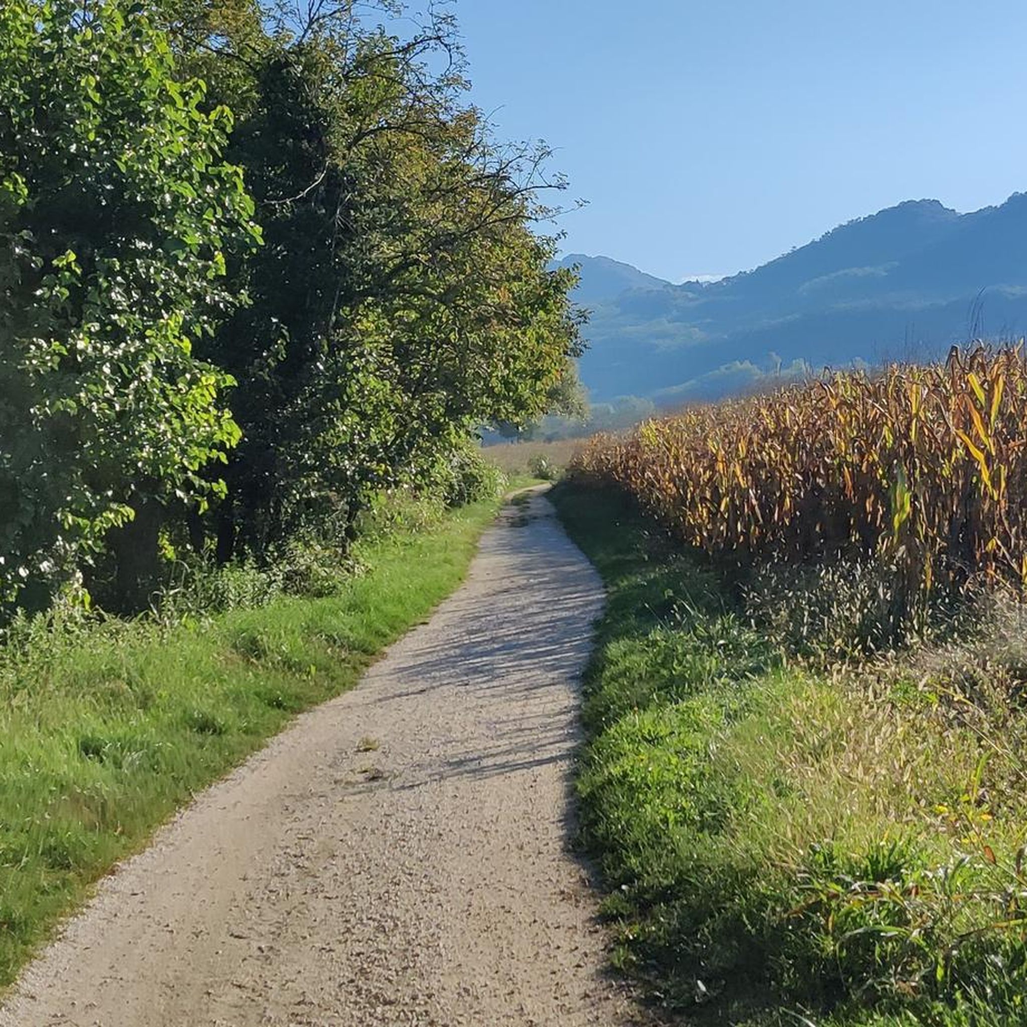
Nice lake with easy to navigate paths.

번역: Google

0

0

So called because it has no tributaries and emissaries, Dead Lake is an intravalley lake formed through landslide accumulations that occurred at the end of the ice age. With its 55 m depth, and a reservoir of approximately 20 million square meters of water, it is the largest of the three lakes in the municipality of Vittorio Veneto. It is fed by underground infiltrations that come from Lake Santa Croce and by karst springs from the right side of Col Visentin. Like the underlying Restello and Negrisiola, arranged in succession, these semi-artificial basins were "built" on ancient basins left by the glacier that descended from the Lapisina Valley and in which mirrors of lake water had taken place. In fact, Val Lapisina is what remains of the branch of an ancient glacier that followed the current course of the Piave. The branch, in turn, divided, forming on one side what is today the Valley and on the other the morainic amphitheater located between Vittorio Veneto and Conegliano.

번역: Google

2

0

Lake Restello (or San Floriano) is one of three bodies of water in the Lapisina Valley. These artificial lakes, arranged in succession, were "built" on ancient glacial basins that once formed lake basins. The three lakes are located at different elevations: Lago Morto, further north, at 274 meters above sea level; Lago del Restello at 177 meters above sea level; and, finally, Lago di Negrisiola at 160 meters above sea level. This difference in elevation allows for exploitation for energy purposes, a process that begins at Lago di S. Croce, via underground infiltration, and ends in the Vittoria alluvial plain. Lago del Restello, in particular, was created by damming the rocky strait of San Floriano, and occupies the depression of an old lake reclaimed during the last century. It is fed by wastewater from the Nove power plant and by springs in the valley floor located in Botteon and Lagusel. The water, used to power the plant's hydroelectric turbines, feeds Lake Negrisiola. On the shores of this basin stand the San Floriano tower, the church of the same name, and the A27 motorway viaduct. The name refers to the restelli di sanità, barriers established by the Republic of Venice to prevent the spread of epidemics by controlling traffic.

번역: Google

1

0

KarstenE
7월 7, 2024, Lago di Lago

Unfortunately, today it is not possible to drive directly along the water due to flooding of the path

번역: Google

0

0

A particularly great area. It rolled well on this section.

번역: Google

0

1

타조 주변에서 가장 인기 있는 경로

타조 MTB 트레일

타조 주변에서 가장 인기 있는 명소

Places to see

Store rating

komoot 모바일 앱으로 영감을 받아보세요

무료 komoot 계정로 끝없는 야외 모험을 손쉽게 찾고, 맞춤 설정하며 길안내할 수 있어요.

또는

지금 komoot에 가입하세요

Store rating

더 살펴보기

타조 주변에서 완벽한 호수를 아직 못 찾으셨나요? 이 지역의 가이드를 확인하여 더 아름다운 장소를 찾아보세요.

론케이드프레고나비토리오 베네토아카펠라 마조레리바인 라고사르메데시손 디 발마리노코넬리아노파데르노 델 그라파포사뇨몰리아노 베네토콜 움베르토모나스티에 디 트레비소코르디냐노보르소 델 그라파폴리나산 피에트로 디 펠레토파라 디 솔리고레프론톨로피에베 디 솔리고카살레 술 실레미안스세가나제로 브랑코프레간지올퀸토 디 트레비소로리아실레아크레스파노 델 그라파모타 디 리벤자메두나 디 리벤자자연 공원 지역 델 피우메 실레빌로르바폰자노 베네토산타 마리아 호수카시에르

근처 어드벤처 가이드

호수 호수 즐길거리

background

새로운 정복을 위한 준비를 하세요

무료로 가입하기

탐험하기
경로경로 플래너기능하이킹MTB 트레일로드 사이클링 경로바이크패킹사이트맵
앱 다운로드
소셜 미디어에서 팔로우하기

© komoot GmbH

개인 정보 보호 정책