경로

플래너

기능

업데이트

App

로그인 또는 가입

앱 다운로드

로그인 또는 가입

로그인 또는 가입

경로
로드 사이클링 경로
이탈리아
투스카니
그로세토

몬테로톤도 마리티모

몬테로톤도 마리티모 최고의 라이딩 경로

4.6

(254)

6,719

자전거 타는 사람

16

라이딩

몬테로톤도 마리티모의 로드 사이클링 경로를 찾으시나요? 그렇다면 몬테로톤도 마리티모 로드 라이딩 컬렉션 중에서 가장 멋진 라이딩 장소를 아래에서 살펴보세요.

마지막 업데이트: 5월 11, 2026

47

자전거 타는 사람

#1.

Campetroso W에서 출발하는 스트라다 델라 마르실리아나 – Lago dell'Accesa 순환 코스

86.1km

03:45

790m

790m

보통 도로 자전거 타기. 좋은 체력 필요. 지면 대부분이 잘 포장되어 있고 라이딩하기 쉬움.

기기에서 길안내

휴대폰으로 전송

저장

보통

어려운 도로 자전거 타기. 우수한 체력 필요. 투어 중 라이딩하기 어려운 비포장 구간이 있을 수 있음.

어려움
guide_signup
저희가 komoot 모바일 앱로 길을 안내해 드리겠습니다.
무료 komoot 계정로 끝없는 야외 모험을 손쉽게 찾고, 맞춤 설정하며 길안내할 수 있어요.

무료 회원 가입

어려운 도로 자전거 타기. 우수한 체력 필요. 지면 대부분이 잘 포장되어 있고 라이딩하기 쉬움.

어려움

보통 도로 자전거 타기. 좋은 체력 필요. 지면 대부분이 잘 포장되어 있고 라이딩하기 쉬움.

보통

보통 도로 자전거 타기. 좋은 체력 필요. 지면 대부분이 잘 포장되어 있고 라이딩하기 쉬움.

보통
무료 회원 가입 후 몬테로톤도 마리티모 주변 라이딩 경로를 12개 더 확인하세요

더 다양한 경로와 다른 탐험가들의 추천을 살펴보세요.

무료 회원 가입

이미 komoot 계정이 있나요?

투어 추천은 다른 사람들이 komoot에서 완료한 수천 개의 활동을 바탕으로 구성되어 있습니다.

오늘 무료 계정으로 시작하세요

다음 모험이 기다리고 있어요.
로그인 또는 가입하기

몬테로톤도 마리티모 주변 인기 장소

Tuscany by bike – history, cypresses and the Strade Bianche

몬테로톤도 마리티모 하이킹

몬테로톤도 마리티모 러닝 트레일

몬테로톤도 마리티모 사이클링

몬테로톤도 마리티모 MTB 트레일

몬테로톤도 마리티모 주변 그래블 라이딩

몬테로톤도 마리티모 주변의 다른 모험

Tuscany by bike – history, cypresses and the Strade Bianche

사이클링 컬렉션 에 의해

Bici in Comune

커뮤니티 팁

Stenio Melani
5월 13, 2026, Strada del Vino Monteregio di Massa Marittima

몬테레조 디 마사 마리티마(Monteregio di Massa Marittima)는 1994년에 설립된 원산지 통제 명칭(DOC)으로, 토스카나의 알타 마렘마 그로세타나 지역에서 생산되는 와인을 식별합니다. 생산 지역은 마사 마리티마(Massa Marittima)와 몬테로톤도 마리티모(Monterotondo Marittimo)의 전체 지자체와 폴로니카(Follonica), 스칼리노(Scarlino), 가보라노(Gavorrano), 로카스트라다(Roccastrada), 카스틸리오네 델라 페스카이아(Castiglione della Pescaia)의 일부 지자체를 포함합니다.

번역: Google

0

0

A truly stunning place both for its nature and landscape and for mountain bike lovers, with many trails for all abilities.

번역: Google

1

0

The Accesa area is also extremely significant from an archaeological perspective. Near the lake, in the Macchia del Monte area, numerous excavations were carried out as early as the 1930s, and resumed in the 1980s, bringing to light numerous remains of four Etruscan villages dating from the 9th to the 6th century BC. The buildings of the various settlements, of which only the foundations are visible, are gathered in scattered groups within a rather large area. Given their location, it is hypothesized that these villages were linked to mining, especially copper from the Fenice Capanne and Serrabottini mines. It is also thought that these mining villages were mining outposts that were subordinate to the large center of Vetulonia, to which they supplied raw materials. In addition to the complexes intended for housing and mining, many tombs of various types (pit, pit, circle, and chamber) were also discovered.

번역: Google

1

0

Approximately 10 km from Massa Marittima, we find Lago dell'Accesa, of great naturalistic, environmental, and historical-archaeological interest, so much so that its evocative atmosphere has given rise to numerous legends. Of karst origin, the lake is approximately 38 meters deep and feeds the Bruna River, its only estuary. Besides being suitable for swimming, it offers refreshing summer refreshment thanks to the typical vegetation surrounding it, consisting of reeds, rushes, poplars, and eucalyptus trees, as well as typical Mediterranean scrub. It is an ideal place for pleasant walks along the shore and in the surrounding area. The crystal-clear waters are populated by a diverse fish fauna, including trout, pike, carp, and perch, as well as an equally rich population of aquatic birds. The Accesa area is also extremely significant from an archaeological perspective. Near the lake, in the Macchia del Monte area, numerous excavations were carried out, uncovering three Etruscan settlements.

번역: Google

1

0

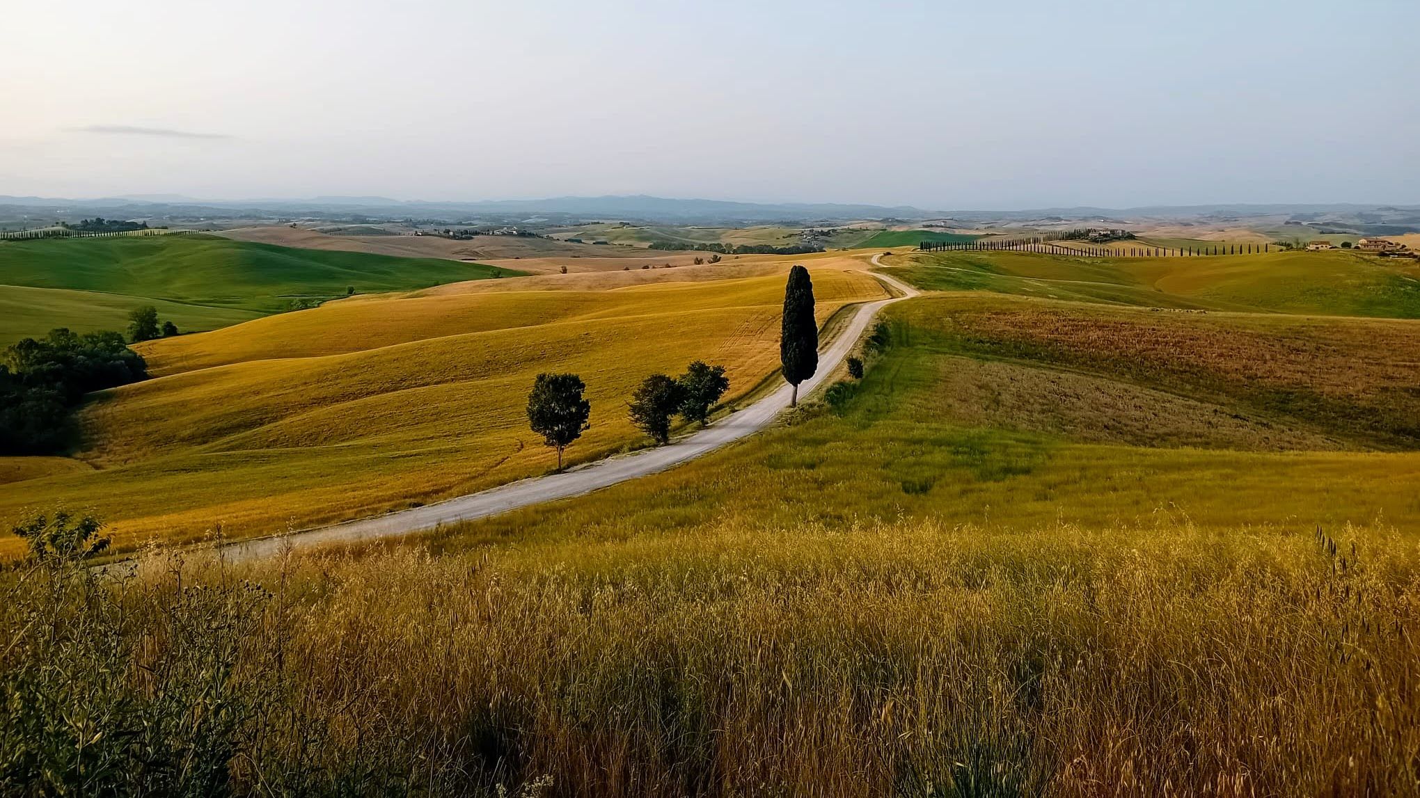
The road is a quiet provincial road with little traffic and beautiful hilly landscapes. The Marsiliana State Reserve is part, for a large stretch, of the Montioni Natural Park and extends for approximately 450 hectares in a vast hilly area. An area for the protection of the hilly landscape and the "Maremma horse." Managed by the State Forestry Corps, the Marsiliana State Reserve extends around the villa of the same name and includes woods, Mediterranean scrub, pastures, and olive groves.

번역: Google

1

0

The Accesa area is also extremely significant from an archaeological perspective. Near the lake, in the Macchia del Monte area, numerous excavations were carried out as early as the 1930s, and resumed in the 1980s, bringing to light numerous remains of four Etruscan villages dating from the 9th to the 6th century BC. The buildings of the various settlements, of which only the foundations are visible, are gathered in scattered groups within a rather large area. Given their location, it is hypothesized that these villages were linked to mining, especially copper from the Fenice Capanne and Serrabottini mines. It is also thought that these mining villages were mining outposts that were subordinate to the large center of Vetulonia, to which they supplied raw materials. In addition to the complexes intended for housing and mining, many tombs of various types (pit, pit, circle, and chamber) were also discovered.

번역: Google

1

0

Approximately 10 km from Massa Marittima, we find Lago dell'Accesa, of great naturalistic, environmental, and historical-archaeological interest, so much so that its evocative atmosphere has given rise to numerous legends. Of karst origin, the lake is approximately 38 meters deep and feeds the Bruna River, its only estuary. Besides being suitable for swimming, it offers refreshing summer refreshment thanks to the typical vegetation surrounding it, consisting of reeds, rushes, poplars, and eucalyptus trees, as well as typical Mediterranean scrub. It is an ideal spot for pleasant walks along the shore and in the surrounding area. The crystalline waters are populated by a diverse fish fauna, including trout, pike, carp, and perch, as well as an equally rich population of aquatic birds.

번역: Google

0

0

The Accesa area is also extremely significant from an archaeological perspective. Near the lake, in the Macchia del Monte area, numerous excavations were carried out as early as the 1930s, and resumed in the 1980s, bringing to light numerous remains of four Etruscan villages dating from the 9th to the 6th century BC. The buildings of the various settlements, of which only the foundations are visible, are gathered in scattered groups within a rather large area. Given their location, it is hypothesized that these villages were linked to mining, especially copper from the Fenice Capanne and Serrabottini mines. It is also thought that these mining villages were mining outposts that were subordinate to the large center of Vetulonia, to which they supplied raw materials. In addition to the complexes intended for housing and mining, many tombs of various types (pit, pit, circle, and chamber) were also discovered.

번역: Google

1

0

몬테로톤도 마리티모 주변에서 가장 인기 있는 경로

몬테로톤도 마리티모 하이킹

몬테로톤도 마리티모 주변에서 가장 인기 있는 명소

Places to see

Store rating

komoot 모바일 앱으로 영감을 받아보세요

무료 komoot 계정로 끝없는 야외 모험을 손쉽게 찾고, 맞춤 설정하며 길안내할 수 있어요.

또는

지금 komoot에 가입하세요

Store rating

더 살펴보기

다른 지역의 최고의 로드 사이클링 경로를 살펴보세요.

마사 마리티마카스틸리오네 델라 페스카이아Riserva Naturale Statale Marsiliana폴로니카오르베텔로로카스트라다자연 보호 구역 디아치아 보트로나리세르바 델라 페닐리아토스카나의 말리아노만치아노몬테 아르젠타리오스칼리노시비텔라 파가니코몬티에리자연 보호 구역 라 피에트라가보라노카팔비오아르시도소Riserva Naturale Poggio All'OlmoArea Naturale Protetta Di Interesse Locale Costiere Di ScarlinoOasi Wwf Lagune Di OrbetelloRiserva Naturale Farma스칸사노Zona Di Protezione Speciale Poggio Tre Cancelli카스텔 델 피아노소라노치니지아노산타 피오라부라노 호수산 플로리아노 호수Riserva Naturale Lago Di Burano파르코 내츄럴 델라 마렘마카스텔아자라Riserva Naturale Monte LabbroRiserva Naturale Monte Penna세지아노Riserva Naturale MontautoRiserva Naturale Pescinello자연 보호 구역 보스코 데이 로코니셈프로니아노캄파냐티코로칼베냐피틸리아노

근처 어드벤처 가이드

Riserva Naturale Statale Marsiliana 즐길거리

background

새로운 정복을 위한 준비를 하세요

무료로 가입하기

탐험하기
경로경로 플래너기능하이킹MTB 트레일로드 사이클링 경로바이크패킹사이트맵
앱 다운로드
소셜 미디어에서 팔로우하기

© komoot GmbH

개인 정보 보호 정책