경로

플래너

기능

업데이트

App

로그인 또는 가입

앱 다운로드

로그인 또는 가입

로그인 또는 가입

경로
Places to see
스페인
카나리아 제도

필란콘

20의 필란콘가지 명소 & 주요 장소

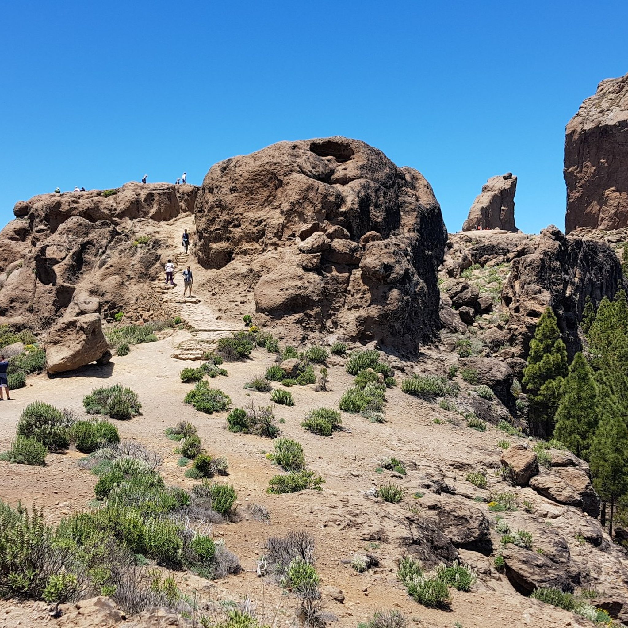
주요 명소와 볼거리가 있는 필라코네스 자연공원은 그란 카나리아 남부의 극적인 화산 지형과 풍부한 생물 다양성이 특징입니다. 보호 구역으로 지정된 이 공원은 깊은 협곡, 광활한 소나무 숲, 그리고 중요한 생태적, 문화적 가치를 지니고 있습니다. 화산 폭발로 형성된 지형은 갈색의 경사진 협곡과 좁은 산등성이의 험준한 풍경을 보여줍니다. 공원은 탐험할 수 있는 다양한 자연 경관과 역사 유적지를 제공합니다.

필라코네스의 주요 명소 및 볼거리

  • 가장 인기 있는 명소는 경치 좋은 오르막길로 유명한 사이클링 코스인 산 바르톨로메–아야카타 도로입니다. 이 경로는 주변 풍경의 탁 트인…

마지막 업데이트: 5월 26, 2026

카미노스 레알레스 하이킹 트레일 (크루스 그란데에서 산 바르톨로메까지)

하이라이트 (구간) • 트레일

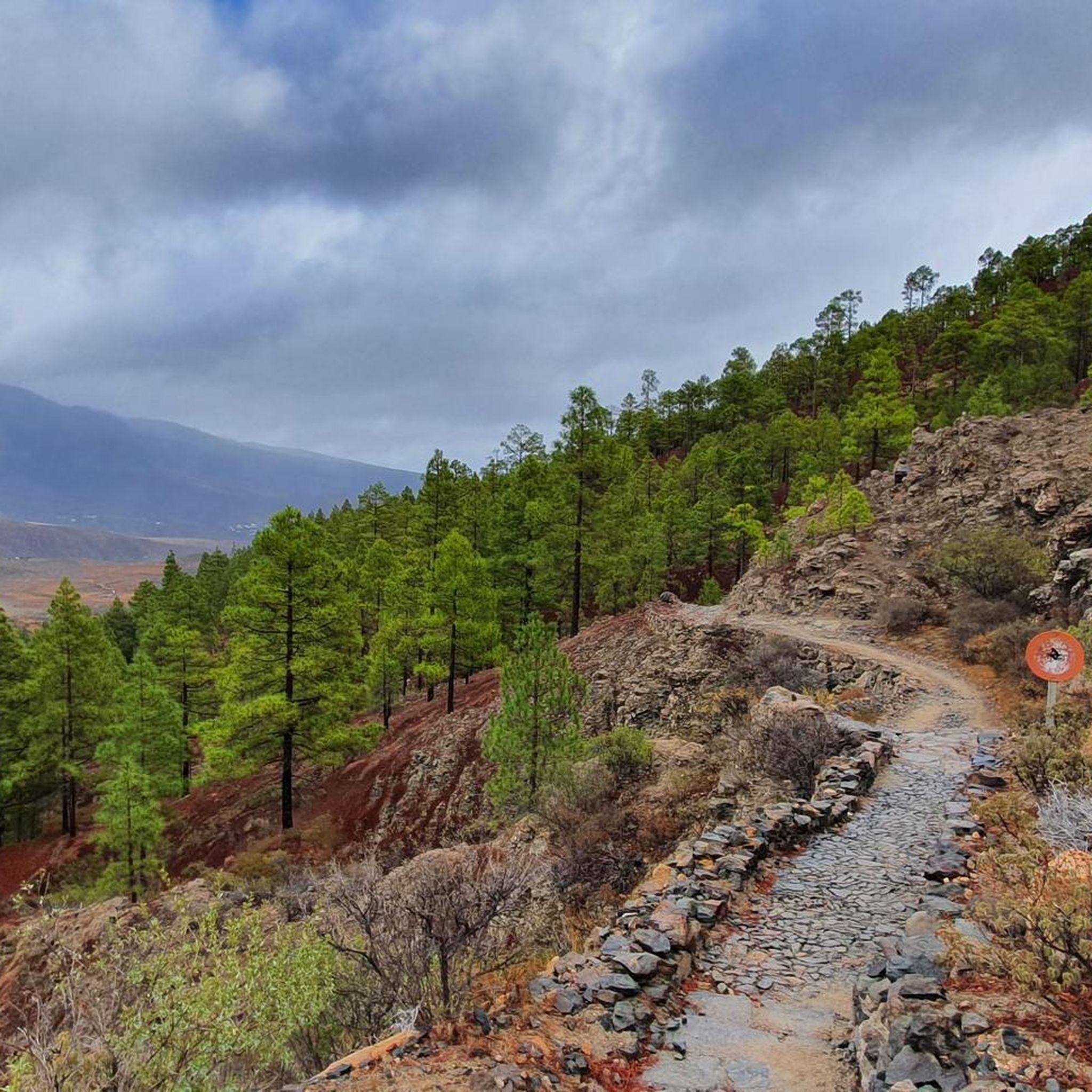
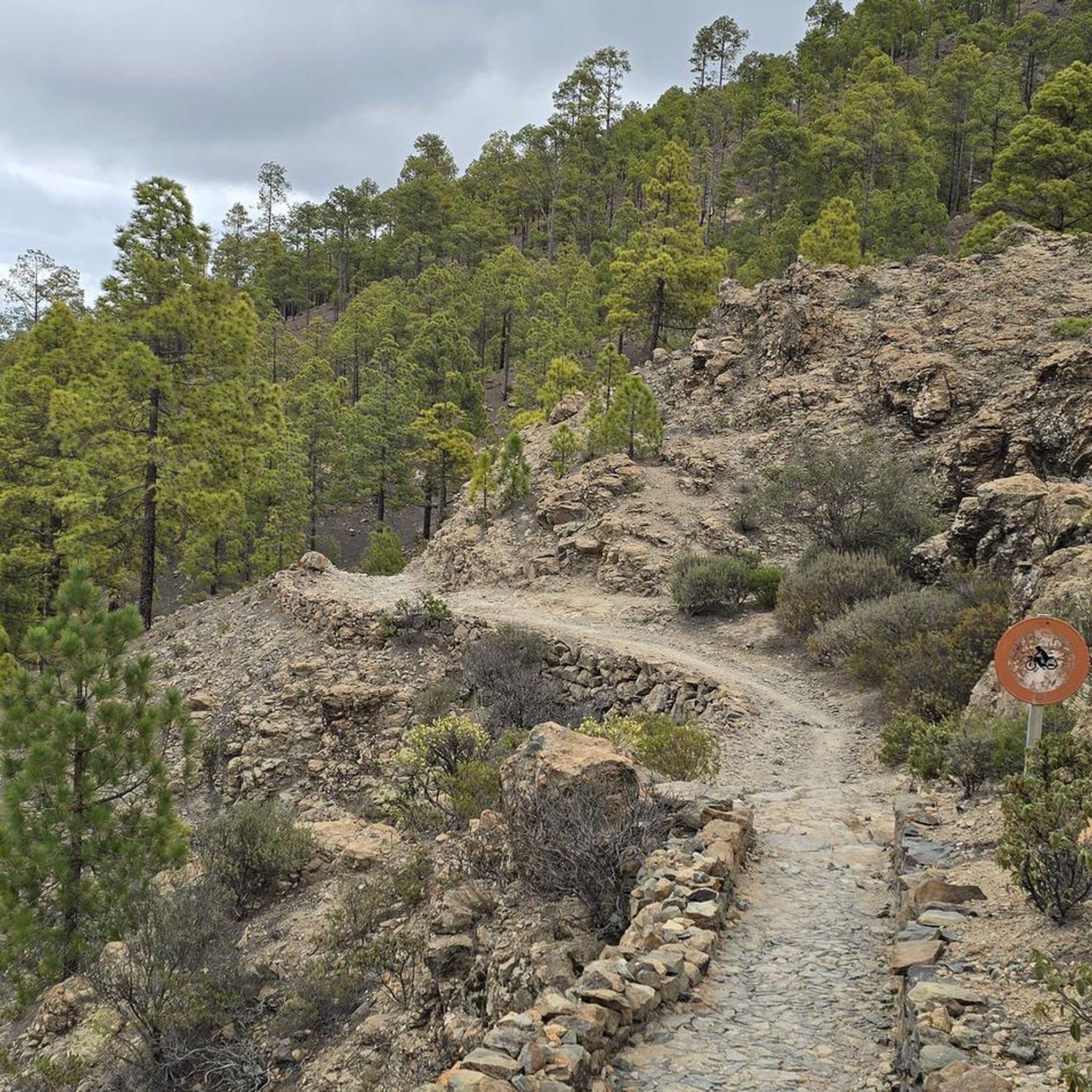
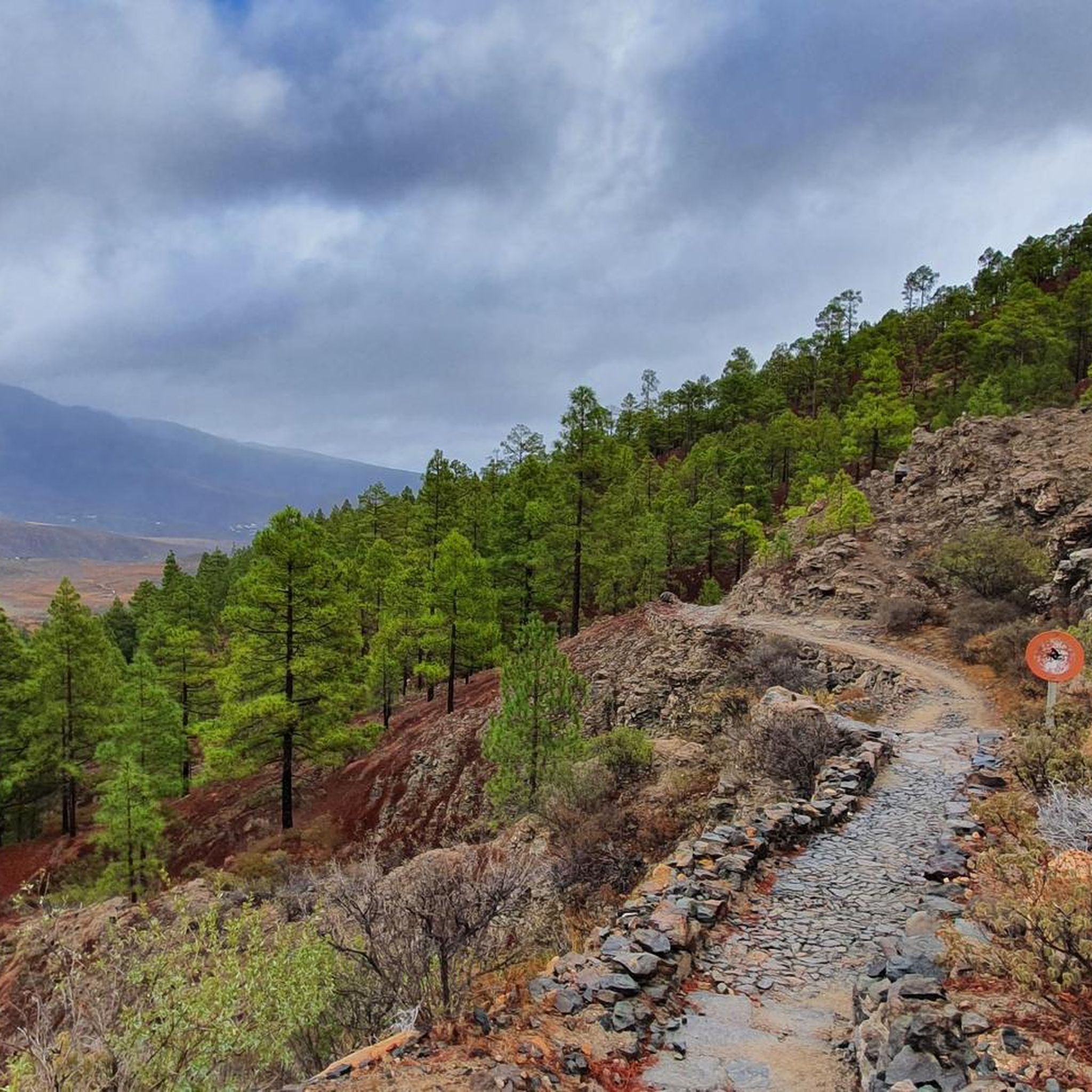
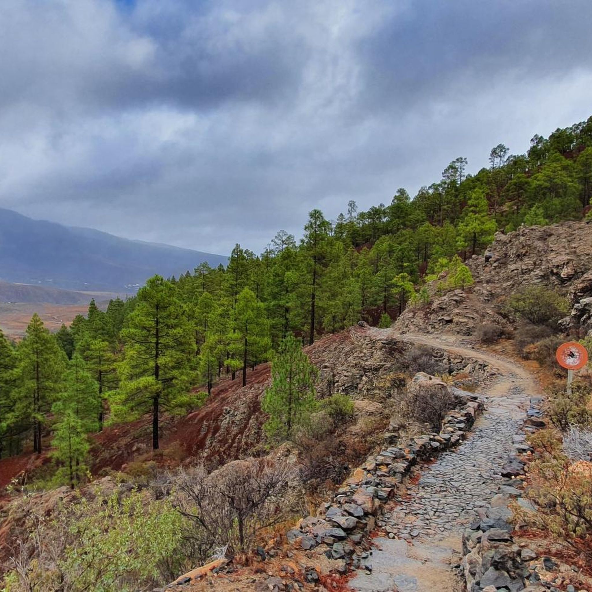
An almost luxuriously well-maintained hiking trail from the Cruz Grande to the district capital San Bartolomé (Tunte). Just before San Bartolomé you come to an intersection. Both roads lead to …

번역자 Google •

에 의해

하이킹 보기

휴대폰으로 전송

저장

아야가우레스 댐

하이라이트 • 호수

On Gran Canaria there are about 60 reservoirs. No wonder: it rains so seldom that one makes every effort to make sensible use of every drop of water. Apart from …

번역자 Google •

에 의해

저장

이런 장소를 발견하려면 지금 가입하세요

최고의 싱글 트랙, 봉우리 및 다양한 흥미로운 야외 장소에 대한 추천을 받아보세요.

무료 회원 가입

산 바르톨로메에서 아야카타로 가는 도로

하이라이트 (구간) • 자전거 도로

Nice climb with nice views. The surface is quite rough most of the times, so climbing is better than descending

에 의해

저장

Presa de La Gambuesa

하이라이트 • 호수

La Gambuesa Dam is a special oasis in Gran Canaria. Throughout the Canary archipelago, water is very scarce, so water reserves like this are very precious. In fact, culturally it …

번역자 Google •

에 의해

저장

Degollada de la Cruz Grande 전망대

하이라이트 • 전망대

The Cruz Grande is an important starting point for hikes. From here, trails start to the reservoir Chira, to San Bartolomé (Tunte), to the Cruz de Tejeda or to the …

번역자 Google •

에 의해

저장

무료로 가입하여 필란콘의 더 많은 명소를 발견하세요.

무료 회원 가입

이미 komoot 계정이 있나요?

오늘 무료 계정으로 시작하세요

다음 모험이 기다리고 있어요.
로그인 또는 가입하기

필란콘 주변 인기 장소

필란콘 하이킹

필란콘 로드 사이클링 경로

필란콘 러닝 트레일

필란콘 MTB 트레일

필란콘 사이클링

필란콘 등산

필란콘 그래블 라이딩

커뮤니티 팁

Genieten op 2 Wielen
4월 9, 2026, Presa de La Gambuesa

La Gambuesa 저수지(presa)는 해발 약 330미터에 위치하며 47,000세제곱미터의 물을 담을 수 있습니다. 이 저수지는 Presa de la Angostura와 불가분의 관계를 맺고 있으며, Barranco de Ayagaures의 유역과 특별한 생태적, 풍경적, 문화적 가치를 지닌 풍경을 공유합니다.

번역: Google

0

0

The entire route is freshly paved. A dream.

번역: Google

1

0

The hiking trail is great to walk and you have a great view of the mountains

번역: Google

0

0

The path would be very beautiful if it hadn't fallen into disrepair in many places. But it is certainly an eye-catcher. This is probably how Caminos Reales were designed in the Canary Islands in the old days.

번역: Google

0

0

Cruz Grande is an excellent starting point for many hikes.

번역: Google

1

0

The Degollada (valley) of the Cruz Grande offers views of two different valleys. On one side you can see the Caldera de Tirajana, and on the other the Chira basin and the pine forest of Pilancones. This is where the paths from north to south cross. The main route is known as the Ruta de la Plata, and was formerly part of a cattle route for transhumance, as well as part of the Way of St. James in Gran Canaria. The oldest volcanic materials are clearly visible in the Caldera de Tirajana due to the effect of erosion, such as the vent "Risco Blanco" and the volcanic layers "Rompeserones" and "Sepultura del Gigante". The plateaus "El Sequero", "El Sitio" and "Los Llanos de Madrid" were formed by the sliding of volcanic materials. In the ravines are the archaeological sites of. "Rosiana", "Los Sitios" and "La Fortaleza de Ansite". In the fertile and cultivated valley you can see the remains of the former palm groves that originally grew here. The Canary Island pine is common in the upper region of the caldera and the slopes are a habitat for some native botanical rarities. In the upper region of Ayagaures is the natural park and pine grove, Parque Natural de Pilancones, which has a great geological and botanical landscape value. As for the flora of the area, the Canary Island pine plays a major role. A species of rockrose and a viper's bugloss are particularly noteworthy. The area is also a bird sanctuary for the native great spotted woodpecker and the finch. The area was declared a World Biosphere Reserve by UNESCO on 29 June 2005.

번역: Google

3

0

The Cruz Grande is a pass that lies at an altitude of 1249 meters. The saddle is also called Degollada de la Cruz Grande. From up there you can enjoy views of two different valleys. On one side you can see the Caldera de Tirajana and on the other side the Chira basin. Many old paths meet at the Cruz Grande, such as the Ruta de la Plata, which is also part of the Way of St. James in Gran Canaria. During your hike you will also come to the Cruz Grande. From there you descend on the Camino Real to San Bartolomé.

번역: Google

2

0

A beautifully laid out hiking trail!

번역: Google

6

0

필란콘에서 가장 인기 있는 경로

필란콘 가족 하이킹

필란콘에서 가장 인기 있는 명소

Lakes

Store rating

komoot 모바일 앱으로 영감을 받아보세요

무료 komoot 계정로 끝없는 야외 모험을 손쉽게 찾고, 맞춤 설정하며 길안내할 수 있어요.

또는

지금 komoot에 가입하세요

Store rating

더 살펴보기

찾고 있는 하이라이트를 아직 못 찾으셨나요? 다른 지역의 주요 명소 가이드를 확인해보세요:

테러텔데발세키요 데 그란 카나리아베가 데 산 마테오테제다산타 브리지다인제니오산타 루시아 데 티라자나아귀메스산 바르톨로메 데 티라자나모간라스 팔마스 데 그란 카나리아산타 마리아 데 기아 데 그란 카나리아아르테나라아루카스발레세코모야갈다르산 니콜라스 데 톨렌티노아게테피르가스다마다바

근처 어드벤처 가이드

산 바르톨로메 데 티라자나 즐길거리

background

새로운 정복을 위한 준비를 하세요

무료로 가입하기

탐험하기
경로경로 플래너기능하이킹MTB 트레일로드 사이클링 경로바이크패킹사이트맵
앱 다운로드
소셜 미디어에서 팔로우하기

© komoot GmbH

개인 정보 보호 정책