경로

플래너

기능

업데이트

App

로그인 또는 가입

앱 다운로드

로그인 또는 가입

경로
Places to see
Canyons
영국
영국
요크셔 앤 더 험버
노스요크셔

요크셔 데일스 국립공원

요크셔 데일스 국립공원‬에서 가장 멋진 ‪20‬개의 협곡

요크셔 데일스 국립공원에 있는 멋진 협곡 20
개를 소개해드릴게요. 아래에서 멋진 협곡을 살펴보고, 다음 요크셔 데일스 국립공원 모험에 도움이 될 만한 사진, 팁, 추가 정보를 알아보세요.

마지막 업데이트: 7월 14, 2026

말햄 코브

하이라이트 • 자연 기념물

The 230 feet (70 m) high, gently curving cliff of Malham Cove will take your breath away. A spectacular geological formation in its own right, the views from above the …

에 의해

하이킹 보기

휴대폰으로 전송

저장

말햄 코브 석회암 평원

하이라이트 • 자연 기념물

Most people walk from Malham village up to the Cove using the road ways. There's actually an alternative route up past the pub, which takes you higher up. I find …

에 의해

저장

이런 장소를 발견하려면 지금 가입하세요

최고의 싱글 트랙, 봉우리 및 다양한 흥미로운 야외 장소에 대한 추천을 받아보세요.

무료 회원 가입

고르데일 스카 폭포

하이라이트 • 자연 기념물

Gordale Scar is one of the most dramatic sights in the Yorkshire Dales. The narrow canyon is dominated on either side by sheer walls of rock, hundreds of feet high, …

에 의해

저장

스트리드

하이라이트 • 자연 기념물

The Strid is a natural wonder, where the river suddenly narrows forcing the water through at great pressure. It was formed by the wearing away of softer rock by the …

에 의해

저장

Hull Pot

하이라이트 • 협곡

Hull Pot, on the western side of Pen-y-Ghent, is a collapsed cavern, and an impressive hole measuring 91m (300ft) long by 18m (60ft) deep.

In the late 18th century, in …

에 의해

저장

무료로 가입하여 요크셔 데일스 국립공원의 더 많은 협곡을 발견하세요.

무료 회원 가입

이미 komoot 계정이 있나요?

오늘 무료 계정으로 시작하세요

다음 모험이 기다리고 있어요.

로그인 또는 가입하기

요크셔 데일스 국립공원 주변 인기 장소

북쪽의 거친 것 — 두 번째 도시 분할

공원을 걷다 - 요크셔 데일스 국가공원을 거쳐

겨울에 데일즈 하이 웨이를 하이킹

GBDURO - 대리스타일 일력 아니다 일제목록 GB 작동

에디번버그에서 맨체스터까지 바이크팩킹 - 펜닌 랠리

데일즈의 심장부에 이르는 인상 깊은 강변 산책 — 리블 웨이

아름다운 경관과 오래된 역사의 결혼 — 레이디 애넌 길 하이킹

요크셔의 아름다운 등골 - 데일스 하이 웨이를 등산하다

#WalkHome2020 — 셰필드에서 커커마우스까지 15일

호수, 데일즈 및 모어스 - 팀 우드코크의 해안 간 오프로드 경로

요크셔 데일스 국립공원의 다른 모험

북쪽의 거친 것 — 두 번째 도시 분할

산악자전거 라이딩 컬렉션 에 의해

Katherine Moore

커뮤니티 팁

Chris Shannon
2월 22, 2026, The Strid

This is a really nice natural beauty place not far from Bolton Abbey and in the Strid woods

1

0

The Strid is a section of the River Wharfe and considered to be one of the most dangerous sections of rivers in the UK. The river is forced through a narrow gap at Great pressure.

1

0

Access: 🚗 c. 2miles from the village of Horton-in-Ribblesdale 🥾 Alternatively, enjoy a 9 miles hike with just 2,000ft of total elevation from Horton-in-Ribblesdale, via Pen-y-Ghent

0

0

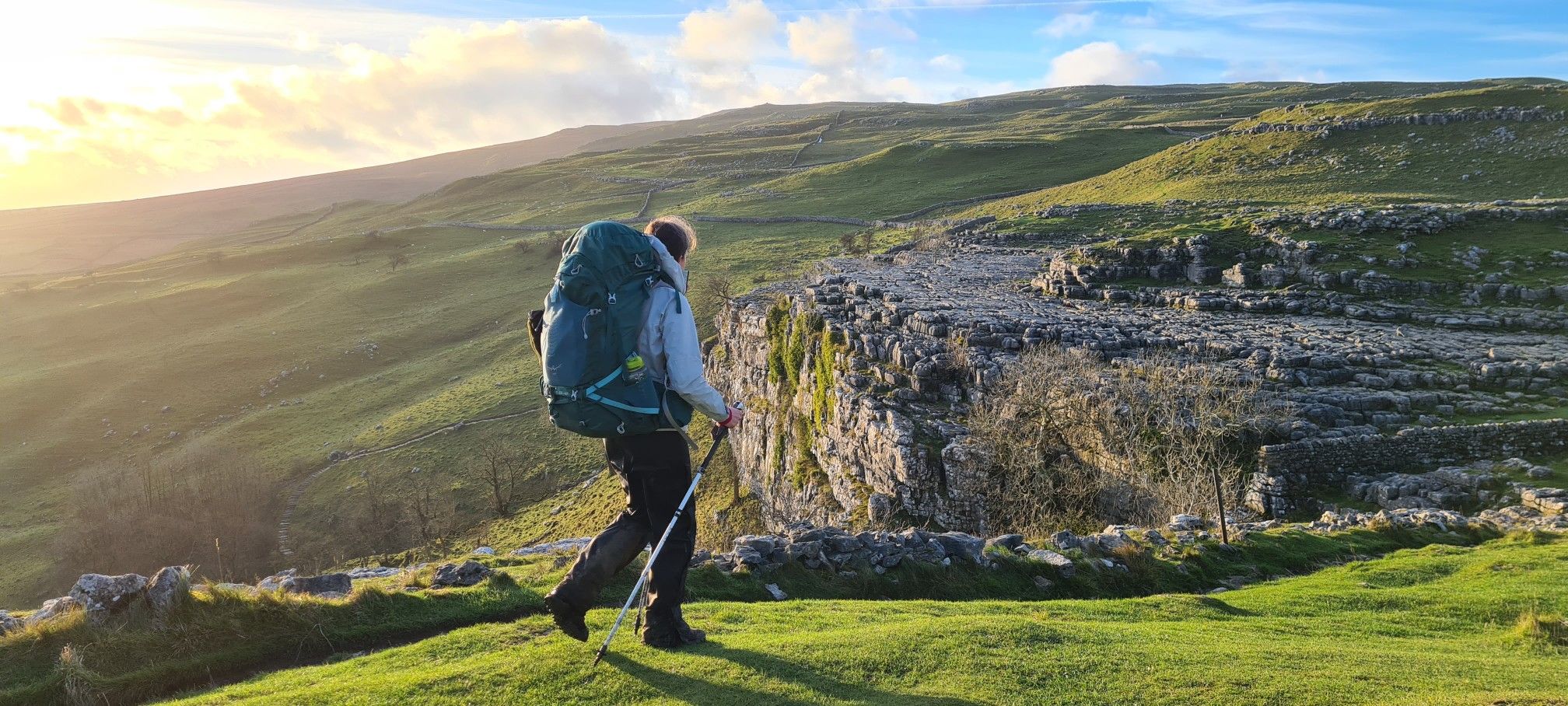
Where the scene in Harry Potter was filmed where Harry and Hermione sat in the Deathly Hallows. Harry & Hermione set up camp in a tent on the Limestone Pavement at the top of Malham Cove, scenes from the film feature views across Malhamdale including the view to Cawden and down to Malham Village and Kirkby Malham. There is amazing views from this point over the scarred landscape. Malham Cove is a 70m (230ft) high curved crag of carboniferous limestone formed after the last ice age. Meltwater, particularly from Malham Tarn, cut back the cove as it fell over the edge as a waterfall. This erosion took place more actively at the lip of the fall, hence the curved shape. The cove was formed by glaciers that plucked rock from the cliff face and carried it away, and by meltwater that eroded the cliff face after the glaciers melted. The top of the cove is a limestone pavement with a distinctive pattern of limestone blocks called clints and fissures called grykes. The grykes have a more humid and warmer microclimate than the pavement, which supports different plant life. The top of the limestone has dry, stony conditions that support plants like Rock Rose and Thyme. Malham Cove once had a waterfall that was larger than Niagara Falls. The last time water flowed over the waterfall was in the 19th century, until extreme rain in 2015. Malham Cove is a short walk from the village of Malham, and is popular with rock climbers. Malham Cove has been featured in several films and TV shows, including Wuthering Heights, the previously mentioned Harry Potter and the Deathly Hallows, and The Trip.

1

0

Malham Cove is a large curved limestone formation a short walk from the village of Malham. It was formed by a waterfall carrying meltwater from glaciers at the end of the last Ice Age. Easy access to the cove from Malham and there are steps to the side of the cove which allow you to climb to the top. Careful very slippery at the top when on the limestone pavement in wet conditions.

1

0

Andy
8월 31, 2024, Malham Cove

Limestone pavement above Mallam.incredable

1

0

The 70 metre (230ft) high, gently curving cliff of white limestone is a Yorkshire Dales gem. It has some unique and rare limestone formations at the top of the cliff. You may recognise scenes from Harry Potter and The Deathly Hallows which featured the unique limestone pavement and views down to Malham Village and Kirkby Malham.

1

0

Not accessible if your not willing to do a Little Rock climbing!

3

1

요크셔 데일스 국립공원에서 가장 인기 있는 경로

요크셔 데일스 국립공원 하이킹

요크셔 데일스 국립공원에서 가장 인기 있는 명소

Places to see

Store rating

komoot 모바일 앱으로 영감을 받아보세요

무료 komoot 계정로 끝없는 야외 모험을 손쉽게 찾고, 맞춤 설정하며 길안내할 수 있어요.

또는

지금 komoot에 가입하세요

Store rating

더 살펴보기

이 지역에서 모든 것을 발견하셨나요? 다음 모험을 위해 요크셔 데일스 국립공원의 추가 협곡을 확인해보세요:

라이데일해러게이트

근처 어드벤처 가이드

Hawes 즐길거리

background

새로운 정복을 위한 준비를 하세요

무료로 가입하기

탐험하기
경로경로 플래너기능하이킹MTB 트레일로드 사이클링 경로바이크패킹사이트맵
앱 다운로드
소셜 미디어에서 팔로우하기

© komoot GmbH

개인 정보 보호 정책