알라메딜라 주변 최고의 교통량 없는 자전거 라이딩 코스
5.0
(1)
13
자전거 타는 사람
3
라이딩
그래블 바이크를 타고 알라메디야(Alamedilla) 주변을 달리는 것은 반건조 지형, 낮은 언덕, 강바닥으로 특징지어지는 풍경 속의 루트를 제공합니다. 이 지역은 해발 800미터 이상까지 고도가 올라가는 다양한 지형을 포함하고 있습니다. 이 지역은 탁 트인 사막 풍경과 그래블 사이클링에 적합한 좀 더 거칠고 구불구불한 길을 혼합하여 제공합니다. 이 지역의 자연적 특징으로는 과다호르투나(Guadahortuna) 강바닥과 근처 고라페 사막(Desert of Gorafe)이 있어 다양한 라이딩 경험을 선사합니다.
알라메디야 주변 교통량이 적은 최고의 그래블 바이크 코스
- 가장 인기 있는 교통량이 적은 그래블 바이크 코스는 고라페 사막 – 데헤사스…
마지막 업데이트: 9월 2, 2026
5
자전거 타는 사람
36.5km
02:45
620m
620m
어려운 자갈길 타기. 우수한 체력 필요. 대부분 포장된 지면. 실력과 관계없이 누구나 갈 수 있음.
5.0
(1)
7
자전거 타는 사람
33.4km
02:23
640m
640m
어려운 자갈길 타기. 우수한 체력 필요. 대부분 포장된 지면. 실력과 관계없이 누구나 갈 수 있음.

무료 회원 가입
1
자전거 타는 사람
36.0km
02:43
650m
650m
어려운 자갈길 타기. 우수한 체력 필요. 대부분 포장된 지면. 실력과 관계없이 누구나 갈 수 있음.
투어 추천은 다른 사람들이 komoot에서 완료한 수천 개의 활동을 바탕으로 구성되어 있습니다.
오늘 무료 계정으로 시작하세요
다음 모험이 기다리고 있어요.
로그인 또는 가입하기
알라메딜라 주변 인기 장소

커뮤니티 팁


There aren't many restaurants in this area. If you're cycling through the Gorafe Desert, this place is a must-visit stop for delicious tapas and cool drinks.
0
0

The Guadahortuna River is an important waterway in the Granada region. The river rises in Montejícar and flows through several municipalities, including Alicún de Ortega, before finally flowing into the Guadiana Menor River. The name "Guadahortuna" means "River of Fortuna" and has its origins in Moorish times. The area served as a border area during the Middle Ages, where Christian troops drove out the Moors.
7
0
Small extended viewpoint with two benches and the coat of arms of Alicun de Ortega.
7
0
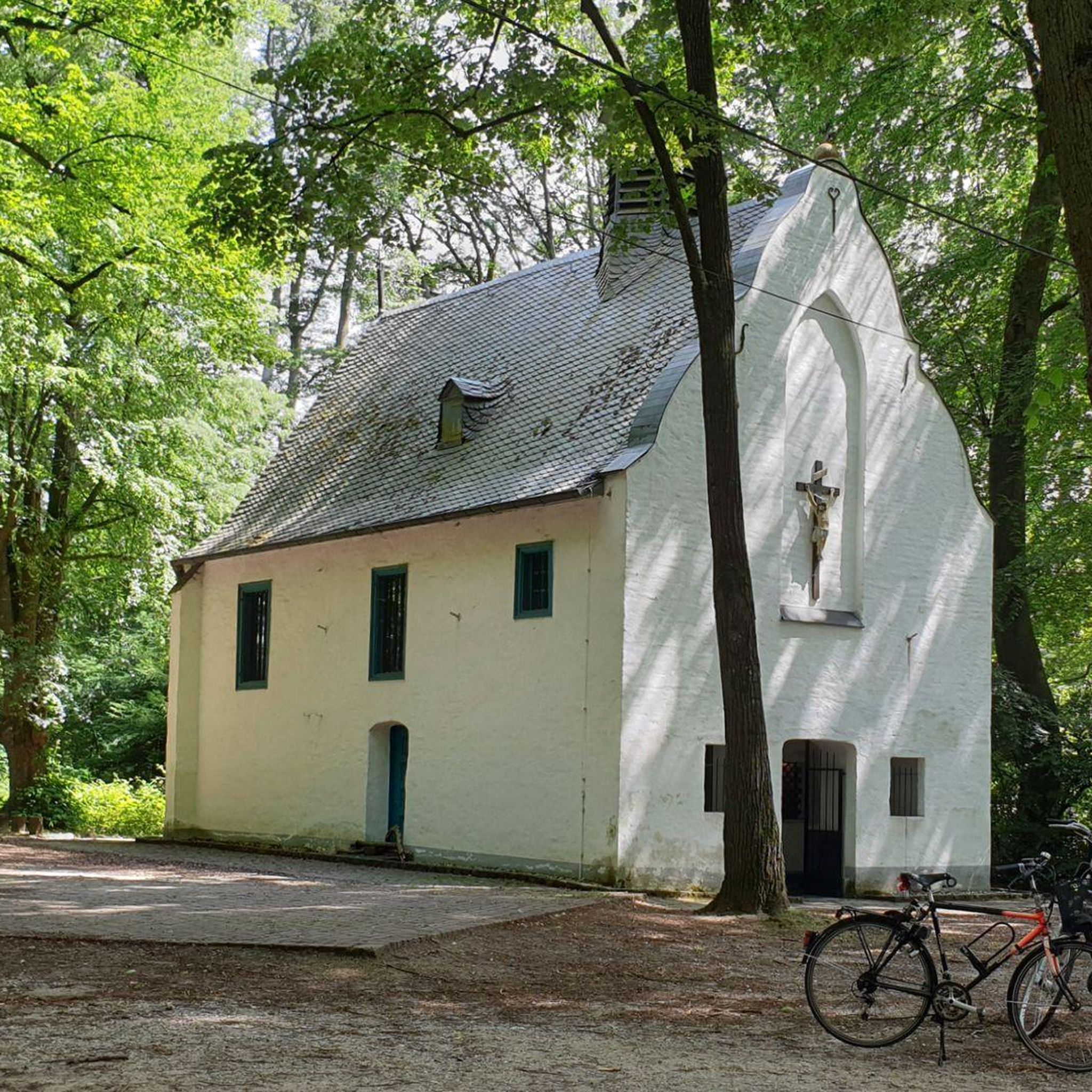
The church is now in a pitiful state. I could not find out whether this is permanent or whether they are going to restore it.
7
0
The church was built in the 16th century, during the Reconquista period. The church has undergone several restorations to preserve its original Mudéjar style and ensure its structural integrity. The church is built in the Mudéjar style, a unique combination of Islamic and Christian architecture typical of the region. The building has a basilica design with a single nave and a wooden ceiling (artesonado) typical of Mudéjar architecture. The interior is decorated with beautiful religious artwork and paintings that highlight the rich religious tradition of the church. The church is an important heritage site for Dehesas de Guadix and attracts visitors for its historical and architectural value.
7
0
Dehesas de Guadix is a small municipality. It is located in the northeast of the comarca of Los Montes and has an area of approximately 57 km²1. The municipality has approximately 426 inhabitants (2016). The history of Dehesas de Guadix goes back to the time of the Reconquista, when the kings of Spain reconquered the area from the Moors. The village was officially founded in the 15th century, when Don Diego Fernández de Iranzo received the land from the kings. One of the most remarkable features of Dehesas de Guadix is the troglodyte dwellings, which are typical of the region. These underground houses are built into the rocks and offer a unique glimpse into the traditional architecture of the area.
7
0
The coat of arms of Dehesas de Guadix is a beautiful symbol that represents the history and identity of the municipality. Here are some important elements of the coat of arms: The coat of arms is divided into three parts. First part: This part shows a mountain (monte) of sinople (green) with a house-cuve (a typical building in the region) of silver, matched with red (gules). Second part: This part shows three oliviers of sinople (green) on a field of gold (oro). Point part: This part shows wavy lines of silver and blue (azur). These elements combine natural and architectural features that are important to the region.
7
0
자주 묻는 질문
알라메디야 주변에는 교통량이 없는 그래블 바이크 트레일이 몇 개나 있나요?
현재 알라메디야 지역에는 교통량이 없는 전용 그래블 바이크 트레일 3개가 등록되어 있습니다. 이 코스들은 경험이 풍부한 그래블 라이더들이 조용함을 추구하기에 완벽한 도전적인 지형과 상당한 고도 상승을 제공합니다.
알라메디야 근처 그래블 바이크 트레일에서는 어떤 종류의 지형을 기대할 수 있나요?
알라메디야 주변의 그래블 트레일, 특히 고라페 사막(Gorafe Desert) 지역의 트레일은 거칠고 다양한 지형을 특징으로 합니다. 준건조한 풍경, 낮은 언덕, 자연 지형을 만나게 되며, 역동적이고 매력적인 경험을 선사합니다. 고라페 사막과는 다르지만, 더 넓은 살라망카(Salamanca) 지역 역시 강변길, 산악 지역, 극적인 협곡을 포함한 다양한 지형을 제공합니다.
숙련된 라이더를 위한 도전적인 그래블 코스가 있나요?
네, 이 가이드에 등록된 교통량이 없는 그래블 바이크 트레일은 모두 난이도가 높게 평가되었습니다. 예를 들어, 데헤사스 데 과딕스(Dehesas de Guadix)에서 시작하는 고라페 사막 – 꿈의 그래블 클라임 루프는 36km에 걸쳐 600미터 이상의 고도 상승을 제공하여 상당한 도전을 선사합니다.
그래블 코스를 따라 어떤 자연 명소를 탐험할 수 있나요?
그래블 트레일을 타면서 여러 자연 기념물과 독특한 지질학적 지형을 발견할 수 있습니다. 주요 명소로는 아세키아 델 토릴(Acequia del Toril), 그라나다 지오파크(Geoparque de Granada) 내의 멋진 그라나다 지오파크를 통과하는 구불구불한 도로, 그리고 석회화 단층 벽이 있습니다.
알라메디야 지역에 순환 그래블 바이크 코스가 있나요?
네, 이 가이드에 소개된 교통량이 없는 그래블 바이크 트레일은 모두 순환 코스이므로 같은 지점에서 시작하고 끝낼 수 있습니다. 예를 들어, 비야누에바 데 라스 토레스(Villanueva de las Torres)에서 시작하는 고라페 사막 – 푼탈 데 돈 디에고 전망대 루프와 비야누에바 데 라스 토레스(Villanueva de las Torres)에서 시작하는 비야누에바 데 라스 토레스 – 데헤사스 데 과딕스 루프가 있습니다.
그래블 트레일 근처에서 어떤 역사적 명소를 볼 수 있나요?
이 지역은 풍부한 역사적 맥락을 제공합니다. 라이딩 중에 스페인과 포르투갈 국경 지대의 이야기를 들려주는 역사적인 정착지와 전략적 지점을 만날 수 있습니다. 구체적인 명소로는 비야누에바 데 라 토레(Villanueva de la Torre)에 있는 산타 아나 교구 교회가 있습니다.
이 자갈길 코스의 시작점 근처에 주차장이 있나요?
이 코스들은 일반적으로 데헤사스 데 과딕스(Dehesas de Guadix)나 비야누에바 데 라스 토레스(Villanueva de las Torres)와 같은 마을에서 시작됩니다. 각 트레일 시작점에 대한 구체적인 주차 정보는 자세히 나와 있지 않지만, 이 마을들에는 일반적으로 트레일에 접근하기에 적합한 공공 주차 옵션이 있습니다.
알라메디야에서 그래블 바이크를 타기 가장 좋은 시기는 언제인가요?
고라페 사막(Gorafe Desert)의 반건조한 주변 환경을 고려할 때, 봄과 가을이 일반적으로 그래블 바이크를 타기에 가장 쾌적한 온도를 제공합니다. 여름은 매우 더울 수 있고 겨울은 더 추운 날씨를 가져올 수 있으므로, 항상 현지 일기 예보를 확인하는 것이 좋습니다.
코스에 전망대나 경치 좋은 곳이 있나요?
물론입니다. 고라페 사막 – 푼탈 데 돈 디에고 전망대 루프는 전망대를 명확하게 강조하며 독특한 사막 풍경의 파노라마 전망을 제공합니다. 이 지역 전반의 거친 지형은 수많은 경치 좋은 기회를 제공합니다.
이 코스들이 '차량 통행 없음'인 이유는 무엇인가요?
이 코스들은 일반적으로 차량 통행이 불가능하거나 바람직하지 않은 조용한 자갈길, 트랙, 오솔길을 활용하도록 특별히 큐레이션되었습니다. 이를 통해 번잡한 도로에서 벗어나 평화롭고 몰입감 있는 사이클링 경험을 보장하며 자연 환경을 온전히 즐길 수 있습니다.
그래블 코스를 따라 휴식하거나 재충전할 장소를 찾을 수 있나요?
코스 자체는 외지고 차량 통행이 없지만, 종종 데헤사스 데 과딕스(Dehesas de Guadix)와 비야누에바 데 라스 토레스(Villanueva de las Torres)와 같은 작은 마을에서 시작하고 끝납니다. 이 마을들에는 라이딩 전후에 재충전할 수 있는 카페나 작은 상점과 같은 기본적인 편의 시설이 있을 수 있습니다. 라이딩 시간 동안 충분한 물과 간식을 휴대하는 것이 항상 좋습니다.


