포크 카운티 주변 최고의 가족 하이킹 & 워킹 코스
5.0
(1)
35
등산객
5
하이킹
폴크 카운티의 가족 친화적인 하이킹 트레일은 담수 습지 및 호숫가에서 관목 서식지와 소나무 숲까지 이어지는 다양한 자연 경관을 제공합니다. 이 지역은 선사 시대의 모래 언덕과 독특한 사막과 같은 관목 지대를 특징으로 하는 레이크 웨일스 능선과 같은 고대 모래 능선으로 특징지어집니다. 하이커들은 사이프러스 돔과 습지를 포함한 다양한 생태계를 만날 수 있으며, 이는 다양한 경험을 제공합니다. 이 트레일은 종종 야생 동물이 풍부한 지역을 통과하는 잘 관리된 길을 특징으로 합니다.
폴크 카운티 최고의 가족 친화적인 하이킹 트레일
- 가장 인기 있는 가족 친화적인 하이킹…
마지막 업데이트: 7월 22, 2026
854m
00:15
0m
60m
초급용 하이킹. 모든 체력 수준에 적합. 실력과 관계없이 누구나 쉽게 갈 수 있는 길.
107km
30:28
2,270m
2,640m
어려운 하이킹. 우수한 체력 필요. 실력과 관계없이 누구나 쉽게 갈 수 있는 길.

무료 회원 가입
1
등산객
보통 하이킹. 좋은 체력 필요. 실력과 관계없이 누구나 쉽게 갈 수 있는 길.
1
등산객
13.9km
04:34
280m
280m
보통 하이킹. 좋은 체력 필요. 대부분 갈 수 있는 길. 미끄러지지 않게 조심해야 함.
4
등산객
2.71km
00:48
80m
80m
초급용 하이킹. 모든 체력 수준에 적합. 실력과 관계없이 누구나 쉽게 갈 수 있는 길.
투어 추천은 다른 사람들이 komoot에서 완료한 수천 개의 활동을 바탕으로 구성되어 있습니다.
오늘 무료 계정으로 시작하세요
다음 모험이 기다리고 있어요.
로그인 또는 가입하기


커뮤니티 팁

Queen Wilhelmina State Park offers some of the most breathtaking views in the state from its fully renovated lodge. Known as the original “Castle in the Sky,” originally built in 1898, the lodge is situated on the 2,681-foot Rich Mountain—Arkansas' second highest peak. The original lodge was built in the late 1800s as a Victorian resort named Wilhelmina Inn to honor the young Queen of the Netherlands, after Dutch investors helped fund the construction of the railroad system. The park includes 41 campsites, including five tent sites with water, one hike-in tent site, picnic areas, and several short hiking trails, and the lodge features 40 rooms, a restaurant featuring Southern cuisine, and a gift shop. Dogs are welcome except in the restaurant and the large hearth room.
0
0
This state line location includes a historic boundary marker established in 1877 after a series of contentious surveys aimed at defining the border between Arkansas and what was then called Indian Territory. The inscription on its north face reads “48 M,” for the 48th mile, “1877” on the south face for the year the marker was installed, “ARK” for Arkansas on the east face, and “CHOC” for Choctaw Territory on the west. In 1976, the marker was listed on the National Register of Historic Places, making it one of the few remaining markers from this survey accessible to the public.
0
0
This trailhead for the Ouachita National Recreation Trail is a scenic crossing point over the Talimena Scenic Byway for thru hikers, and a starting point for hikers to explore other trails in the area. There is a small trailhead sign, but no parking. However, there is a parking area a short distance away at the Deadman Vista Overlook. Due to the limited availability of water sources in the area, especially during dry seasons, it is an ideal spot to store water for the upcoming few miles until you reach Cedar Branch or Horsethief Spring.
0
0

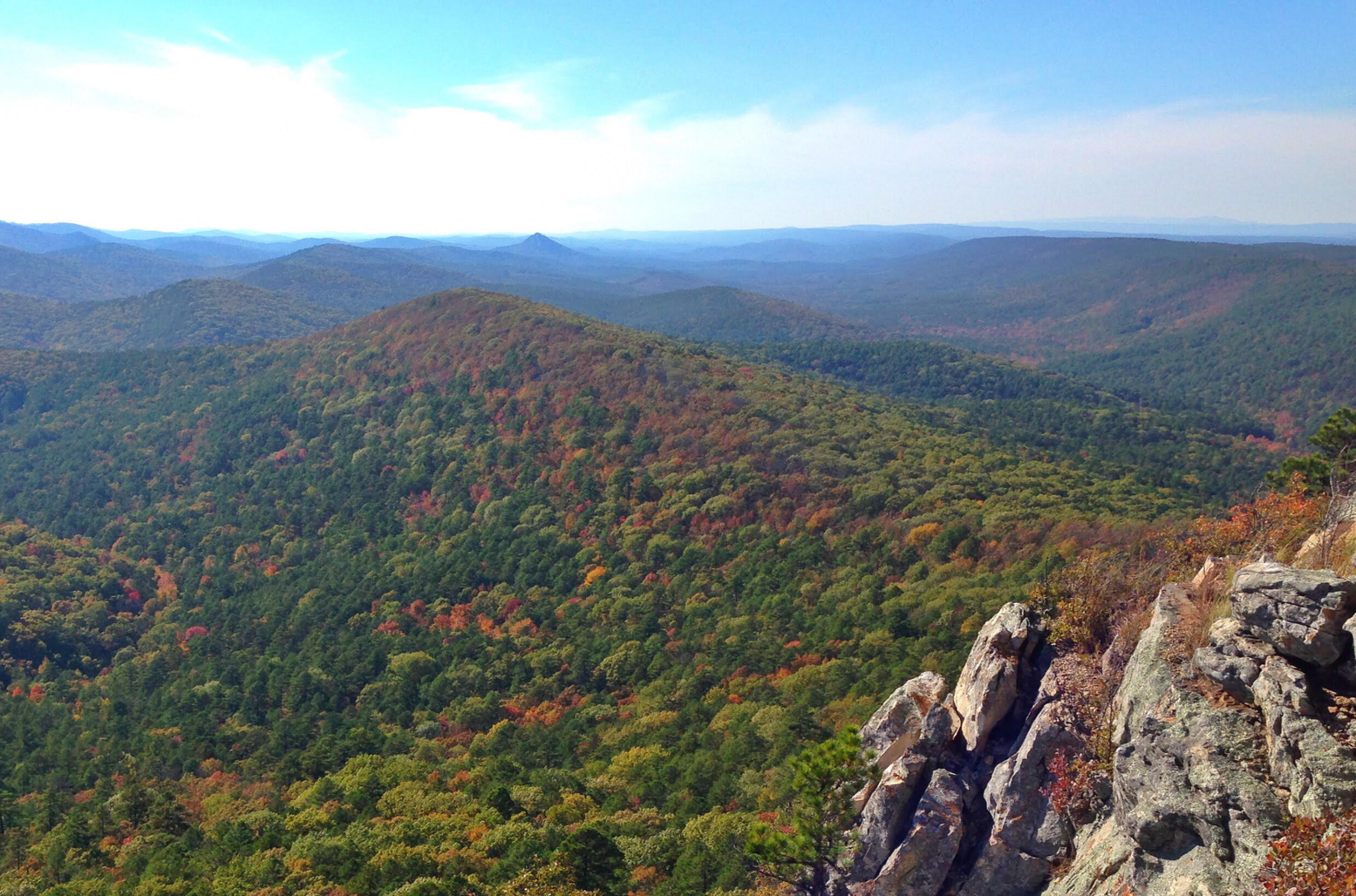
A prominent feature along the Eagle Rock Loop Trail with picturesque views over the diverse landscape of dense forests and rocky terrain in the Ouachitas.
1
0

Scenic 25-acre lake in a remote mountain setting. The Civilian Conservation Corps developed the Shady Lake Recreation Area in 1937. The Shady Lake Trail traverses Saline Creek and passes the historic Shady Lake Dam. It continues along the eastern edge of the campground. The trail is ideal for day hiking. Mountain bikers may also use the trail.
2
0
The Tall Peak Fire Tower is a historic fire tower in the Ouachita National Forest. It is located at the top of Tall Peak in the southwestern part of the national forest in Polk County, Arkansas. It is a fieldstone structure built about 1938 by a crew of the Civilian Conservation Corps (CCC), and features the distinctive flared corners that typify CCC architecture. It is accessible via a forest service road off Polk County 64 ( also known as forest service road 38).
2
0
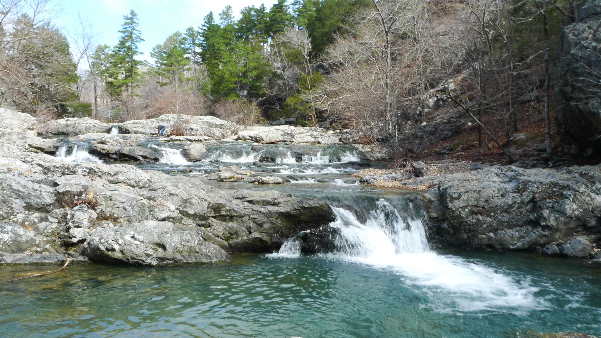
The falls are a short series of cascades which lead into a small pool that is popular for swimming. The falls are known for their picturesque beauty, especially after periods of rain when the water flow is higher.
1
0

자주 묻는 질문
폴크 카운티에는 가족 친화적인 하이킹 트레일이 몇 개나 있나요?
폴크 카운티는 가족에게 적합한 다양한 트레일을 제공합니다. 이 가이드에는 신중하게 선정된 5개의 코스가 포함되어 있으며, 쉬운 산책부터 좀 더 도전적인 하이킹까지 모든 가족의 모험 수준에 맞는 것이 있습니다.
폴크 카운티에서 가족 하이킹 시 어떤 지형을 예상할 수 있나요?
폴크 카운티의 트레일은 플로리다의 다양한 자연 경관을 보여줍니다. 고대 모래 능선, 소나무 숲, 담수호 옆을 구불구불 이어지는 길을 찾을 수 있습니다. 쉬운 서던 벨 디포 출발 하이킹 루프와 같은 일부 트레일은 완만하고 접근하기 쉬운 지형을 제공하며, 다른 트레일은 나무 판자길이나 설탕 모래 길을 특징으로 할 수 있습니다.
어린 자녀나 유모차를 동반한 가족에게 적합한 쉽고 짧은 하이킹 코스가 있나요?
네, 폴크 카운티에는 가족에게 완벽한 몇 가지 쉬운 옵션이 있습니다. 퀸 빌헬미나 저수지 트레일은 1km 미만의 쉽고 짧은 하이킹 코스로, 빠른 가족 나들이에 이상적입니다. 서던 벨 디포 출발 하이킹 루프는 2.7km의 또 다른 쉬운 옵션입니다.
폴크 카운티에서 가족 하이킹 시 어떤 야생 동물을 볼 수 있나요?
폴크 카운티는 야생 동물이 풍부합니다! 하이커들은 종종 악어, 흰따오기 및 흰머리수리와 같은 다양한 조류, 땅거북, 심지어 흰꼬리 사슴까지 발견합니다. 서클 B 바 보호구역과 같은 지역은 특히 "악어 골짜기 트레일"을 따라 야생 동물 관찰로 유명합니다.
폴크 카운티에서 가족 하이킹을 위한 순환 코스가 있나요?
네, 폴크 카운티의 많은 트레일은 편리한 탐험을 위해 루프로 설계되었습니다. 예를 들어, 서던 벨 디포 출발 하이킹 루프는 훌륭하고 쉬운 순환 옵션입니다. 루프 트레일은 되돌아가지 않고 출발점으로 돌아오기 때문에 가족에게 완벽합니다.
트레일을 따라 볼 수 있는 흥미로운 랜드마크나 관심 지점이 있나요?
트레일을 탐험하면서 독특한 자연 지형과 역사적인 지점을 만날 수 있습니다. 퀸 빌헬미나 주립공원 & 롯지는 경치 좋은 휴식처를 제공하며, 톨 피크 소방 탑은 역사적인 랜드마크를 제공합니다. 또한 쉐이디 호수 댐과 같은 아름다운 수경 시설도 찾을 수 있습니다.
폴크 카운티에서 가족과 함께 하이킹하기 가장 좋은 시기는 언제인가요?
늦가을부터 이른 봄까지(대략 11월부터 4월까지)의 서늘하고 건조한 달이 폴크 카운티에서 하이킹하기에 일반적으로 가장 쾌적합니다. 이 기간 동안 기온이 온화하고 습도와 벌레가 적어 가족 경험이 더욱 즐거워집니다.
폴크 카운티의 가족 친화적인 하이킹 트레일에 개를 데려갈 수 있나요?
폴크 카운티의 많은 공원과 보호 구역에서는 목줄을 맨 개를 트레일에 동반하는 것을 허용합니다. 가기 전에 특정 공원 규정을 확인하는 것이 항상 좋지만, 일반적으로 반려동물 가족 구성원을 위한 개 친화적인 옵션을 많이 찾을 수 있습니다.
다른 하이커들은 폴크 카운티의 가족 친화적인 트레일에 대해 가장 무엇을 즐기나요?
komoot 커뮤니티는 폴크 카운티의 가족 친화적인 트레일에 대해 평균 별점 5.0점으로 매우 높게 평가합니다. 리뷰어들은 종종 다양한 생태계, 풍부한 야생 동물 관찰 기회, 그리고 모든 연령대가 자연 속에서 평화로운 휴식을 취할 수 있도록 잘 관리된 길을 칭찬합니다.
나이가 더 많은 어린이를 동반한 가족을 위한 더 길고 중간 난이도의 트레일이 있나요?
좀 더 모험을 원하는 가족을 위해, 이글 락 루프(13.9km) 또는 톨 피크 트레일(14.7km)과 같은 트레일은 중간 정도의 난이도와 더 긴 거리를 제공합니다. 이 코스는 나이가 더 많은 어린이와 청소년이 더 도전적인 지형과 야외 활동 시간을 경험할 수 있는 좋은 방법을 제공합니다.
폴크 카운티의 자연 지역 및 보호 구역에 대한 자세한 정보는 어디에서 찾을 수 있나요?
폴크 카운티 전역의 다양한 자연 지역 및 환경 보호 구역에 대한 자세한 내용은 공원 및 레크리에이션 전용 공식 폴크 카운티 정부 웹사이트(polkfl.gov)를 방문할 수 있습니다. 이 자료는 가족의 야외 모험 계획에 귀중한 정보를 제공합니다.
포크 카운티에서 가장 인기 있는 경로
포크 카운티에서 가장 인기 있는 명소


찾고 계신 것을 찾지 못하셨나요?
포크 카운티에서 더 많은 하이킹를 확인하고 목적지에서 완벽한 경로를 찾아보세요.
더 살펴보기
다른 지역의 최고의 하이킹를 살펴보세요.
