세르베라 주변 최고의 교통량 없는 자전거 라이딩 코스
4.5
(20)
1,756
자전거 타는 사람
13
라이딩
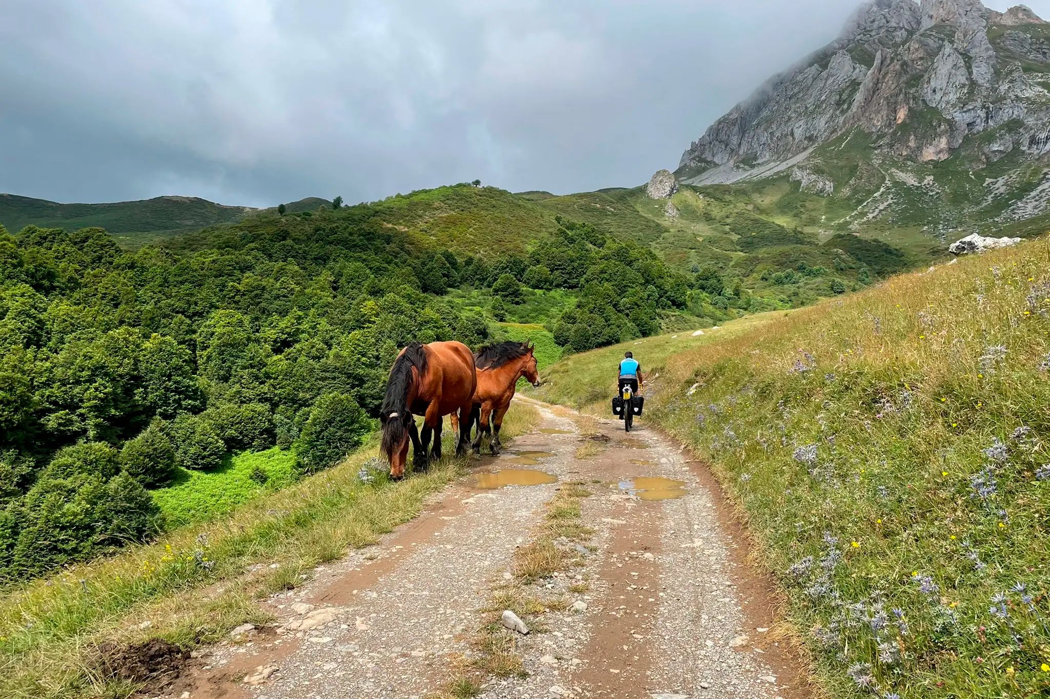
자전거 도로를 타는 것은 세르베라 주변의 다양하고 종종 거친 풍경을 특징으로 하며, 산악 및 구릉 지형, 강 계곡, 저수지가 특징입니다. 세르베라 데 피수르가 및 세르베라 델 마에스트레와 같은 지역을 포함하는 이 지역은 상당한 고도 변화와 너도밤나무, 참나무, 소나무 숲을 통과하는 경치 좋은 도로를 제공합니다. 사이클리스트는 도전적인 오르막과 다양한 자연 경관을 가로지르는 극적인 전망을 기대할 수 있습니다.
세르베라 주변 교통량이 적은 최고의 자전거 도로 코스
- 가장 인기 있는 교통량이 적은 자전거 도로 코스는 비드리에도스에서 출발하는 세르베라 데 피수르가 – 루에스가 저수지…
마지막 업데이트: 11월 7, 2026
5.0
(1)
47
자전거 타는 사람
51.2km
02:34
830m
830m
보통 도로 자전거 타기. 좋은 체력 필요. 지면 대부분이 잘 포장되어 있고 라이딩하기 쉬움.
32
자전거 타는 사람
42.7km
02:10
720m
720m
보통 도로 자전거 타기. 좋은 체력 필요. 지면 대부분이 잘 포장되어 있고 라이딩하기 쉬움.

12
자전거 타는 사람
36.1km
01:46
510m
510m
보통 도로 자전거 타기. 좋은 체력 필요. 지면 대부분이 잘 포장되어 있고 라이딩하기 쉬움.
10
자전거 타는 사람
70.8km
02:57
530m
530m
보통 도로 자전거 타기. 좋은 체력 필요. 지면 대부분이 잘 포장되어 있고 라이딩하기 쉬움.
13
자전거 타는 사람
36.8km
01:48
490m
490m
보통 도로 자전거 타기. 좋은 체력 필요. 지면 대부분이 잘 포장되어 있고 라이딩하기 쉬움.
더 다양한 경로와 다른 탐험가들의 추천을 살펴보세요.
이미 komoot 계정이 있나요?
투어 추천은 다른 사람들이 komoot에서 완료한 수천 개의 활동을 바탕으로 구성되어 있습니다.
오늘 무료 계정으로 시작하세요
다음 모험이 기다리고 있어요.








세르베라 주변의 다른 모험

커뮤니티 팁

팔렌시아 산맥 입구에 모든 편의 시설을 갖춘 마을. 문화 및 자연적으로 볼거리와 즐길 거리가 많습니다.
0
0

세르베라 데 피수에르가(Cervera de Pisuerga)의 아름다운 목조 현수교.
0
0

Alar del Rey는 크기 면에서는 작은 마을입니다. 하지만 이베리아 반도에서 가장 흥미로운 수력 공학 작품 중 하나인 카스티야 운하(Canal de Castilla)의 출발점입니다. 이곳에는 철도역이 있어 멋진 모험을 시작하기에 완벽한 장소입니다.
0
0


The Bear Trail in Cervera de Pisuerga is a circular hiking route of approximately 11 kilometres. It begins at the San Roque bridge and follows the right bank of the Pisuerga River, passing through the village of Arbejal and reaching the Requejada reservoir.
5
0

Stage 1. Alar del Rey/Cervera de Pisuerga 87 kilometers. 1,850 positive meters. The Canal de Castilla begins in Alar del Rey, an illustrious work of 18th century hydraulic engineering that was an important vein of communication, commerce and prosperity in much of the Castilian lands for a century. In 1860 the railway monopolized the trade in cereals, goods and minerals in the north of Castile and transport barges stopped using the canal, which continued in use until the mid-20th century, exploiting the hydraulic energy of the locks and irrigation systems. . The starting point is the dock of the old piers of the Canal de Castilla, a very pleasant place to start a gravel trip of a couple of days of bikepacking along the Palentino Romanesque Natural Path, which largely coincides with the Ruta del Coke charcoal. “Cok” or coke is a high-quality hard coal with good heat capacity that is highly appreciated in the metallurgical industry. The best coke deposits were in exclusive mines in Fuentes Carrionas and Montaña Palentina, mainly in the valleys of Mudá, Castillería and Santullán. The extracted mineral was transported by horse and cart to the piers of the Canal de Castilla bound for Valladolid and Palencia, where distribution began. The cycle tour follows the old mining road to the mountains of northern Palencia, visiting a few rural Romanesque jewels. Before leaving we passed by the milestone where the Canal de Castilla takes its water from the Pisuerga River. I discovered this beautiful river spot thirty years ago, when I cycled along the canal towpaths for the first time. Now we leave in the opposite direction following the red posts of the Nature Trail. The roads are good for gravel cycling, the relief is a bit leg-breaking and there are several hard slopes that warm up the muscles with the gravel single chainring but the surface is great. The first town is Prádanos de Ojeda, on a rural hill above extensive cereal fields that are very good for warming up the legs before the first slopes, it is the end of summer and the stubble is full of large balls of packed straw. The path crosses the Pradera de las Tortas mountain and Santibáñez de Ecla appears hidden among some hills of holm oaks and holm oaks. The church of San Juan can be seen now or in the second stage because the return track connects here. The path runs through hills populated by dense holm oak forests and passes through Villaescusa de Ecla, which has the Romanesque church of Santa Elena and in a nearby ravine the Cervigona Waterfall. The silhouette of the Palentina Mountain and the Curavacas peak draw attention on the horizon. The path jumps small hills of holm oaks and holm oaks and at the heights the view takes in the mountains of the Cantabrian Mountains of Palencia. The surface is excellent and the bikes descend at full speed to the town of Cozuelos de Ojeda. The church is monumental, Renaissance with star-crossed vaults and a Herrerian tower. Outside the church there are remains of an ancient cloud conjurer, a popular place of prayer during harvest time to keep storms and clouds or clouds away from the sky. The route leaves the urban complex of Cozuelos de Ojeda on the left and continues through some steppe hills to a plateau with good views of the mountains, from Valdecebollas to Espigüete. In the moor is the crossing of the Perazancas de Ojeda variant on the return route. The next town is Vallespinoso de Aguilar. The hermitage of Santa Cecilia, immediately standing out on a castle hill, is dated to the 12th century and was declared a historical-artistic monument in 1951. The portico has well-carved capitals and the location conveys the atmosphere of a fortress sanctuary. The path goes up a somewhat rocky slope and enters new slides in the land of Aguilar de Campoo. At the foot of Monte de la Ruya, when the hardest slope of the stage appears in front of you, the detour to Barrio de San Pedro and Barrio de Santa María, two districts of Aguilar de Campoo, comes out on the right. The descent is fantastic with views of the large lake of the Aguilar reservoir. First is Barrio de San Pedro, with a very welcoming ambushed entrance and the church of San Pedro, Romanesque from the 13th century with many later additions. And then the hermitage of Santa Eulalia, solitary next to the road, another well-preserved historical-artistic monument of the rural Romanesque of Palencia. In the town, the church of the Assumption also preserves parts of Romanesque origin.
0
0
자주 묻는 질문
세르베라 주변에 교통량이 적은 로드 사이클링 루트는 몇 개나 있나요?
세르베라 주변에는 교통량이 적은 로드 사이클링 루트가 14개 있으며, 다양한 경험을 제공합니다. 여기에는 초급 루트 2개, 중급 루트 10개, 고급 루트 2개가 포함되어 있어 다양한 체력 수준에 맞춰져 있습니다.
세르베라의 교통량이 적은 로드 사이클링 루트에서는 어떤 종류의 지형을 예상할 수 있나요?
세르베라 지역, 특히 세르베라 데 피수르가(Cervera de Pisuerga)와 같은 지역은 다양하고 종종 험준한 풍경을 제공합니다. 상당한 고도 상승이 있는 산악 및 언덕 지형뿐만 아니라 그림 같은 강 계곡과 저수지를 예상할 수 있습니다. 루트는 종종 너도밤나무, 참나무, 소나무 숲을 지나며 로드 사이클리스트에게 다양하고 도전적인 프로필을 제공합니다.
경험이 풍부한 라이더를 위한 도전적인 교통량이 적은 로드 사이클링 루트가 있나요?
네, 도전을 추구하는 숙련된 라이더를 위해 세르베라는 상당한 고도가 있는 어려운 루트를 제공합니다. 그러한 루트 중 하나는 바도-세르베라(Vado-Cervera) 출발 세르베라 데 피수르가 – 알토 데 라 바르가 전망대 루프로, 84km 이상을 커버하며 1180미터 이상의 상승량이 있습니다. 또 다른 힘든 옵션은 바도-세르베라(Vado-Cervera) 출발 벨리야 델 리오 카리온 – 벨리야 델 리오 카리온 루프로, 117km 이상을 달리며 1550미터 이상의 고도 상승이 있습니다.
세르베라의 교통량이 적은 로드 사이클링 루트를 따라 어떤 자연 경관을 볼 수 있나요?
세르베라의 루트는 자연의 아름다움이 풍부합니다. 산악 호수와 비드리에로스(Vidrieros) 출발 세르베라 데 피수르가 – 루에스가 저수지 루프에 소개된 루에스가 저수지와 같은 수많은 저수지를 따라 사이클링할 수 있습니다. 이 지역은 또한 고대 주목, 너도밤나무, 참나무 숲을 포함한 상당한 삼림 지역을 자랑하며, 피에드라스루에가스 전망대(Piedrasluengas Viewpoint)와 같은 높은 지점에서 파노라마 전망을 제공합니다.
교통량이 적은 로드 사이클링 루트를 따라 전망대나 경치 좋은 곳이 있나요?
물론입니다! 많은 루트가 숨 막히는 파노라마 전망을 제공합니다. 특히 세르베라 데 피수르가 – 알토 데 라 바르가 전망대 루프는 알토 데 라 바르가 전망대를 포함합니다. 이 지역의 다른 주목할 만한 전망대에는 피코스 데 에우로파(Picos de Europa)를 향한 광범위한 전망을 제공하는 피에드라스루에가스 전망대와 레케하다 저수지의 전망을 제공하는 다양한 장소가 있습니다.
다른 로드 사이클리스트들은 세르베라의 교통량이 적은 루트에 대해 무엇을 가장 즐기나요?
세르베라의 교통량이 적은 로드 사이클링 루트는 komoot 커뮤니티에서 평균 5.0점의 높은 평가를 받고 있습니다. 리뷰어들은 종종 고요하고 시골스러운 환경, 극적인 산악 풍경, 차량 통행이 많은 곳에서 벗어나 자연 및 문화 명소를 평화롭게 탐험하는 것을 칭찬합니다.
세르베라에 가족 친화적이거나 더 쉬운 교통량이 적은 로드 사이클링 루트가 있나요?
네, 세르베라에는 가족이나 더 편안한 라이딩을 원하는 사람들에게 적합한 쉬운 교통량이 적은 로드 사이클링 루트가 2개 있습니다. 이러한 루트는 더 어려운 오르막의 강도 없이 이 지역의 아름다움을 부드럽게 소개하며 모든 기술 수준에 즐거운 경험을 제공합니다.
세르베라에서 교통량이 적은 로드 사이클링을 즐기기에 가장 좋은 시기는 언제인가요?
산악 및 험준한 지형을 고려할 때, 봄과 가을은 일반적으로 세르베라에서 교통량이 적은 로드 사이클링을 즐기기에 가장 좋은 시기입니다. 날씨는 일반적으로 더 온화하며 자연 경관은 활기찹니다. 여름은 특히 낮은 고도에서 더울 수 있으며, 겨울에는 높은 산악 고개에서 더 추운 온도와 잠재적인 눈이 내릴 수 있습니다.
세르베라에 교통량이 적은 순환 로드 사이클링 루트가 있나요?
네, 세르베라의 교통량이 적은 로드 사이클링 루트 중 다수는 순환형으로, 같은 지점에서 시작하고 끝낼 수 있습니다. 예로는 비드리에로스(Vidrieros) 출발 세르베라 데 피수르가 – 루에스가 저수지 루프와 바도-세르베라(Vado-Cervera) 출발 세르베라 데 피수르가 – 루에스가 저수지 루프가 있으며, 이 지역을 탐험하기 위한 편리한 옵션을 제공합니다.
세르베라의 교통량이 적은 로드 사이클링 루트 주차는 어디서 할 수 있나요?
모든 루트에 대한 특정 주차 장소가 자세히 설명되어 있지는 않지만, 많은 루트가 비드리에로스(Vidrieros), 바도-세르베라(Vado-Cervera) 또는 살리나스 데 피수르가(Salinas de Pisuerga)와 같은 마을이나 빌리지에서 시작합니다. 이러한 장소는 일반적으로 사이클리스트에게 적합한 공공 주차 시설을 제공합니다. 라이딩 전에 선택한 출발 마을의 현지 주차 옵션을 확인하는 것이 좋습니다.
루트를 따라 어떤 문화적 또는 역사적 관심 지점을 찾을 수 있나요?
자연의 아름다움 외에도 세르베라의 교통량이 적은 로드 사이클링 루트는 종종 문화적 및 역사적으로 중요한 지역을 통과합니다. 이러한 루트에 대한 특정 역사 유적지가 자세히 나열되어 있지는 않지만, 이 지역의 시골 특성 덕분에 전통적인 마을과 지역 유산을 접하게 되어 라이딩과 함께 지역의 역사를 발견할 수 있습니다.
세르베라 주변에서 가장 인기 있는 명소


찾고 계신 것을 찾지 못하셨나요?
세르베라에서 더 많은 로드 사이클링 경로를 확인하고 목적지에서 완벽한 경로를 찾아보세요.
더 살펴보기
다른 지역의 최고의 로드 사이클링 경로를 살펴보세요.
