고달밍 주변 최고의 버스 정류장 출발 하이킹 & 워킹 코스
4.6
(2532)
17,544
등산객
47
하이킹
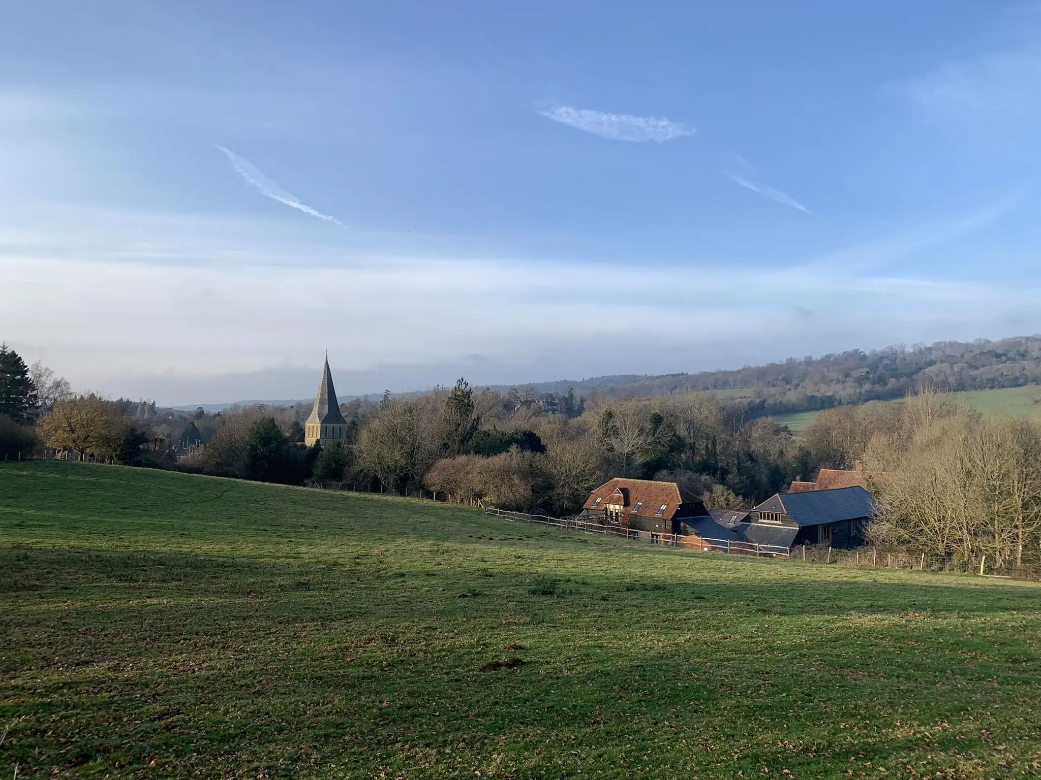
하이킹 코스는 Godalming 주변의 버스 정류장에서 시작하여 Surrey Hills Area of Outstanding Natural Beauty의 다양한 풍경으로 이어집니다. 이 지역은 광활한 삼림 지대, 넓게 펼쳐진 초원, 고원 습지를 특징으로 하며 하이커들에게 다양한 지형을 제공합니다. 고요한 Wey 강은 Godalming을 통과하며 Lammas Lands를 따라 물가 산책로를 제공합니다. Hydon's Ball과 같은 언덕은 주변 지역의 탁 트인 전망을 제공합니다.
Godalming 주변 최고의 버스 정류장 하이킹 코스
- 가장 인기 있는 버스 정류장 하이킹 코스는 Godalming, Hydon's Ball 및 Large Enton Lake 루프 — Surrey Hills로,…
마지막 업데이트: 8월 24, 2026
4.3
(7)
27
등산객
15.7km
04:14
210m
210m
보통 하이킹. 좋은 체력 필요. 실력과 관계없이 누구나 쉽게 갈 수 있는 길.
4.5
(4)
22
등산객
9.54km
02:36
140m
140m
보통 하이킹. 좋은 체력 필요. 실력과 관계없이 누구나 쉽게 갈 수 있는 길.

무료 회원 가입
14
등산객
2.92km
00:45
20m
20m
초급용 하이킹. 모든 체력 수준에 적합. 실력과 관계없이 누구나 쉽게 갈 수 있는 길.
5.0
(2)
12
등산객
7.53km
01:54
10m
10m
초급용 하이킹. 모든 체력 수준에 적합. 실력과 관계없이 누구나 쉽게 갈 수 있는 길.
4.3
(4)
12
등산객
9.25km
02:33
160m
160m
보통 하이킹. 좋은 체력 필요. 실력과 관계없이 누구나 쉽게 갈 수 있는 길.
더 다양한 경로와 다른 탐험가들의 추천을 살펴보세요.
무료 회원 가입
이미 komoot 계정이 있나요?
투어 추천은 다른 사람들이 komoot에서 완료한 수천 개의 활동을 바탕으로 구성되어 있습니다.
오늘 무료 계정으로 시작하세요
다음 모험이 기다리고 있어요.
로그인 또는 가입하기


커뮤니티 팁

Large kissing gate through which a reasonable sized buggy should be fit. Gate entrance needs levelling. Trampers might struggle.
0
0
Stile is a bit wobbily and could do with TLC. There is also no grip so in the words of JBJ could be slippery when wet. There is a gap in the fence to the right of the photo which a medium sized dog should be able to fit through.
0
0

There’s now a fantastic cafe at the boat house, open Tuesday to Sunday, amazing coffee and sandwiches which can be enjoyed by the river, inside the cafe or to takeaway.
1
0

A little unique feature within the Surrey Hills the area is littered with reminders of the war.
0
0


Hydon's Ball is a prominent hilltop situated in the Surrey Hills AONB not too far from Godalming. The hilltop is one of the top 10 highest points in Surrey and is marked by a trig point. The hill is home to a lovely variety of heathland and woodland, and there are some lovey views on offer of the surrounding countryside from the top. Keep your eyes peeled for wildlife whilst you're here, including butterflies and birds of prey.
1
0

This highlight has notable historical significance. It shows the place where the old Wey and Arun Canal started from on the River Wey. For several decades in the 19th century the Wey and Arun Canal was a vital trade link between the south coast and the River Thames and London. The Canal was 23-miles long and linked the rivers Wey and Arun between Shalford in Surrey and Pallingham in Sussex. Commercial trade on the Wey and Arun Canal reached a peak of 23,000 tons in 1839. However, with the establishment of the railways canal trade traffic started to decrease and had virtually stopped by 1868. Although no longer looking at its best the start of the old Canal is still evident 150 years after most canal traffic ceased. Restoration of the Wey and Arun Canal is underway and it is planned that “London’s lost route to the sea” will eventually be reopened.
0
0
The River Wey is one of Surrey’s best kept secrets. Many are surprised by the rural tranquility of the river and by its scenic views, open spaces and wildlife. The prettiest part of the River Wey is arguably that between Godalming and Guildford, and in particular the 0.65-mile river section between Trowers Footbridge, Farncombe, and the Tilthams Corner Road. Here the meandering Wey offers a different rural view around each corner. It is a delight to walk on a well-maintained footpath and to observe the tranquil and interesting river and its scenic surroundings. In summer, the canopies from nearby trees add to the river’s beauty. If you are fortunate, you may see a brightly coloured narrowboat either moored or passing by. If you are interested in history, you may wish to study the lovely brick-built Towers bridge that dates from about 1770, and the well-maintained World War II pillbox situated 25m from the river just south of Tilthams Corner Road.
0
0
자주 묻는 질문
갓달밍 주변에는 버스 정류장에서 출발하는 하이킹 코스가 얼마나 있나요?
갓달밍 주변 버스 정류장에서 접근 가능한 하이킹 코스는 40개 이상입니다. 대부분(약 35개)은 쉬움 등급이며, 좀 더 도전적인 코스를 찾는 분들을 위해 7개의 보통 난이도 옵션이 있습니다.
갓달밍 버스 정류장에서 출발하는 하이킹 코스에서는 어떤 풍경을 기대할 수 있나요?
갓달밍 버스 정류장에서 출발하는 하이킹 코스는 웨이 강(River Wey)과 라마스 랜드(Lammas Lands)를 따라 이어지는 고요한 강변 길부터 서리 힐스 뛰어난 자연 경관 지역(Surrey Hills Area of Outstanding Natural Beauty) 내의 넓은 숲, 탁 트인 공유지, 고지대 황야에 이르기까지 다양한 풍경을 제공합니다. 또한 하이든스 볼(Hydon's Ball)과 같은 언덕으로 이어지는 코스도 있어 파노라마 전망을 즐길 수 있습니다.
갓달밍 버스에서 접근 가능한 쉽고 가족 친화적인 산책로가 있나요?
네, 갓달밍에는 쉽고 가족 친화적인 산책로가 여러 곳 있습니다. 짧고 완만한 산책을 원하시면, 3km가 채 안 되는 갓달밍의 팜콤 보트 하우스 – 라마스 랜드 건너편 전망 루프를 고려해 보세요. 브로드워터 공원과 호수(Broadwater Park and Lake) 역시 평탄하고 쉬운 산책로와 넓은 공간, 놀이터를 갖추고 있어 가족에게 이상적입니다.
갓달밍 버스 정류장에서 출발하는 순환 코스를 찾을 수 있나요?
갓달밍 버스 정류장에서 접근 가능한 코스 중 상당수는 순환 코스이므로 출발점과 도착점이 같습니다. 보통 난이도의 순환 코스 예시로는 갓달밍, 하이든스 볼, 그리고 라지 엔톤 호수 루프 — 서리 힐스가 있으며, 다양한 지형과 아름다운 경치를 제공합니다.
갓달밍 버스 정류장에서 접근 가능한 반려견 친화적인 하이킹 코스가 있나요?
네, 갓달밍 지역의 많은 코스는 반려견 친화적이며, 특히 숲, 공유지, 웨이 강(River Wey)을 따라 이어지는 코스들이 그렇습니다. 위틀리 및 밀포드 공유지(Witley and Milford Commons)와 같은 지역은 반려견에게 적합한 넓은 산책로를 제공합니다. 항상 반려견이 통제 하에 있도록 하고, 특히 가축이나 야생 동물 근처에서는 주의하며, 특정 지역의 제한 사항을 확인하세요.
이 코스를 따라 어떤 흥미로운 랜드마크나 자연 지형을 볼 수 있나요?
다양한 흥미로운 랜드마크와 자연 지형을 발견할 수 있습니다. 일부 코스는 갓달밍의 역사적인 페퍼팟(Pepperpot)과 중세 시대의 교회를 지나갑니다. 자연의 아름다움으로는 훌륭한 전망을 제공하는 하이든스 볼(Hydon's Ball) 정상이나 사일런트 풀(Silent Pool)과 같은 고요한 장소를 만날 수 있습니다. 웨이 강 자체도 중요한 자연 지형이며, 라마스 랜드(Lammas Lands)는 중요한 보존 구역을 제공합니다.
가는 길에 펍이나 카페가 있는 코스가 있나요?
네, 일부 코스는 지역 상점을 지나도록 설계되었습니다. 예를 들어, 갓달밍의 힐탑 키친 카페 루프는 카페에 들를 수 있는 보통 난이도의 하이킹 코스입니다. 서리 힐스(Surrey Hills)의 많은 마을과 도시에는 하이커들에게 인기 있는 휴식처인 전통적인 펍들도 있습니다.
갓달밍 하이킹에 대해 다른 하이커들이 가장 즐기는 점은 무엇인가요?
갓달밍 지역은 komoot 커뮤니티에서 높은 평가를 받고 있으며, 2,200개 이상의 평가에서 평균 4.5점의 점수를 받았습니다. 리뷰어들은 종종 평화로운 강변 산책로에서부터 탁 트인 전망을 제공하는 도전적인 오르막까지 다양한 풍경과 대중교통으로의 접근성을 칭찬합니다. 잘 관리된 길과 서리 힐스(Surrey Hills)의 자연 경관이 자주 언급됩니다.
갓달밍 버스 정류장에서 출발하는 더 길고 보통 난이도의 하이킹 코스가 있나요?
더 길고 보통 난이도의 하이킹을 원하시면, 약 9.5km이며 하이든스 볼(Hydon's Ball)까지 오르는 갓달밍의 터널 오브 리브스 – 하이든스 볼 정상 루프를 고려해 보세요. 이 코스는 좀 더 충분한 거리를 원하는 분들에게 거리와 고도 변화의 좋은 균형을 제공합니다.
버스 정류장에서 출발하는 도보 여행으로 갓달밍의 역사를 탐험할 수 있나요?
네, 갓달밍의 역사를 탐험할 수 있습니다. 갓달밍 역사 트레일(Godalming Historic Trail)은 여기에 명시적으로 komoot 코스로 나와 있지는 않지만, 방문객들이 페퍼팟(Pepperpot), 중세 시대의 교구 교회, 필립스 기념 공원(Phillips Memorial Park)과 같은 랜드마크를 볼 수 있게 해주는 잘 알려진 지역 산책로입니다. 이 특정 트레일에 대한 자세한 정보는 갓달밍 시의회 웹사이트에서 확인할 수 있습니다: 갓달밍 시내 산책 및 나무 트레일.
고달밍 주변에서 가장 인기 있는 명소


더 살펴보기
다른 지역의 최고의 하이킹를 살펴보세요.
