그린브리어 카운티 최고의 워킹 & 하이킹 경로
5.0
(1)
17
등산객
7
하이킹
하이킹은 애팔래치아 산맥 내 다양한 트레일을 제공합니다. 이 지역은 구불구불한 산, 활엽수 계곡, 그린브라이어 강과 같은 중요한 강 시스템이 특징입니다. 하이커들은 울창한 삼림, 철도 트레일, 모논가헬라 국유림 내 지역을 탐험할 수 있으며, 야외 활동을 위한 다양한 지형을 제공합니다.
그린브라이어 카운티 최고의 하이킹 트레일
- 가장 인기 있는 하이킹 코스는 95.9마일(154.3km) 길이로 40시간 이상 소요되는 그린브라이어 강 트레일입니다. 이 철도 트레일은 그림 같은 강변 전망, 수많은 다리, 두 개의 터널을 특징으로 합니다.
- 현지 하이커들 사이에서 또 다른 인기 코스는 4.0마일(6.5km) 길이의…
마지막 업데이트: 9월 2, 2026
4
등산객
11.5km
03:01
100m
100m
Embark on a moderate hike along the Cow Pasture Trail, a 7.1 miles (11.5 km) route that takes you through the scenic woodlands of the Cranberry Wilderness. You'll gain 319…
1
등산객
6.51km
01:50
130m
130m
Explore The Holler, Twin Pines, and Old Roads Trail Loop, an easy 4.0-mile hike in Greenbrier State Forest with varied terrain.

무료 회원 가입
154km
40:02
1,000m
830m
Hike the Greenbrier River Trail, a difficult 95.9-mile route through lush forests and along the Greenbrier River in West Virginia.
154km
40:02
1,000m
830m
Hike the Greenbrier River Trail, a difficult 95.9-mile route in West Virginia, offering riverside views, forests, and historical tunnels.
1
등산객
Hike the moderate 5.8-mile Greenwood Point Trail in George Washington & Jefferson National Forests for scenic Lake Moomaw views.
5.0
(1)
6
등산객
5.95km
01:32
30m
30m
초급용 하이킹. 모든 체력 수준에 적합. 실력과 관계없이 누구나 쉽게 갈 수 있는 길.
투어 추천은 다른 사람들이 komoot에서 완료한 수천 개의 활동을 바탕으로 구성되어 있습니다.
오늘 무료 계정으로 시작하세요
다음 모험이 기다리고 있어요.
로그인 또는 가입하기


커뮤니티 팁

Anthony Road, at mile marker 14.4 heads west into Frankford, where you can grab groceries, stop at a post office, or use a public phone. To the east, Anthony Road heads toward the forest service campgrounds and vastness of the Big Draft Wilderness.
0
0
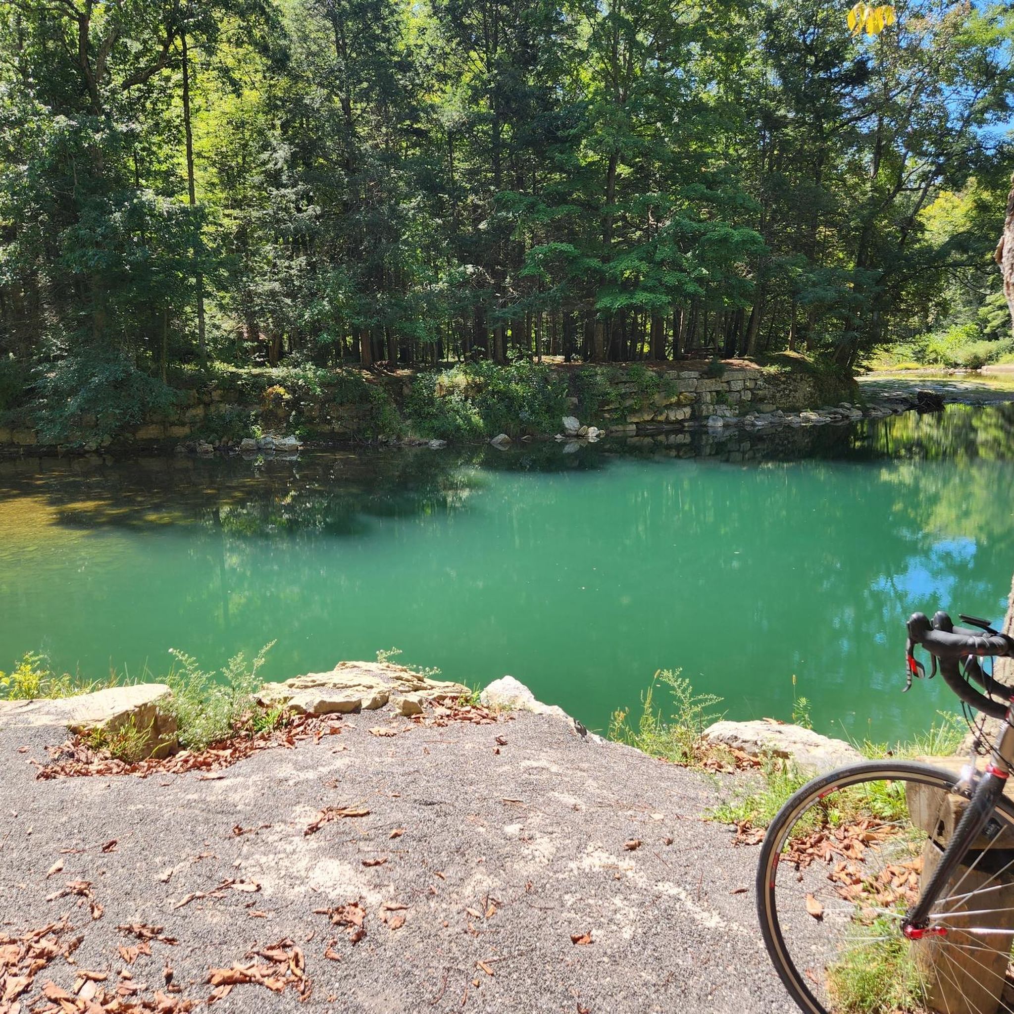
Renick, called Falling Spring on some maps, is a remote little town that offers a post office, limited food options, and public phone access. This area of the river has some great swimming spots, like Norman Blue Hole just north of town along the the trail. Within mile marker 25 through Renick, there's potable water, bathrooms, and picnic tables. You can find a bike repair station within mile 25, where the trail intersects with Slab Camp Road.
0
0
This 402-foot tunnel was completed in 1900 to allow railway passage directly through Droop Mountain. Even in daylight hours, it's dark in the middle of a 402-foot tunnel! A flashlight is recommended if you're riding through.
0
0
Located within the thick forest around mile marker 8.1, Loopemount Waterfall is truly a hidden gem. It doesn't have a constant flow and it's best viewed after a heavy rain.
0
0
From this spot, in the curve between the picnic tables at mile marker 7.5 and the bathrooms at mile marker 9.5, you can catch some glimpses of the river through the open gaps in the trees as you ride above it.
0
0
This campsite at mile 20.5, across the trail from the river, has a tent pad, picnic table, fire ring, and pit toilets. This campsite does not have a potable water source. This campsite, like the other official sites along the trail, operates on a first-come basis.
0
0
At mile 9.5, there's a small wooden shelter along with a fire ring, picnic table, and public water fountain. This spot can be a good place to seek refuge from inclement weather or spend a night.
0
0
As the official starting point of the trail, this parking area offers detailed trail information on signage, a drinking water refill station, a bike repair station, and picnic tables under some shady trees.
0
0
자주 묻는 질문
그린브라이어 카운티에는 하이킹 트레일이 몇 개 있나요?
그린브라이어 카운티에는 6개의 하이킹 트레일이 있습니다. 이 코스들은 이 지역의 아름다운 애팔래치아 풍경을 가로지르는 쉬운 산책부터 도전적인 트레킹까지 다양한 경험을 제공합니다.
그린브라이어 카운티에 초보자에게 적합한 쉬운 하이킹 트레일이 있나요?
네, 그린브라이어 카운티에는 초보자나 편안한 산책을 원하는 분들에게 완벽한 2개의 쉬운 하이킹 트레일이 있습니다. 좋은 선택지는 레이크 셔우드에서 시작하는 레이크 셔우드 루프로, 호수 주변을 따라 5.9km의 쾌적한 길을 제공합니다.
그린브라이어 카운티에 숙련된 트레커를 위한 도전적인 하이킹 코스가 있나요?
물론입니다. 숙련된 트레커를 위해 2개의 어려운 트레일이 있습니다. 특히 그린브라이어 강 트레일은 154km의 길이와 상당한 고도 변화, 강을 따라 펼쳐지는 다양한 지형을 횡단하며 상당한 도전을 제공합니다.
그린브라이어 카운티에서 폭포가 있는 하이킹 트레일을 찾을 수 있나요?
그린브라이어 카운티는 구불구불한 산과 강 계곡으로 유명하지만, 그린브라이어 강 트레일은 길고 광범위한 경로를 따라 바위가 많은 절벽과 작은 폭포가 특징이며, 그림 같은 자연 경관을 발견할 수 있습니다.
트레일을 따라 어떤 자연 경관과 랜드마크를 볼 수 있나요?
그린브라이어 카운티의 트레일은 다양한 풍경 속을 구불구불 이어집니다. 울창한 숲, 강 전망, 독특한 지질학적 형성을 탐험할 수 있습니다. 주목할 만한 명소로는 레이크 셔우드 레크리에이션 지역, 광활한 빅 드래프트 야생 지역, 그리고 그린브라이어 강 트레일을 따라 있는 역사적인 드롭 마운틴 터널이 있습니다.
그린브라이어 카운티에 루프 하이킹 코스가 있나요?
네, 순환 코스를 선호하신다면 더 홀러, 트윈 파인스, 올드 로드 트레일 루프가 훌륭한 선택입니다. 이 쉬운 6.5km 트레일은 같은 지점에서 시작하고 끝낼 수 있어 편리하고 경치 좋은 경험을 제공합니다.
그린브라이어 카운티에서 하이킹하기 가장 좋은 시기는 언제인가요?
그린브라이어 카운티는 연중 아름다운 하이킹 기회를 제공합니다. 봄에는 울창한 진달래가 피어나고, 가을에는 활엽수 계곡에서 멋진 단풍을 감상할 수 있습니다. 여름은 강과 호수를 즐기기에 이상적이며, 겨울 하이킹도 보람 있을 수 있지만 일부 트레일은 눈이나 얼음에 대한 적절한 장비가 필요할 수 있습니다.
그린브라이어 카운티의 하이킹 트레일은 반려견 동반이 가능한가요?
그린브라이어 카운티의 많은 트레일은 반려견 동반이 가능하며, 특히 그린브라이어 주립 숲(Greenbrier State Forest)과 그린브라이어 강 트레일(Greenbrier River Trail)이 그렇습니다. 출발하기 전에 특정 트레일 규정을 확인하는 것이 항상 가장 좋지만, 일반적으로 목줄을 한 반려견은 여러분과 함께 자연의 아름다움을 즐길 수 있습니다.
다른 하이커들이 그린브라이어 카운티 하이킹에서 가장 즐기는 것은 무엇인가요?
komoot 커뮤니티는 그린브라이어 카운티의 하이킹 경험에 대해 평균 5.0점의 높은 점수를 부여하고 있습니다. 리뷰어들은 종종 고요한 자연의 아름다움, 강변 트레일부터 울창한 숲에 이르기까지 다양한 풍경, 그리고 야생 동물 관찰 기회를 칭찬합니다.
이 지역에 더 길고 여러 날 동안 하이킹할 수 있는 옵션이 있나요?
더 긴 모험을 찾는 분들에게 그린브라이어 강 트레일은 훌륭한 선택입니다. 이 154km 길이의 레일 트레일은 전국에서 가장 긴 트레일 중 하나이며, 여러 날 동안 하이킹을 즐길 수 있고 수많은 접근 지점과 그림 같은 강변 전망을 제공합니다.
그린브라이어 밸리의 다른 명소에 대한 더 많은 정보는 어디에서 찾을 수 있나요?
하이킹 외에도 그린브라이어 밸리는 풍부한 야외 활동과 명소를 제공합니다. 방문할 만한 장소에 대한 더 많은 영감을 얻으려면 웨스트버지니아 관광 공식 웹사이트를 방문하세요: 그린브라이어 밸리에서 꼭 방문해야 할 9곳.
그린브리어 카운티에서 가장 인기 있는 명소


더 살펴보기
다른 지역의 최고의 하이킹를 살펴보세요.
