발하임에서 가장 멋진 20개의 천연기념물
자연 기념물은 발하임 주변 지역의 지질학적 과거와 경치 좋은 아름다움을 엿볼 수 있게 해줍니다. 라인헤센(Rheinhessen) 지역에 위치한 이 지역은 구불구불한 언덕과 광활한 포도밭이 특징입니다. 방문객들은 지역의 지질학적 명소와 풍경을 정의하는 자연적 특징을 탐험할 수 있습니다. 이러한 장소들은 자연 환경과 그 역사적 중요성을 감상할 기회를 제공합니다.
발하임 주변 최고의 자연 기념물
- 가장 인기 있는 자연 기념물은 하우크 채석장(Hauck's Quarries)으로, 상당한 지질학적 중요성을 지닌 또 다른 인공 유적지입니다. 이 채석장들은 약 2억 9천만 년 전에 형성된 플론하임 사암(Flonheim sandstone)을 보여주며, 로마…
마지막 업데이트: 9월 28, 2026
하우크슈 슈타인브뤼헤
하이라이트 • 구조물
번역자 Google •
팁에 의해

샤프하우젠 근처 복원된 젤츠강
하이라이트 • 강
번역자 Google •
팁에 의해

이런 장소를 발견하려면 지금 가입하세요
최고의 싱글 트랙, 봉우리 및 다양한 흥미로운 야외 장소에 대한 추천을 받아보세요.
아울하이머 탈 채석장
하이라이트 • 자연
번역자 Google •
팁에 의해

아울하이머 텔헨의 안데사이트 노두
하이라이트 • 자연 기념물
번역자 Google •
팁에 의해

골드베르크브루넨 플뢰르스하임-달스하임
하이라이트 • 기념물
번역자 Google •
팁에 의해

무료로 가입하여 발하임 주변의 더 많은 자연 기념물을 발견하세요.
이미 komoot 계정이 있나요?
오늘 무료 계정으로 시작하세요
다음 모험이 기다리고 있어요.
커뮤니티 팁


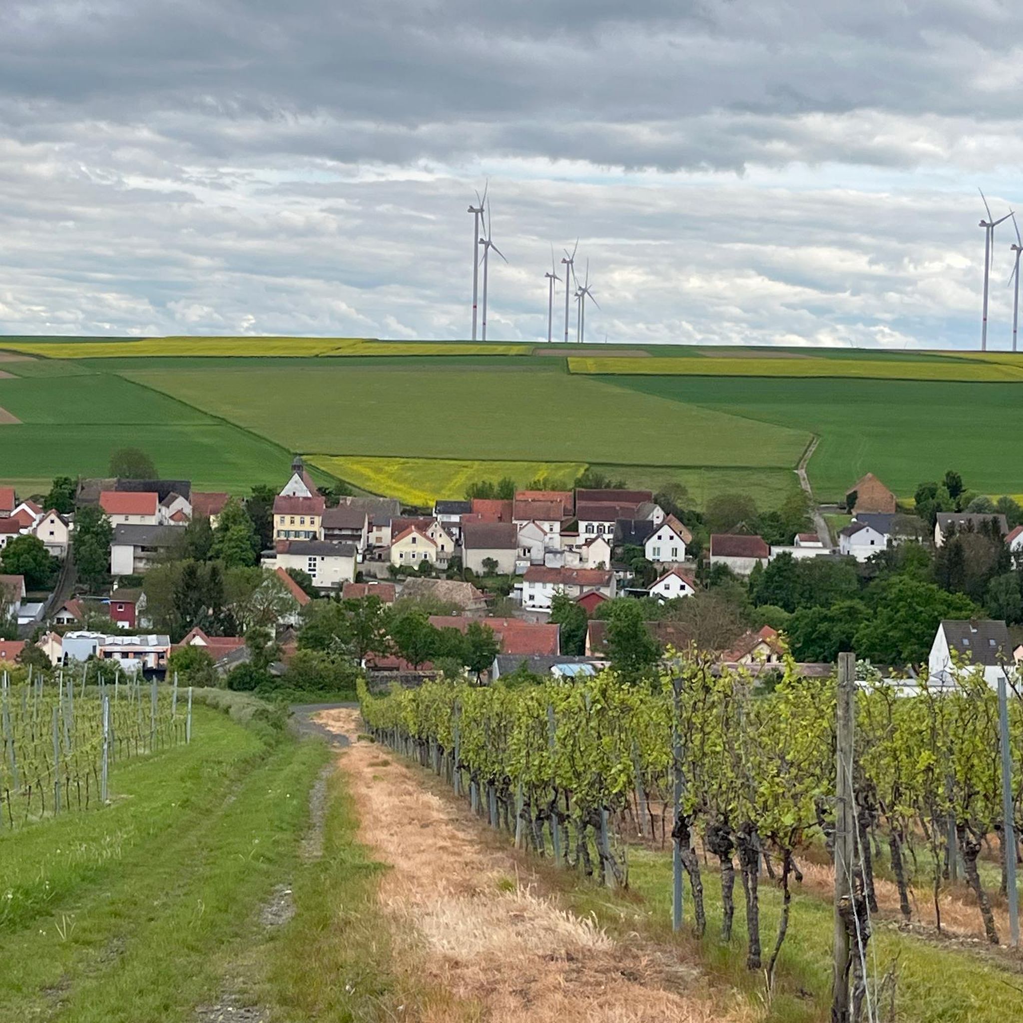
The renaturalized Selz River near Schafhausen is a prime example of successful nature conservation in Rheinhessen. This section of the Selz River south of Alzey-Schafhausen has undergone extensive ecological enhancement in recent years – and you'll notice this immediately when you walk along it.
1
0

The Aulheim Valley lies within the Flonheim district in Rheinhessen. Geologically, Rheinhessen largely corresponds to the Mainz Basin, the northeastern edge of the Upper Rhine Graben. When the Upper Rhine Graben collapsed millions of years ago during the folding of the Alps, a connection was created via the Rhone Valley to a subtropical sea in the south and via the Hessian Depression to what is now the North Sea. This led to two flooding phases in the Oligocene and Miocene. The Vorholz Peninsula was only briefly flooded. The floor of the Mainz Basin consists of rock formations from the Rotliegend or Permian periods (296–251 million years ago). There was volcanic activity here from fissure volcanoes that covered the surface with layers of lava. In the Aulheim Valley, the lava was fast-flowing, low-silica lava, which cooled quickly and solidified into porous sediment with numerous gas inclusions. This made andesite unsuitable as a building material. Water and minerals penetrated the inclusions, and after the water evaporated, agates and geodes slowly formed. On the path through the Aulheim Valley from the Geistermühle to the Aulheimer Mühle, you can still see the retaining walls of the slope on the side facing Flonheim. Boundary stones can still be found here, marking the old district boundary.
1
0
The Aulheim Valley lies within the Flonheim district in Rheinhessen. Geologically, Rheinhessen largely corresponds to the Mainz Basin, the northeastern edge of the Upper Rhine Graben. When the Upper Rhine Graben collapsed millions of years ago during the folding of the Alps, a connection was created via the Rhone Valley to a subtropical sea in the south and via the Hessian Depression to what is now the North Sea. This led to two flooding phases in the Oligocene and Miocene. The Vorholz Peninsula was only briefly flooded. The floor of the Mainz Basin consists of rock formations from the Rotliegend or Permian periods (296–251 million years ago). There was volcanic activity here from fissure volcanoes that covered the surface with layers of lava. In the Aulheim Valley, the lava was fast-flowing, low-silica lava, which cooled quickly and solidified into porous sediment with numerous gas inclusions. This made andesite unsuitable as a building material. Water and minerals penetrated the inclusions, and after the water evaporated, agates and geodes slowly formed. On the path through the Aulheim Valley from the Geistermühle to the Aulheimer Mühle, you can still see the retaining walls of the slope on the side facing Flonheim. Boundary stones can still be found here, marking the old district boundary.
1
0

There used to be a coast here but that was a few days ago! 😉
2
0

Really wonderful renaturation. There are lots of places to sit and watch waterfowl.
1
0
Nature is taking back bit by bit!
1
0

발하임 주변에서 가장 인기 있는 명소


더 살펴보기
발하임 주변의 최고의 동굴을 찾기 위해 이 가이드를 확인해보세요:
