보딩턴에서 가장 멋진 4개의 천연기념물
Boddington 주변의 최고의 자연 기념물은 다양한 지역에 걸쳐 있는 다양한 자연적 특징을 포함합니다. 서호주에서는 Boddington 지역에 광대한 주립 산림, Hotham 강, Bibbulmun Track 구간이 있습니다. 영국에서는 노샘프턴셔의 Boddington Meadow가 생물 다양성으로 유명한 자연 보호 구역입니다. 이 지역들은 다양한 풍경과 지역 야생 동물을 관찰할 기회를 제공합니다.
Boddington 주변 최고의 자연 기념물
- 가장 인기 있는 자연 기념물은 1840년경에 건설된 상당한 석조 우물 머리를 특징으로 하는 역사적인 장소인 Holy Well, Burton Dassett입니다. 이 우물은 그리스 양식으로 유명하며 여전히 방문객이 찾고 있으며, 물속에서…
마지막 업데이트: 10월 16, 2026

Bishops Bowl Lakes
하이라이트 • 자연 기념물
팁에 의해

이런 장소를 발견하려면 지금 가입하세요
최고의 싱글 트랙, 봉우리 및 다양한 흥미로운 야외 장소에 대한 추천을 받아보세요.
오늘 무료 계정으로 시작하세요
다음 모험이 기다리고 있어요.
커뮤니티 팁

It is an unusual half-moon stone structure holding the water, with three strange heads out of whose mouths the water flows down to the river.
0
0

We had to double back on ourselves slightly to see the lakes, as they were hidden behind a hedge
0
1

If you follow the beautiful trail that departs from Southam heading east and runs alongside the River Stowe, you will come across The Holy Well, believed to be the oldest recorded Holy Well in England. It has been there for over a thousand years, with its most recent renovation taking place almost twenty years ago.
1
0

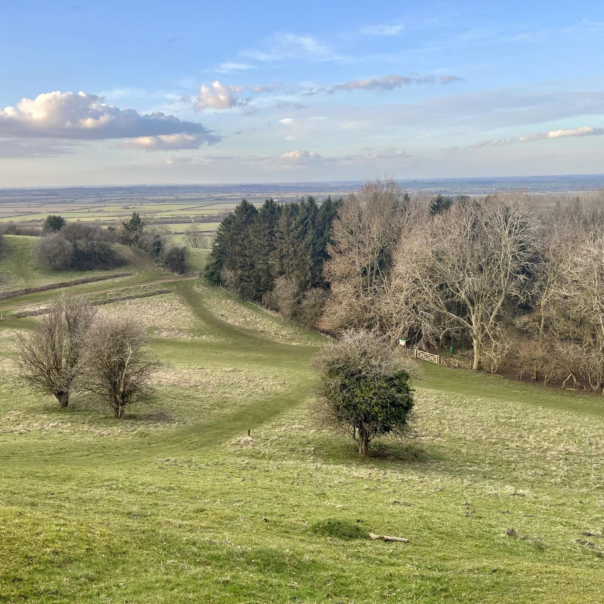
A circular earthwork is clearly visible on the ground on Harts Hill. It measures approximately 15m internal diameter, the ditch is 2m wide and the entrance (facing SE) is 2.5m across.
0
0
The site of a holy well which dates to the Medieval period, though the stone work surrounding the well dates to the Imperial period. Further restoration has taken place in the 20th century. It is situated 800m west of the church, Southam. Oldest recorded holy well in England? The first mention of the well is apparently 998, when it is mentioned in a charter to Leofwine by King Ethelred the Unready as a consequence as the term holy well per se derives from Old English halig this is probably the oldest recorded. However, it does not appear to be specifically mentioned as such. However in a Feet of Fines there is a notice in 1206 of a: “half acre land at Hallewellcul to the north” Over the next 800 years there then appear to be regular references to the well. By the 18th century there is reference to some sort of protective structure, although the date of the current structure cannot perhaps be gauged from these references. By 1701 a record notes that the Rector was exempted from keeping the well and fencing in repair: “one footway of the breadth of three feet leading from a certain stile at the bottom of an ancient enclosed ground called Bury Orchard towards Ufton by the Brook to the said well called Holy Well.” By 1760, a public footpath to the well was made permanent in an Act of Parliament and the enclosures act noting: “it is hereby further enacted and declared, That the said Well, called Holy Well, in the said Open Fields of Southam aforesaid, shall not be allotted to any of the said Proprietors, but shall be inclosed round with Posts and Rails, Three Yards at least distant from the Stone-work of the said Well, by, and at, the Expence of all the said Proprietors, and shall be kept for the Benefit of all the Inhabitants of the Parish of Southam aforesaid; and which said Posts and Rails shall, forever thereafter, be repaired and kept in Repair by, and at, the Expence of the Inhabitants of Southam aforesaid; and that the said Commissioners, or their Successors, or any three or more of them, shall assign, or lay out, a Footway from the Town of Southam aforesaid, to the said Well..” Healing eye water The main two properties, other than a possibly being better than beer, is that it was very cold but never froze and that it was good for eyes. Indeed, its powers in restoring eyes lead to a Henry Lilley-Smith establishing in 1818 an eye and ear hospital not far. Local remedies also recall how to make a tincture with the well water for eyes. The well of St Fremund? One of the possible reasons for the site being a holy well is that it was associated with the Mercian saint Fremund. The Life and Death of the Most Holy Fremund, King and Martyr by Burghard, 12th century (tr. from text in Nova Legenda Anglie ) tells how St Fremund, having been beheaded: “stood up as if nothing had happened, picked his head up off the ground, and set out with the head in his hands. The crowd were amazed at this miracle and followed in his tracks, praising God. He made his way to a spot between Itchington and Harbury, and when he got there he took a stand and thrust the point of his sword in the ground. He prayed to God for a little water to wash his head and body, and what he sought, he gained. For a spring welled up at this very spot, flowing in an unfailing stream and proving the merits of this famous martyr before all the world. He drank of its waters, he washed his wounds, he gave honour to that God in whom all live and have their being. Then turning his head to the east, he sank dead to the ground”. The Metrical Life of St Fremund by William of Ramsay, 1194×1220 (tr. from text in Pinchbeck Register 1925) repeats the story from Burghard, detailing how ‘No sooner had he wished for water than a spring appeared/ Purer than dew, clearer than crystal, finer/ Than gold, and scattering silver sands’. Later, the Life of Sts. Edmund and Fremund by John Lydgate, 1434 tells how “there sprong up a welle/ With crystal watrys the stremys gan up welle;/ And wessh away the blood that was so red,/ Which doun disttillyd from his hooly hed”. egend has it that Fremund was a son of Kind Offa of Mercia. After his death, a great battle ensued at Radford Semele against the invading Vikings in which Fremund was completely victorious. However as Fremund knelt in prayer of thanksgiving one of his own men envious of his success struck off his head. However the legend suggests that the well was not at Southam. For when his corpse stood up, picking up his head and walking away; he stopped somewhere between Harbury and Whitton, possibly Whitnash and there a miraculous well sprung up at his feet, in the water of which he washed his head then lay down and died. This would go against the view that the Southam well is the same. Well preserved fabric The first description of the site is Carlisle (1812) ‘Observations on the positions of the alien cell of Begare, and of Halywell upon Watling Street’ who describes: “a well of very fine clear water, called Holywell, or Halywell, which has always been reputed salubrious. It is… perpetually overflowing, without much variation from the seasons. It is a basin on the declivity of a rising ground. Its form is the larger section of a circle; the bottom is paved with smooth stones; and the sides are walled with the same, a little higher than the water stands, which is about two feet deep. It was formerly nearly encompassed with another wall, and upon a stone, at the mouth of the well, the words Utere, sed non abutere were inscribed.” However it was apparently in decline by the 1850s as an article written on the 6th October 1855 in the Warwickshire Advertiser describes: “on the foot road from Southam to Stoney-Thorpe, the residence of H T Chamberlain Esq., is an Ancient Well called ‘Holy Well’ now in a dilapidated condition; but even in its present state, the massive stone work, with curious and not very elegant carved head shews it to have been at one time an object of interest. Its earlier history is not clear, some asserting that it was the source from which Stoney Thorpe was supplied with water when used as a Priory ……it is a large semi-circular well about five feet deep embanked with massive stone masonry, and is supplied by a powerful spring of the Purest Water. It lies at a lower level than the Town, otherwise it might without much expense, be made most valuable for domestic and sanitary purposes. Tradition says it formally had a stone seat placed round it; was furnished with drinking vessels, and covered by an Arched Stone Roof; thus affording refreshment to the Traveller, and a pleasant resort to the health seeker. It is now proposed to restore by a public subscription, this beautiful relic of antiquity, and a considerable sum has already been promised.” This restoration is described by Freton (1890) in his The Warwickshire Feldon: a sketch of its hills and valleys, waters, famous trees, and other physical features in the Proceedings of Warwickshire Naturalists’ & Archaeologists’ Field Club, states that around 40 years ago: “I and a few enthusiastic friends undertook to clear out this old well, in the hopes that it might lead to its ultimate restoration. Our efforts as amateur navvies excited little sympathy among the rough labouring lads of the neighbourhood, who seemed to look upon us as having a slate off, and we invariably found our labour of one evening fruitless the next, so after a week’s hard work we gave it in.” Certainly when Richardson (1928) found it as: “a semicircular recess in the bank. A low retaining wall – recently renovated – prevents the bank from slipping down into it. At its foot is a flagged path along the curved margin of the semicircular well. Impounding the water in the well… is low two buttressed stonework. The stonework is much mutilated, the water flowing over the two broken and worn ends; but the central portion is higher and has three faces sculptured on it from orifices below which the water spouts out. Two flights of steps– that on the left with three steps, that on the right with four – lead down to a “trough” below the stonework”. The most curious facet of the well are the well worn, and hence presumably ancient carved heads. What is their origin? Thoughts have ranged from effigies of sun gods to the recycled remains from a priory or church. I certainly favour the later and they were probably gargoyles and incorporated in the fabric in the 18th century. This may explain why they look more worn than would be expected if was last constructed in that century. However, it seems odd to have incorporated them and it may have been an attempt to produce a folly for a local lord. Well restored However, despite Richardson’s favourable visit, not everything was positive. In 1925 the water was diverted into a reservoir and the provision of mains water artesian wells in the 1930s took their toll on the flow, an article in a local newspaper noting that: “the Holy Well itself a few yards away has been partly emptied, and no water now flows into its basin in dry weather.” By 1981, Brian Townsend noted in Southam Through the Centuries III notes it was little more than a trickle but a year after clearing out and restoration by the Community Enterprise Programme restored the flow through the heads. Yet by 1991 it was dry again, possibly as the result of quarrying and work on a by-pass. This is what it was like when I first visited…filled with rain water and polluted by crab apples. Through the 1990s restoration was planned but due to various reasons it was never attempted until the early 2000s. By 2005 the water supply was relocated and it could be restored, a Holy Well community was established an Heritage Lottery Fund money of £102,500 was successfully obtained. By 2005-7 the site was splendidly restored with seats and a palisade fence with delightful well related carvings on the posts…a fantastic return to the glory..the crowning of that glory the fact the water flows as profusely as ever. A delightful site and a holy well must.
0
0
Bishops Bowl Fishery sits on a 90 acre former limestone quarry, located on the Oxfordshire/Warwickshire border. The quarry work many years ago has created an attractive stone faced bowl. The whole site is recorded as a site of scientific interest. As at Lyme Regis, the Blue Lias at Harbury is rich in marine fossils. In 1927 and 1928 the skeletons of two marine reptiles were found in Harbury quarry. They are an ichthyosaur and a plesiosaur, and both fossils are now in the Natural History Museum, London. The plesiosaur is the unique example of the early Jurassic species Macroplata tenuiceps.
1
0
The Battle of Edgecote Moor took place 6 miles (9.7 km) north east of Banbury, Oxfordshire, in what is now the civil parish of Chipping Warden and Edgcote, England on 26 July 1469 during the Wars of the Roses. The site of the battle was actually Danes Moor in Northamptonshire, at a crossing of a tributary of the River Cherwell. The battle saw supporters of Richard Neville, Earl of Warwick, defeat the forces of King Edward IV, leading to the king's capitulation soon afterwards.
1
0
자주 묻는 질문
보딩턴 주변에서 어떤 자연 명소를 탐험할 수 있나요?
보딩턴은 주로 호담 강(Hotham River)을 중심으로 다양한 자연 명소를 제공합니다. 경치 좋은 호담 강 강변(Hotham River Foreshore), 고요한 라이언스 댐(Lions Weir), 역사적인 랜포드 풀(Ranford Pool)을 탐험할 수 있습니다. 더 멀리 떨어진 곳에는 자연의 아름다움과 지역 역사가 조화를 이루는 툴리스 다리(Tullis Bridge)가 있으며, 마라동 보호구역(Marradong Reserve)과 광활한 주립 산림(State Forests)은 특히 봄철 야생화로 생동감 넘치는 자라(jarrah)와 마리(marri) 나무를 자랑합니다.
보딩턴의 자연 기념물 근처에 가족에게 적합한 산책로가 있나요?
네, 여러 산책로가 가족 친화적입니다. 호담 강 강변(Hotham River Foreshore)에는 잘 정비된 산책로가 있으며, 2km 길이의 랜포드 풀 산책로(Ranford Pool Walk Trail)는 경치 좋은 경로로 인기가 많고 아이들이 수영하기 좋은 장소로 이어집니다. 랜포드 풀 산책로는 캐러밴 파크와 풀 사이의 휠체어 접근도 가능합니다. 더 긴 산책을 원하시면 툴리스 다리(Tullis Bridge) 주변에 3km 순환 산책로가 있습니다.
보딩턴의 자연 명소에서 어떤 종류의 야생 동물을 볼 수 있나요?
호담 강(Hotham River)과 그 주변 지역은 토착 야생 동물로 풍부합니다. 라이언스 댐(Lions Weir)에서는 다양한 물새와 긴목 거북을 관찰할 수 있습니다. 랜포드 풀 산책로(Ranford Pool Walk Trail)에는 지역 조류 및 어종에 대한 유익한 안내판이 있습니다. 주립 산림(State Forests)과 보호구역(reserves)은 다양한 토착 식물의 서식지이며, 특히 봄철 야생화가 큰 볼거리입니다.
보딩턴의 자연 기념물과 통합된 역사 유적지는 무엇인가요?
보딩턴에서 약 9km 떨어진 툴리스 다리(Tullis Bridge)는 중요한 역사 유적지입니다. 원래 1912년에 목재 산업을 위해 건설된 트러스 스타일의 철도 다리였으며, 그 일부가 오늘날까지 남아 있습니다. 이곳은 자연의 아름다움과 지역 역사가 독특하게 조화를 이루며, 산책로는 호담 강(Hotham River)과 주변 시골의 멋진 전망을 제공합니다.
보딩턴의 자연 기념물 근처에서 할 수 있는 최고의 야외 활동은 무엇인가요?
보딩턴 주변의 자연 기념물은 다양한 야외 활동을 위한 훌륭한 기회를 제공합니다. 호담 강 강변(Hotham River Foreshore)에서 피크닉과 바비큐를 즐기거나, 라이언스 댐(Lions Weir)과 랜포드 풀(Ranford Pool)에서 조류 관찰이나 낚시를 하거나, 강에서 카누를 탈 수 있습니다. 주립 산림(State Forests)은 하이킹과 캠핑에 이상적이며, 특히 봄철 야생화 관찰에 좋습니다. 더 체계적인 경로를 원하시면 보딩턴 주변 쉬운 하이킹을 탐색하거나 자전거 경로를 고려해 보세요.
보딩턴의 자연 명소를 방문하기 가장 좋은 시기는 언제인가요?
주립 산림(State Forests)과 보호구역(reserves)이 토착 야생화로 만개하는 봄철은 보딩턴의 자연 기념물을 방문하기에 특히 유명한 시기입니다. 하지만 호담 강 강변(Hotham River Foreshore)과 라이언스 댐(Lions Weir)은 일 년 내내 피크닉과 강 전망을 위한 고요한 환경을 제공합니다. 여름에는 라이언스 댐(Lions Weir)을 건너 강 건너편으로 걸어갈 수도 있습니다.
Boddington 주변에 전망대나 경치 좋은 곳이 있나요?
네, Morts Road를 따라 Tullis Bridge까지 가는 길은 Marradong Reserve를 통과하며 올리브 농장과 과수원을 포함한 주변 시골의 멋진 경치를 제공합니다. Tullis Bridge 주변의 산책로에서도 Hotham River와 자연 환경의 멋진 전망을 감상할 수 있습니다.
Boddington에 휠체어 접근이 가능한 자연 명소가 있나요?
Ranford Pool 산책로는 캠핑장과 Ranford Pool 사이에서 휠체어 접근이 가능하여 Hotham River를 따라 접근 가능한 자연 경험을 찾는 분들에게 좋은 선택입니다.
자연 기념물 근처에서 피크닉이나 바비큐를 할 수 있는 곳이 있나요?
물론입니다. Hotham River 강변에는 정자 및 바비큐 시설이 잘 갖춰져 있어 피크닉 장소로 이상적입니다. 또한 Tullis Bridge에는 피크닉 테이블이 마련되어 있어 나무 그늘 아래에서 즐거운 시간을 보낼 수 있습니다.
Boddington의 자연 환경에 대한 더 많은 정보는 어디서 찾을 수 있나요?
지역의 자연 및 환경, 특정 특징 및 보존 노력에 대한 자세한 정보는 공식 Boddington Shire 웹사이트를 방문하십시오: boddington.wa.gov.au.
Boddington 근처에서 더 긴 하이킹이나 사이클링 코스가 있나요?
네, 더 광범위한 야외 활동을 찾는 분들을 위해 Boddington 마을에서 오래된 철도 보호 구역을 따라 Tullis Bridge까지 이어지는 16km 왕복 산책로가 있으며, 탁 트인 목초지와 삼림 지대를 통과합니다. 사이클링 애호가를 위해 Komoot에서는 Boddington 주변의 다양한 사이클링 코스를 제공하며, 중간에서 어려운 난이도의 코스 및 교통량이 적은 자전거 도로도 포함됩니다.
보딩턴 주변에서 가장 인기 있는 명소


더 살펴보기
보딩턴 주변의 최고의 동굴을 찾기 위해 이 가이드를 확인해보세요:
