발레 아그리콜라에서 가장 멋진 16개의 천연기념물
천연기념물을 방문하여 발레 아그리콜라의 아름다운 풍경을 만나보세요. 발레 아그리콜라에 있는 16
개의 천연기념물과 상세 정보를 살펴본 후에 방문하고 싶은 천연기념물을 다음 모험 계획에 추가해보세요!
마지막 업데이트: 10월 28, 2026


이런 장소를 발견하려면 지금 가입하세요
최고의 싱글 트랙, 봉우리 및 다양한 흥미로운 야외 장소에 대한 추천을 받아보세요.
캄피텔로 마테세 고원
하이라이트 • 자연 기념물
번역자 Google •
팁에 의해

푼타 줄리아(안티치마 델라 갈리놀라)
하이라이트 • 정상
번역자 Google •
팁에 의해
I Campanarielli
하이라이트 • 자연 기념물
번역자 Google •
팁에 의해

무료로 가입하여 발레 아그리콜라 주변의 더 많은 자연 기념물을 발견하세요.
이미 komoot 계정이 있나요?
오늘 무료 계정으로 시작하세요
다음 모험이 기다리고 있어요.
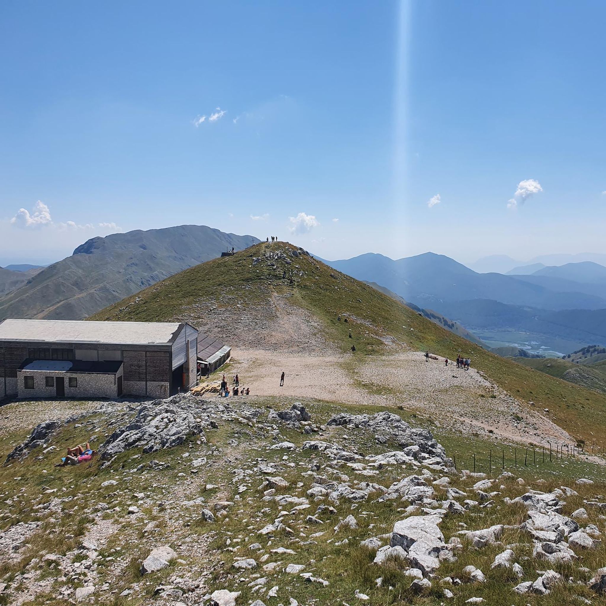
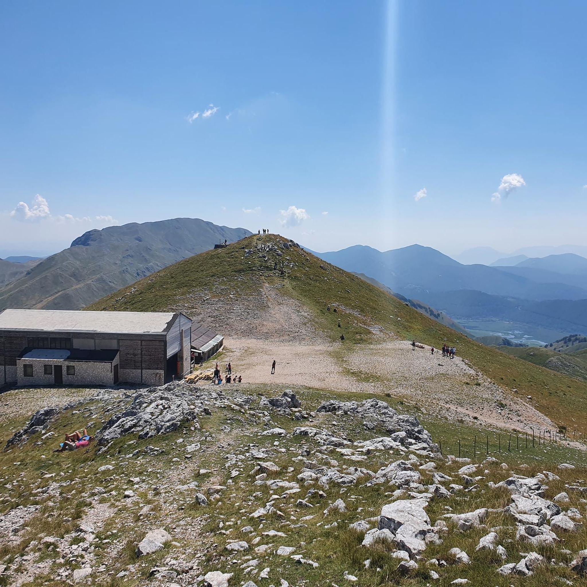


커뮤니티 팁

전반적으로 좋은 하이킹이었지만, Miletto에서 Tamburo, Campanariello를 거쳐 Grotta delle Ciaole까지 가서 출발점으로 완전히 돌아오는 길은 수치스럽게도 표시가 되어 있지 않아 GPS 없이는 이동하기 어려운 길입니다. 최소한의 경험이 없다면 모험하지 마십시오. 지역 산악 협회가 사고와 특히 하이커 길 잃음을 방지하기 위해 길에 표시를 해주기를 진심으로 바랍니다.
0
0

Gallinola (1,923 m above sea level) is the second highest peak in the Matese range and is located in Molise. It can be reached from Campitello Matese via a 5.5 km hike and an elevation gain of just under 500 meters. The view from the summit is spectacular, stretching from the Maiella to the Tyrrhenian Sea, clearly visible in good weather.
1
0

A short hike with no particular difficulties. The trailhead from Campitello Matese is unmarked and difficult to identify. The trail itself is poorly marked. For those like me who'd never done it, it's essential to follow the trail on an app or similar. The descent was made by descending from the chairlift side (which doesn't operate and doesn't appear to be in operation anymore), then descending along the ski slope, which halfway through features a barbed wire barrier (!) that I had to cross.
0
0

Challenging route with a difference in altitude of about 600m, starting from the Ecocamous refuge located in the Santa Maria valley. During the route you will encounter woods, valleys and a beautiful view of Lake Matese. The route leads to the highest peak in Campania, La Gallinola (1923m)
0
0

Getting there from the Santa Maria refuge was a slog but when you admire the view you understand that it's worth it
3
0

Chiara absolutely not, moreover even the path to get there is not well signposted and much less beaten. You have to be an expert hiker
1
0

Hi... I would like to know if the stretch to climb the two towers is via ferrata or not... Thank you very much.
0
0

Mount Miletto (2,050 meters above sea level) straddles Campania and Molise and offers a 360° view of the Apennines, Lake Matese and the Mediterranean Sea in the distance.
0
0
발레 아그리콜라 주변에서 가장 인기 있는 명소


더 살펴보기
발레 아그리콜라 주변의 최고의 동굴을 찾기 위해 이 가이드를 확인해보세요:
