코르셴브로이히에서 가장 멋진 4개의 산 정상
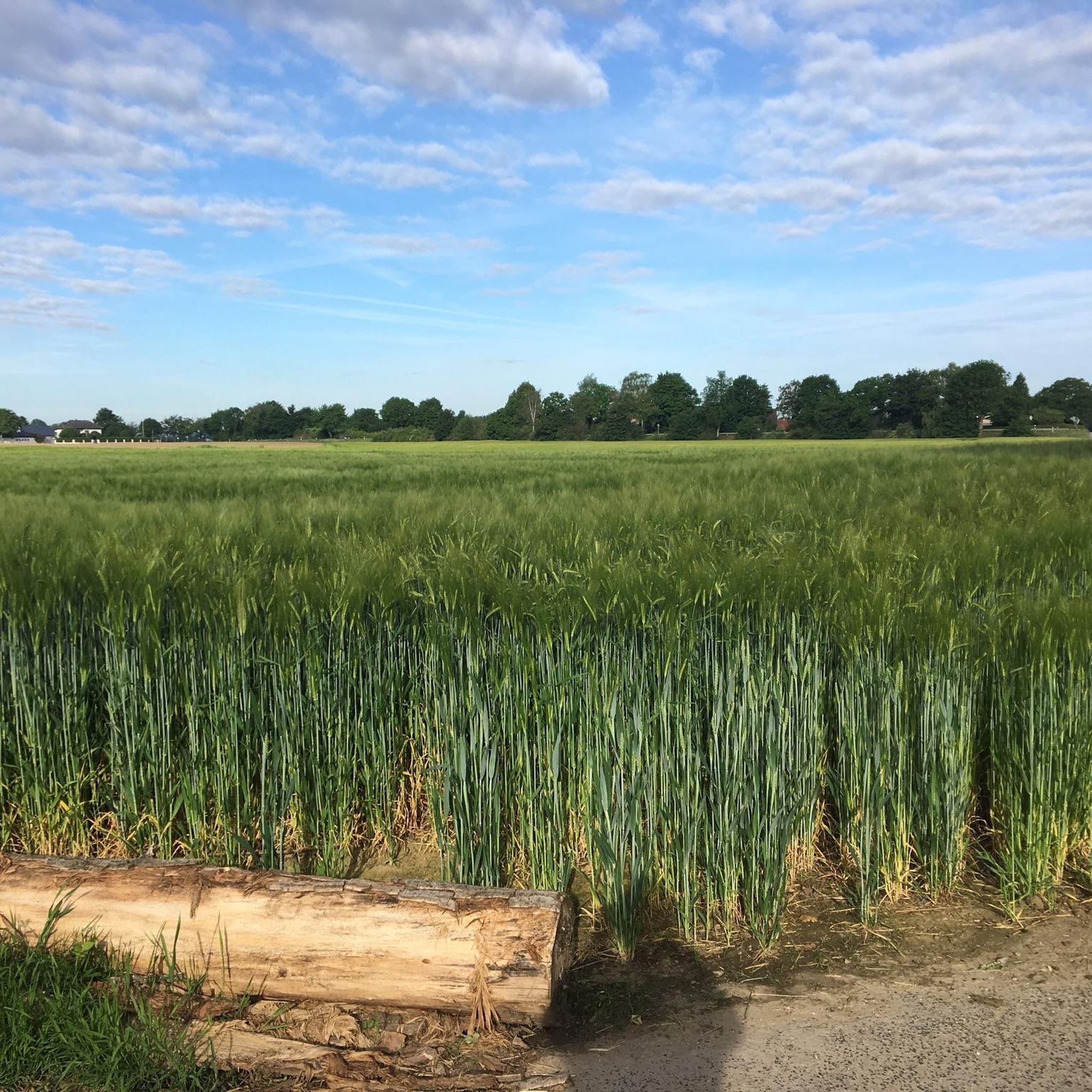
Korschenbroich 주변의 산봉우리는 도시 자체가 저지대에 위치해 있기 때문에 완만한 높이가 특징입니다. Korschenbroich 내 최고 지점은 해발 약 74미터에 달합니다. 주변 지역은 평탄하지만, 더 넓은 지역에는 야외 활동으로 인기 있는 여러 고지대와 언덕이 있습니다. 이러한 장소들은 전통적인 산맥은 아니지만 전망대와 하이킹 기회를 제공합니다.
Korschenbroich 주변 최고의 산봉우리
- 가장 인기 있는 산봉우리는 몬테 클라모트(라인더 회헤)로, 70미터 높이의 구불구불한 길, 계단, 짧은 엔듀로 트레일을 제공하는 자연 기념물입니다. 묀헨글라트바흐에서 산악자전거를 타기 좋은 곳입니다.
- 또 다른 꼭 봐야 할 명소는 정상 및 전망대인…
마지막 업데이트: 9월 30, 2026
몬테 클라못(라이드터 회에) 오르기
하이라이트 • 정상
번역자 Google •
팁에 의해

Monte Klamott (Rheydter Höhe)
하이라이트 • 자연 기념물
번역자 Google •
팁에 의해
이런 장소를 발견하려면 지금 가입하세요
최고의 싱글 트랙, 봉우리 및 다양한 흥미로운 야외 장소에 대한 추천을 받아보세요.
프로이덴베르크 언덕
하이라이트 • 정상
The Freudenberg lies on the edge of the Rennesböschke. To reach Anrath in the direction of Krefeld, …
번역자 Google •
팁에 의해

오늘 무료 계정으로 시작하세요
다음 모험이 기다리고 있어요.
커뮤니티 팁

The Rheydter Höhe was created in 1945 from rubble left behind by the bombing of the cities of Mönchengladbach and Rheydt. The bombing destroyed 65 percent of the two urban areas. In the 1950s, large amounts of household waste were dumped on the rubble mountain. To enable plants and trees to grow, a layer of humus around one to two meters high was added to the household waste. In the 1990s, this resulted in poisonous gas emissions coming out of the rubble, which are no longer noticeable today. However, about 30 meters from the plateau, the viewing platform, you can see isolated pieces of plastic bags on the serpentine walls that were washed away by rain over time. At the northern foot of the rubble mountain there is a water playground, a pond and the Rheydter city forest with barbecue areas, mini golf, a café and opportunities for other activities. From WIKIPEDIA
0
0
Over time, this pile of rubbish has become a lovely hiking destination. The lake and the playground at the foot of the mountain complete the picture. The only rubbish left is the waste of a few two-legged pigs.
3
0

It's also fun for children. With playground, lake and play hide and seek.
3
0

The Rheydter Höhe was created in 1945 from rubble left behind by the bombing of the cities of Mönchengladbach and Rheydt. In the 1950s, it was increased to 133 meters above sea level by storing household waste, which earned it the name Monte Klamott among the population. With a height of 64 m from the foot to the summit, Monte Klamott is the highest mountain of rubble in Germany. Due to its exposed location, the mountain is still visible from the edge of the Bergisches Land. (source wikipedia)
3
0

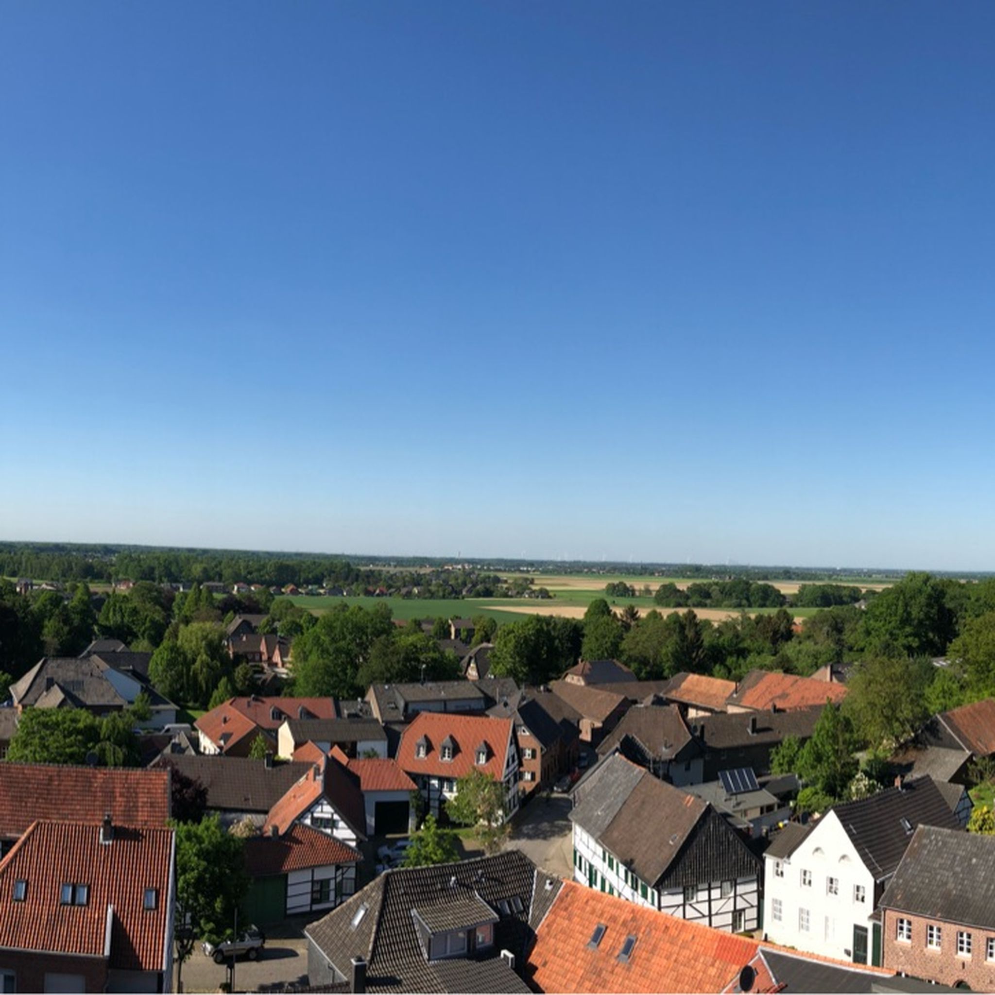
Many stairs lead to the upper plateau, 133 m above sea level. NN. Up here you have great views in all directions.
3
0

The highest point in Anrath is the Freudenberg with 37.7m above sea level. The Freudenberg lies on the edge of the Rennesböschke. To reach Anrath in the direction of Krefeld, in front of the Hörmeshof (Moertter) on the left, over the golf course past the Renneshof and right at the edge of the forest there are two old beech trees. In between, the Freudenberg rises with the summit cross. Further through the bush you come to the street "Am Stock". Directly next to the Freudenberg is an erratic boulder, the inscription of which indicates English soldiers who died when their bomber crashed. This label is unfortunately very badly weathered and can no longer be read.
5
0

70 vertical meters, serpentines, stairs and short enduro trails. If you want to mountain biking in MG, you can not get around this small survey. That's fun!
4
0
Great way in Gladbach something difficult trails and slopes to practice.
2
0
자주 묻는 질문
코르셴브로이히 주변에는 어떤 고지대를 찾을 수 있나요?
코르셴브로이히는 저지대에 위치해 있어 전통적인 산봉우리는 찾기 어렵습니다. 대신, 이 지역에는 종종 인공적으로 만들어진 언덕들이 있어 지역 전망대와 레크리에이션 기회를 제공합니다. 여기에는 몬테 클라모트(라인터 회에) 및 폴라트너 회에 정상과 같은 장소가 포함됩니다.
코르셴브로이히 근처에 가족 친화적인 고지대나 하이킹 코스가 있나요?
네, 여러 고지대가 가족에게 적합합니다. 몬테 클라모트(라인터 회에)는 관리가 용이한 오르막길을 제공하여 가족 친화적인 곳으로 알려져 있습니다. 또한, 프로이덴베르크 언덕도 가족 친화적이며 숲이 우거진 환경을 자랑합니다.
코르셴브로이히 지역의 가장 높은 지점이나 '봉우리'는 무엇인가요?
코르셴브로이히 자체 내의 가장 높은 지점은 해발 약 74미터(243피트)입니다. 하지만, 몬테 클라모트(라인터 회에)와 같은 인근 고지대는 해발 약 133미터까지 올라가 지역 탐험을 위한 가장 상당한 높이를 제공합니다.
이러한 고지대에서 어떤 전망을 기대할 수 있나요?
몬테 클라모트(라인터 회에)에서는 특히 나무가 앙상한 겨울과 봄에 묀헨글라트바흐 시 전체의 멋진 전망을 즐길 수 있습니다. 폴라트너 회에 정상에서도 프리머스도르프, 노이엔하우젠, 구슈토르프, 긴도르프와 같은 주변 마을의 좋은 전망을 제공합니다.
이러한 고지대 위나 근처에 역사적인 장소가 있나요?
네, 프로이덴베르크 언덕은 역사적인 장소로 간주됩니다. 이곳에는 정상 십자가와 비행기 추락으로 사망한 영국 군인들을 기념하는 비문이 새겨진 표석이 있지만, 비문은 현재 심하게 마모되었습니다.
이 고지대 지역을 전망을 위해 방문하기 가장 좋은 시기는 언제인가요?
최고의 파노라마 전망을 위해서는, 특히 몬테 클라모트 (라인더 회헤)에서는 겨울과 봄철을 추천합니다. 이 시기에는 나무에 잎이 없어 시야를 가리지 않습니다.
이 고지대 트레일에서 산악자전거를 탈 수 있나요?
네, 몬테 클라모트 (라인더 회헤)와 폴라터 회헤 정상 모두 산악자전거로 인기 있는 장소입니다. 몬테 클라모트는 지그재그 코스, 계단, 짧은 엔듀로 트레일을 제공하며, 폴라터 회헤는 아름다운 내리막길과 함께 산악 훈련을 위한 좋은 기회로 여겨집니다.
이 고지대 근처에 반려견 친화적인 하이킹 트레일이 있나요?
네, 코르셴브로이히(Korschenbroich) 지역 주변에는 여러 반려견 친화적인 하이킹 옵션이 있습니다. '트리트바흐(Trietbach)를 따라가는 길 – 빌리-한넨 공원 루프' 또는 '니어스 강변길 – 라인트 성 루프'와 같은 코스를 찾을 수 있습니다. 더 자세한 내용은 코르셴브로이히 주변 반려견 친화적인 하이킹 가이드를 살펴보세요.
이 고지대 근처에서 어떤 다른 야외 활동을 할 수 있나요?
고지대 탐험 외에도 이 지역은 다양한 야외 활동을 제공합니다. '호프브루흐(Hoppbruch) 자연 보호 구역 – 호이스트 하우스(Haus Horst) 전망 루프'와 같은 수많은 러닝 트레일을 찾거나, '리트베르크(Liedberg) 풍차 탑 – 리트베르크 성 루프'와 같이 버스 정류장에서 시작하는 하이킹을 즐길 수 있습니다. 더 많은 옵션을 보려면 코르셴브로이히 주변 러닝 트레일 및 코르셴브로이히 주변 버스 정류장에서 출발하는 하이킹 가이드를 확인하세요.
방문객들은 코르셴브로이히 주변의 고지대에서 가장 즐기는 것은 무엇인가요?
방문객들은 지역의 레크리에이션 기회와 이러한 고지대의 독특한 특징을 높이 평가합니다. 많은 사람들이 특히 산악자전거를 위한 오르막길의 도전과 주변 풍경을 가로지르는 보람 있는 전망을 즐깁니다. 역사적인 요소와 자연적인 환경 또한 매력을 더합니다.


