쉬운 벨포르 주변 하이킹 및 워킹 코스
4.4
(2025)
13,389
등산객
547
하이킹
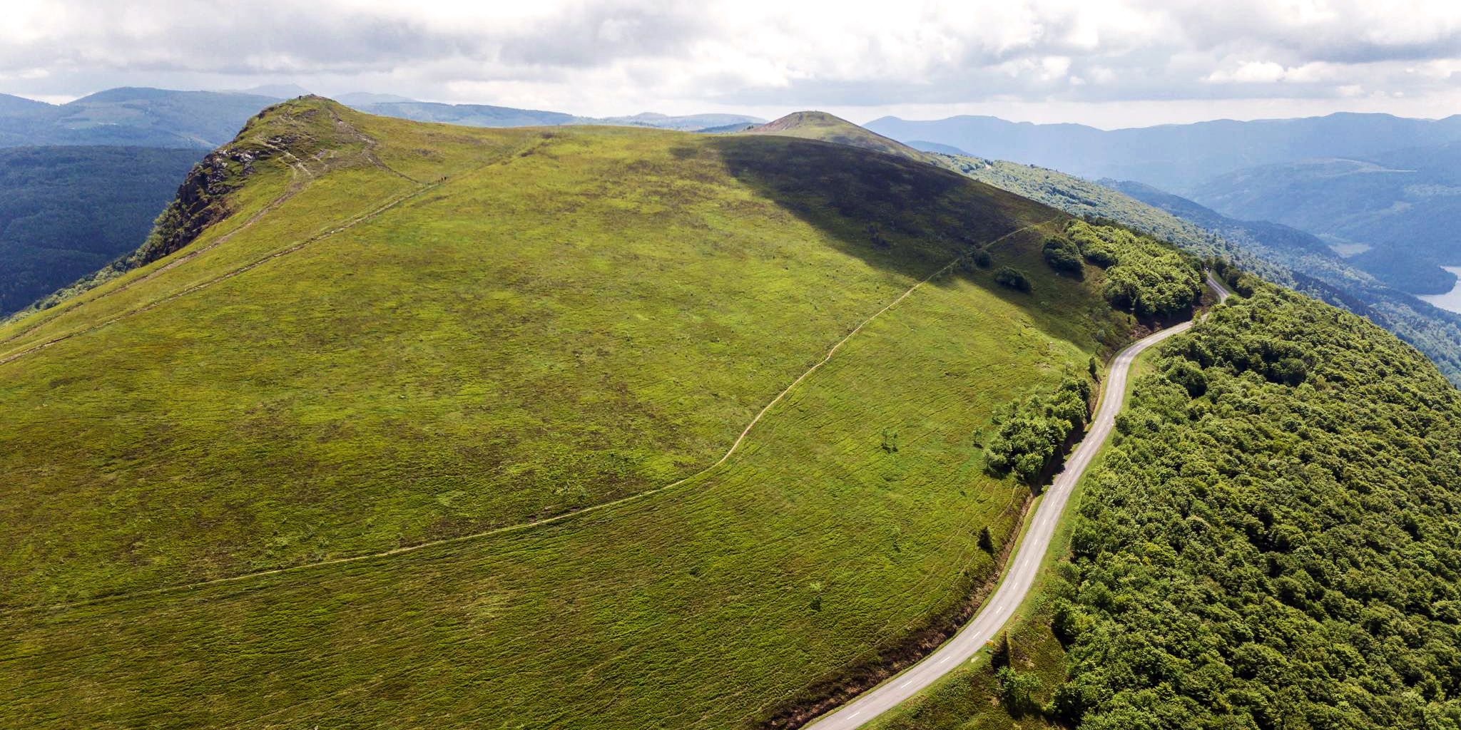
쉬운 하이킹 트레일은 벨포르 주변의 쥐라 산맥과 보주 산맥 사이에 위치한 프랑스 부르고뉴-프랑슈-콩테 지역의 다양한 풍경을 가로지릅니다. 이 지역은 광활한 숲, 수많은 호수, 언덕이 있어 야외 활동을 위한 다양한 지형을 제공합니다. 하이커들은 보주 산맥(특히 발롱 도알자스 포함)의 전망을 제공하는 길을 탐험하거나 지역 연못 주변의 고요한 경로를 즐길 수 있습니다. 이러한 지리적 위치 덕분에 다양한 선호도에 맞는 다양한 쉬운 하이킹 경험이 가능합니다.
벨포르 주변 최고의 쉬운 하이킹 트레일
- 가장 인기 있는 쉬운 하이킹 경로는 발롱 도알자스 — 보주 산맥 지역 자연…
마지막 업데이트: 8월 31, 2026
4.4
(101)
357
등산객
6.45km
01:59
230m
230m
초급용 하이킹. 모든 체력 수준에 적합. 실력과 관계없이 누구나 쉽게 갈 수 있는 길.
5.0
(6)
5
등산객
6.47km
01:41
50m
50m
초급용 하이킹. 모든 체력 수준에 적합. 실력과 관계없이 누구나 쉽게 갈 수 있는 길.

무료 회원 가입
4.6
(111)
935
등산객
3.56km
01:00
70m
70m
초급용 하이킹. 모든 체력 수준에 적합. 실력과 관계없이 누구나 쉽게 갈 수 있는 길.
4.7
(38)
497
등산객
6.13km
01:34
20m
20m
초급용 하이킹. 모든 체력 수준에 적합. 실력과 관계없이 누구나 쉽게 갈 수 있는 길.
4.8
(34)
478
등산객
5.30km
01:21
10m
10m
초급용 하이킹. 모든 체력 수준에 적합. 실력과 관계없이 누구나 쉽게 갈 수 있는 길.
4.8
(28)
343
등산객
4.50km
01:09
20m
20m
초급용 하이킹. 모든 체력 수준에 적합. 실력과 관계없이 누구나 쉽게 갈 수 있는 길.
4.8
(26)
302
등산객
4.83km
01:14
20m
20m
초급용 하이킹. 모든 체력 수준에 적합. 실력과 관계없이 누구나 쉽게 갈 수 있는 길.
4.8
(9)
146
등산객
7.38km
01:55
50m
50m
초급용 하이킹. 모든 체력 수준에 적합. 실력과 관계없이 누구나 쉽게 갈 수 있는 길.
4.5
(11)
93
등산객
7.05km
01:51
50m
50m
초급용 하이킹. 모든 체력 수준에 적합. 실력과 관계없이 누구나 쉽게 갈 수 있는 길.
4.2
(17)
53
등산객
5.20km
01:20
20m
20m
초급용 하이킹. 모든 체력 수준에 적합. 실력과 관계없이 누구나 쉽게 갈 수 있는 길.
더 다양한 경로와 다른 탐험가들의 추천을 살펴보세요.
무료 회원 가입
이미 komoot 계정이 있나요?
투어 추천은 다른 사람들이 komoot에서 완료한 수천 개의 활동을 바탕으로 구성되어 있습니다.
오늘 무료 계정으로 시작하세요
다음 모험이 기다리고 있어요.
로그인 또는 가입하기




벨포르 주변의 다른 모험


커뮤니티 팁

A fantastic view is guaranteed, the terrain is almost alpine.
3
0
Hiking from the balloon over the mountain ridge through the High Vosges promises wonderful solitude and panoramic views.
3
0

The Citadel of Belfort is a historically complex building, reflecting five centuries of fortifications. It was built after the conquest of the city in 1687, replacing a medieval castle that previously stood on this rocky outcrop.
5
0
Wooden sculpture of the Lion of Belfort in the entrance area of the Citadel.
5
0
The Lion is the symbol of the city of Belfort. All Belfort residents are proud of this pink sandstone colossus. The Citadel and the Lion of Belfort were voted the French people's favorite monument in 2020.
5
0

The lion is the largest stone statue in France. As a symbol and guardian of the city, it is also a visual landmark and even invites you to take a city safari. Info: https://www.belfort-tourisme.com/de/entdecken/die-highlights/der-loewe/
0
0

very beautiful route!!! drive slowly!! watch out for pedestrians
0
0

The Church of St. Christopher was designed by the engineer Philippe Mareschal and built from 1727 to replace the Saint-Denis Collegiate Church. It opened for worship in 1750. Its façade, in the classical style with superimposed Doric and Ionic colonnades, is decorated with a triangular pediment bearing the king's coat of arms and religious motifs. This ornamentation was partially altered after the siege of 1870-1871. The towers were built between 1784 and 1788 (north tower) and in 1845 (south tower). The large organ is the work of the postman J.-C. Valtrin and has been restored and modified several times, notably in 1971 by François and Joseph Calinet and Kurt Schwenkedel. It was declared a historic monument by decree of 28 January 1930, erected as a basilica in 1952, and became a cathedral in 1979 following the creation of the Diocese of Belfort-Montbéliard.
1
0
자주 묻는 질문
벨포르 주변에는 쉬운 하이킹 트레일이 얼마나 있나요?
벨포르는 다양한 풍경을 가로지르는 190개 이상의 쉬운 등급의 트레일을 제공합니다. 이 트레일들은 보주 산맥과 쥐라 산맥의 기슭부터 고요한 호숫가까지 이어집니다.
벨포르 주변의 쉬운 하이킹에서는 어떤 종류의 지형을 예상할 수 있나요?
벨포르 주변의 쉬운 하이킹은 넓은 숲을 통과하는 완만한 길, 그림 같은 호수와 연못 주변의 평탄한 루트, 발롱 달자스와 같은 지역의 적당하고 점진적인 오르막이 있는 트레일을 포함한 다양한 지형을 특징으로 합니다. 대부분의 쉬운 루트는 고도 상승이 최소화되어 있어 다양한 체력 수준의 사람들이 접근하기 좋습니다.
쉬운 순환 산책로가 많이 있나요?
네, 벨포르 주변의 많은 쉬운 하이킹은 시작점과 끝점이 같은 순환 루트로 설계되어 있습니다. 예로는 보주 산맥 지역 공원의 발롱 달자스 루프와 벨포르 출발 에탕 데 포르주 – 포르주 연못 루프가 있습니다.
벨포르 주변의 쉬운 트레일은 어린이를 동반한 가족에게 적합한가요?
물론입니다. 에탕 데 포르주 또는 라크 뒤 말소시와 같은 수많은 호수와 연못 주변의 많은 쉬운 트레일은 가족에게 이상적입니다. 평탄하고 잘 관리된 길과 야생 동물 관찰 기회를 제공하여 모든 연령대가 즐길 수 있습니다.
이 쉬운 하이킹에 반려견을 데려갈 수 있나요?
일반적으로 벨포르 주변의 대부분의 하이킹 트레일, 특히 숲길과 호수 주변에서는 반려견을 동반할 수 있습니다. 그러나 자연 보호 구역이나 야생 동물이 있는 지역에서는 목줄을 착용하고, 특정 루트나 보호 구역에 대한 현지 규정을 확인하는 것이 항상 권장됩니다.
어떤 쉬운 하이킹이 최고의 경치를 제공하나요?
탁 트인 전망을 위해서는 콜 뒤 발롱 달자스 출발 아름다운 전망 – 발롱 달자스 루프와 같은 발롱 달자스 지역의 쉬운 루트를 고려해 보세요. 고요한 물 풍경과 조류 관찰을 위해서는 벨포르 출발 에탕 데 포르주 – 포르주 연못 루프를 강력히 추천합니다.
호수나 연못 주변에 쉬운 하이킹 트레일이 있나요?
네, 이 지역의 아름다운 호수와 연못은 훌륭한 쉬운 하이킹 기회를 제공합니다. 벨포르 출발 에탕 데 포르주 – 포르주 연못 루프와 샤테누아 레 포르주 출발 에탕 샤테누아 루프는 고요한 물 풍경을 즐기고 현지 조류를 관찰하기에 인기 있는 선택지입니다.
쉬운 하이킹 트레일을 따라 어떤 흥미로운 랜드마크나 명소를 볼 수 있나요?
많은 쉬운 트레일에서 역사적, 자연적 랜드마크를 볼 수 있습니다. 인상적인 벨포르 요새나 상징적인 발롱 달자스를 지나는 루트를 탐험할 수 있습니다. 벨포르 출발 벨포르의 사자 – 벨포르 전망 루프는 도시의 유명한 기념물 전망을 제공합니다.
다른 하이커들은 벨포르에서의 쉬운 하이킹에 대해 무엇을 가장 즐기나요?
벨포르 주변의 쉬운 하이킹 트레일은 코무트 커뮤니티에서 평균 4.4점의 높은 평가를 받고 있습니다. 리뷰어들은 종종 이 지역의 다양한 풍경, 잘 관리된 길, 숲과 호수의 평화로운 분위기를 칭찬합니다. 쉬운 루트에서 경치 좋은 전망대와 역사 유적지에 쉽게 접근할 수 있다는 점도 자주 언급됩니다.
벨포르에서 쉬운 하이킹을 하기에 가장 좋은 계절은 언제인가요?
벨포르는 일년 내내 쾌적한 쉬운 하이킹 경험을 제공합니다. 봄에는 푸른 녹음과 야생화가 만발하고, 가을에는 넓은 숲에서 생생한 단풍을 볼 수 있습니다. 여름에는 그늘진 길을 제공하며, 겨울에도 상쾌한 산책을 즐길 수 있지만, 일부 고지대 트레일은 적절한 장비가 필요할 수 있습니다.
조류 관찰 기회를 제공하는 쉬운 하이킹 트레일이 있나요?
이 지역의 수많은 연못과 습지는 조류 관찰에 훌륭합니다. 에베트 살베르 출발 베론 연못 – 조류 관찰 장소 루프와 세르마마니 출발 조류 관찰 장소 – 베론 연못 루프는 다양한 조류로 유명하며, 에탕 데 포르주에는 전용 관측소가 있습니다.
벨포르에서 대중교통을 이용하여 쉬운 하이킹 트레일에 접근할 수 있나요?
벨포르에서 접근 가능한 쉬운 트레일이 많이 있으며, 일부는 도시 중심부나 대중교통으로 갈 수 있는 인근 마을에서 바로 시작됩니다. 발롱 달자스 지역과 같이 더 멀리 떨어진 루트의 경우, 대중교통과 짧은 택시 또는 운전을 결합하여 트레일 시작점까지 이동해야 할 수도 있습니다.


