파르코 나치오날레 델라 발 그란데 주변 최고의 폭포 하이킹 & 워킹 코스
4.4
(18507)
77,194
등산객
3
하이킹
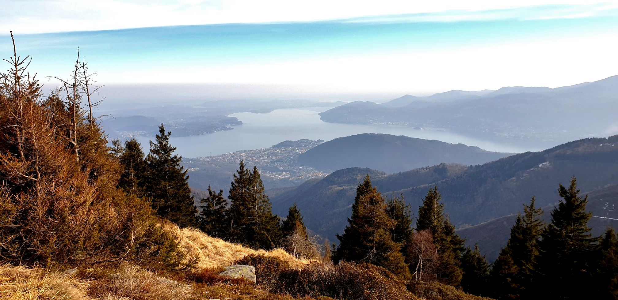
폭포 하이킹 트레일은 이탈리아 최대의 황야 지역인 발 그란데 국립공원(Parco Nazionale della Val Grande)을 가로지르며, 거칠고 다양한 지형이 특징입니다. 이 지역은 가파르고 울창한 숲이 우거진 계곡, 깊은 협곡, 솟아오른 레포틴 알프스(Lepontine Alps)의 봉우리들을 자랑합니다. 수많은 개울과 강이 공원 곳곳에 인상적인 협곡을 만들어내며 폭포와 자연적인 수경관이 풍부한 풍경을 만들어냅니다. 이 보호 구역은 폭포가 있는 트레일을 찾는 하이커들에게 다양한 환경을 제공합니다.
발 그란데 국립공원 주변 최고의 폭포 하이킹 트레일
- 가장 인기 있는 폭포 하이킹 코스는 말레스코(Malesco)에서 출발하는 3.2마일(5.1km) 길이의 로아나 폭포 전망…
마지막 업데이트: 9월 13, 2026
4.5
(2)
3
등산객
9.80km
04:17
790m
790m
보통 하이킹. 좋은 체력 필요. 대부분 갈 수 있는 길. 미끄러지지 않게 조심해야 함.
2
등산객
5.01km
02:12
450m
450m
보통 하이킹. 좋은 체력 필요. 대부분 갈 수 있는 길. 미끄러지지 않게 조심해야 함.

4
등산객
14.1km
03:59
300m
300m
보통 하이킹. 좋은 체력 필요. 실력과 관계없이 누구나 쉽게 갈 수 있는 길.
4.3
(15)
58
등산객
7.60km
02:16
230m
230m
보통 하이킹. 좋은 체력 필요. 대부분 갈 수 있는 길. 미끄러지지 않게 조심해야 함.
4.2
(5)
30
등산객
9.32km
02:44
250m
250m
보통 하이킹. 좋은 체력 필요. 대부분 갈 수 있는 길. 미끄러지지 않게 조심해야 함.
투어 추천은 다른 사람들이 komoot에서 완료한 수천 개의 활동을 바탕으로 구성되어 있습니다.
오늘 무료 계정으로 시작하세요
다음 모험이 기다리고 있어요.
파르코 나치오날레 델라 발 그란데 주변 인기 장소
파르코 나치오날레 델라 발 그란데 주변의 다른 모험

커뮤니티 팁

The Cascata della Froda waterfall, in Castelveccana, is a cascade of water about 100 meters high originating from Mount Cuvignone. It can be reached by a walk through the woods starting from the hamlet of Nasca. This pleasant trail, also suitable for families, passes streams, ancient trout ponds, and old mills.
3
0

You can park your car at the end of the trail. There's room for 4-5 cars.
0
0

Beautiful town with bars and restaurants.
24
0

The city of Roman origin lies on the Toce in the center of the Val Ossolane (Ossola Valley) on the route from the Simplon Pass to Lake Maggiore, in a valley widening into which various side valleys flow, on a large alluvial fan that the Bogna, the right tributary of the Toce, has created here. Today, Domodossola has 17,684 inhabitants (as of December 31, 2022). As the (formerly) largest Italian city whose name begins with "D", Domodossola is used in Italian spelling tables for this letter ("D come Domodossola"). Source: https://de.wikipedia.org/wiki/Domodossola In addition to the weekly market on Saturday, the Sacro Monte di Domodossola is particularly worth visiting. It is part of the Sacri Monti. The Sacri Monti in Piedmont and Lombardy have been part of the UNESCO World Heritage Site in northern Italy since 2003. Finally, you should enjoy the Italian flair in the town. In summer, be sure to eat an ice cream or stop off at a café or pizzeria, it's worth it.
3
0

Small port overlooking Lake Maggiore.
10
0

Chiesa Maria Ss. Immacolata, Nasca,(Castelveccana) Church of Maria Santissima Immacolata - Nasca,(Castelveccana) XVI (construction of the entire property) The first mention of the sacred building in the hamlet of Nasca dates back to 1523 and coincides with the introduction of a weekly mass celebrated by the parish priest of the rectory of S. Vittore, to whose maintenance the inhabitants of the place committed themselves with a special instrument. It is not known what shapes and dimensions this primitive church had; it is certain that, being built in times of plague, it was originally named after S. Rocco. The church overlooks the central district of the hamlet of Nasca. The need to adapt to an already established urban layout led to the anomalous exposure of the altar, which was oriented to the north. In short, the desire to adapt to criteria of accessibility and urban decency prevailed. The beautiful façade, completed in the mid-18th century and characterized by large light backgrounds on which pilasters and darker stone frames stand out, contributed to this last aspect by remaining aesthetically still indebted to the happy formulas of the 17th century, widespread in the middle Verbano area. The church extends over a large and single-aisled nave, ending in a polygonal apse of equal width. The nave is divided into three bays, each covered by a "clawed" barrel vault. In the central bay there are two chapels, one on each side. The perception of the airy 18th century plan is partially spoiled by a lively pictorial decoration, created during an intervention in the first decades after the Second World War. To the left of the entrance is the niche of the baptistery. In the choir on the counterfaçade is the organ, an instrument built by a still anonymous workshop and installed at the beginning of the twentieth century. The bell tower rises on the east side, near the presbytery. Text / Source: Municipality of Castelveccana https://www.comune.castelveccana.va.it/c012045/zf/index.php/servizi-aggiuntivi/index/index/idtesto/20050
10
0
Cascata de la Froda Nasca,(Castelveccana) Castelveccana: Froda Waterfall The Froda waterfall is one of the hidden beauties of the province of Varese. Although it offers a truly spectacular show, in reality it is not as well known and reported as it deserves. But this makes it even more special for those who decide to discover it. After taking the path on the edge of the SP7, you will immediately immerse yourself in a very fascinating natural setting. The route is suitable for everyone and the children will certainly enjoy feeling like little explorers. It is advisable to wear mountain boots: along the path you will have to pass a short ford. In winter, special attention must be paid to ice. Once you arrive under the waterfall, you will be amazed: with its height of about 100 meters, it is a real wonder not to be missed, especially after heavy rains. But even with a slender jet it will amaze you ... An iron rope allows you to approach the waterfall without slipping. Text / Source: cascatetrekking.com https://www.cascatetrekking.com/cascate/italia/lombardia/varese/castelveccana-cascata-della-froda/
11
0
자주 묻는 질문
파르코 나치오날레 델라 발 그란데에 폭포 하이킹 코스가 얼마나 있나요?
이탈리아 최대의 황야 지역인 파르코 나치오날레 델라 발 그란데는 인상적인 폭포와 급류를 특징으로 하는 다양한 하이킹 코스를 제공합니다. 이 가이드에서는 이러한 자연 수경을 보여주기 위해 특별히 설계된 여러 코스를 강조하여 탐험을 위한 다양한 옵션을 제공합니다.
파르코 나치오날레 델라 발 그란데의 폭포 하이킹에서 어떤 지형을 예상할 수 있나요?
파르코 나치오날레 델라 발 그란데의 지형은 험준하고 다양하며, 가파르고 울창한 계곡, 깊은 협곡, 레폰틴 알프스의 우뚝 솟은 봉우리들이 특징입니다. 폭포 코스는 종종 강과 시냇물을 따라 이어지며, 숲을 통과하고 때로는 울퉁불퉁한 길을 따라 이동해야 합니다. 대부분의 코스는 중간 정도의 난이도를 예상할 수 있습니다.
폭포가 있는 순환 코스가 있나요?
네, 이 지역의 여러 폭포 하이킹 코스는 시작점과 끝점이 같은 순환 코스입니다. 예를 들어, 말레스코에서 출발하는 로아나 폭포 전망 – 리오 로아나 폭포 루프는 3.2마일(5.1km)의 중간 난이도 코스이며, 포르토 발트라발리아에서 출발하는 토렌트 여울 – 프로다 폭포 루프는 9.1마일(14.6km)의 더 긴 수경 탐험 코스입니다.
폭포 트레일 주변의 주목할 만한 자연 경관이나 전망대는 무엇인가요?
폭포 자체 외에도 이 공원은 길들여지지 않은 풍경으로 유명합니다. 광활한 너도밤나무와 밤나무 숲, 고산 초원, 강이 깎아 만든 극적인 협곡을 만날 수 있습니다. 일부 트레일은 레폰틴 알프스의 전망을 제공합니다. 더 넓은 자연 경험을 위해 포갈로 강 자연 풀장 또는 인상적인 산 베르나르디노 협곡 탐험을 고려해 보세요.
발 그란데의 폭포 하이킹 근처에서 어떤 역사 유적을 찾을 수 있나요?
발 그란데는 알페 프라(Alpe Prà)와 포갈로(Pogallo)와 같은 버려진 마을을 포함한 인간의 흔적이 풍부한 역사 유적지입니다. 또한 트레일 주변에서 오래된 대피소, 가축 통로, 계단식 밭, 봉헌 예배당, 심지어 '카도르나 라인'의 군사 요새까지 발견할 수 있습니다. 이러한 유적들은 이 지역의 과거를 엿볼 수 있게 해주며 독특한 분위기를 자아냅니다.
파르코 나치오날레 델라 발 그란데에 가족 친화적인 폭포 하이킹 코스가 있나요?
발 그란데의 많은 트레일은 험준하지만, 하이킹에 익숙한 나이 있는 어린이 동반 가족에게 적합한 중간 난이도 코스도 있습니다. 말레스코에서 출발하는 로아나 폭포 전망 – 리오 로아나 폭포 루프는 3.2마일(5.1km)의 짧고 중간 난이도 옵션으로 고려해 볼 수 있습니다.
파르코 나치오날레 델라 발 그란데의 폭포 트레일에 대해 다른 하이커들이 가장 좋아하는 점은 무엇인가요?
이 지역은 코무트 커뮤니티로부터 높은 평가를 받고 있으며, 4000건 이상의 리뷰에서 평균 4.5점의 점수를 받았습니다. 하이커들은 종종 공원의 때 묻지 않고 외딴 자연, 극적인 풍경, 그리고 이 황야 지역 내 수많은 급류와 강 경관을 발견하는 상쾌한 경험을 칭찬합니다.
폭포 하이킹 지역 근처에서 숙박이 가능한가요?
공원의 외딴 경계 내에는 인간의 거주지가 거의 없습니다. 하지만 트레커들을 위해 몇 개의 소박한 비박지와 4개의 대피소가 숙박용으로 마련되어 있습니다. 이들은 종종 기본적이고 직원이 없는 시설이므로 미리 계획하는 것이 필수적입니다. 이러한 옵션에 대한 자세한 정보는 파르코 나치오날레 델라 발 그란데 주변의 오두막과 산장 가이드에서 찾을 수 있습니다.
폭포 하이킹을 위해 파르코 나치오날레 델라 발 그란데를 방문하기 가장 좋은 시기는 언제인가요?
폭포 하이킹을 위해 방문하기 가장 좋은 시기는 일반적으로 봄과 초여름으로, 눈이 녹으면서 더 풍부하고 인상적인 폭포를 볼 수 있습니다. 가을에는 단풍이 물들어 아름다운 풍경을 선사합니다. 여름은 더울 수 있지만, 울창한 숲의 그늘과 폭포의 시원한 물보라가 더위를 식혀줍니다. 출발하기 전에 항상 현지 날씨를 확인하세요.
이 지역의 폭포 근처 하이킹 시 특별한 안전 고려 사항이 있나요?
파르코 나치오날레 델라 발 그란데의 험준하고 길들여지지 않은 특성을 고려할 때, 철저히 준비하는 것이 중요합니다. 특히 수경 근처의 트레일은 가파르고 울퉁불퉁할 수 있습니다. 항상 적절한 하이킹 신발을 착용하고, 충분한 물과 보급품을 휴대하며, 변화하는 날씨에 유의하십시오. 험준한 지형에 익숙하지 않은 경우, 현지 전문가 가이드와 함께 하이킹하는 것이 좋습니다.
발 그란데 국립공원 정보 센터는 어디에서 찾을 수 있나요?
정보 센터는 일반적으로 공원 주변 마을에 위치하며, 공원 경계 내 유일한 마을인 치코냐(Cicogna)가 있습니다. 이 센터에서는 안내, 지도, 최신 트레일 상태 및 규정에 대한 정보를 제공할 수 있습니다. 또한 국립공원 협회 웹사이트에서 공원에 대한 일반 정보를 찾을 수 있습니다.
파르코 나치오날레 델라 발 그란데 주변에서 가장 인기 있는 경로
파르코 나치오날레 델라 발 그란데 주변에서 가장 인기 있는 명소


더 살펴보기
다른 지역의 최고의 하이킹를 살펴보세요.
