구리 강 인구 조사 지역 최고의 워킹 & 하이킹 경로
4.7
(25)
227
등산객
16
하이킹
구리 강 인구 조사 지역에서 하이킹하며 알래스카 구석 부분까지 살펴볼까요? 구리 강 인구 조사 지역에 있는 모든 하이킹 및 워킹 경로 컬렉션 중 가장 멋진 하이킹 경로를 엄선하여 소개해드릴게요. 다른 하이커가 공유한 실제 팁과 사진을 살펴보고 후기를 읽으며 마음에 드는 구리 강 인구 조사 지역 워킹 경로를 찾아보세요.
마지막 업데이트: 9월 1, 2026
2
등산객
5.62km
01:35
180m
0m
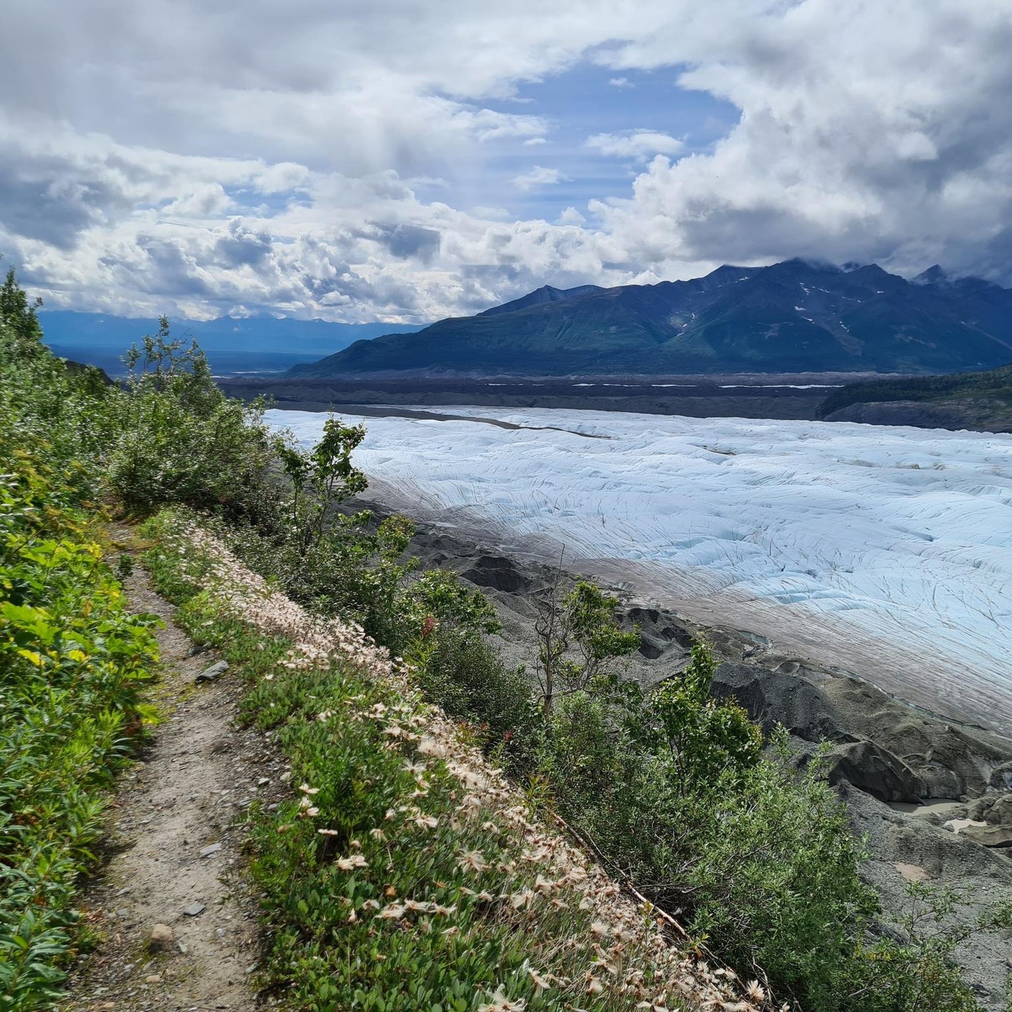
Embark on an easy hike along the Gulkana Glacier Trail, a 3.5-mile (5.6 km) route that offers a direct encounter with glacial landscapes. You will gain 606 feet (185 metres)…
1
등산객
2.22km
00:35
20m
10m
This easy 1.4-mile loop in Wrangell-St. Elias National Park offers views of Mount Drum and an immersive walk through Alaska's boreal forest.

무료 회원 가입
1.89km
00:30
30m
0m
Hike the easy 1.2-mile West Kennecott Glacier Trail to explore an active glacier and see the Stairway Icefall in Wrangell-St. Elias National
5.0
(4)
46
등산객
16.5km
06:18
1,150m
1,150m
Hike the difficult Bonanza Mine Trail for 10.3 miles (16.5 km) to explore historic mine ruins and panoramic glacier views.
5.0
(4)
40
등산객
6.17km
01:38
60m
60m
Hike the easy 3.8-mile Root Glacier Trail in Wrangell-St. Elias National Park to experience a glacier up close and explore historic Kennecot
4.8
(4)
26
등산객
14.8km
04:08
280m
280m
Hike the 9.2-mile Erie Mine Trail in Wrangell-St. Elias National Park for glacier views, mining history, and challenging ascents.
4.4
(5)
26
등산객
11.3km
03:16
300m
300m
Hike the moderate Caribou Creek Trail in Wrangell-St. Elias National Park for solitude, wildflowers, and views of Mount Sanford.
5.0
(4)
17
등산객
3.53km
01:06
130m
130m
Hike the easy 2.2-mile Liberty Falls Trail for views of the Wrangell Mountains and Copper River, with the sound of Liberty Falls nearby.
9
등산객
7.89km
03:35
630m
630m
Hike the moderate Skookum Volcano Trail in Wrangell-St. Elias National Park for panoramic views and unique volcanic geology.
5
등산객
15.8km
06:05
1,110m
1,110m
Hike the difficult 9.8-mile Jumbo Mine Trail in Wrangell-St. Elias National Park for stunning alpine views and historical mine artifacts.
더 다양한 경로와 다른 탐험가들의 추천을 살펴보세요.
무료 회원 가입
이미 komoot 계정이 있나요?
투어 추천은 다른 사람들이 komoot에서 완료한 수천 개의 활동을 바탕으로 구성되어 있습니다.
오늘 무료 계정으로 시작하세요
다음 모험이 기다리고 있어요.
로그인 또는 가입하기



커뮤니티 팁

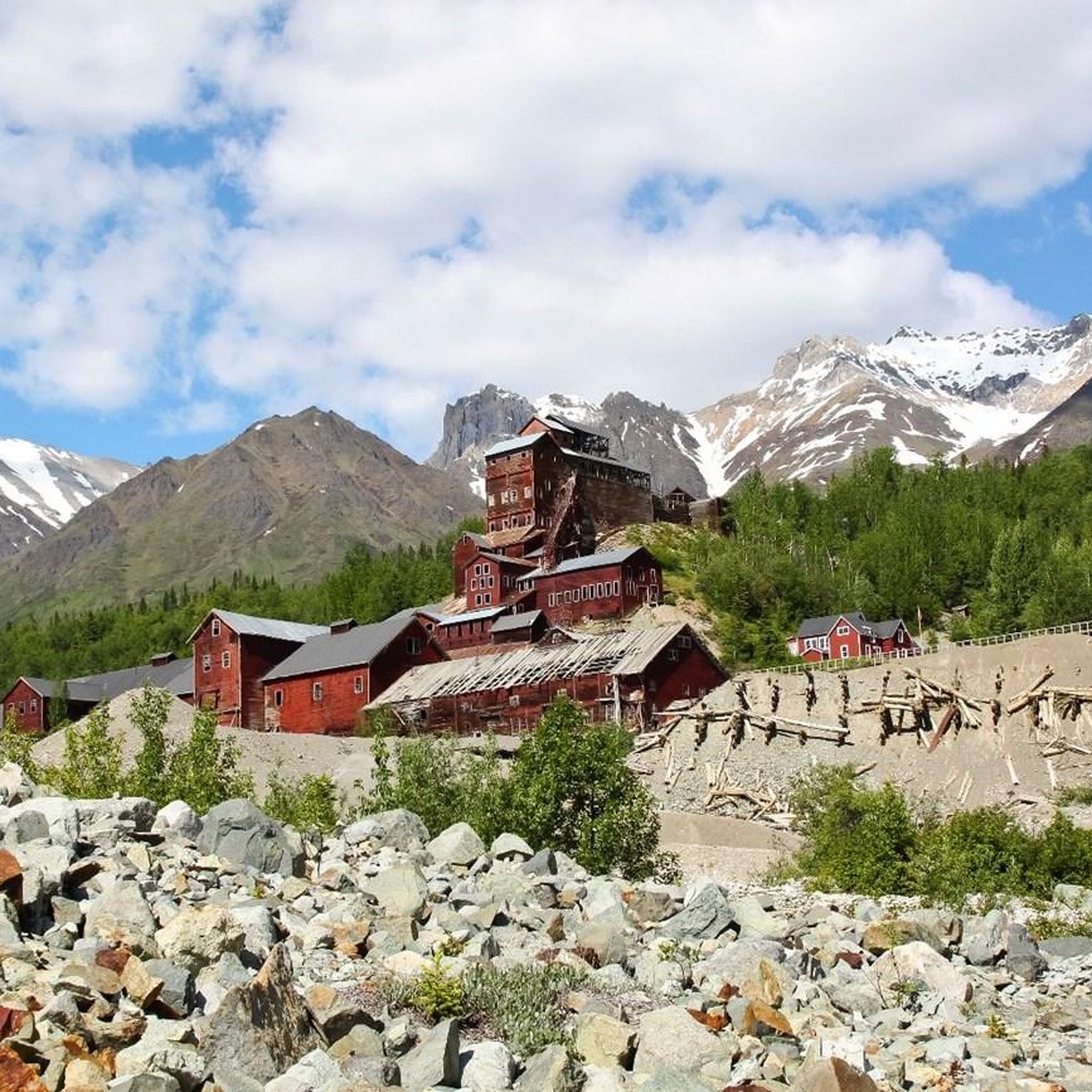
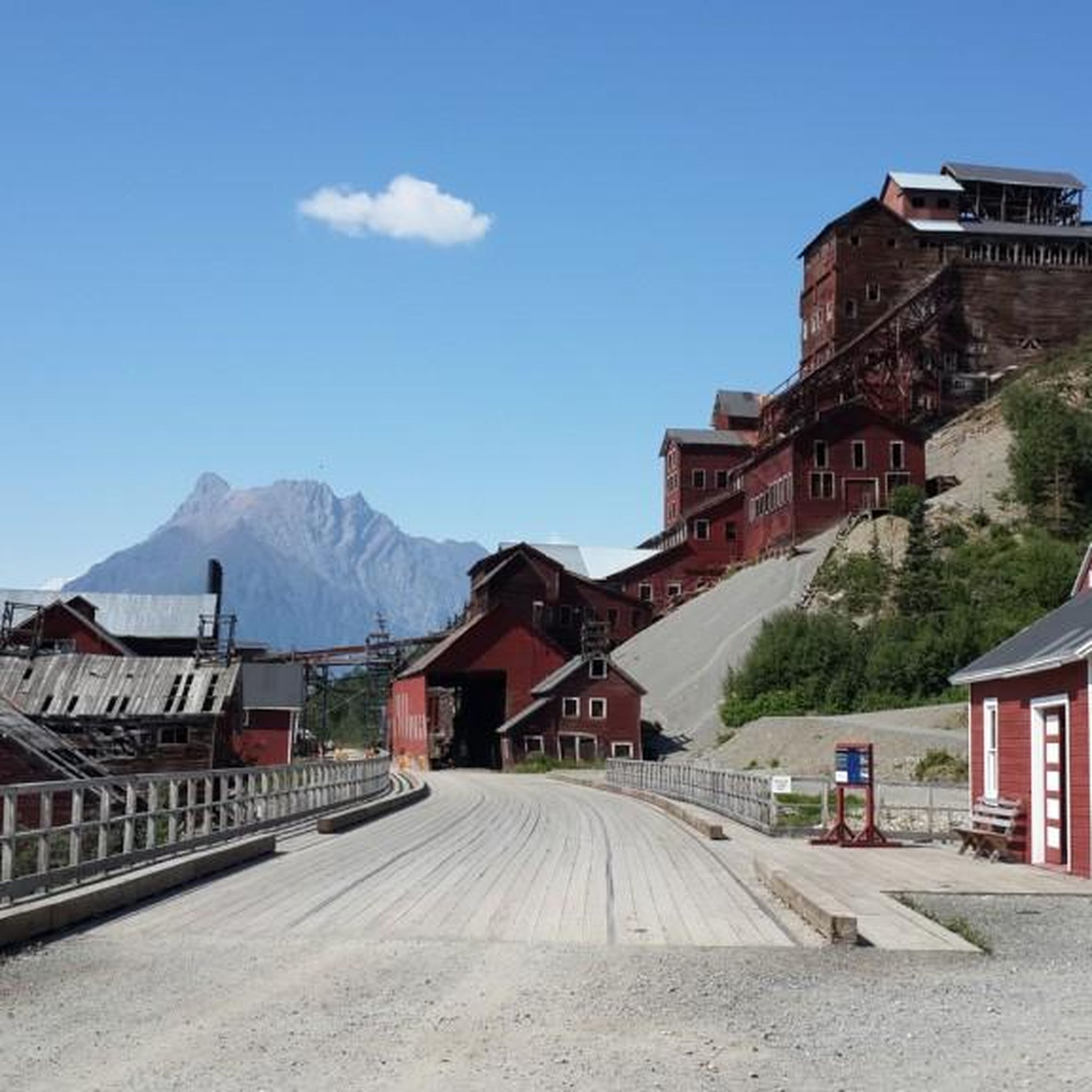
The Kennicott Mine can be visited in the summer after the mine has melted. There are guided tours and mountain tours as well as glacier tours on the nearby Kennicott Glacier. Important: the car can only be driven as far as McCarthy.
0
0

A rustic cabin at the end of Caribou Creek Trail. Reservations are required and must be made at least six months in advance of intended stay. More information can be found here: nps.gov/wrst/planyourvisit/caribou-creek-cabin.htm
0
0
Stream drainages converge at this point. Follow the drainage to the left, which climbs to Skookum Pass.
0
0
A pass that offers views of adjoining valleys. Geological formations indicative of the area's volcanic past are apparent on the hillsides.
0
0
This is the location of the defunct Bonanza Mine, which closed in 1938. Buildings, tools, and other artifacts from the mine's operation are still visible in the area.
0
0
The junction of the Root Glacier Trail and the Bonanza Mine and Jumbo Mine Trails. Root Glacier Trail ascends close to Erie Mine, but does not provide access to the ruins. Bonanza Mine and Jumbo Mine Trails diverge at a later junction.
0
0
The site of the historic Jumbo Mine is littered with artifacts and dilapidated buildings. Exploration of the site is permitted, but the unstable buildings do pose a safety risk—as do undiscovered mining-era explosives that could potentially still be in the area. The NPS advises using caution if you leave the trail to look more closely at the mine site.
1
0
The trail crosses Jumbo Creek here—water levels vary by season and time of day.
0
0
구리 강 인구 조사 지역에서 가장 인기 있는 경로
구리 강 인구 조사 지역에서 가장 인기 있는 명소


찾고 계신 것을 찾지 못하셨나요?
구리 강 인구 조사 지역에서 더 많은 하이킹를 확인하고 목적지에서 완벽한 경로를 찾아보세요.
더 살펴보기
다른 지역의 최고의 하이킹를 살펴보세요.
